Black Pine Breeze - November 2nd, 2013
I sit here little over a year removed from the most recent events of this trip report having just started up a job in New Jersey. I’m still not entirely sure how this came to be and what exactly this means for the future if anything, but if the events that led to this moment were, to quote Shelby Foote, “stars in their courses”, then what transpired in and between what’s covered in the following tidbits certainly gave birth to those stars and set them on their course.
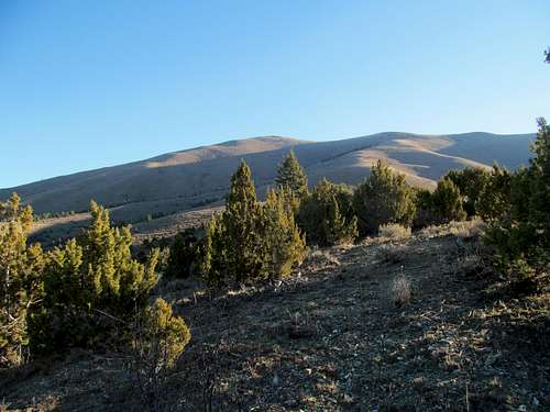
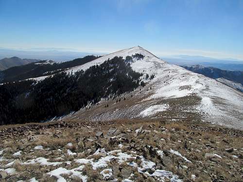
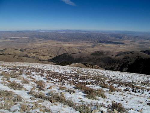
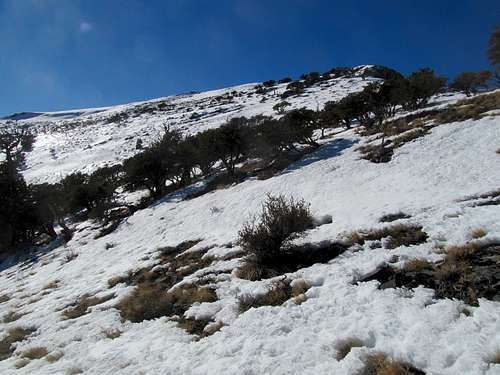
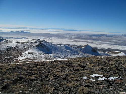
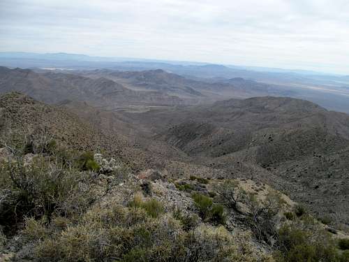
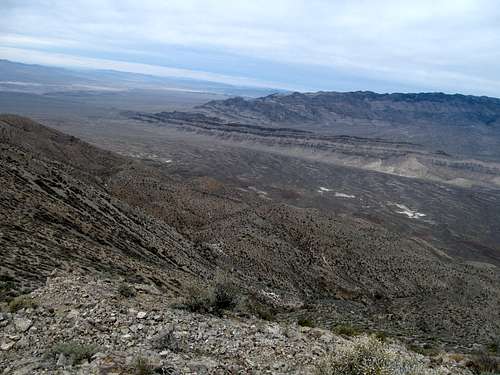
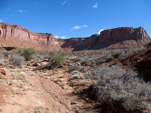
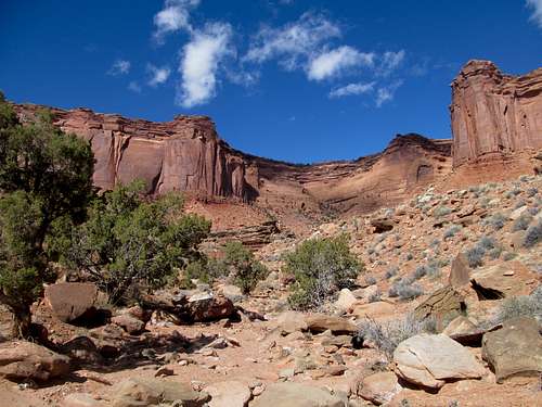
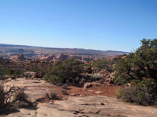
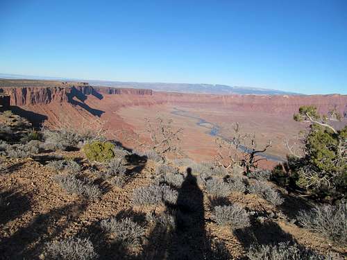
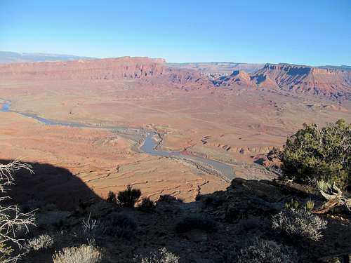
But first there was that initial taste of winter the week before my Nevada/Notch Peak trip. I teamed up with Matt (mtybumpo on SP) to go for Black Peak, a prominent P4K in Idaho and one of those peaks that always catches your eye as you drive on by on the way to bigger and grander things (in my case, on trips between Salt Lake and the Ketchum area). We approached the peak via Sixmile Canyon, where the air was reasonably warmish and the slopes were bare of snow.
The ascent was straightforward and pleasant though not that exciting; after a bit of loose footing we traversed east up a subsidiary ridge directly up to the ridge crest, a steady gain. As we emerged from the protection of the canyon I felt that first gust of winter: a steady soul sucking wind that bore down on us harshly, ruthlessly, and relentlessly. It was torture, and it was a bad portent foreshadowing in a year of hiking in which ideal weather proved a little tougher to grasp and hold on to.
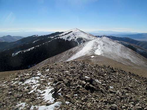
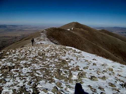
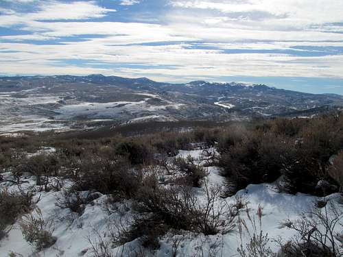
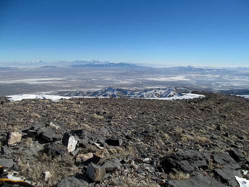
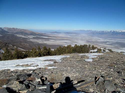
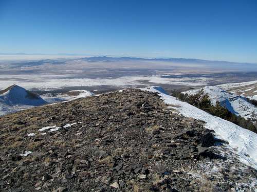
We gained the ridge near a bump south of the north summit, so we traversed to the top and enjoyed the views and where we could, a quick reprieve from the wind.
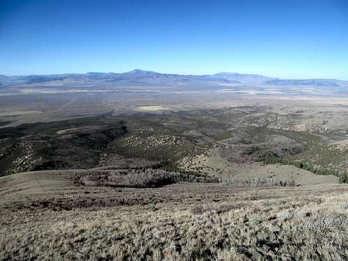
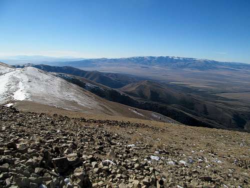
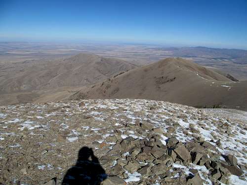
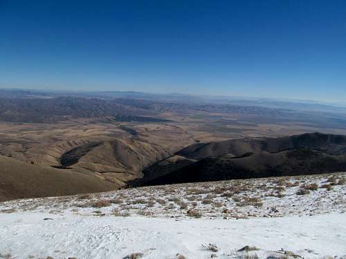
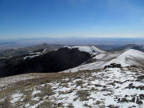
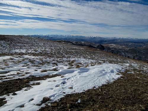
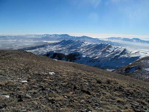
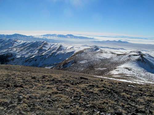
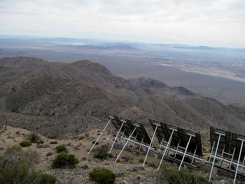
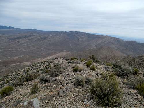
Then it was time for the traverse to the south summit, which was approximately equal in height. On a windless day the traverse would have been a breeze (pun kinda intended) while soaking in views from the Bear River Range to the Albions and the Raft Rivers, but today the route was sheer torcher: ups and downs with nonstop exposure against the wind and freezing-cold ankle-deep snow at times to boot.
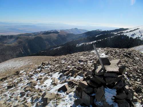
We made it and sought refuge by the summit shelter, which provided a small escape from the wind, though venturing beyond it to take a picture south meant risking your fingers and your sanity.
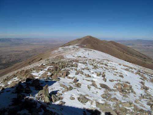
At least the traverse back was with the wind. As soon as I could I dipped back into Sixmile canyon and bushwhacked back towards the direction of the car, with Matt not far behind. Once we were under the shelter of the ridges a mile or so to the south it was pleasant again, warm even.
Having survived, we thought better of making an attempt on the Raft Rivers, what with the wind and all the snow covering its northern ascent slopes.
My three day weekend to Notch/Diamond/Telegraph followed, as well as a detour for the 4Runner to the body shop after wrecking a deer on the drive back from that trip. It wasn’t the worst timing though, since I wouldn't miss it while flying into Tampa then joining a bunch of friends in a rental van for a booze cruise up to Tallynasty, as the locals called it, for an FSU/Syracuse football game. We watched Fameis Jameis throw a few screen passes while the Seminoles wrecked the Orange almost by default, and I even gave in and participated in the tomahawk chop. I never cared for FSU before, but was won over by the hospitality of Tallahassee (despite a frigidly cold night drinking outside downtown) as well as the enthusiasm of our friends for their alma matter. (On a further sports related sidenote, having attended the last true Big East Tournament semi-final in NYC earlier in the year I had the privilege of watching both the eventual college basketball champions – Louisville, along with the eventual college football FSU Seminoles in person in the same year…not a bad thing to check off your life list alongside all the other peak related shit.)
Porcupine for Thanksgiving - November 28th, 2013
And a hop and a skip after Tally it was finally time to go home. The price to pay to avoid having to call off a vacation day was that I would have to make the cross country drive over Thanksgiving weekend. As bleak as the prospect of spending Thanksgiving Day driving across I-80 in Wyoming was, at least this meant that I had no need to rush my trip.
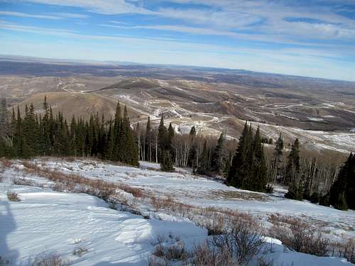
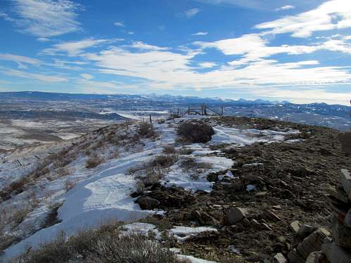
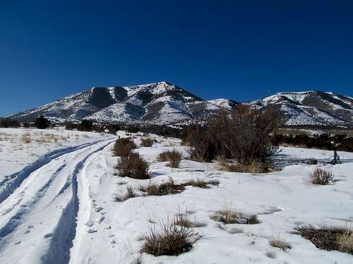
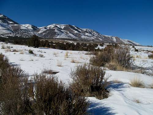
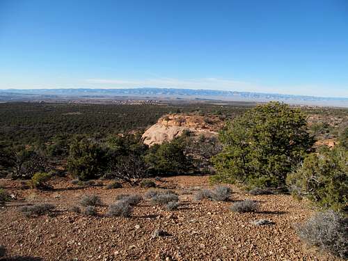
Which meant that Greg and I had time to do a quick trip up Porcupine Peak Thanksgiving morning, a small rounded hump off the main Uinta crest northeast of Coalville with enough prominence to make the Utah Top 100. There was some concern about the peak being on restricted property, but the sign off UT-133 made it clear that the mountain, part of a state wildlife management territory, restricted access only to hunters. Which I think meant we were in the clear.
The route is pretty straight forward. We started out near a service road, then some cross country, then up to hit another service road junction, where we could walk the road to the summit ridge, generally travelling in a west or occasionally northwesterly direction towards the peak.
There were some muddy areas where the snow had melted but it was generally easy going. Once on the ridge it was a matter a couple fence crossing to the summit area and a rather large cairn.
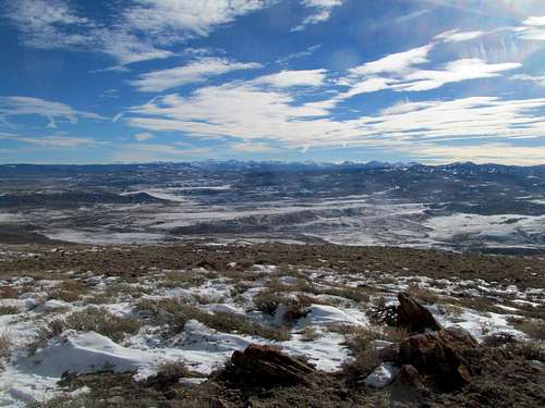
Porcupine isn’t much of an exciting mountain but it did yield some good views of the high Uintas, now clad in permafrost.
We descended and I bid adieu to Greg for the time being, wishing him and Kadee a happy Thansgiving. As expected driving I-80 through Wyoming was bleakness defined, what with even most of the shitty truck stops closed. I did make it to Cheyenne and found a nice bar that got me pretty blitzed. I struggled through the next day, while managing to tag Panorama Point in Nebraska (a surprisingly decent highpoint with views towards the Front Range 14ers, something I did not suspect). Then more painful driving to a motel past Des Moines, then another night getting blitzed in Cleveland, before I finally made it back to Mass on Sunday.
It was good to be home for the holidays, but alas that was all the time I had. If you had given me a few more weeks perhaps my homesickness would have been satiated, and I could have returned to Utah antsy and triggerhappy for new peaks, but alas I found myself moping my way back across the country in early January.
Again with the wind, over 70 mph constant from western Nebraska all the way back to Utah; it killed my gas efficiency and made conditions particularly treacherous while crossing the Laramies and Medicine Bows in Wyoming, where I could barely muster 40 mph on the freeway and the sides of the highway were littered with about a half dozen flipped over tractor trailers and FedEx trucks.
Burning down Stookey - January 26th, 2014
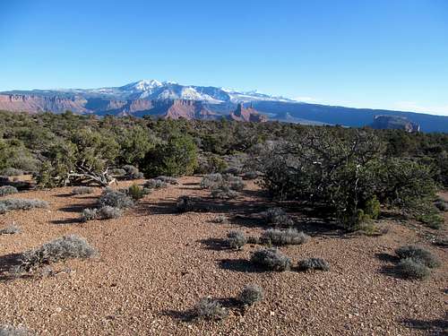
I was in a contradictory frame of mind as I drove back to Utah. My immense resistance to returning was a clear signal that I needed to get the hell outta dodge, whether it be back east, or perhaps check out a new city out west...maybe Denver or Las Vegas or Cali, or even under the radar places like Boise or Reno/Tahoe or Albuquerque. But at the same time, the work and the anguish I went through returning meant that I had to make it count, which meant getting my top priority peaks and other outdoors shit done, so that the return trip wasn't made in vain.
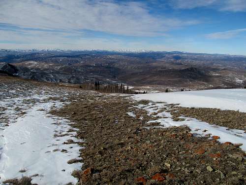
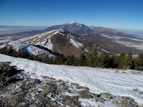
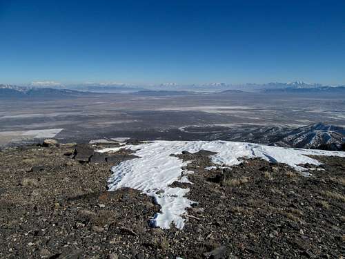
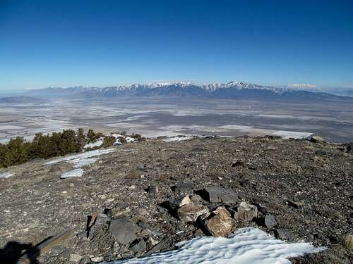
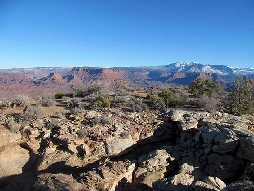
A week after the return I had a clear weather forecast combined with the Saturday before the Conference Championships, which meant no football. Stookey Benchmark was a P2K in the southern end of the Stansbury Range that I had yet to get, and its proximity combined with its unclimbedness bothered me that much more. Greg climbed the peak years ago but signed up for a repeat since it was a chance for him to also escape the immediate Salt Lake Valley area.
My concern was more focused towards the access roads than the peak itself, seeing as much of the high desert was blanketed by snow. Having never done it before, I was surprised at how well the 4Runner drove on a road covered by well packed snow. I was unsure of how far I should push it, and was thinking of stopping at one point, but Burn by Elle Goulding came on the radio, and since that was like the best fire jam on the radio till Tay Tay hit the airwaves with Shake it Off later in the year, I decided to at least keep driving until the song played its course.
Snow was a given for this trip, the only question was how much we would have to deal with.
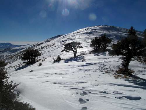
The hope was that we could avoid it a little bit by travelling the south side of the ascent ridge. This turned out to be the case; once we left the end of the snowy road we hit the ridge and ascended pleasant dry ground, which we enjoyed until we neared the ridge crest.
Once more, summer conditions quickly turned arctic, with the difficulties compounded by the slushy, soft and often knee deep snow. It made for slow going, especially for me, but we eventually both enjoyed the views on the summit before heading down.
There’s nothing complicated about the ascent route, but it is damn steep, and I wandered a little further right (SE) along the downclimb trying to find the path of least resistance, dropping into the drainage sooner and needing to swing back north to rejoin Greg. The rest of the road walk back had its occasional postholes, but that was it for the suffering for the day, though the weekend saw agony of a different kind; the Pats lost to the Broncos on Sunday, no surprise and not a huge letdown seeing as we were underdogs, but buzzkill nevertheless.
Gassin' Up - February 15th, 2014
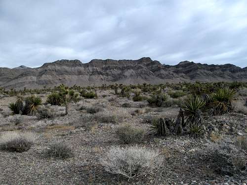
A few weeks later Greg suggested a Vegas trip, bearing in mind that he and I have very different definitions for Vegas trips but me, I’d be hard pressed to go in the middle of February, what with the month lying in the middle of slow season and with all the good pools still closed. Greg obviously had a few peaks however that he wanted to clean up in the area, namely Gass and McCullough. Both of us left Salt Lake Friday night; Greg got out earlier and found a good campspot near the Moapa Peak exit and as for me, obviously I wanted to find a motel. Unfortunately I was hard pressed to find anything in my towns of choice, St. George or Mesquite, due to the fact that there was some Senior 50+ triathlon in town, so I settled for one in Cedar City, which wasn’t a bad thing, since I discovered a delightful little bar in town and drank, danced, chatted, and watched some college basketball with some locals that, relative to it being Southern Utah and all, weren’t all THAT crazy.
It was rough waking up predawn to catch up with Greg and Kadee the next morning, but the one reward was that I was able to catch some of the USA Russia prelim Ice Hockey game on TV, then listen to the rest of the scintillating win on the radio, with TJ Oshie blasting his way through Russian hearts and minds around the time I passed the Moapa Peak area. Greg and Kadee had once more gotten a slight head start, but I eventually caught up and we started down the rough roads leading to Gass Peak’s trailhead.
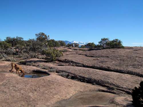
A cloudy day made for different hiking aesthetics but proved to be a different type of scenery.
The warm weather was certainly a blessing as well, as was a good ascent route following first a dirt road, then easy desert cross country, then finally a good trail that led to the summit.
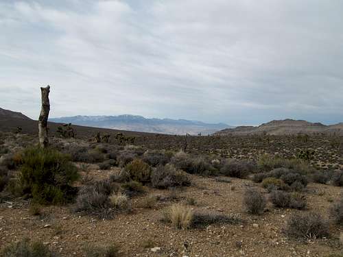
The views were a pleasant surprise, showing a unique perspective of Las Vegas sitting in a bowl with high peaks surrounding it in every direction, amidst the backdrop of the awe inspiring Sheep and Spring Mountains.
We breezed down the trail and with some time to kill, did some rock throwing at joshua trees in the open desert before parting ways. Greg and Kadee were headed down to camp by McCullough while I obviously had to go into the city.
My old college roommate Dave was now stationed in Nellis AFB and lived in North Vegas with his wife and labdoodle…as I found out they were pretty much at the foot of Gass Peak. I stopped by a Lee’s Liquors delighting in their free samples (such a breath of fresh air coming from Utah), then hung out with them the rest of the night.
My will to do McCullough waned; I was tired, physically and mentally from mountains. Something changed too in the last two months; after two years in Utah I was on autopilot, getting those peaks every weekend, with occasional binges back home or somewhere like Vegas or NYC to see friends and get my social/civilization fix, but a month home had brought me out of that nearly vegetative peakbagging mindset. I yearned for company constantly now, to just hang out, do nothing, grab dinner and drinks; I knew I missed my friends and family, but didn’t realize how much I missed that aspect of life until coming back west having been submerged home for a month.
Wanting to catch up on sleep I ducked out on McCullough and just chilled the next day, catching up on old times back in Amherst, getting coffee and pizza, etc. Hanging out in 70 degree weather and doing nothing all day seemed to me like heaven just now, and I grudgingly drove back to Utah Sunday night, all the way plotting ways to get out somewhere, anywhere, whether it be home, or a more vibrant city like Denver, or Cali, or hell…Reno/Tahoe. I was talking to my buddy and old roommate Brian on the phone as well, who was dying to leave his shit job at JP Morgan. We plotted and strategized about job searching, networking, and escape in general.
Murphy Trail & Mesa Arch - February 22nd, 2014
Over the next couple of weeks I tried my damnedest to stop procrastinating on my resume with not much avail. Things were moving much faster however on Brian's end…a hedge fund client of his in Manhattan suddenly had an opening, and he was their first choice. As this was happening I decided that another trip to Moab was long overdue.
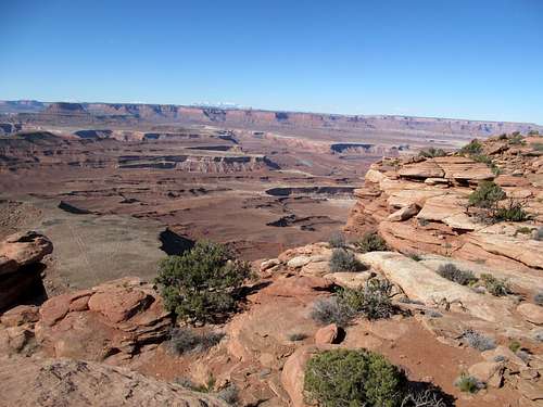
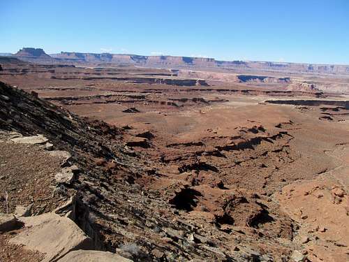
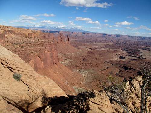
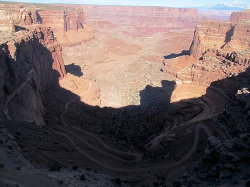
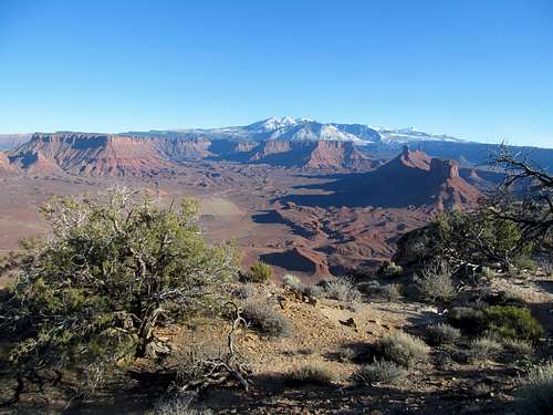
The plan was to do my own thing Saturday while Greg picked up some P1K’s near Price, then meet up with him and Kadee in town Saturday night and Sunday. I had always wanted to do one of those trails in the Island of the Sky in Canyonlands where you drop down to the White Rim, and I decided on the Murphy Trail.
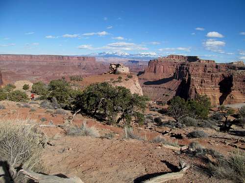
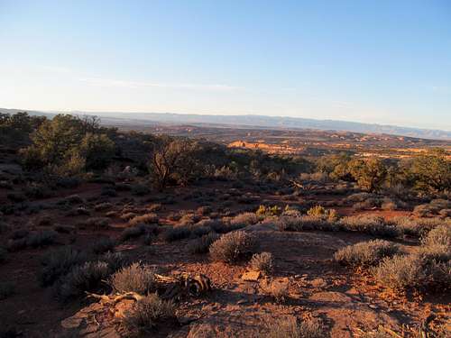
Once more the balmy weather was heavenly. The park was still relatively deserted in late February, and I found the nondescript trailhead and started off what began as a pretty dull flat trail across the plateau.
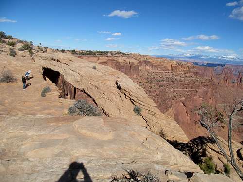
The Murphy Trail is built as a lollipop type loop that descends down and back up the plateau, with a separate spur trail to an overlook. I decided to jaunt over to the overlook first, then backtracked my way back to the main trail.
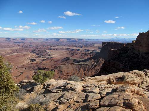
The spur trail also had some good viewpoints north on your way to the overlook point.
I followed the sandy trail as it finally began its descent, a remarkable work of engineering as it winds magically sheerly through a cul-de-sac break in the plateau cliffs, traversing where no class 1 route should exist.
After that, a quick jog down the foothills of the plateau to the lower White Rim Plateau, where you can look back at the cliffy escarpment and still wonder at the ingenuity of the route.
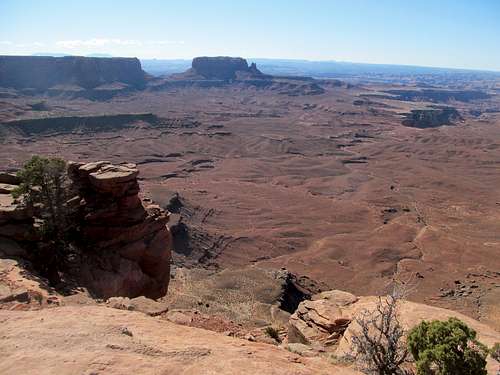
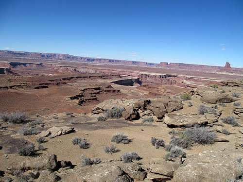
I took the left fork, following it down the hogback feature, which traverses higher ground that gives you good views in either direction, and you notice how quickly it is before the giant cliffs of the upper Island disappear into a distance memory, and wonder at the maze of red clay buttes now standing between you and the upper rim.
Near the terminus of this look there are some grand views across the Green River, towards the remote Maze section of the park, Cleopatra’s Chair, and somewhere along the Canyon rims, Lands End, another Utah P2K.
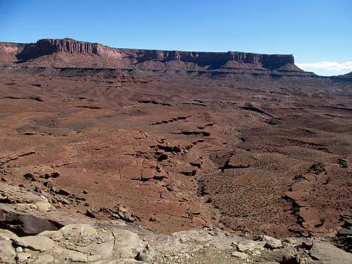
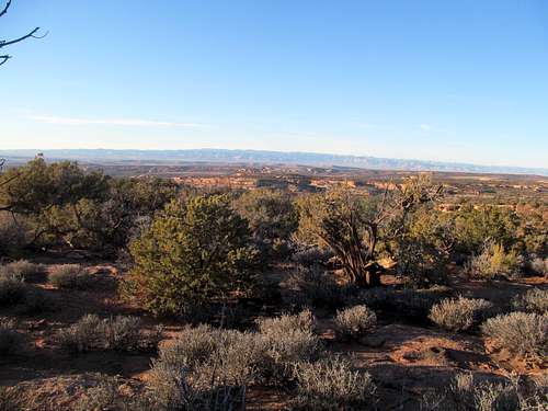
Eventually you join the White Rim jeep road for awhile before leaving it to follow a wash back to the Island. I found the trail here less developed, and the afternoon sun made this section seem dry and plainer than the upper part of the loop.
Then a guessing game, approaching the massive island walls and wondering where the magical pathway through was.
The trail turns a corner, and magically you’re ascending through a cul-de-sac that appears out of nowhere.
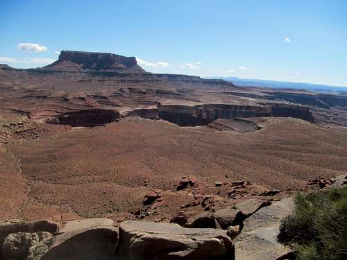
The upper sections of the trail were slightly frightful for someone like me who’s not a big fan of heights, and the sandy upper sections a little tedious after a long day of hiking.
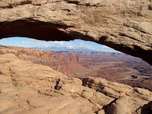
I did a quick hike of Mesa Arch on the drive back, where the afternoon sun made for perfect lighting conditions with the east facing vistas, gazing the inexplicable maze of horseshoe turns the Colorado River cuts through the bedrock between where I stood and Moab, where it flows tranquilly for the rafting concessionaires to offer easy access to eager tourists, kids and families from around the world.
A last quick hike of the Shafer Canyon Point and Overlook ended a good relaxing Saturday. Kadee and Greg had arrived in town too, and I joined them for a delightful dinner of cocktail infused rantings on my part, and likely patient tolerance on theirs.
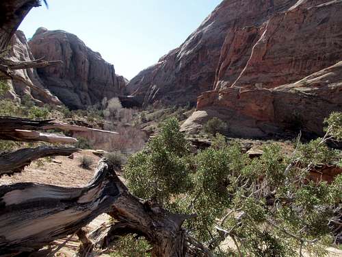
Negro Bill Canyon & Dome Plateau - February 23rd, 2014
I woke afresh Sunday for a morning hike of Negro Bill Canyon and Morning Glory Arch outside of town. My route was the basic one, up a very popular trail. Greg however decided to be adventurous. He would attempt to leave the hotel and traverse a neighboring canyon to its end, at which point he would try to descend down into Negro Bill near the Arch. We would potentially meet up at some point in the canyon, then proceed for an attempt of Dome Plateau, a P1K between Arches National Park and Castle Valley.
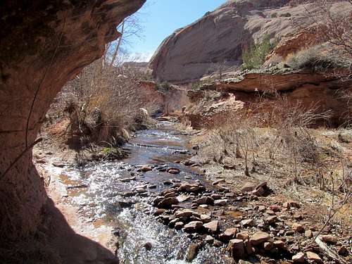
The hike along the creek was delightful in the type of crisp early morning air that seems exclusive to redrock proximate nooks and crannies in canyon country during the bridge seasons.
It was nice to saunter along the sound of constant running water as I craned my neck at the vertical walls on either side.
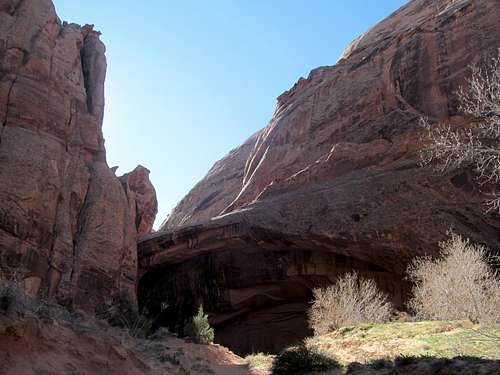
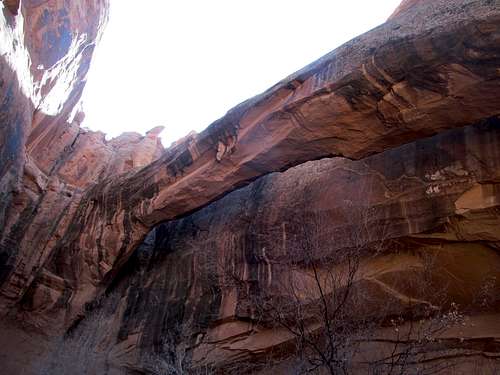
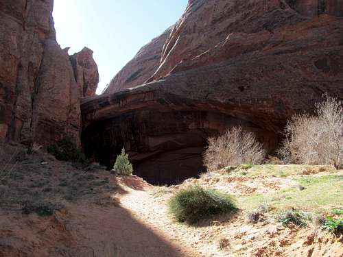
I found the side trail descending down to the side canyon, and climbed up on a ledge trail which eventually took me straight to the bottom of Morning Glory Arch.
The scene was solitary and tranquil as I wandered around the small alcove and marveled at the immensity of arch as well as its little intricacies, like a tiny cascade that trickled neatly down a right angled groove through the rock.
The canyon walls here were very sheer and overhanging, and I wondered if Greg would be able to find any sort of a route from the higher plateaus down.
The hike out was very scenic as well, as I enjoyed greeting the line of people now heading in to the canyon for their morning jaunts.
I called Kadee afterwards and found that they were running late, so after a delicious polenta brunch at the Ekleticafe (a very oddball place but in a good way, definitely recommend it if you’re in town) I did a little drive along the Colorado further down to the Potash area, seeing Corona Arch along the way as well as numerous rock climbers clipping in to the sandstone that stood at the highway’s edge.
I got back and met her at the trailhead, where she after a quick hike into the canyon she was still waiting for Greg emerge from the other end somewhere. We waited further and I talked to some people hanging out at the trailhead, but there was no reception so we had to drive back into town. As I had suspected, Greg had been unable to find a tenable route into the canyon, so he had to do the runners trails all the way back to the highway, where he met us near the Denny’s. After grabbing some food to go we headed into Arches, where despite my reservations about our afternoon start we readied ourselves for the Dome Plateau.
Dome is a P2K sitting outside the park, starting its slow incline amidst the eroded dunes near Delicate Arch and rising all the way to Castle Valley, where it drops steeply into the Colorado River. To reach it we had to drive all the way past the last parking lot of the Delicate Arch scenic drive, over the curb, and onto a very rough and tumble jeep road as it leaves the park following the Cache Valley wash.
We left the road and headed for some reasonable gradients, finding our route through drainages and some sandstone ledges.
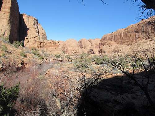
After some minor scrambling and several levels of ascent we hit the sparsely wooded plateau. Several miles in the distance we spotted a couple hills, which marked the possible highpoints.
I was getting worried where we were on time and kept telling Greg he should go for the highpoint and leave me behind. I wasn’t intent on getting the summit so I would’ve been happy just hiking around the rim and checking out the already glorious views back into Arches and north at the Roan Cliffs and Wagon Road Ridge, but he kept saying that we were fine.
We crossed several washes that would have drained through parallel drainages...alternate routes we could've taken, but ones that Greg suspected might cliff out. Eventually we crossed and followed intermittently 4WD roads before hitting a couple of spots that competed for the actual highpoint status.
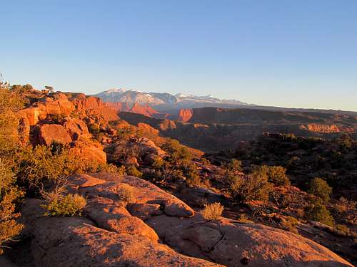
Here I was bedazzled at the scene, Parriot Mesa and the Fisher Towers area sitting between the Colorado River set amidst golden red rock cliffs, and rising above it all the La Sal Mountains, still clad in a blanket of snow. The pictures certainly made the trip worth it.
We still had another 5 or 6 miles to backtrack our way to the car, and it was getting dark.
The sun was setting just as we started our final downclimb, and Greg suddenly had a work call. Knowing he couldn’t get reception further down, he had to resolve the issue now and send out some emails while still at the plateau rim, while I tried to find my way down with Oquirrh through the cliffy maze of ledges and chutes through an ever darkening landscape.
I won’t lie and say I didn’t panic as the sun accelerated down the horizon, even calling Kadee to let her know where me and Greg were, and to call for help if I slipped descending in the dark and didn’t make it down. I had never cut it this close with the sunset before, but eventually me and Oquirrh, alternating route finding responsibilities, managed to arrive back at flat ground, where we walked the last stretch back to the road and eventually to the car.
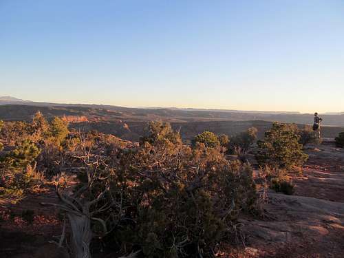
Greg met us, and we headed back in the dark, me still shaken from the experience. But all in all it had been worth it, not the summit necessarily but the unique dusk views of the vast area stretching from Colorado to Arches which Dome's summit allows you that unique 360 degree glimpse of. But it was the events later this night that would have a lasting impact on where I sit now.
Driving back to Salt Lake I went on a call with my buddy and his brother, brainstorming interview strategies, tactics and questions. It went well, Brian got the job, and soon I was on the path to Jersey. I wanted to get out Utah, but I didn't know what I wanted, whether it was being back east with friends and family, or staying west climbing and exploring the outdoors. NYC seemed like a good compromise to settle down a little, take a few years from the constant and sometimes very stressful summit chasing life, then wait and see where my head was afterwards. For over two years I had tested myself to see if I could live away from home...and the answer was yes, but I missed them all a hell of a lot. Now it was time, after what would be three years constantly doing outdoors shit, could I step away from it for a few years not getting that weekly fix. My buddy convinced me to migrate to NY/NJ only for a year or two, neither one of us planning to stay for too long. He wanted me to commit to moving there by May or June, but I pushed back. Like I said, I wanted to make my last drive and now last year out west count, especially as the summer rolled around. And I did. So as I sit writing this in the dirty Jerz now getting steadily antsy for the mountains again I don’t know what the future holds, but I can at least look fondly at a very eventful 2014 full of summits, peaks, and some unexpected setbacks and misadventures that nevertheless made every moment I had left out west count.


Comments
Post a Comment