
|
|
Route |
|---|---|
|
|
47.34201°N / 121.01323°W |
|
|
Hiking |
|
|
Spring, Summer, Fall |
|
|
Half a day |
|
|
Walk Up |
|
|
Overview
The Yellow Hill Trail is the shortest route to the summit of Elbow Peak. At 10 miles roundtrip and 3100 feet elevation gain it can easily be done in 5 hours or less (depening on physical ability). The route itself does have a downfall in that it doesn't just serve hikers but dirt bikers as well. The trail itself is in decent conditions, though there are some deep rifts in it from the dirt bikes.
Getting There
VIA THE YELLOW HILL TRAILHEAD: Located between the town of Teanaway and Route 97 take Teanaway road north roughly 7 miles to the intersection with the West Fork Teanaway Road. Make a left on the West Fork Teanaway Road and follow it a half mile to the Middle Fork Teanaway Road. Make a right on that road and follow the road (dirt) roughly 2 1/2 miles until you seen a sign should the Yellow Hill Trailhead on your right. Continue about 100 yards to a parking area.Route Description

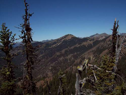
The Yellow Trail is the shortest route to the summit of Elbow (5 miles one way 3100 elevation gain). The route itself leaves from the south as a road/trail combination. Often the trail branches from the road's switchbacks and heads up steeply only to connect to the road later in the hike. At the highpoint of the ridge the road end and the trail begins from here on. The trail then traverses just east of the true summit of Yellow Hill before dropping down a gap 300 feet. There is a rise again before falling slightly onto a narrow ridge.
This narrow ridge is not a complete knife edge but some caution should be used here because the trail which traverses the western side is loaded with kitty litter and can cause for some not so good footing. Some caution should be used here especially in winter or early spring during high avalanche danger. You can choose going across the top rocks of the narrow ridge, which has some exposure on both sides and some kitty litter and questionable rock but is very doable (class 2). Again though in winter, this is should be approached with caution especially with cornices.
Once crossing the narrow ridge the trail will then head directly to within feet of the true summit area. There are some of the high spot to the left of the trail, and one high point on the northern edge that is on the right and through the trees. Check them all out for their views.
Essential Gear
In the summer all you need is the 10 essentials. Trekking poles do help. In the early spring or winter an ice axe is mandatory, though even that will only help you so much if the snow is powder along that ridge. Snowshoes are always a good idea if you are going early and so are traction devices to cover yourself.External Links
Add E alt="Click for Cle Elum, Washington Forecast" height=60 width=468>