I have been
staring at Mount Constance from my home town of Edmonds for well over 20 years. It was visible from the playground at my elementary school. For that reason it is one of my original inspirations, a visual infatuation of sorts. Since my mountaineering began, there has been the knowledge that one day I would climb this mountain. Part of the allure is the fact that the upper portion of the route is complex, exposed, and not well documented. An inspection of the topograph map reveals a
baffling mess of confused jagged lines, densely packed and difficult to decipher. These accumulative conditions breed uncertainties, also known as adventure.
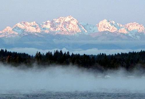
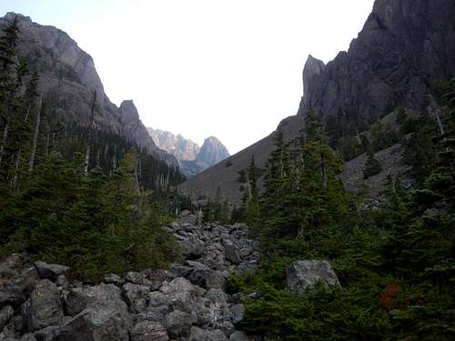
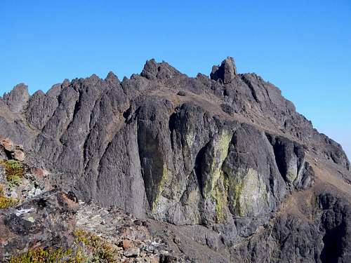
![Constance And Warrior]() Mount Constance seen from the East
Mount Constance seen from the East
Greg, Dave and I started on the old washed-out road, aiming to camp at Lake Constance by nightfall. The washout itself was humungous. I could see why there are no plans for repair. As so often happens, the river changed its course, so the road was subsequently erased. Normally, the remainder of the road would make for a good bicycle ride approach, but Dave didn't have a bike so we walked the 3 miles beyond the washout.
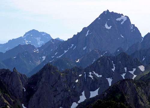
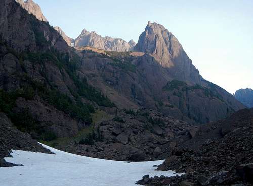
![The Brothers And Contance]() Mount Constance seen from the north
Mount Constance seen from the north
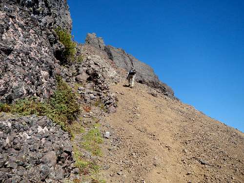
The Lake Constance trail is an amazing bit of engineering. It rises 3350 feet in only 2 miles. About half way to the lake, it passes through a small basin where the creek runs underground. Above that, the trail weaves its way through a series of small cliff faces. Many parts of the trail are solid class 3 with roots for handholds and consequences for mistakes.
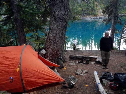
![Camping Lake Constance]() The teal colored water of Lake Constance
The teal colored water of Lake Constance
When we reached the lake, I was impressed by it's beauty. The water was teal colored and fish were jumping for bugs. We set up my tent, took our boots off to air out our feet, and filtered some water for the coming day. I forced myself to wait until 5pm before eating my burrito.
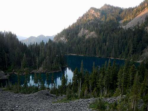
![Lake Constance Below]() Above The Lake
Above The Lake
| ![The Mouth of Avalanche Canyon]() Entering Avalanche Canyon
Entering Avalanche Canyon
|
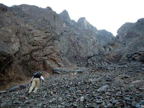
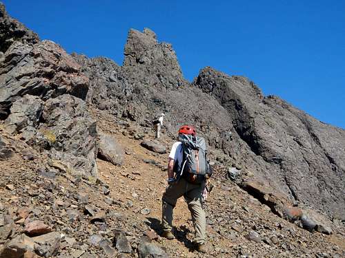
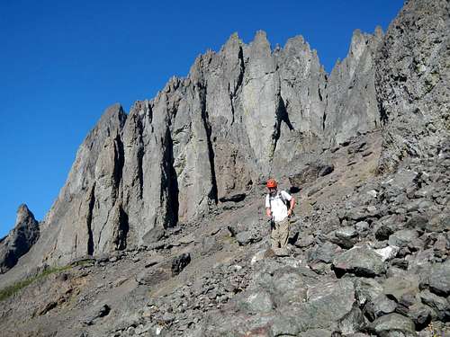
The following morning we rose with the sun and scaled the talus slopes immediately north of the lake. We were entering the mouth of Avalanche Canyon, a deep gorge between the main peak of Mount Constance and a slightly lower peak called Inner Constance. This area is certainly a unique place on earth. It's nothing like the rest of the Olympics. There were cliffs rising over a thousand feet on both sides and the bottom of the gorge through which we had to pass was relatively narrow. Large rock pinnacles towered above us. There was a sense of grandeur here and simultaneously the realization that we are small creatures.
![Inside Avalanche Canyon]() Inside Avalanche Canyon
Inside Avalanche Canyon
| ![Entering The North Chute]() Entering the North Chute
Entering the North Chute
|
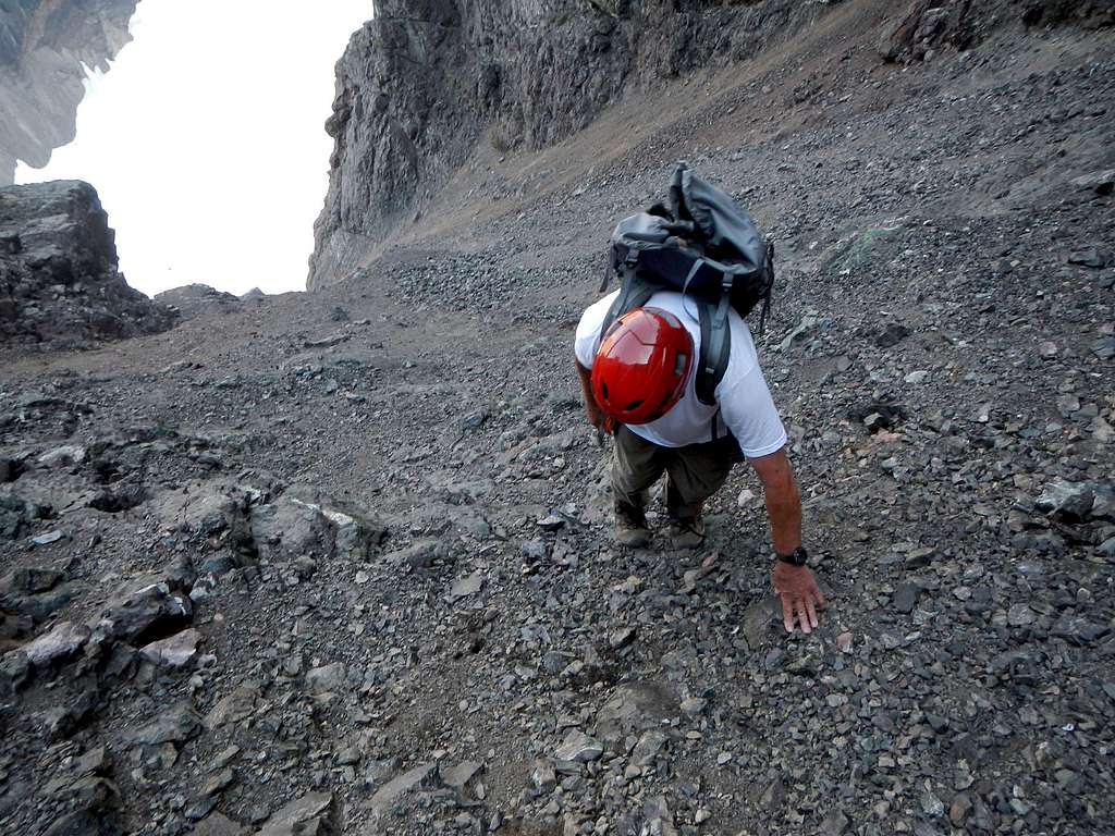
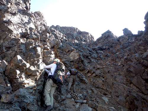
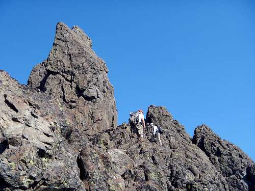
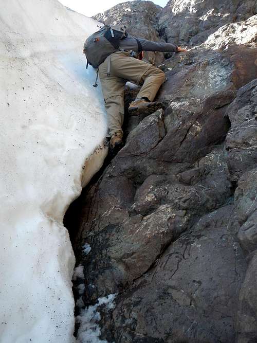
We crossed talus, large and small, and then bypassed the South Chute entrance, ascending loose talus up to the mouth of the North Chute. These are the two main options for escape from Avalanche Canyon and access to the upper route-maze. Supposedly the South Chute is full of horrible scree, so we left that for the descent. But as it turned out, the North Chute is steeper, and although it's more solid than the South Chute underneath, the top of the rock in the gully is covered with kitty-litter. To make matters worse, it escalated from class 2 to class 4. We discovered better rock with less kitty-litter on the right side, where it gets steeper.
![The North Chute]() Climbing on Kitty-Litter
Climbing on Kitty-Litter
At the top of the north chute we crossed a narrow exposed
ledge trending left. This is where the top of the south chute route comes in from the loose gully below. We scrambled north through a notch to a snowfield on the other side. The snow was hard, steep, and icy, so we used the moat for some protection, and followed that for a distance. Scrambling in moats can be tricky at times, especially when you come to a narrow section where the icy snow presses you against the rock wall. It's also important to beware of deep spots where carelessness could plunge you into the depths below the snow. We came to the end of the moat and stepped back onto the rock.
![Scrambling To A Notch]() Scrambling to a notch
Scrambling to a notch
| ![The High Traverse]() Beyond The Moat
Beyond The Moat
|
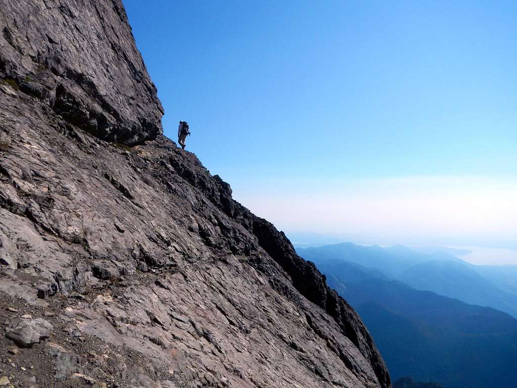
We crossed some loose slopes and came to some narrow crack ledges embedded in down-sloping exposed slabs. It's amazing how many ledges and cliffs there are on Mount Constance. As we discovered, once you're beyond the chutes, there's cliffs below you for the rest of the way. This knowledge weighed heavy on our minds.
![Constance Ledges]() crack ledges on down-sloping slabs
crack ledges on down-sloping slabs
Greg was in the lead and he came to what looked like a bad spot. We assured him that it was probably the correct way to proceed. He slowly edged his way along and around an exposed corner with an overhang above.
"
You'll die here", he said.
"
What?" I asked, laughing nervously.
"
You'll die here, if you fall"
He said it again, with a weird tone in his voice, "
You will die, if you fall here"
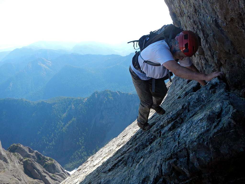
![Hold On With Your Fingers]() The Finger Traverse
The Finger Traverse
He was beginning the famous Finger Traverse, one of the most renowned route features in the Olympic Range. I had invited him on this trip at the last minute. He hadn't had any time for research or mental preparation. He'd never even heard of the Finger Traverse. The first time I had seen footage of this spot, I thought
No F-ing Way!, but now, years later, here I was.
[NOTE: Take a look at
this photo from coonrads trip, which is much better than the one I got when we were there.]
If you don't like exposure, it might give you the creeping horrors to watch your climbing partners scramble into the middle of a rock mouth which appears as if it could spit you out into the void at any second. But if you do like exposure, it's sort of fun. :) Honestly, it wasn't so bad. It's true that it's very exposed while foot placements are thin, but the horizontal handhold crack at the top is wide open, so we were able rely on that for the length of the traverse. Dave came along behind me and then we were all through it. Beyond the Finger Traverse we had to lose some elevation before continuing.
![Mount Constance Upper Route]() Diagonal ledge visible (bottom right), scree slopes and summit pinnacle above
Diagonal ledge visible (bottom right), scree slopes and summit pinnacle above
| ![Loose Scree Slope]() Ascending Scree
Ascending Scree |
The remainder of the summit ridge was now visible. There was a sort of half-bowl feature below us which allowed access to a diagonal ramp. We scrambled around through the convexity and then crossed another loose slope to reach the diagonal ramp. The down-sloping ramp dissected a large cliff face and there was more loose rock to contend with, so we proceeded with caution. I used the wall on the left to get some reassuring hand-holds. At the top of the ramp we came to a large open slope below the summit pinnacle. We fought our way up through horrible scree until we came to a miniature headwall. Here we got back onto semi-solid rock and scrambled north until reaching the crest of a small ridge, which is adjacent to the 40 foot tall summit pinnacle, but separated by a deep chasm. It seemed strange, because we had thought we were near the end of the route, but the chasm between the ridge where we were and the prominent summit spire was deep and not crossable. Instead we had to scramble the ridge crest north beyond the the summit pinnacle and then come back around where it connected, out on the north face.
![Nearing The Summit Pinnacle]() Nearing the summit pinnacle
Nearing the summit pinnacle
| ![The Summit Pinnacle]() Following the ridge adjacent to the summit pinnacle
Following the ridge adjacent to the summit pinnacle |
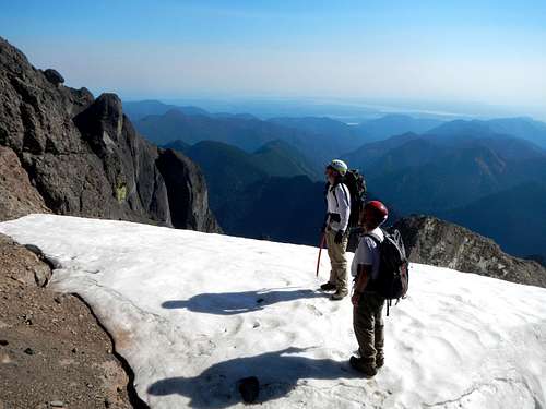
The exposure on the north face was breathtaking. 1700 feet straight down to a large snowfield. We could tell just from looking at the north side of the summit pinnacle, it was not a good option for climbing without a rope. We scrambled around to the east side of the spire. There were some tricky moves just to get onto the thing, but once we did, we found a safer 3rd class route up the east side of it. When I came to the summit I fulfilled a longstanding dream. And what an intense route! This was definitely my favorite climb of the year, and it wasn't over yet. For Dave and I, we had now stood together on the three highest peaks in the Olympic Range. Pretty damn good for a guy in his 60's!
![Mount Constance Summit]() Sitting on the summit
Sitting on the summit
After a short break on top, we reversed our route to the bottom of the diagonal ramp. The scree was much more pleasant on the way down. From the base of the ramp we descended to the bottom of the half-bowl, rather than going back up towards the Finger Traverse. Dave said he thought it would be faster to cross the Terrible Traverse instead. This is another famous route feature, steep exposed snow with treacherous cliffs right below it. People have lost their lives there. I was nervous about the prospect. Thankfully as it turned out, this late in the season, the snow was melted back to slightly revealing a small ledge. We crossed the narrow exposed ledge right at the base of the steep icy snow. For some reason I was still apprehensive about what we might find around the next corner. It seemed like the snowfield we had bypassed in the moat might be a problem for us now that we were on a much lower route. Sometimes I hate being right...
![Inner Constance West Face]() Inner Constance seen from the summit
Inner Constance seen from the summit
After following another series of ledges we came to the base of aforementioned snowfield. It barred the way, just as I had feared. We scrambled down into a vertical moat/gully adjacent to the snowfield and followed that up as far as we could, to where the snow made full contact with nearly vertical rock walls. There was no safe way proceed, although we did have some choices. We could try to cross the snow at it's narrowest point and get down onto a lower loose rocky slope, but this was surely not the standard route, and we had no idea where we might end up. It would probably turn out to be a dead-end. Alternatively, we could use our crampons and ice axes to climb straight up the 60 degree icy snow, but a mistake would be fatal. Not a good option. While Dave and I were discussing what we should do, trying to decide, Greg got onto the rock and free-solo climbed to a rocky perch above the snow. WTF! Dave and I were astounded. For a guy without any rock experience, Greg had made the free-solo look easy. Did he even know what he had just done? In truth it was not easy. All the handholds were sloper and the foot placements were smears, especially tough moves to do in mountaineering boots. Greg was the tallest of the three of us, so he had an unfair advantage in the crux move which was a stretch.
![Free Solo]() Dave free climbing
Dave free climbing
We couldn't afford to spend another hour backtracking to the Finger Traverse. If we did that, we would have to face the cliffy section of trail below the lake in complete darkness, with full packs. Without expressing it verbally, Dave and I looked at each other with the same thought,
I guess we're going that way. Dave followed up, using his ice ax on the icy snow left of the crappy rock, getting some sloper holds with his right hand, a mixed climb of sorts. He had a hard time getting through the crux spot, which did nothing to inspire confidence in me. I decided to climb further to the right on pure rock. I ran into a difficult corner, it was necessary to get around it, but there were no footholds. Some of this rock felt like 5.8. The features were just small rounded bumps with depressions in between. None of the moves I made felt very trustworthy, and the open space loomed large behind me, a sickening thought. Absolute focus was necessary. After 30 feet of free-solo climbing we all came to where the moat was open, a welcome sight.
![Below The South Chute]() Coming back to Avalanche Canyon
Coming back to Avalanche Canyon
Beyond the snowfield we scrambled back through the notch and then descended a very loose scree gully to some open slopes, further down on the east face. From there we passed through a col to the top of the South Chute, and more scree-skiing (screeing). Back in Avalanche Canyon I felt glad to be alive after the free-solo climbing. I believe sometimes in the mountains we are forced to make quick judgments and take some risk to avoid bigger hazards.
Back at camp we packed up quickly and hit the trail hoping to make it out to the road before dark. This we did accomplish. We even made it most of the way to the washout before headlamps were necessary.


Comments
Post a Comment