
|
|
Mountain/Rock |
|---|---|
|
|
39.76890°N / 120.43676°W |
|
|
Plumas |
|
|
Hiking, Scrambling |
|
|
Spring, Summer, Fall, Winter |
|
|
7252 ft / 2210 m |
|
|
Overview
Beckwourth Peak is a forested peak in the Northern extension of the Sierra Nevada Range. Located directly west of the Sierra Valley, Beckwourth Peak has excellent views of the valley and surrounding mountains.
Beckwourth Peak should not be confused with the Beckwourth Pass area, about 17 miles to the east. Beckwourth Peak is located southwest of the small town of Beckwourth, California, and directly south of the larger town of Portola, California.
The summit has microwave towers, and a road leads directly to the summit from the town. The road itself is 4WD most of the way, and the road can be driven by 2WD vehicles for a couple miles in good conditions, which is about 3 ¼ miles to the summit. The start of Beckwourth Peak Road is about 5 ¼miles from the summit.
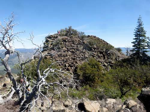
There are actually two summits to Beckwourth Peak about 650 yards apart. The north summit is listed on topo maps as the named peak, but the true summit is by the microwave towers. The summits are very close in height.
Beckwourth Peak is best hiked in spring or fall months, in dry periods. The mountain can get snow, but snow levels vary depending on winter, and snow typically melts by early spring. Be wary of hiking Beckwourth Peak in winter because summit is approached via the north side where snow conditions will be more significant.
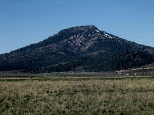
Beckwourth Peak from the east from the Sierra Valley
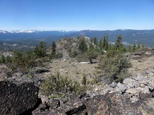
Summit view to the northwest 4-16-2016
Getting There
Beckwourth Peak is best approached from the north. Private land blocks access from the east side and south side. There are no access roads from the west side. To get there drive to the town of Portola, California.
Portola, California is off of Highway 70, about an hour from Reno, Nevada and about two and a half hours from Sacramento, California. To get to the start of Beckwourth Peak Road take Gulling Road into town and follow signs for the A15 Road, which is about 1½ miles from the Highway 70. Have a map of Portola handy on your phone, and you should be fine.
Once at Beckwourth Peak Road, drive as far up as you wish. 2WD recommended to go no further than 2 miles to the first big turn off.
Route
About two miles up the road is a big turn off. There are three roads. The first road on the left is going back down the hill. The 2nd on the left heads towards Beckwourth Peak. The third road stays straight and leads to a dead end about a mile further up. From this area, where the forest opens up into a meadow, it is about 3 ¼ miles to the summit towers. You can do both summits in about 7 miles round trip from here, gaining about 1,600’.
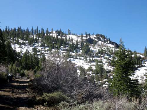
Rocky north face
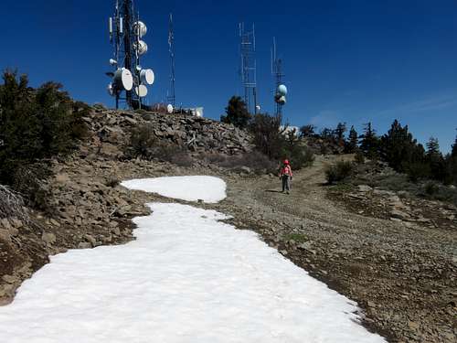
Summit towers
Group on north summit
When my group did the hike on April 16, 2016, we drove just ½ mile up Beckwourth Peak Road and did about 10 miles of hiking to get both summits, gaining just under 2,300’.
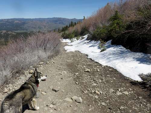
Descending the summit road