Toggle navigation
Mountains
Routes
Images
Trip Reports
Forum
What's New
People
Areas & Ranges
Articles
Trailheads
Canyons
Huts & Campgrounds
Albums
Logistical Centers
Fact Sheets
Lists
Custom Objects
Gear
Plans & Partners
WELCOME TO SUMMITPOST
SIGN IN
REGISTER
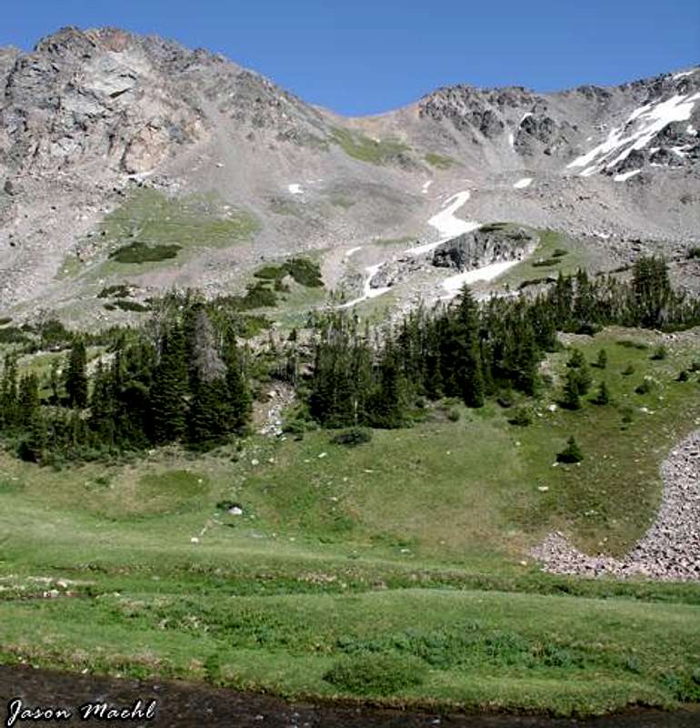
Lots of flat grassy area to...
View High-Resolution Image
Lots of flat grassy area to...
Lots of flat grassy area to pitch a tent between Sundance Lake and Shadow Lake along the West Fork of the Rock Creek. Whitetail Peak is in the background.
« PREV
NEXT »
granitepeaker
on
Aug 4, 2005 6:06 pm
Comments & voting
Other parents
Lat/Lon:
45.09890°N / 109.6297°W
Image ID:
118456
5587 Hits
76.47
% Score
7
Votes
Log in to vote
Comments
No comments posted yet.
to post!
Don't have an account?
Castle Mountain
(Mountain/Rock)
You are at
the First
Image
Viewing
#1 of 1
GALLERY
You are at
the Last
Image
granitepeaker's Image Gallery
« PREV
Viewing
#13 of 109
GALLERY
NEXT »
Castle Mountain
(Mountain/Rock)
Loading....
Route to Castle Rock Spire
(Route)
Loading....
×
You need to login in order to vote!
User Name
Password
Remember me
Forgot your password?
Log me out when I close my browser.
Keep me logged in all the time.
sign in as a user
Don't have an account?
Register now for FREE
Rating available
Suggested routes for you
People who climb the same things as you
Comments Available
Create Albums
Register Here


