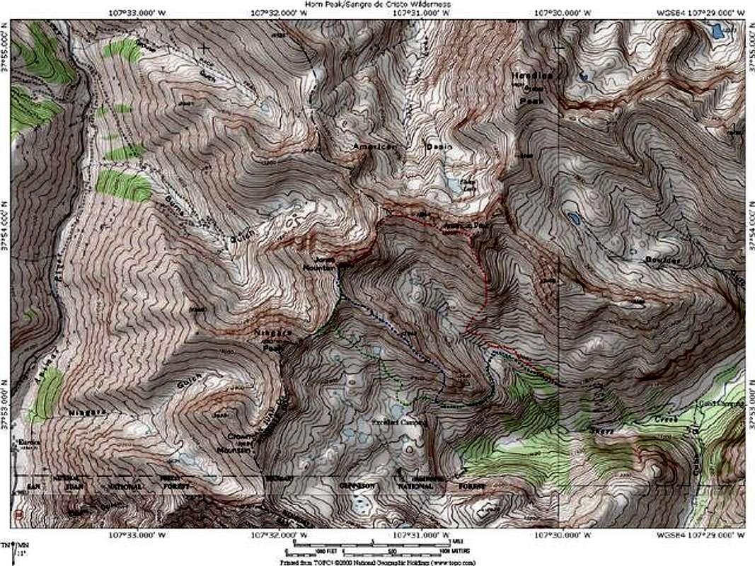
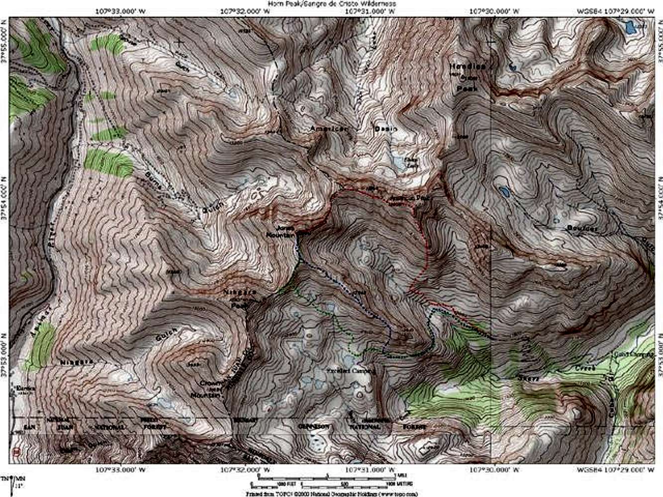
A map portraying Jones Mountain Routes from Snare Gulch. The red route is the eastern ridge via a traverse of "American Peak" (it may also be accessed by the "American"-Jones Saddle). In blue is Jones' south ridge. The green route leads into upper Snare Gulch and allows Niagara Peak to be added to the hike. Map generated with National Geographics Topo! software. Jon Bradford


