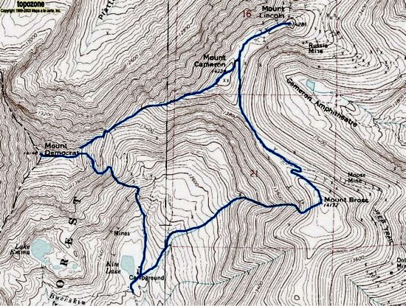
A map showing a slightly unusual version of the DeCaLiBron circuit, a climb that bags four 14ers, three of them official. Black dots indicate where snow was traversed in mid-June of 2004. The standard route ascends
Democrat's Southeast Ridge to the summit, descends to the Democrat-Cameron saddle, ascends Cameron via the west ridge, goes out and back quickly to
Lincoln and then traverses
Bross's north ridge. Descent is via the west slopes or (when snow is present only!) the western couloir.


