
-
 24523 Hits
-
 77.48% Score
-
 8 Votes
|
|
Area/Range |
|---|---|
|
|
50.75000°N / 6.01660°E |
|
|
2276 ft / 694 m |
|
|
Overview
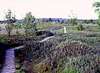
Once again, certainly not a major mountain but in Belgium terms it is - i.e. it is the countries highest point. The lowly remains of a once mighty volcanic area, this particular peak once called de Hoge Venen. Located in the pleasant, forested Parc Naturel de Haut Fagnes in eastern Belgium, the ascent of Signal de Botrange can provide a good if not spectacular introduction to Belgium nature.
Unfortunately (or for some the opposite) a road runs across it's tree covered summit between Eupen and Malmady. It is a round hill like summit rising in the Belgium Ardennes and adorned by a tower or the 'Signal of Botrange'.
A day long route purely to ascend the mountain would be hard to come by unless you began well away from the summit itself, but there is pleasant walking in the forest. One pleasant (if not short) route would be to start at the nature centre a couple of miles south and walk through the forest tracks to the tower area. An easy walk for old and young!
If thats not enough, go explore the lovely Hautes Fagnes area (meaning high marsh) but remember - bring a rain coat! Don't despair on a rainy day - the Fagnes gain a delightful quality when mist covered and rain dashed.
The Belgium government has built a tower 6 metres high next to the summit that places whoever climbs it at exactly 700 metres above see level.
 |  |  |  |
Getting There
One alternative would be to drive, or take the bus from Eupen (they leave every hour from the bus station) southbound over the N6 towards Malmedy. There are plenty of train connections with Eupen from Aachen in Germany or Liege in Belgium. The road will pass over the summit (easily spotted with the tower). Two miles south is the Nature Centre where bags can be left if need be and a cup of coffee obtained. It has one or two interesting artefacts on the local nature but the screaming school parties may hurry you on. Then walk to the summit on the road or better on forest tracks. Other alternatives would be using the N672 from Verviers or the N6 north from Malmady. Buses will pick you up on the road next to the nature centre when leaving - hitching is difficult because the traffic really shifts along this road and probably won't see you!
 |
Red Tape
Not a sausage required in terms of permits. An all year round peak but summer is probably the best choice - a sunny winters day would be good. Plenty of wildlife in the area including deer and foxes but unlikely to see much unless you go into the woods themselves. The nature centre has a lot more information than me.
For up to date information on public access and closing of some of the areas in the park call the Natuur Centrum 00 32 (0) 80 44 03 00. It is open from 10:00 to 18:00 hours every day.
When To Climb
All year round and summer is best, although don't expect good weather all the time as slightly less that 1.5m of rain is said to fall on this spot during the year.
 |  |
Camping and Lodging
Best to stay in Eupen or Malmady or any other town in the area and there are several camping sites in the region.
A good option is to stay in Robertville (a few kms south of the summit). From here you can plan a whole day walk all the way up to Signal de Botrange - going trough some of the nicest parts of the park.
 |
Mountain Conditions
The weather can change quickly in the Ardennes, so it pays to call ahead to the local tourist office for the daily ski bulletin. For information in the Eastern Cantons call 080/22.76.64. For conditions in Liege province call 041/22.42.10. For Namur province, contact 081/40.80.10. Or watch the weather reports on Belgian television.
Average temperatures:
All year round: 6.1 °C
In January: -1.0 °C
In July: 16.0 °C
Annual average precipitation: 1400 mm
Average number of rainy days per year 172
Average number of days with snow per year: 43
Average number of foggy days per year 175
 |
Geological Beginnings
According to geological studies the Hoge Venen region (which is Dutch for Hautes-Fanges – not the name of the mountain), and in fact most of the Ardennes, originated from a relatively fast geological uplift in the Miocene period. So, even though there is still some volcanic activity in the area, the origin of the uplifting is not volcanic.
External Links
- Hoge Venen Natuur Centre
In Dutch, French and German only
- Nature Centre
In English
- Natural Park web-site
In French and German only
Antony Walker - Nov 4, 2002 6:46 pm - Hasn't voted
Untitled CommentThis has now been included in the overview chapter.
Thanks for the information
gatogringo - May 27, 2003 2:13 am - Hasn't voted
Untitled CommentI will have to disagree on this observation. According to geological studies the Hoge Venen region (which is Dutch for Hautes-Fanges – not the name of the mountain), and in fact most of the Ardennes, originated from an relatively fast geological uplift in the Miocene period. So, even as there is still some volcanic activity in the area, the origin of the uplifting is not volcanic.
lutjebroek - Jun 7, 2003 5:38 am - Hasn't voted
Untitled CommentIk zie dat je nederlands bent, da's iets makkelijker. De hoge Venen is inderdaad het gebied van de halve ardennen. De venen zelf zijn kraters opgevuld met, je raad het nooit, veen. Het is wel degelijk oud vulkanisch gebied (60 miljoen jaar geleden). Toen waren de bergen daar alleen een stukkie hoger.
Antony Walker - Mar 30, 2004 2:11 pm - Hasn't voted
Untitled CommentThis has now been added. Thanks
Antony Walker - Mar 30, 2004 2:14 pm - Hasn't voted
Untitled CommentThis has now been added. Thanks.
Antony Walker - Mar 30, 2004 2:15 pm - Hasn't voted
Untitled CommentThis info has been updated. Thanks.
Antony Walker - Mar 30, 2004 2:16 pm - Hasn't voted
Untitled CommentThis has been updated. Thanks for the info.
Antony Walker - Mar 30, 2004 2:17 pm - Hasn't voted
Untitled CommentI have added your opinions to the site. Thanks.
lutjebroek - Oct 24, 2002 6:04 am - Hasn't voted
Untitled CommentIt is an old vulcano, like Baraque Fraiture and Baraque michel. It is called de Hoge Venen.
Antony Walker - Nov 4, 2002 6:46 pm - Hasn't voted
Untitled CommentThis has now been included in the overview chapter.
Thanks for the information
gatogringo - May 23, 2003 5:07 am - Hasn't voted
Untitled CommentAverage temperatures:
Al year round: 6.1 °C
In January: -1.0 °C
In July: 16.0 °C
Annual average precipitation: 1400 mm
Average number of rainy days per year 172
Average number of days with snow per year: 43
Average number of foggy days per year 175
gatogringo - May 26, 2003 5:44 am - Hasn't voted
Untitled CommentThe Belgium government has built a tower 6 metres high next to the summit that places whoever climbs it at exactly 700 metres above see level.
gatogringo - May 27, 2003 2:13 am - Hasn't voted
Untitled CommentI will have to disagree on this observation. According to geological studies the Hoge Venen region (which is Dutch for Hautes-Fanges – not the name of the mountain), and in fact most of the Ardennes, originated from an relatively fast geological uplift in the Miocene period. So, even as there is still some volcanic activity in the area, the origin of the uplifting is not volcanic.
Proterra - Aug 11, 2008 4:36 am - Hasn't voted
Re: Untitled CommentYou're mixing facts. The Ardennes/Eifel were first uplifted in the Devonian when (I believe the Caledonian and Avalonian plates collided with the proto-European plate) It rose to fairly lofty peaks, probably comparable to the Pyrenees nowadays, and then got eroded out to close to sea level during the Cretaceous. In the Miocene volcanic uplifting started again creating all these wonderful craters in mostly the Eifel region, and which continues even today. (around 0.4 mm/year) Centre of volcanic activity has shifted eastward from the Miocene though, from the Belgian-German border to the eastern Eifel, with the last major eruption (VEI 5-6, comparable with Pinatubo) at Laachersee, NW of Koblenz, Germany. This was in 10.930 BCE. Because the Eastern Ardennes haven't seen any volcanic activity in the last 5-6 million years, the craters there are filled up with peat, creating high marshland.
gatogringo - May 27, 2003 2:57 am - Hasn't voted
Untitled CommentFor up to date information on public access and closing of some of the areas in the park call the Natuur Centrum 00 32 (0) 80 44 03 00. It is open from 10:00 to 18:00 hours every day.
gatogringo - May 27, 2003 3:02 am - Hasn't voted
Untitled CommentA good option is to stay in Robertville (a few kms south of the summit). From here you can plan a whole day walk all the way up to Signal de Botrange - going trough some of the nicest parts of the park.
lutjebroek - Jun 7, 2003 5:38 am - Hasn't voted
Untitled CommentIk zie dat je nederlands bent, da's iets makkelijker. De hoge Venen is inderdaad het gebied van de halve ardennen. De venen zelf zijn kraters opgevuld met, je raad het nooit, veen. Het is wel degelijk oud vulkanisch gebied (60 miljoen jaar geleden). Toen waren de bergen daar alleen een stukkie hoger.
Antony Walker - Mar 30, 2004 2:11 pm - Hasn't voted
Untitled CommentThis has now been added. Thanks
Antony Walker - Mar 30, 2004 2:14 pm - Hasn't voted
Untitled CommentThis has now been added. Thanks.
Antony Walker - Mar 30, 2004 2:15 pm - Hasn't voted
Untitled CommentThis info has been updated. Thanks.