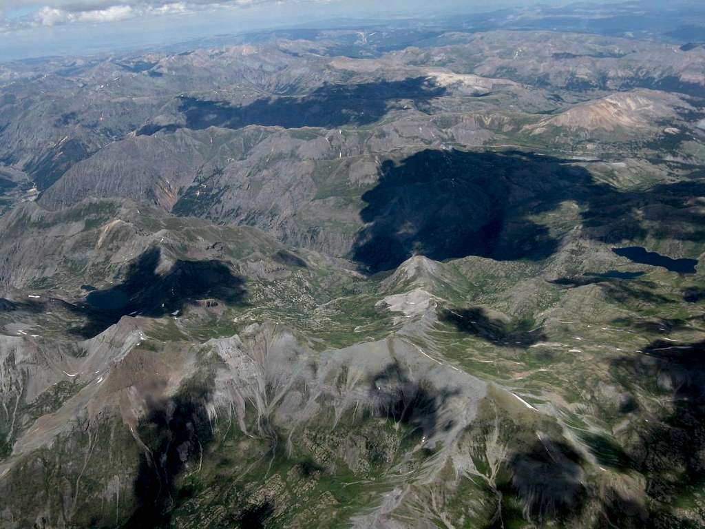
Aerial photo of 7.17.2010 SP hike area
An aerial photo of the July 17, 2010 SP hike area. The upper end of Cunningham Creek / Highland Mary trailhead, where we began and ended the hike, is at the base of the cloud covered area in the center of the photo. The Highland Mary Lakes are seen at central right side of photo. The peaks we hiked are in foreground, and Spencer Basin, that we hiked back down, is in center of photo, just below the cloud covered area. The photo was taken from 17,000' in a glider by Gliderman the day after the hike. I missed a great day of hiking on the 18th, but it was also a spectacular day for gliding and aerial photos... took about 200 on that 5 hour flight.


Comments
Post a Comment