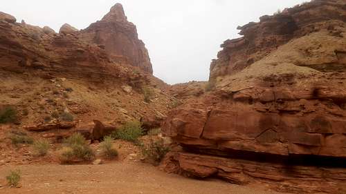
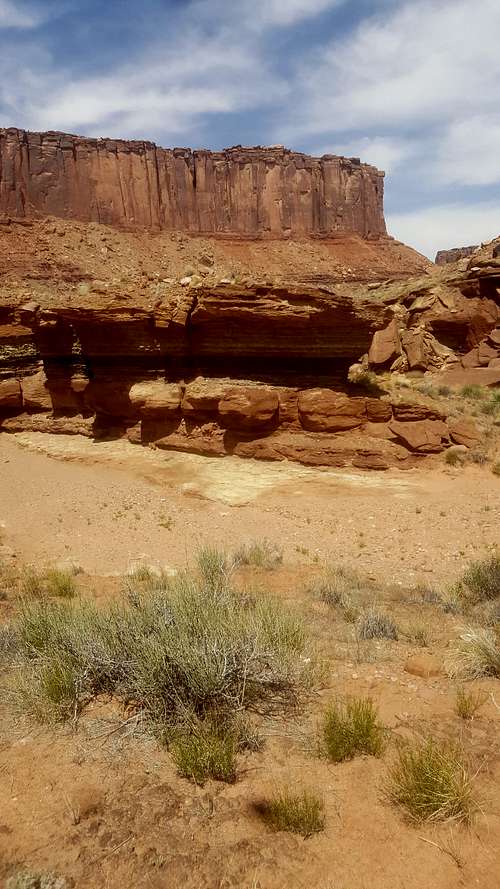
![Syncline trail]() Syncline trail
Syncline trailI was looking for a backpacking trip in canyonlands that was accessible with a passenger car and had a permit available a week from when I was planning it. Although the Island in the Sky district was not my first choice, the campsites I had been thinking I would reserve in the Needles were booked out for the next 2 months! I found a trip suggestion from backpacker magazine for an 18-mile loop in the Island in the Sky district that they claimed was "the best weekend" in canyonlands, so I was in! The route is from the Alcove Spring trail to the Taylor canyon road meeting up with the White Rim road at the green river. Then the route returns to the Island in the Sky via Upheaval Canyon and the Syncline loop.
I couldn't get on the trail until about 8:30 am, since I had to pick up my backcountry permit that morning. I had been planning to stay the night at the labyrinth campground, however after talking to the ranger, I found out that my permit was actually for the Taylor Canyon zone. The ranger suggested I camp just east of the white rim road, which was still in the taylor canyon zone. Not exactly what I had expected, but it seemed like it would work.
The first bit of the hike involved walking the 1.2 miles from the upheaval dome parking lot to the Alcove Spring trailhead. Once there, the views immediately opened up. The trail starts to descend very fast. The pictures I had seen on SP and others were much more intimidating than the trail actually was. I didn't have to take my pack off at all, which was a pleasant surprise. The views in this part of the trail are amazing. The combination of the expanse of the floor below along with the canyon walls steeply plunging downward make for an incredible sight.
![Start of the alcove spring trail]() Start of the alcove spring trail
Start of the alcove spring trail![First views of Alcove Spring]() First views of Alcove Spring
First views of Alcove Spring![Tree at the beginning of alcove spring trail]() Tree at the beginning of alcove spring trail
Tree at the beginning of alcove spring trail![Alcove Spring.]() Alcove Spring.
Alcove Spring.
![Steep rocky trail]() Steep rocky trail
Steep rocky trail![Cairns]() Cairns
Cairns
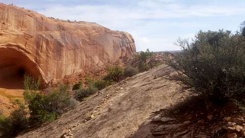
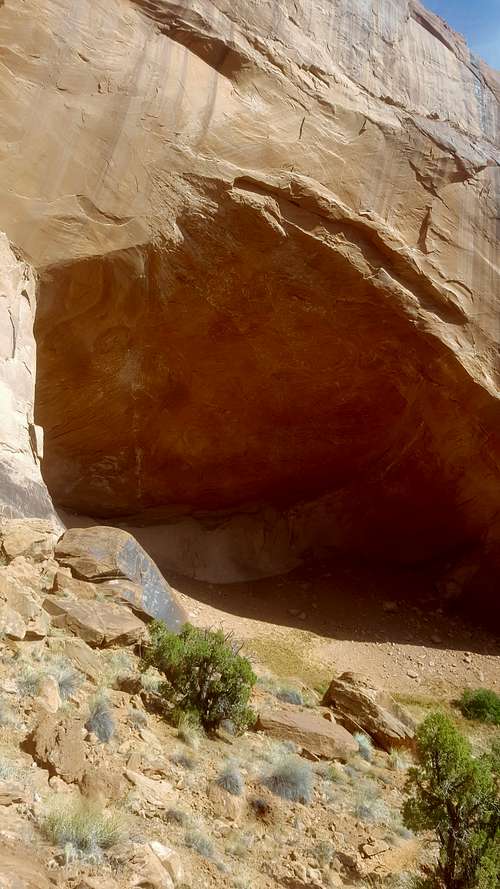
There is a small spur trail to the inside of the giant alcove. I made my way close to it, but turned around because the soil was too loose. Like everywhere in Canyonlands at this time of year, the color of the plants inside the spring was bright green, which made for a stark contrast to the deep reds of the canyon walls.
![In the alcove]() In the alcove
In the alcove![The spring part]() The spring part
The spring part![The descent]() The descent
The descent![Looking back at the descent]() Looking back at the descent
Looking back at the descent
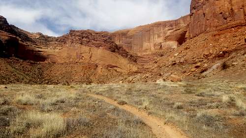
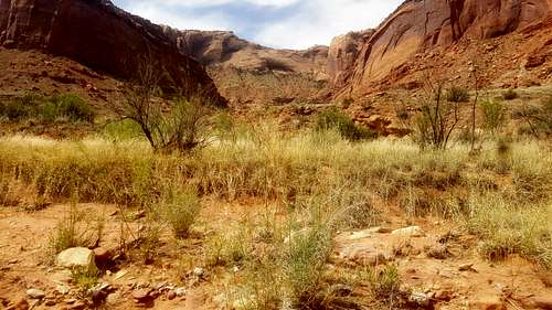
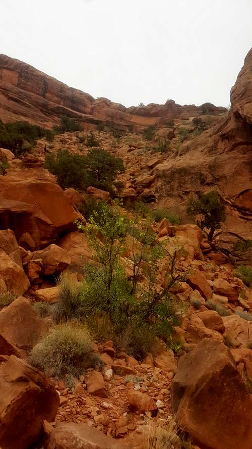
After the trail descends to the valley floor, the going gets somewhat less interesting. The trail follows the bottom of a wide open canyon, and after a mile or so follows the bottom of a wash. Some of the features of the wash are pretty interesting.
![Views in trail canyon]() Views in trail canyon
Views in trail canyon![Wash walls]() Wash walls
Wash walls
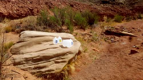
Someone curiously left 5 gallons of water in the middle of trail canyon.
![Leftover Water]() Leftover Water
Leftover Water
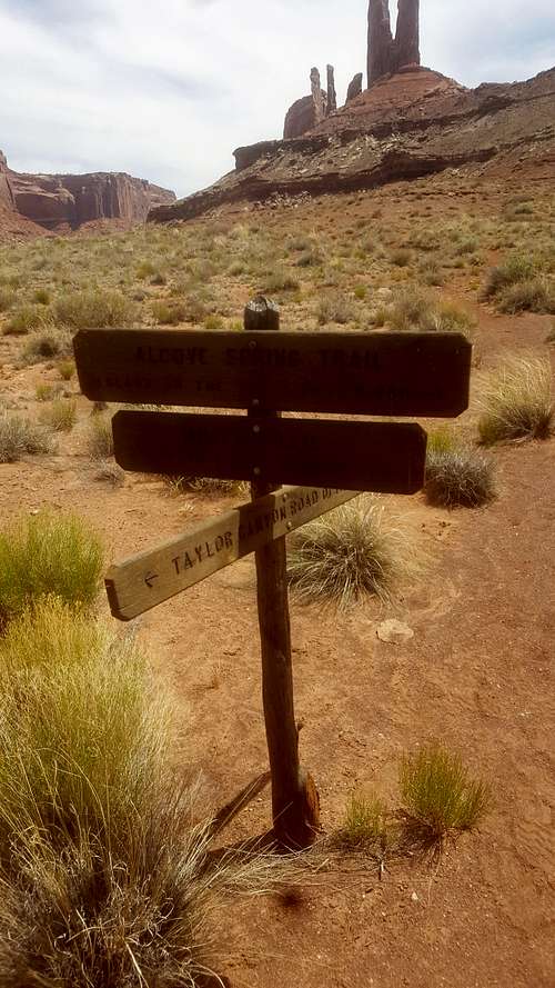
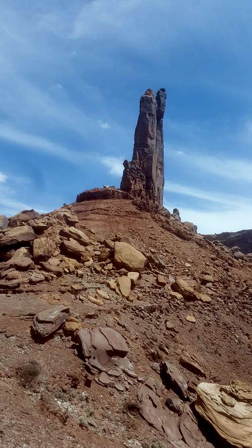
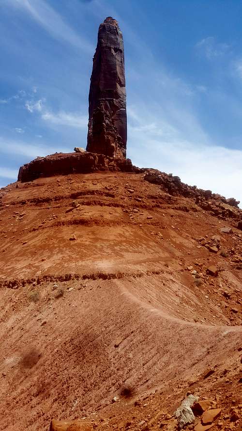
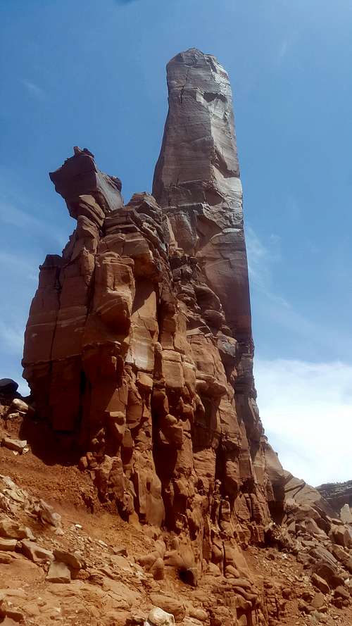
After 6 miles I came upon Moses and Zeus, the massive rock spires at the meeting of Trail and Taylor Canyons. I saw that there was a sign pointing to a trail that went toward them for a mile. I didn't want to tire myself out, so I disappointedly decided I wouldn't do the spur trail.
![Trail Sign]() Trail Sign
Trail Sign
I took a lunch break at the campground at the beginning of the Taylor canyon road and eventually convinced myself to turn back around and do the extra mile to see Moses and Zeus. After all, it looked like it might not even gain any elevation. Maybe it just went to another viewpoint, I hoped. As I made my way over there, I crossed paths with two other guys who had followed me out of alcove spring. Since I had only carried my water bottle from my lunch spot I must have seemed pretty strange. They were a little whooped too, and said they would stop at the first good view. Since I didn't want to look like a wimp, I decided to follow, and when they stopped, I felt obligated to go all the way up, naturally.
![Trail to mz]() Trail to mz
Trail to mz![Halfway up]() Halfway up. Boy was I wrong about this trail!
Halfway up. Boy was I wrong about this trail!
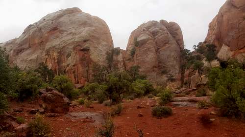
![Directly under moses and zeus]() Directly under moses and zeus
Directly under moses and zeus ![Moses and Zeus]() Moses and Zeus
Moses and Zeus
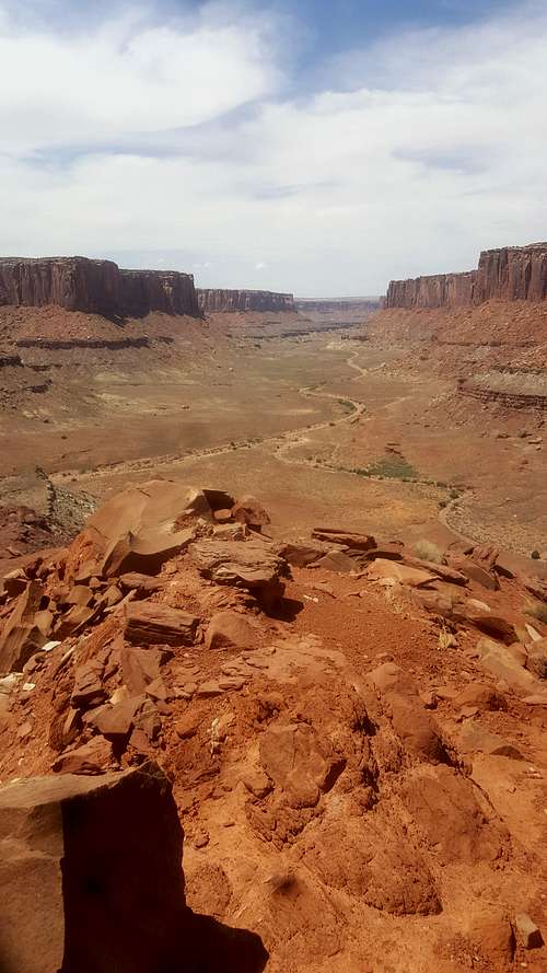
The formations themselves were kind of tough to see from directly below them. However, the sprawling views of the canyon below were well worth the hike.
![View from moses and zeus]() View from moses and zeus
View from moses and zeus![Looking east]() Looking east
Looking east
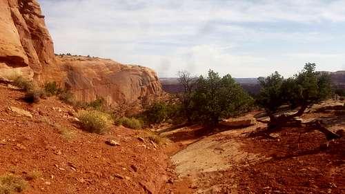
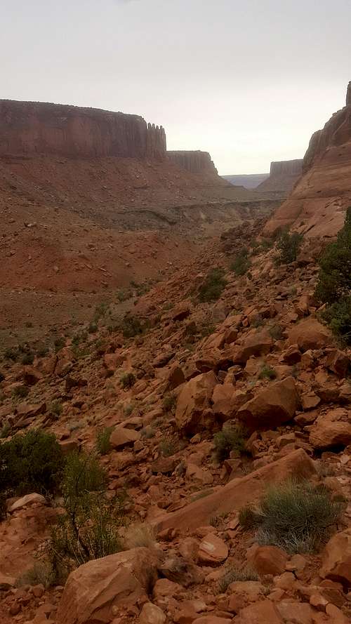
After returning from moses and zeus, I made my way down taylor canyon road through a large canyon which was much more open than the canyon leading up to moses and zeus.
![Taylor Canyon]() Taylor Canyon
Taylor Canyon After 5 more hot miles, I finally arrived at the labyrinth campground. Since my permit was technically only for the taylor canyon zone, I couldn't camp in one of the sites at labyrinth, but had to stay a little ways back into taylor canyon. I was still within walking distance of the green river though.
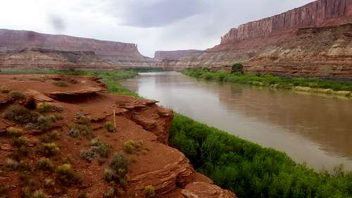
![Green River]() Green River
Green River![Sunrise at green river]() Sunrise at green river
Sunrise at green river
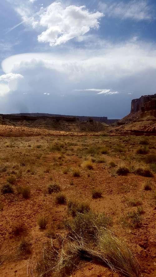
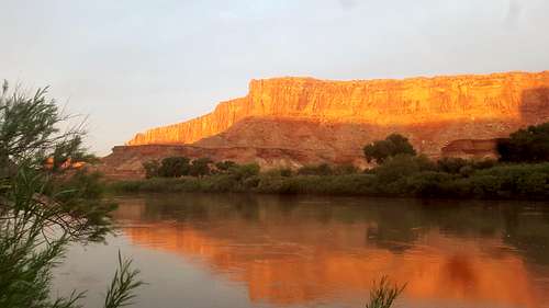
I was jealous of the people staying in the labyrinth sites, since they got to wake up to a sweeping overlook of the river covered in rich greenery. I managed to get up before sunrise the next morning, but the reward was fleeting. After about 10 minutes of a glorious orange glow on the canyon walls, the sun was obscured by clouds that would hide it for the rest of the day. Unfortunate for the views, but a welcome respite from the heat.
I foolishly left my food in a plastic grocery bag while I went to filter and treat water from the river. When I came back, birds and some other desert critters had taken all but half a bag of granola. Oh well! It was a good thing I had eaten plenty the night before, and I felt fine all day. Continuing from the river, I took the upheaval canyon trail all the way back to the upheaval dome trailhead. The start of the trail at the river is a wide sandy wash with a lot of interesting vegetation.
![Upheaval canyon]() Upheaval canyon
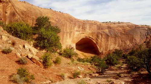
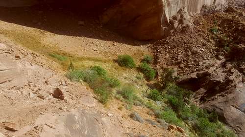
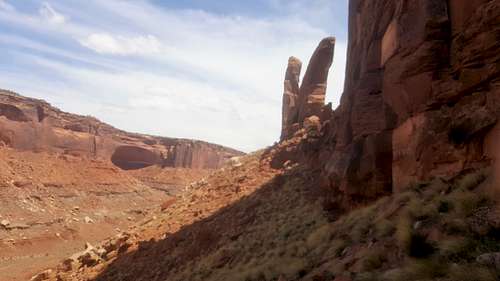
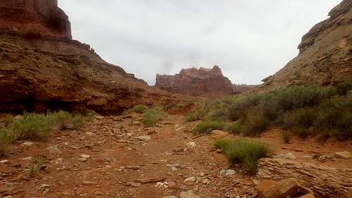
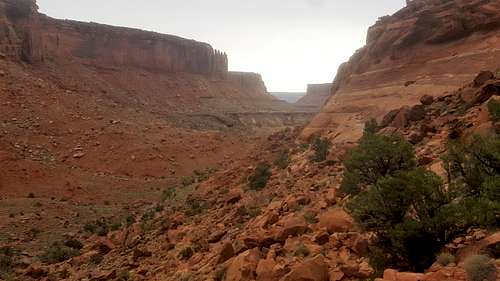
Upheaval canyonThe wash ever so slightly continues to get narrower over the next 3 miles. I was pleased to find out that all the way to the syncline trail, the elevation gain is very slight. The syncline trail follows a relatively narrow canyon, whose walls get taller and taller as you continue southeast.
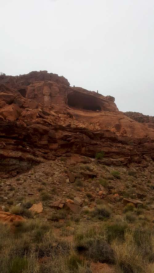
I saw a few caves high up in the walls, which looked like they would be nice spots to sit and take it all in if you could get up there.
![Syncline trail]() Syncline trail
Syncline trail![Cave on the syncline trail]() Cave on the syncline trail
Cave on the syncline trail
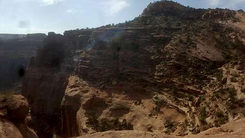
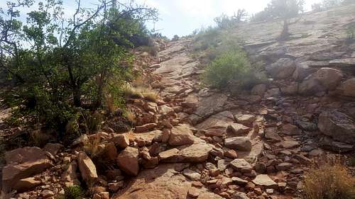
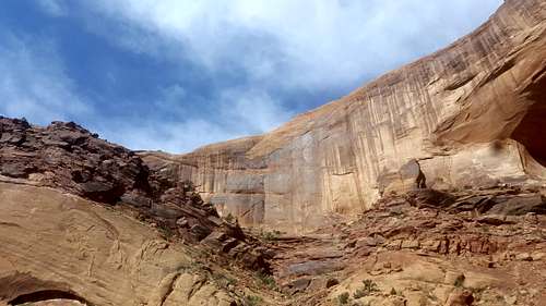
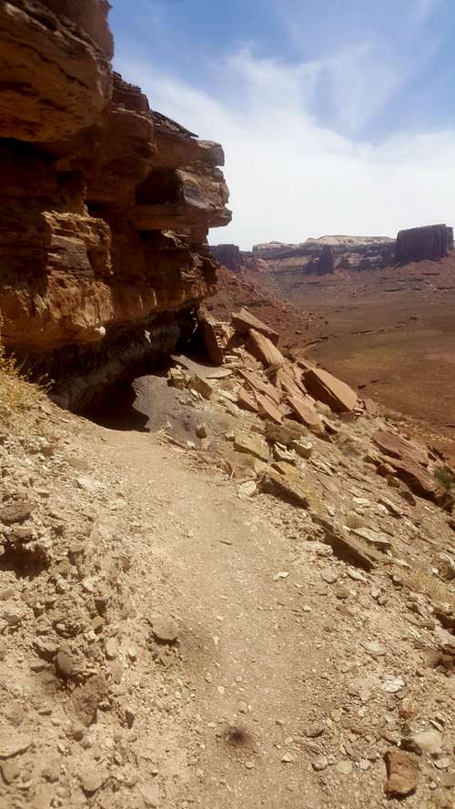
Eventually the canyon ends and the syncline trail steeply ascends a wall of boulders. This looked more intimidating than it was, since the trail is so well-kept that it was basically a staircase.
![Looking up the rock wall]() Looking up the rock wall
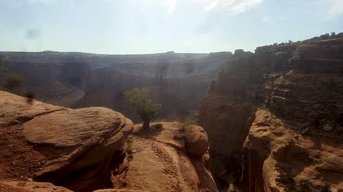
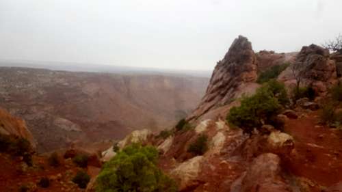
Looking up the rock wallAt the top, there were a few natural chairs that I took advantage of. It was pretty incredible to look out on the canyon and know that I had it all to myself.
![Looking down canyon]() Looking down canyon
Looking down canyon![Another view down the canyon]() Another view down the canyon
Another view down the canyon After that point, I saw my first people of the day, the first of many. The trail continued to climb for a little while, and, probably because I had neglected to bring any rain gear, it started to drizzle. At this point, it was a mad dash back to my car, and I had somewhat less enjoyment of the still-incredible boulders and red sand in the last mile or so of trail.
![Rock formations]() Rock formations
Rock formations![Large rocks]() Large rocks
Large rocks As I arrived back at the upheaval dome parking lot, I was incredulous at the crowds bumping elbows and hunting for parking spots to walk the tenth of a mile to the overlook. I remembered the feeling of serene solitude at the top of what was then my personal canyon and, despite the blisters and soreness in my legs, I was glad I took the long way.
I hope my report helped some if you're considering doing this loop. Thanks for reading!
Comments
No comments posted yet.