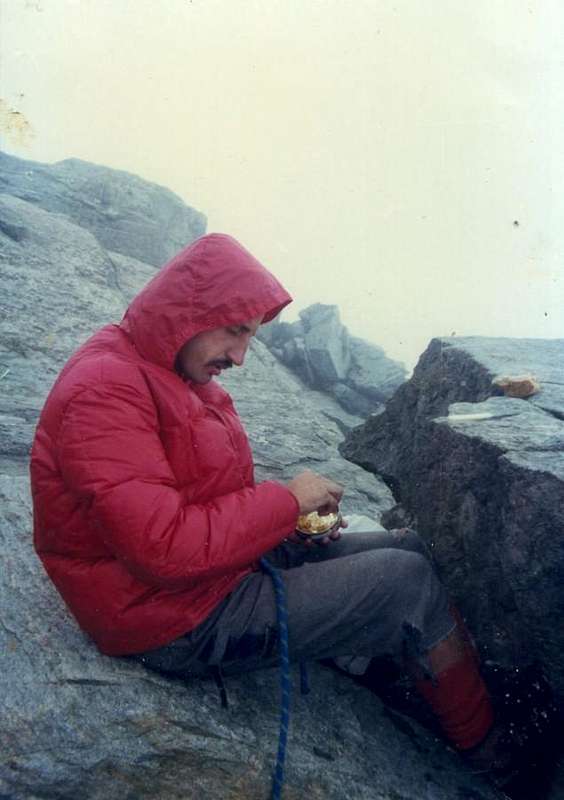
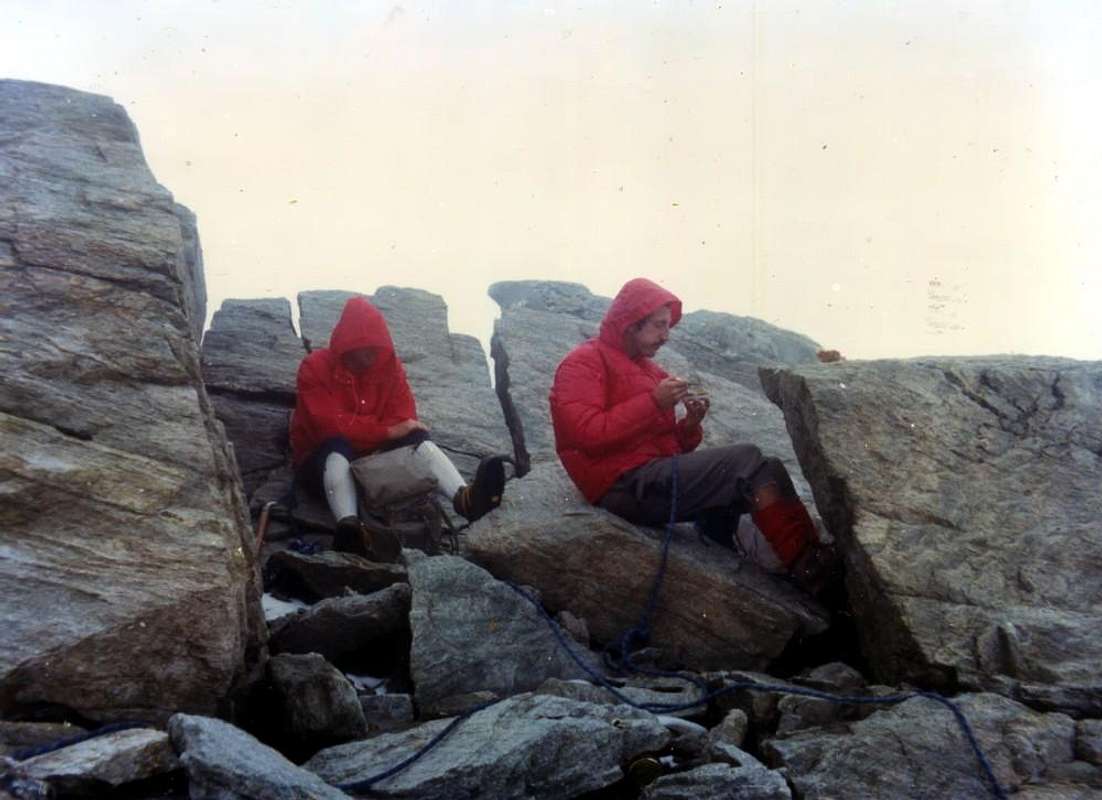
La montagna chiama i suoi figli, ed essi rispondono fedelmente al suo appello…
Osvaldo Cardellina, Diario alpinistico, 1964-65
Page texts: @ OsvaldoCardellina"Osva", passed away on May 2, 2022. Page owners: Christian Cardellina e Osvaldo Cardellina. Any updates from September 12, 2022: Antonio Giani, page administrator, friend and climbing companion.
Testi della pagina: @ OsvaldoCardellina "Osva", scomparso il 2 maggio 2022. Proprietari pagina:Christian Cardellina e Osvaldo Cardellina. Eventuali aggiornamenti dal 12 settembre 2022: Antonio Giani, amministratore della pagina, amico e compagno di salite.
Overview
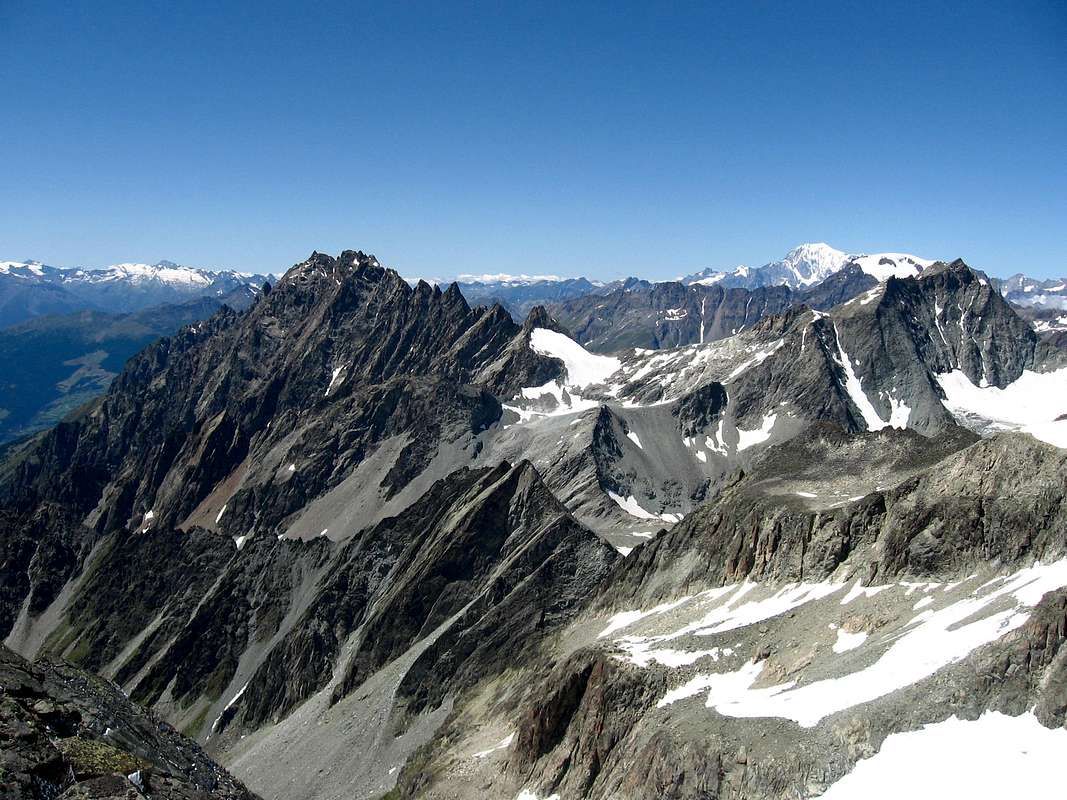
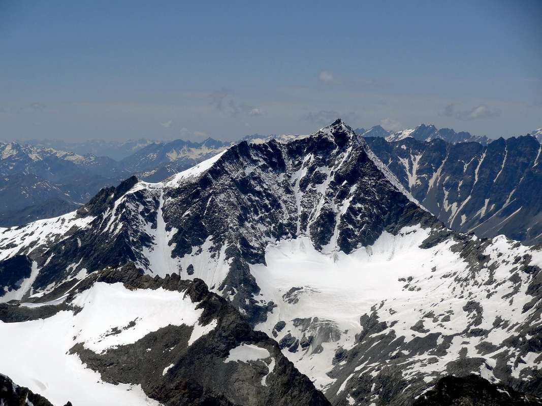
This beautiful mountain, Symbol of Ollomont Valley, is formed by five ridges with four sides. It sounds like a contradiction, but in fact the South Slope is divided into two parts by a small spur which separates the South Slope, covered by the Glacier of Mont Gelé, another turned more towards the Southwest and to form a small stony vallon, l'apex of which is located on a small hilltop between the Peak and a large shoulder more to the West. The same is limited on its left margin by a Crest-Edge Southwest, which separates it from the vertical Wall West. Another steep edge divides, starting from an elevation above the South Col of Balma, the Eastern Slope off, like a trapeze, the triangular Wall East-northeast, above the Glacier de Crête Sèche on Swiss territory, from another, narrower, facing Southeast over the left lateral moraine of the same. In fact, placed on the chain of Italian/Swiss border, this mountain has the last two Faces, as well as the Northwest Wall, completely in Switzerland. The other, namely South, Southwest and West "look" the Valley of Aosta and precisely the Ollomont Valley and the upper part of the By Eastern Basin. But there are three, in practice, the ridges that determine the character of the mountain: the Ridge Northwest that reaches from the Summit to the West the great shoulder 3.446 meters above the Western Wall; from this the border ridge turn sharply Northwest reaching the Fenêtre Durand (2.797m), an important and wide pass between Gelé Mont Avril and between By Basin and the Valley Mauvoisin-Bagnes in Valais. The same is also called "Fenêtre de Calvin", because it seems that through the same the Protestant Calvin fled from persecution in Italy to Switzerland.
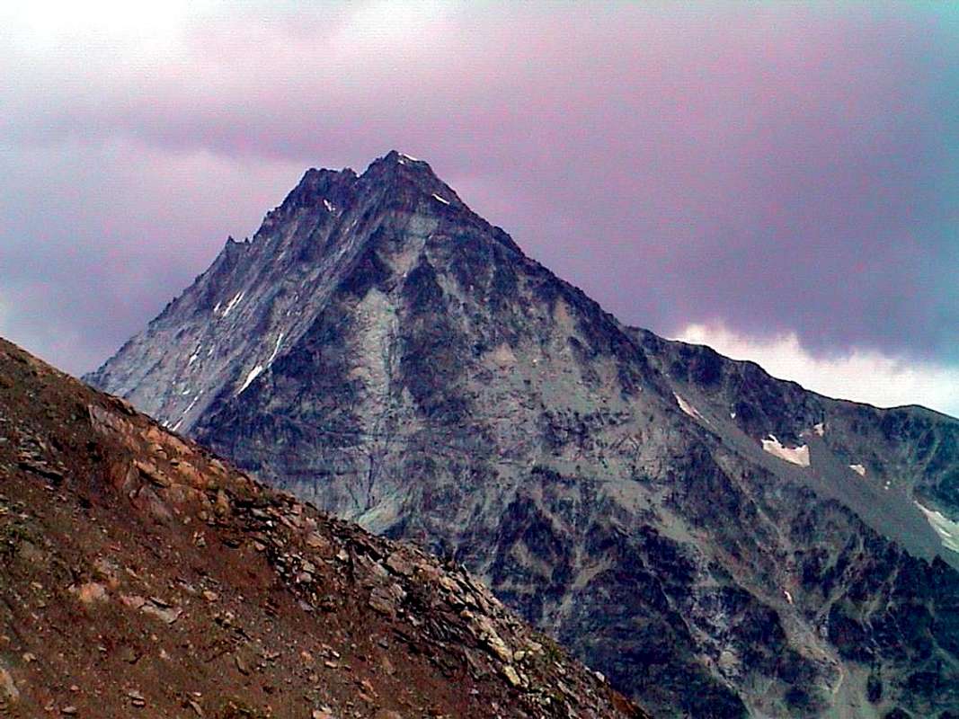
North-northeast Ridge, Eastern Faces & Southeast Crest from Trouma des Boucs, by andrea.it
The second, or Ridge North-northeast, is the only fully in Switzerland and down to the Pointe d'Ayace (3.019m), forming a powerful buttress, act to separate the Walloon Fenetre Northwest from the one on the opposite side of Crete Sèche. The last, which, like the previous starts right on the Vertex, heads back on the border to the South reaching an Ante Top before the Col de la Balme (3.320m), the Mont of the same name (3.347m), where he completed the border with Switzerland, and the much more important Mont Gelé Pass (3.180m), which precedes the "robust" Mountain Chain of Morions. This last, very important and indented with numerous Summit, ends above the Village of the Municipality of Valpelline, separating this last valley from Ollomont. The other ridges, spurs or edges (South-southwest, Southwest, Southeast) have less relevance "aesthetic", although they maintain a clear importance in terms of topography. Equally, if we analyze the slopes, three are formidable walls (Northwest, East and West), while the South Slope in the end is, at least in terms of talking about mountaineering, certainly the most important, as it passes over the Normal Route frequented by almost all of those who want to climb the Mount Gelé. Rare are the climbs through the beautiful and challenging Ridge Northwest from Finestra (Window) Durand, very rare for the homologous and long North-northeast probably climb for exploratory purposes in a single occasion in 1907, standard from Chanrion Hutte those of Crest Southeast from Col de la Balme or "random" even integral from Mont Gelé Pass. With regard to the walls to be collected as the Northwest has a few ascents and difficult, probably no more repeated, the West probably one uphill, while the East and Southeast still expect the climbers. The other ridges, slopes have exclusively historical and still are of marginal, secondary importance.
Northwest & East-northeast (left) Walls amongst three ridges, by om
Let's quickly History.
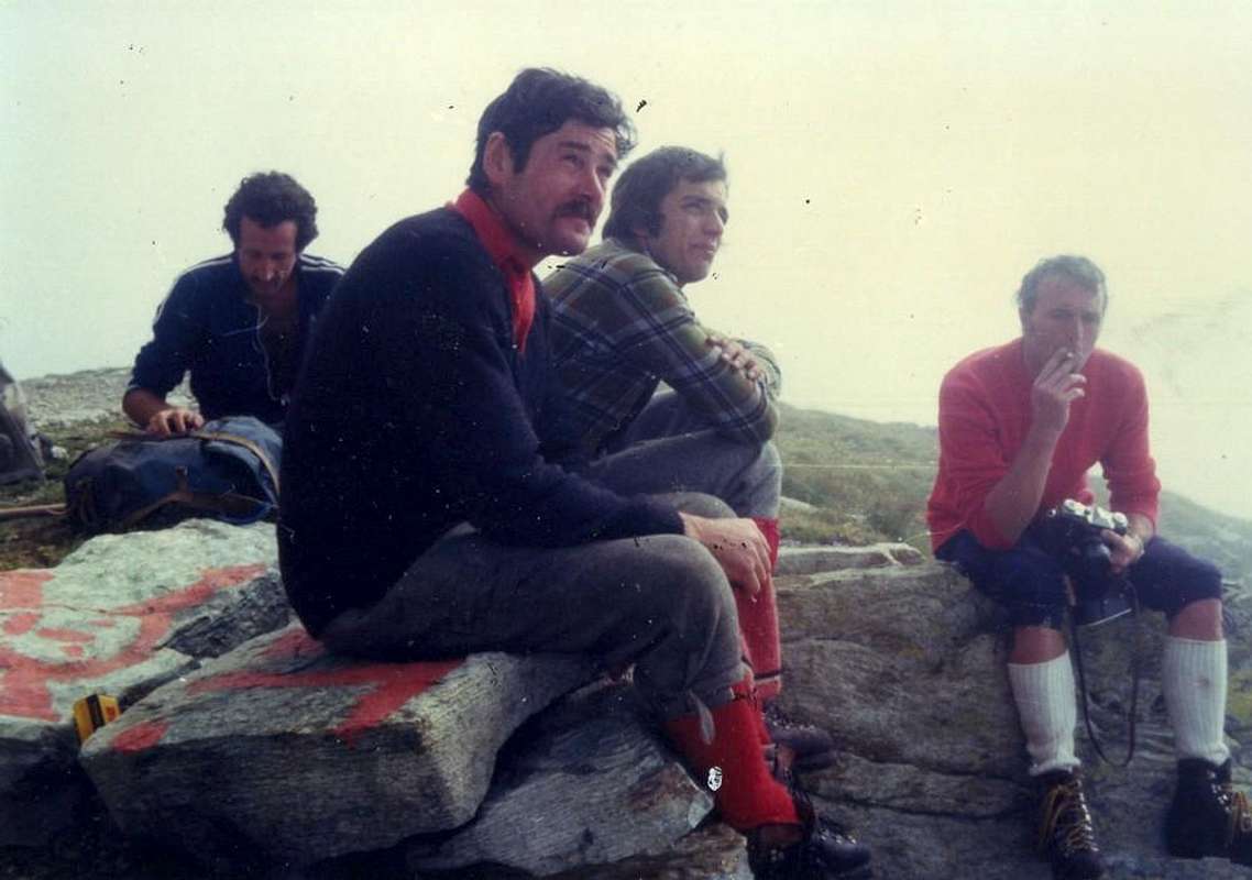
August 11th, 1861: first climb English F.W. Jacomb with Mountain Guides Chamonix Jean Baptiste Croz and the famous Michel Croz (will fall to the Matterhorn in July 1865), through the Southeast from Dzovenno Hamlet with slope downhill slope to the Southwest to the current Bivouac Regondi and Ollomont. July 16th, 1894: E.F.M. Benecke and H.A. Cohen from Chanrion Hut through Glacier Crete Sèche, East slope Balme Pass, Southeast Crest. Current Standard from Switzerland. July 31th, 1899: first climb of the wall as well as solitary Northwest by the Austrian F.L. Frankhauser through the great Central Canal. Beginning of 1900: up by unknown climbers of Cresta Northwest. It is aware of Giovanni Merope and Silvio Urbano August 25, 1970 by Nino Bivouac Regondi and always the same of a party of two climbers Lombard ) Como or Brescia Towns?) August 10th, 1975 (personal meeting with the two mountaineers). August 13th, 1907: Emile Fontaine with Guides French L. Fellay and E. Michellod from Chanrion Hut through Glacier Crete Sèche and Sella 3.160 meters. September 16th, 1914: Attilio, Augusto, Elisa and Giuseppina Porro first complete ascent on Southwest Slope to Western Antetop. April 7th, 1917: first ascent resort by renowned Aldo Bonacossa with Mountain Guide Courmayeur Julien Rey. No known winter ascents, although with the increasing popularity of the Ski-Mountaineering least after the war may have already been realized.
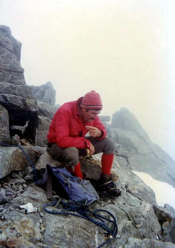
Summer of 1922: A. Antonini, C. Bestetti, Carlo Bramani and Vitale Bramani (the inventor of the rubber soles for climbing "Vibram") open a new route on the north-west wall, which you do not know the route. Probably between the two Routes 1899 (Frankhauser Couloir) and 1968 (Swiss Routes). July 30th, 1967: Osvaldo Cardellina with Dutchman Jan Westenbroeck, first ascent of the integral Ridge Southeast from Col du Mont Gelé, bypassing on edge Mont de la Balme. August 24th, 1968: Swiss Hubert Bruchez and Laurent Troillet open a way very hard and live in the Eastern sector of the Northwest Wall. 10 Agosto 1975: Osvaldo Cardellina, Marco Cossard, Giuseppe Lamazzi and Enrico Zanella complete descent on small Southwest Spur up to the altitude of 2.940 meters. August 5th, 1976: Osvaldo Cardellina and Marco Cossard climb the Wall East-northeast through diagonal couloir, departing Dzovenno, crossing Pass and Glacier Crete Sèche. August 24th, 1991: Osvaldo Cardellina, only, first ascent of the Southwest Ridge from the altitude 2.500 meters to Great Shoulder 3.446 meters, from Glacier, Bivouac Nino Regondi, Alp Thoules with complete and integral descent of the Southeast Ridge at Mont de la Balme and Col du Mont Gelé.
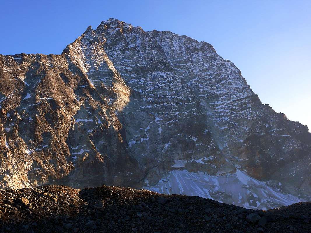
North & West Walls from Northwest, by alpinerunner
Questa bella montagna, Simbolo della Valle di Ollomont, é formata da cinque creste con quattro versanti. Sembra un'incongruenza, ma in realtà il Versante Meridionale é diviso in due parti da un piccolo contrafforte separante il Versante Sud, coperto dal Ghiacciaio del Mont Gelé, da un altro rivolto più verso Sudovest e tale da formare un valloncello petroso, l'apice del quale trovasi sopra una piccola Sommità tra la Vetta ed uno Spallone più ad Occidente. Lo stesso é limitato sul suo margine di sinistra da una Cresta-Spigolo Sudovest, che lo separa dalla verticale Parete Ovest. Un altro ripido spigolo divide, partendo da una elevazione a Sud sopra il Colle della Balma, il largo Versante Orientale, a guisa di trapezio, la triangolare Parete Est-nordest sopra il Glacier de Crête Sèche in territorio svizzero, da un'altra, più ristretta, rivolta a Sudest sopra la morena laterale sinistra del medesimo. Infatti, posta sulla catena di confine italo/svizzero, questa montagna presenta queste due ultime facce, nonché la Parete Nordovest, completamente in territorio elvetico. Le altre, ovvero Sud, Sudovest ed Ovest "guardano" la Valle di Aosta e precisamente la Valle d'Ollomont e la parte superiore ed Orientale della Conca di By. Ma sono tre, in pratica, le grandi creste determinanti la fisionomia della montagna: la Cresta Nordovest che dalla Sommità raggiunge verso Ovest la grande spalla 3.446 m sopra la Parete Ovest; da questo la cresta di confine piega decisamente a Nordovest raggiungendo la Fenetre Durand (2.797 m), importante e largo valico tra il Gelé ed il Mont Avril e tra la Conca di By e la Valle di Mauvoisin-Bagnes nel Vallese. Lo stesso é chiamato anche "Fenêtre de Calvin", perché sembra che tramite lo stesso il Protestante Calvino sia fuggito dalle persecuzioni in Italia verso la Svizzera. La seconda, o "Crestone" Nord-nordest, é l'unica completamente in territorio svizzero e scende verso la Pointe d'Ayace (3.019 m) formando un potente contrafforte, atto a separare il Vallone Fenetre a Nordovest da quello di Crète Sèche sul lato opposto. L'ultima, che, come la precedente ha inizio proprio sul Vertice, si dirige nuovamente sul confine verso Mezzogiorno raggiungendo una Antecima precedente il Col de la Balme (3.320 m), l'omonimo Mont (3.347 m), dove ha termine il confine con la Svizzera, ed il ben più importante Colle del Mont Gelé (3.180 m), che anticipa la "robusta" Catena dei Morions. Quest'ultima, molto importante e frastagliata con numerose Vette, termina sopra l'abitato del Comune di Valpelline, separando questa valle da quella di Ollomont. Le altre creste, contrafforti o spigoli (Sud-sudovest, Sudovest, Sudest) han minor rilevanza "estetica", anche se mantengono una netta importanza dal punto di vista topografico.
N-NE Ridge (left), NW Wall, NW Ridge, W Wall & SW Crest, by p-mike
Ugualmente, se analizziamo i versanti, tre presentano ardue pareti (Nordovest, Est ed Ovest), mentre il Versante Meridionale alla fin fine costituisce, almeno parlando in termini alpinistici, sicuramente quello più importante, poichè sopra d'esso passa la Via Normale frequentata da quasi tutti coloro che son diretti al Mont Gelé. Rare sono le ascensioni tramite la bella ed impegnativa Cresta Nordovest dalla Finestra Durand, molto rare per l'omologa e lunga Nord-nordest probabilmente salita a scopo esplorativo in unica occasione nel 1907, standard dalla Cabane de Chanrion quelle della Cresta Sudest dal Col de la Balme o "casuali" le integrali dal Col del Mont Gelé. Per quanto concerne la pareti da rilevare come la Nordovest conti poche e difficili ascensioni, probabilmente non più ripetute, la Est probabilmente un'unica salita, mentre la Ovest e la Sudest aspettano ancora dei salitori. Le altre creste o versanti hanno esclusivamente carattere storico e comunque risultano di marginale o secondaria importanza.
Southern, Southwestern Slopes & West Wall (profile), by marco 979
Facciamone rapidamente un profilo dal punto di vista Storico-Cronologico.
11 Agosto 1861:prima salita assoluta l'inglese F.W. Jacomb con le Guide di Chamonix Jean Baptiste Croz ed il celebre Michel Croz (cadrà al Cervino nel Luglio 1865), tramite il Versante Sudest da Dzovenno con discesa per il Versante Sudovest verso l'attuale Bivacco Regondi ed Ollomont. 16 Luglio 1894: E.F.M. Benecke e H.A. Cohen dalla Cabane de Chanrion, Ghiacciaio di Crète Sèche, Versante Est del Col de la Balme e la Cresta Sudest. Via Normale Svizzera. 31 Luglio 1899: prima salita assoluta nonché solitaria della Parete Nordovest da parte dello austriaco F.L. Frankhauser per mezzo del Canalone Centrale. Inizio del 1900: salita da parte di alpinisti sconosciuti della Cresta Nordovest dalla Fenetre Durand. Si é al corrente d'una salita da parte di Giovanni Meropre e Silvio Urbano il 25 Agosto 1970 dal Bivacco Nino Regondi e sempre dallo stesso di una cordata di due alpinisti lombardi il 10 Agosto 1975 (incontro personale con i medesimi sulla Cima). 13 Agosto 1907: Emile Fontaine con le Guide francesi L. Fellay ed E. Michellod dalla Cabane de Chanrion tramite il Ghiacciaio di Crète Sèche e la Sella 3.160 metri. 16 Settembre 1914: Attilio, Augusto, Elisa ed Giuseppina Porro prima ascensione completa del Versante Sudovest fino all'Antecima Ovest. 7 Aprile 1917: prima salita sciistica da parte del famoso Aldo Bonacossa con la Guida di Courmayeur Julien Rey. Non si conoscono salite compiute in pieno inverno, anche se con la sempre maggior diffusione dello Sci-Alpinismo potrebbe essere già stata realizzata, almeno nel dopo guerra.
Estate del 1922:A. Antonini, C. Bestetti, Carlo Bramani e Vitale Bramani (l'inventore delle suole per l'arrampicata in gomma "Vibram") aprono una via nuova sulla Parete Nordovest, della quale non si conosce lo itinerario. Probabilmente in mezzo alle due Vie 1899 (Canalone Frankhauser) e 1968 (Via degli Svizzeri). 30 Luglio 1967: Osvaldo Cardellina con l'olandese Jan Westenbroeck, prima salita integrale della Cresta Sudest dal Col du Mont Gelè, con traversata del Mont de la Balme. 24 Agosto 1968: gli svizzeri Hubert Bruchez e Laurent Troillet aprono una via molto difficile e diretta nel settore Orientale della Parete Nordovest. 10 Agosto 1975: Osvaldo Cardellina, Marco Cossard, Giuseppe Lamazzi ed Enrico Zanella discesa completa del contrafforte Sudovest fino a quota 2.940 metri. 5 Agosto 1976: Osvaldo Cardellina e Marco Cossard salgono la Parete Est-nordest tramite il canalone diagonale, con partenza da Dzovenno, Colle e Ghiacciaio di Crête Sèche. 24 Agosto 1991: Osvaldo Cardellina, solo, prima ascensione della Cresta Sudovest dalla quota 2.500 metri allo Spallone 3.446 metri, da Glacier, Bivacco Nino Regondi, Alpe Thoules e discesa completa ed integrale della Cresta Sudest al Mont de la Balme e Col du Mont Gelè.
Right: N-NE Ridge, E-NE, SE Faces, SE Crest & South Slope from Col du M. Gelé, by andrea.it
Getting There
BY CAR:
From TORINO, MILANO, etc: Motorway A5. Exit at IVREA or Quincinetto (PIEDMONT) From IVREA Town: before in West to Aosta, after in Northwest to Gignod, Etroubles, Saint-Oyen, Saint Rhémy en Bosses, (Southwestern and Northwestern Sides) and in North to Allein, Doues, Valpelline (Northeastern Side) Municipalities. From Courmayeur Resort: before in East to Aosta, after in Northwest to Ollomont and Valpelline Municipalities.
From FRANCE: through the Mont Blanc Tunnel to Entrèves-crossroads to Vény/Ferret Valleys - Mountain Guides of Courmayeur - La Saxe Rock Gym - Courmayeur. By Little Saint Bernard Pass, closed since November until half May to La Thuile Valley - Pré Saint Didier - Courmayeur. It is not necessary to take Motorway A5: you can drive on SS.26, in the direction of AOSTA - IVREA - TURIN.
BY PLANE:
Aeroporto "Corrado Gex" Saint Christophe (Aosta).
Three Approaches & Routes Description
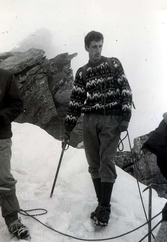
Near the Col du Mont Gelé with fog 1967, by Jan Westenbroeck
The Normal Route from the side of Valpelline starts from the Village of Dzovenno or, rather, from the one just above Ru or Ruz (1.697m). Approach A Park the car and start walking along a comfortable dirt road leading to the Baou de Bouque (2.129m) and to the Berrier Alps (2.192m; T/E, 1h'30). From those a long and very panoramic crosswise path (fine spring at 2.242 meters) leads to Crête Sèche Hut (2.410m) and on up to the Franco Spataro Bivouac (2619m); recently has been closed). Direct variant (certainly the most used): the dirt farm road, concomitant with the trail n° 2 to Alpage Berrier, at the hairpin bend around 1.950 meters, near the Torrent du Moulin, part to the North a path-shortcut unnumbered and even unreported by signals, that, through direct ascent in wooded promontory at the Torrent de Crête Sèche, reached very quickly (in less than half an hour) the "Berrio di Governo" (Government's Boulder), whence the above Refuge Crête Sèche. Route A Follow toward the "Plan de la Sabbla" (Sand Tableland), an alluvial plain with many meanders; go up to a following plain known as Petit Plan and, leaving to the East a pond (2.721m), always crossing to North; after tourning Northwest and to reach an snowy gully in altitude around 2.800 meters (attention if it is verglass presence) between two rocky band and to join the Aroletta Glacier in altitude about 3.000 meters and by West direction reach the Col du Mont Gelé (3.144m) (A/F+; 1h'30/1h'45). From the pass on the opposite switch Glacier du Mont Gelé and, after passing a rocky insignificant rocky altitude 3.175 meters, continue Northbound on medium slopes (30°/32°) until you reach the Western base of the Mont de la Balme (3.347m), passing under the same and the next hill of the same name (3.420m). From this point to turn more to the Northwest, passing under the jagged ridge Southeast, also known as "Créneaux du Mont Gelé", arriving on lower slopes (usually no crevasses that are located more to the West) to the terminal crevasse. It easily exceeds the same and through easy rock and just steep snowy slopes (32°/35°) to reach the great Cross placed on the Top; or turn right reaching the Crest Southeast at the end, making sure the frames snowy, usually facing North (A/F; 1h'15/1h'30; 3h'00/3h'15 from the shelter; half-hour earlier starting from the Spataro).
Standard Route from Dzovenno Hamlet, by marco979
La Via Normale dal lato della Valpelline inizia dal Villaggio di Dzovenno o, meglio, da quello appena soprastante di Ru o Ruz (1.697 m). Avvicinamento A Posteggiare nel largo spiazzo ad Ovest di Ru, iniziando la salita lungo la comoda strada poderale conducente all'Alpeggio Baou de Bouque (2.129 m). Oltrepassatolo si raggiunge poco dopo gli Alpeggi del Berrier (2.192 m; T/E; 1h'30). Da questi con un lungo diagonale molto panoramico (splendida sorgente a 2.242 metri) si raggiunge dapprima il masso detto "Berrio di Governo" e subito dopo il Rifugio Crête Sèche (2.410 m). Continuare a salire fino a Bivacco Franco Spataro (2.619 m; da poco tempo é stato chiuso). Variante diretta (sicuramente la più utilizzata): dalla strada poderale, concomitante con il sentiero n° 2 per l'Alpe Berrier, presso il tornante a gomito 1.950 metri circa, vicino al Torrent du Moulin, parte verso Nord un sentiero-scorciatoia non numerato e neppur segnalato che, tramite salita diretta nel promontorio boschivo presso il Torrent de Crête Sèche, raggiunge più rapidamente (mezz'ora in meno) il "Berrio di Governo" (Masso del Governo), donde al soprastante Rifugio di Crête Sèche. Via A Proseguire in direzione del "Plan de la Sabbla", spianata alluvionale con numerosi meandri; salire sempre verso Nord ad una successiva conosciuta come Petit Plan e, lasciato ad Est un laghetto (2.721 m), volgere a Nordovest raggiugendo a quota 2.800 metri circa un canalone nevoso (attenzione se in verglass) tra due fasce rocciose e risalirlo fino al Glacier de l'Aroletta a quota 3.000 metri circa; con direzione Ovest pervenire al Col du Mont Gelé (3.144 m) (A/F+; 1h'30/1h'45). Passare sull'opposto Glacier du Mont Gelé e, oltrepassata una insignificante quota rocciosa a 3.175 metri, proseguire con direzione Nord su medie pendenze (30°/32°) fino a raggiungere la base Ovest del Mont de la Balme (3.347 m), passandovi sotto come al successivo omonimo colle (3.420 m). Da questo punto volgere maggiormente a Nordovest sotto la frastagliata Cresta Sudest, conosciuta anche come "Créneaux du Mont Gelé", arrivando su minori pendenze (in genere assenza di crepacci che si trovano più ad Ovest) alla terminale. Superatala agevolmente e tramite facili roccette ed appena più ripidi pendii nevosi (32°/35°) si raggiunge la grande Croce posta sulla Sommità; oppure piegando a destra per raggiungere la cresta Sudest nella parte finale, facendo attenzione alle cornici nevose, in genere rivolte a Nord (A/F; 1h'15/1h'30; 3h'00/3h'15 dal Rifugio Crête Sèche; mezz'ora in meno dallo Spataro).
The Standard Route from the side of Ollomont starts from the Hamlet of Glacier also Glassier or, rather, from the Nino Regondi Bivouac. Approach B From Glacier also Glassier (1.549m) take the mule-track to By Basin before the bridge and follow up to Farinet House, where you must turn right branch toward Fenêtre Durand. Follow the dirt road up to the Balme de Bal Pasture (2.128m); along the mule track n° 5, or along the dirt road, to the Alp Lombardin (2.309m) arriving there go to the Northeast up to the Alp Thoules (2.381m), where the private farm dirt road ends (E/F; 2h'00/2h'15). From this it is possible to reach the Bivouac Nino Regondi (2.599m), after Lake de la Batsèya or Bonseya (2.513m), through a small unnumbered path, that heads for Southeast through the Vallon of Acqua Bianca (White Water) (EE/F; 3h'15/3h'30).
Route B From Bivouac Regondi reach Glacier du Mont Gelé around 2.750 meters, leaving on the right the "Hopital des Chamois" (2.783m) and along the first part by debris and rocks smoothed easy to follow. Passing beneath the entire Chain of Morions reach the beginning of the same, very variable depending on the year (0h'45/1h'00); continue without encountering particular areas with crevasses passing under the Trident de Faudery, Becca Crevaye and Becca Faudery and reaching, immediately below this last the Col du Mont Gelé (EE/A/F; 1h'00/1h'15) and to connect this to the previous route that climbs from Dzovenno-Ru in Valpelline (total 3h'00/3h'15).
Standard Route from Col du Mont Gelé, by marco979
La Via Normale dal lato di Ollomont inizia dal Villaggio di Glassier od anche Glassier o, meglio, dal Bivacco Nino Regondi. Avvicinamento B Da Glacier o Glassier (come nel cartello del villaggio) (1.549 m) con la mulattiera prima del ponte, che sale alla Conca di By, seguendola sino alla Casa Farinet, ove si prende il ramo di destra per la Fenêtre Durand. Portarsi sulla poderale e seguirla sino all'Alpe Balme de Bal (2.128 m); dall'alpeggio per la mulattiera n° 5, o per la strada poderale, dirigersi verso l'Alpe Lombardin (2.309 m) e risalire sulla destra o Nordest sino all'Alpe di Thoules (2.381 m), dove la strada poderale privata ha termine (E/F; 2h'00/2h'15). Da questa é possibile raggiungere il Bivacco Nino Regondi (2.599 m), dopo il Lago de la Batsèya o Bonseya (2.533 m), tramite un sentierino non numerato che si dirige verso Sudest attraversando il Vallone dell'Acqua Bianca, alle pendici dell'imponente Catena che dal Mont Morion raggiunge il Mont Clapier e la dirimpettaia Punta Fiorio (EE/F; 3h'15/3h'30).
Via B Dal Bivacco Regondi raggiungere il Glacier du Mont Gelé intorno ai 2.750 metri circa, lasciando sulla destra l'"Hopital des Chamois" (2.783 m) e percorrendo la prima parte tramite detriti e rocce levigate di facile percorrenza. Passando al di sotto dell'intera Catena dei Morions raggiungere l'inizio del medesimo, molto variabile a seconda delle annate (0h'45/1h'00); continuare senza incontrare particolari zone con crepacci transitando sotto il Trident de Faudery, la Becca Crevaye e la Becca Faudery e raggiungendo, subito appresso a quest'ultima il Col du Mont Gelé (EE/A/F; 1h'00/1h'15) e da questo collegarsi alla precedente via che sale da Dzovenno-Ru in Valpelline (in totale 3h'00/3h'15).
Route C: in full for the Southeast Ridge. Moreover, reached the Col du Mont Gelé with the two previous tours, continue along the whole of the South East Ridge. By the same procedure on the wide saddle, past the rocky insignificant quota 3.175 meters, reaching the North with the Southern base of the Mont de la Balme after a about hundred metres from the pas. From this point the ridge becomes rocky and sharp and in as many reach the Summit (3.347m) overcoming some exposed passages with the edge of the ridge until the III°+ rock pretty good (the first ascent of note is by Gino and Silvia Buscaini the September 13th, 1970, while the first ascent of the Summit is up to the rope in 1861). A short but steep descent on the North Ridge leads to the next and the same name and off the hill (3.420m), which comes from the East the great snowy couloir which is the Normal Via Switzerland. The next leg is easier, linear and panoramic until the ante South Peak (3.442m), consisting of a pointed blade rocky shaped tower; this, after a short difficult descent (II°+) the ridge turns more to the North-northwest, forming what is called the "Créneaux du Mont Gelé", a part of the ridge very jagged like a lacework and slits of a castle. Consists of a half-dozen elevations it is not easy to climb because the rock becomes more fragile and exposure to significant over the East Wall East-northeast; staying on the cutting steps up to meet III°+, however, bypassed the left (West). After reaching a more "robust" and forked tower reaches a carving after which comes a secondary gully from Glacier de Crête Sèche. Turning increasingly to the Northwest ridge has a portion less "rough" coming of a sudden snow that form the framework for the Northeast; passed this carefully you will reach the Top (A/PD+ AD; 3h'45/4h'15, depending on the conditions and the followed via; 2h'20, from Bivouac Spataro in the first ascent with integral route). This Crest Southeast should have been covered in full in only two occasions: in 1967 uphill and downhill in 1991, because the strings that come from Chanrion Hut generally from the Balme Pass themselves ahead Glacier du Mont Gelé, as the party in 1970 after the Mont de la Balme ((which has already been traveled, without their knowledge, in July 1967).
Southeast Ridge and Southeast & East-northeast Faces, by andrea.it
Via C:integralmente per la Cresta Sudest. Inoltre, raggiunto il Colle del Mont Gelé con i due precedenti itinerari, continuare percorrendo integralmente la Cresta Sudest. Dallo stesso procedere sulla larga sella che, oltrepassata l'insignificante quota rocciosa a 3.175 metri, raggiungendo con direzione Nord la base Meridionale del Mont de la Balme dopo un centinaio di metri dal colle; da questo punto la cresta diventa rocciosa ed affilata ed in altrettanti raggiunge la Sommità (3.347 m) superando alcuni tratti esposti con passaggi sul filo di cresta fino al III°+ su roccia abbastanza buona (la prima ascensione nota é di Gino e Silvia buscaini il 13 di Settembre 1970, mentre la prima della Sommità spetta alla cordata del 1861). Una breve ma ripida discesa sulla Cresta Nord conduce al successivo nonché omonimo e largo colle (3.420 m), dove arriva da Est il canalone innevato costituente la Via Normale Svizzera. il successivo tratto è più facile, lineare e panoramico fino alla Antecima Sud (3.442 m), costituita da un aguzza lama rocciosa a forma di torretta; da questa, dopo una corta non facile discesa (II°+) la cresta volge più a Nord-nordovest formando quello che vien detto il "Créneaux du Mont Gelé", ovvero un tratto di cresta molto frastagliata a guisa di merlettatura e feritoie d'un castello. Costituito da una mezza dozzina di elevazioni non é di facile arrampicata poiché la roccia diventa più fragile e l'esposizione ad Oriente notevole sopra la Parete Est-nordest; restando sul filo s'incontrano passaggi fino al III°+, peraltro aggirabili sulla sinistra (Ovest). Dopo aver raggiunto una più "robusta" e biforcuta torre si raggiunge un intaglio successivo al quale perviene un canalone secondario dal Glacier de Crête Sèche. Volgendo progressivamente più a Nordovest la cresta presenta un tratto meno "accidentato" arrivando ad un successivo innevato che forma cornice a Nordest; superato questo, dopo due asperità, con cautela si raggiunge la Sommità (A/da PD ad AD+; 3h'45/4'15, a seconda delle condizioni e dal percorso seguito; 2h'20, dal Bivacco Spataro nella prima salita con percorso integrale). Questa Cresta Sudest dovrebbe essere stata percorsa integralmente in due uniche occasioni: nel 1967 in salita e nel 1991 in discesa, poiché le cordate provenienti dalla Cabane de Chanrion in genere dal Col de la Balme si portano sul Glacier du Mont Gelé, come la cordata 1970 dopo la salita al Mont de la Balme per la Cresta Sud (tra l'altro già percorsa, a loro insaputa, nel Luglio 1967).
Route D: by South-southwest small Buttress. This route follows a buttress not very obvious that divides the Southern slope with the Glacier of Mont Gelé one geared more to the Southwest and consists of snowfields and scree. Is cycled down in 1975 due to the presence of dense fog, in which case it may be useful as a reference constant, avoiding the chance to go to cross the glacier itself in its most central and dangerous. Surely it can be a viable track in such situations of bad weather, but in any case requires pinpoint the ability to know more or less exactly where to start off. Here in any case we describe it from the bottom, even if it is not to be recommended as a via to climb being always preferable one that goes from Col du Mont Gelé or Standard Route, certainly easier, secure and fast. From Alpages of Thoules towards Southeast follow the path trail that heads to the Regondi Bivouac to the point 2.347 meters just above the union of Torrent Fenetre with two other secondary branches that come from the minuscule Lac du Mont Gelé (2.960m). Continue for a short distance, but with the path more evident, reaching 2.490 meters altitude that right at the base of this little spur. Abandoning the road that goes to the bivouac, turning instead to the left starting to get on the right side of a series of small promontories, rocky slopes to the West and composed of grassy debris and rotten rocks on the right. Exceeded the three most prominent (2.726m, 2.795m, 2.965m) you go down slightly, reaching an enough wide saddle (2.842m) immediately to the West of the pond above. From this you can easily exceed three small rocky humps, now at the Western edge of the glacier, which lead to a turret (3.163m), followed by one notch (3.080m). Continue on the edge of the ridge, reaching a stretch of rocks with steep climbing not more difficult but enough exposed, reaching a subsequent far more pronounced tower (about 3.370/5 meters), it also followed by carving. Another acute elevation leads to Western Antesummit on Northwest Ridge halfway between the great Shoulder (3.446m) and the Top; after a short usually snowy, with the possibility of frames in the North, it easily is reached (A/F+/PD-; in ascent 4h'15/4h'45). Downhill, in fog, reaching the first obvious elevation rocky stretch after the snowy definitely heading left or South, whence as above in reverse.
Normal & secondaries Routes from Ollomont-Glacier, by Antonio
Via D: tramite il piccolo Contrafforte Sud-sudovest. Questa via segue un contrafforte non molto in evidenza che divide il Versante Meridionale con il Ghiacciaio del Mont Gelé da uno rivolto più a Sudovest e costituito da nevai e pietraie. Risulta percorsa in discesa nel 1975 a causa di presenza di fitta nebbia: in questo caso può essere utile come riferimento continuo, evitando di casualmente andare ad attraversare il ghiacciaio medesimo nella sua parte più centrale e piuttosto pericolosa. Sicuramente può essere una valida traccia in siffatte situazioni di cattivo tempo, però in ogni caso richiede capacità di saper individuare il punto più o meno preciso, dove iniziare a scendere. Qui in ogni caso la descriviamo partendo dal basso, anche se non é da consigliarsi come via di salita, essendo sempre preferibile quella che sale dal Colle del Mont Gelé o Via Normale, certamente più facile, sicura e rapida. Dall'Alpe Thoules seguire verso Sudest la piccola traccia di sentiero che si dirige verso il bivacco fino al punto 2.347 metri, appena al di sopra dell'unione del Torrent Fenêtre con altri due rami secondari provenienti dal minuscolo Lac du Mont Gelé (2.960 m); continuare ancora per breve tratto, ma con sentiero più evidente, raggiungendo l'altitutine di 2.490 metri proprio alla base di questo piccolo contrafforte. Abbandonando la via che si dirige al bivacco, voltare invece sulla sinistra iniziando a salire sul lato destro una serie di piccoli promontori, rocciosi ad Ovest e composti da pendii erboso detritici sulla destra. Superati i tre più in vista (2.726 m, 2.795 m, 2.965 m) si scende di poco raggiungendo una larga sella (2.842 m) subito ad Ovest del laghetto suddetto. Da questa si superano facilmente tre gobbette rocciose, ormai al margine Occidentale del ghiacciaio, che conducono ad una torretta (3.163 m), seguita da un intaglio (3.080 m); si prosegue sul filo di cresta, arrivando ad un tratto di rocce più ripide con arrampicata non difficile ma più esposta, raggiungendo una successiva ben più pronunciata torre (3.370/5 metri circa), anch'essa seguita da intaglio. Un'acuta elevazione conduce ad una Antecima Ovest sulla Cresta Nordovest a metà strada tra lo Spallone Occidentale (3.446 m) e la Sommità; dopo breve tratto in genere nevoso, con possibilità di cornici a Nord, facilmente la si raggiunge (A/F+/PD-; in salita 4h'15/4h'45). In discesa, in caso di nebbia, raggiungere la prima evidente elevazione rocciosa dopo il tratto innevato dirigendosi decisamente a sinistra o Sud, donde come sopra a rovescio.
Route E: along Southwestern Slope. Located immediately to the left (West) of the previous itinerary, this easy slope down towards the Walloon of Eaux Rouges and on the Alp Thoules. During the first ascent in 1861 was used for the descent, which took place after the climb the Col du Mont Gelé. We do not know if the fact is due to particular weather conditions, such initiatives exploration of the mountain (can be), a decision that you want to avoid the glacier (in those days definitely larger) waves or simply make a more rapid pace. Probably a little of everything, even if we lean to the latter hypothesis. The strong Michel Croz had clear ideas and a Guide mountain certainly was second to no one in those days across Europe. The instinct of the two brave Guides Chamonix had suggested to them, at a glance, the downward path, performing a mix of the highest part of the South Slope, crossed diagonally to the Southwest, the climbing of the small South West Buttress at saddle 2.842 meters, the crossing to the West by a small rocky channel and the final descent through the Southwest Slope, coming to the "Chemin du Morion", as it was called the trail from Alp Thoules reached the glacier, above Plan de Breuil into "Vallone dell'Acqua Bianca". In fact in those days when there was still the bivouac (1952) himself went directly to the East, passing through a gorge at the base of the South-southwest Buttress, reaching the same; this path, which today is considered a variant of descent, was the Normal Route from Ollomont Valley. The first complete ascent of this side is only implemented in 1914 (Via Porro) along the top with a detour first right and then left to overcome a rocky strip and conclude on Antetop West at large shoulder (3.446m) by means of a snowy stream and rocks (danger of falling stones). The bottom is made up of steep grassy slopes on the side of a torrent that descends vertically; the same reaches the terminal moraine of an ancient and extinct glacier flowing in the long middle section, consists of a steep scree or snowfields. There is also a "Low Variant of connection" which, starting from the Fenêtre Durand (2.797m) and through the base of the West Wall, reaches an altitude of 2.563 meters, right at the base of the ridge of the Southwest; rounding to the right the same you get into this side. It can have a meaning for those coming from Switzerland, not wanting to make the ascent from Glacier Crête Sèche, but, in any case, should continue to the Bivouac Nino Regondi. Now these roads have only a "historical value" and are boring and dangerous. They can be useful but you prefer the downhill Buttress South-southwest, certainly more secure, but less convenient and just more difficult (A/F+/PD-; 3h'30/4h'00 uphill and 2h'00/2h'30 downhill Thoules).
Routes on Southwest Slope & "Crestone" & West Wall, by Antonio
Via E: lungo il Versante Sudovest. Situato subito a sinistra (Ovest) del precedente itinerario, questo facile versante scende in direzione del Vallone dell'Acqua Bianca e sopra l'Alpe di Thoules. Durante la prima ascensione dell'Agosto 1861 é stato utilizzato per la discesa, dopo la salita avvenuta dal Col du Mont Gelé. Non sappiamo se il fatto é dovuto a particolari condizioni metereologiche, ad iniziative d'esplorazione della montagna (può essere), a decisione di volere evitare il ghiacciaio (a quei tempi sicuramente di maggiori dimensioni e più pericoloso) oppure semplicemente onde effettuare una più rapida discesa. Probabilmente un pò di tutto ciò, anche se propendiamo per l'ultima delle ipotesi. Il forte Michel Croz aveva le idee chiare e come Guida di montagna di certo non era secondo a nessuno, a quei tempi, in tutt'Europa. L'istinto delle due brave Guide di Chamonix aveva lor suggerito, con semplice occhiata, il percorso di discesa, effettuando un misto tra la parte più elevata del Versante Meridionale, attraversato in diagonale a Sudovest, lo scavalcamento del piccolo Contrafforte Sudovest alla sella 23842 metri, l'attraversamento ad Ovest tramite un canalino roccioso e la definitiva discesa tramite il Versante sudovest, arrivando al "Chemin du Morion", com'era chiamato il sentiero che dall'Alpe Thoules raggiungeva il ghiacciaio, al di sopra del Plan de Breuil nel Vallone dell'Acqua Bianca. Anzi a quei tempi quando ancora non esisteva il bivacco (1952) lo stesso proseguiva direttamente ad Est, passando in una goletta alla base del Contrafforte Sud-sudovest, raggiungendo il medesimo; questo percorso, oggi considerato una variante di discesa, costituiva la Via Normale dalla Valle di Ollomont. La prima salita completa di questo versante viene realizzata solo nel 1914 (Via Porro) percorrendo la parte alta con una deviazione prima a destra e poi a sinistra per superare una fascia rocciosa e concludere sull'Antecima Ovest presso la grande spalla (3.446 m) per mezzo d'un canalino nevoso e roccette (pericolo di caduta di pietre). La parte inferiore é costituita da ripidi pendii erbosi posti a lato d'un torrente che scende in verticale sopra la Comba des Eaux Blanches confluendo nell'omonimo Torrent; la stessa raggiunge la morena frontale d'un antico ed ormai estinto ghiacciaio confluendo nel lungo settore mediano, formato da una ripida pietraia o da nevai. Esiste anche una "Variante Bassa di collegamento" che, partendo dalla Fenêtre Durand (2.797 m) ed attraversando alla base della Parete Ovest, raggiunge quota 2.563 metri, proprio alla base della Cresta Sudovest; doppiando a destra la stessa si entra in questo versante. Può avere un significato per chi provenisse dalla Svizzera, non volendo effettuare l'ascensione dal Ghiacciaio di Crête Sèche, ma, in ogni caso, conviene continuare per il Bivacco Nino Regondi. Ormai queste vie possiedono esclusivamente una "valenza storica" e sono noiose, nonché pericolose. Possono essere utili in discesa, ma si preferisce il Contrafforte Sud-sudovest, certamente più sicuro anche se meno agevole ed appena più difficile (A/F+/PD-; calcolare 3h'30/4h'00 in salita e 2h'00/2h'30 in discesa dall'Alpe Thoules).
Route F: integrally by Southwest "Crestone". This remarkable ridge, also topographically speaking, divides the previous steep southwestern Slope from the West Wall, currently still inaccessible. Crossed at the base altitude of 2.650/60 meters as Variant (see Route E), besides the one already described, coming from the Fenêtre Durand, had risen in a unique opportunity at the end of August 1991. All three of these routes do not reach the Summit, but converge in a great Western Shoulder (3.446m), still not far away from it. Starting from Alp Thoules via the "Chemin du Morion" go short section of the same, which is abandoned before reaching the wake of torrential slope to the Southwest heading North towards the 2.500 meters. Reached the apex of the lower ridge with climb diagonally to the Northwest we arrive at 2.653 meters altitude, where in practice begins the same. From the small saddle of this grassy headland start climbing for debris and scrap often covered with turf reaching progressively a more rocky ends, via a wide rift, a first turret-shaped castle with lacework (I°+/II°-). The next very narrow notch climb directly to 10 meters (II°+) and then continue on the right and, after two small balconies, reach a wider detrital ledge. The next "hop" is approximately similar to the right for easy sinuous groove that leads to a second easier stretch that ends against a large triangular wall of around 150 meters; rise immediately to the right by means of another wider channel that leads to the ridge edge consists of steep rocks up to the altitude about 3.150 meters. Up to this point the ridge gives half a dozen easy "loopholes" to the right on the Southwest Slope. The next wall, over 200 meters high and marked by two rocky couloirs that descend diagonally to Southeast, you win more easily than with appearances around the first two thirds to the left (West) and then end up directly in the center for a large rift reaching a series of ledges debris. From this point for easy broken rocks, debris and some snowfield it reaches the shoulder whence, in a short time, to the Top. Overall, from the base to the climb "Spallone" difference in height, with a fairly homogeneous path, of almost 800 meters with passages of II°/II°+ and a few short sections of III°-; Thoules to the Vertex of 1.138 meters (A/PD/PD+; 3h'30/4h'00). This path can become much more interesting in the presence of snow, which could eliminate the tedious "fittings" stony and make "exciting" final.
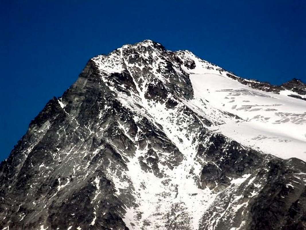
Route G: by Western Wall. There are no ascents of this beautiful triangular wall. Including the Northwest and Southwest Ridges, plunges almost vertically to 555 meters above the Lac de Fenêtre (2.797m), at the hill of the same name (2.797m). Clearly visible in foreground from nearby Monte Avril (3.347m) where during the whole climb is highlighted the contrast with the more icy Wall Northwest. Ends on the great Shoulder Western and is characterized by a large shield grayish in its center. Now placed in the closet of personal ambitions mountaineering.
The "virgin" Western Wall between SW & NW Ridges, by Antonio
Via F: integralmente per il "Crestone" Sudovest. Questa notevole cresta, anche topograficamente parlando, divide il precedente Versante Sudovest dalla ripida Parete Ovest, attualmente ancora inaccessa. Attraversato nella parte basale in altitudine di 2.650/60 metri circa come Variante (vedi Via E), oltre quella già descritta, arrivando dalla Fenêtre Durand, risulta salito in un'unica occasione a fine di Agosto 1991. Tutte e tre queste vie non raggiungono la Sommità, bensì confluiscono nell Spallone Ovest (3.446m), comunque a non molta distanza dalla medesima. Partendo dall'Alpe Thoules tramite il "Chemin du Morion" percorrere breve tratto del medesimo, che si abbandona prima di raggiungere il solco torrentizio del Versante Sudovest dirigendosi a Settentrione verso i 2.500 metri. Raggiunta l'apice inferiore della cresta con salita in diagonale a Nordovest si arriva alla quota 2.653 metri, dove in pratica inizia la stessa. Dalla selletta di questo promontorio erboso iniziare a salire per detriti e rottami spesso ricoperti da manto erboso raggiungendo progressivamente una parte più rocciosa che si conclude, tramite una larga spaccatura, ad una prima torretta a forma di castello con merletti (I°+/II°-). Dal successivo stretto intaglietto salire direttamente per 10 metri circa (II°+) per poi continuare subito a destra e, dopo due balconcini, raggiungere una più ampia cengia detritica. Il similare salto successivo si aggira a destra per un facile canalino sinouoso che porta ad un secondo più facile tratto concludentesi contro una grande parete triangolare di circa 150 metri; salire subito a destra per mezzo di un altro più largo canale che conduce sul filo di cresta composto da ripido pietrame fino a quota 3.150 metri circa. Fino a questo punto la cresta concede una mezza dozzina di facili "scappatoie" a destra sul Versante Sudovest. La successiva parete, alta oltre 200 metri e segnata da due canaloni rocciosi che scendono in diagonale a Sudest, si vince più facilmente che all'apparenza: aggirare i primi due terzi a sinistra (Ovest) e poi finire direttamente in centro per una grande spaccatura raggiungendo una serie di cengie detritiche. Da questo punto per facili rocce rotte, detriti e qualche nevaio si raggiunge lo Spallone donde, in breve tempo, alla Sommità. Complessivamente dalla base allo Spallone la salita presenta un dislivello, con percorso abbastanza omogeneo, di quasi 800 metri con passaggi di II°/II°+ e qualche breve tratto di III°-; dall'Alpe Thoules alla Vetta di 1.138 metri (A/PD/PD+; calcolare 3h'30/4h'00). Questa via può diventare molto più interessante con neve, tale da eliminare i noiosi "raccordi" pietrosi e far diventare più "eccitante" la parte finale.
Via G: per la Parete Ovest. Non risultano ascensioni di questa bella parete triangolare. Compresa la le Creste Nordovest e Sudovest, precipita quasi verticale per 555 metri al di sopra del Lac de Fenêtre (2.797 m), presso l'omonimo colle (2.797 m). Bene in vista frontalmente dal vicino Monte Avril (3.347 m) da dove durante tutta la salita viene evidenziato il contrasto con la più ghiacciata Parete Nordovest. Termina sullo Spallone Ovest ed é caratterizzata da un grande scudo grigiastro nel suo centro. Riposta ormai nel ripostiglio delle personali velleità.
Route H: through Northwest Ridge. Beautiful ridge that rises from Fenêtre Durand for 670 meters dividing the two Walls West and Northwest until the Top of big Shoulder. Also calculating the 73 meters to reach the Vertex of the climb becomes over 840 meters. Very rarely frequented, until 1975 were only two other ascents in addition to the first at beginning '900. It runs along the ridge edge or through small workarounds to the North. The time of 4 hours indicated in "Pennine Alps Vol. I" by Gino Buscaini, Edition C.A.I./T.C.I. 1971, is extremely content: in the first repetition of 1970 were employed 13 hours, but in bad weather; in the second of 1975, which I have had personal information, from 7 to 8, if memory serves me correctly. This signal indicates that, in addition to the bad quality of the rock, which also accounted for the difficulties with steps II° and III° should be revisited at least the distance of some brief "mauvais pas". More realistically 5h'30 to 6h'30 with some short step of III°+/ IV°-; still always exposed and exclusively addressed to Mountaineers.
NW & W Walls amongst N-NE, NW & SW Ridges, by Emilio Bertona
Via H: tramite la Cresta Nordovest. Bella cresta che sale dalla Fenêtre Durand per 670 metri dividendo le due Pareti Ovest e Nordovest sino alla sommità della grande spalla. Calcolando anche i 73 metri per raggiungere il Vertice la salita diventa di oltre 840 metri. Molto raramente frequentata, fino al 1975 risultavano soltanto altre due ascensioni oltre alla prima. Si percorre sul filo di cresta o tramite piccoli aggiramenti a Settentrione. L'orario di 4 ore indicato in "Alpi Pennine Vol. I°" di Gino Buscaini, Edizione C.A.I./T.C.I. 1971, é oltremodo contenuto: nella prima ripetizione del 1970 furono impiegate 13 ore, ma con cattivo tempo; nella seconda del 1975, della quale ho avuto personale informazione, dalle 7 alle 8, se non mi tradisce la memoria. Segnale questo che indica, oltre alla cattiva qualità della roccia, che anche le difficoltà valutate con passaggi di II° e III° devono essere rivisitate almeno nella percorrenza di qualche "mauvais pas". Più realisticamente calcolare dalle 5h'30 alle 6h'30 con qualche passaggio di III°+/IV°-; comunque sempre esposta e rivolta ad Alpinisti.
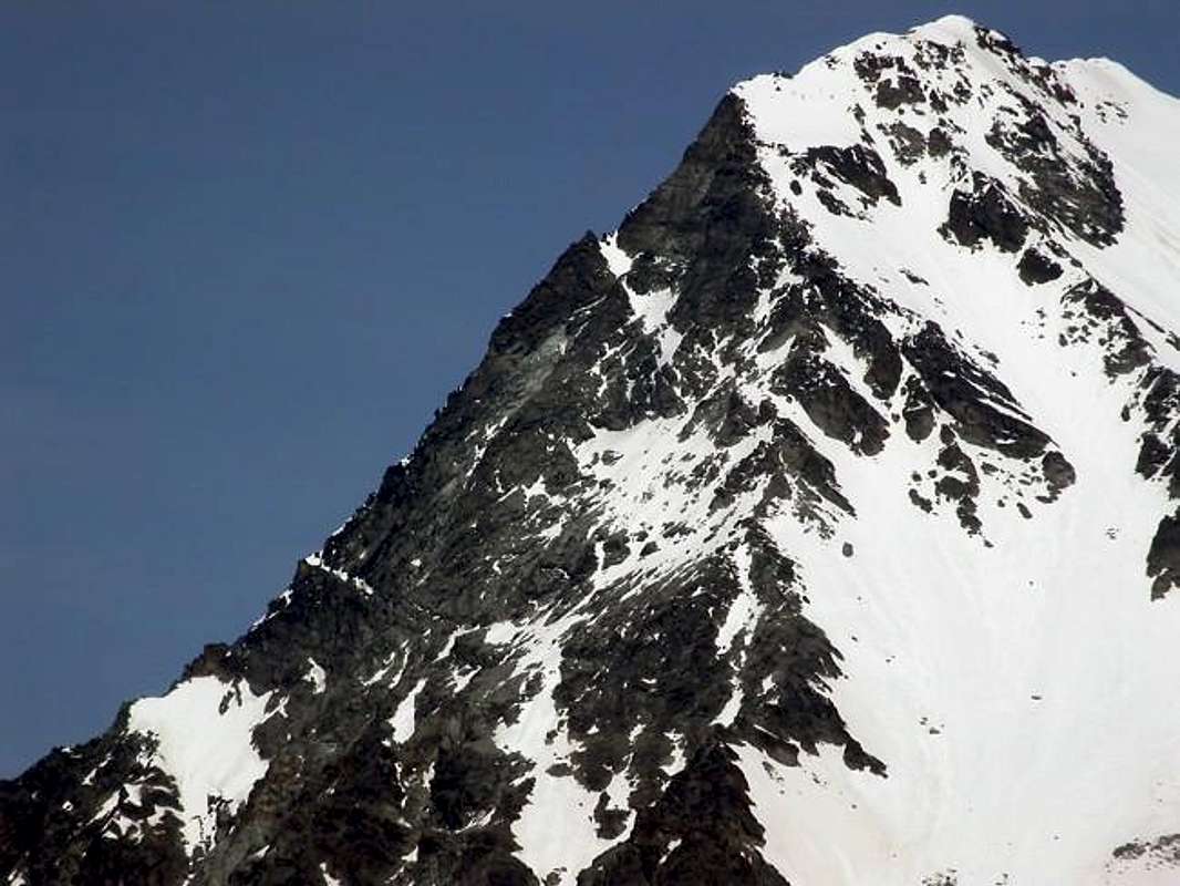
Route I: by Northwest Wall. This great wall is contained between the two Ridges Northwest and North-northeast. High up to 650 meters and large almost 400 is divided into two separate areas by a horrid Central Gully reaching the summit ridge at a notch just over a hundred metres from the Top on the West Ridge; the same path was a unique time in late July 1899 with a nice firm solitary by the Austrian Frankhauser. Were plotted on the same two ways: one in 1922 by four Italian climbers led by Vittorio Bramani, of which, however, is not aware of the precise route (presumably in the sector immediately to the left of the couloir and then Direct Via to the Summit); the other by two strong Swiss mountaineers who have opened a new path in the field even more to the left (East). Of this you know the path to the left of attack with a secondary channel which ends at two small spires on North-northwest Ridge at about 130/40 meters from the Vertex. But they too, rejected this deviation to North-northeast Ridge, concluded directly in Peak. Ascension most dangerous and difficult through the Central Gully; certainly more difficult in the remaining sectors right also left. Do not know more ascents and probably no other reps. 1) - Route 1899 Goes along the great Central Couloir that reaches the West Ridge at about 120 730 meters from the Summit. Traveled once. In crossing from Fenêtre Durand eastward quickly reach a first slide less steep (40°) that reaches the crevasse at an altitude of around 2.900 meters; exceeded the same in its center, continue always on the slope again "open" but with progressive maximum gradient (from 40° to 60°). When the channel flexes more left narrowed somewhat, continue on its side orographic left, or on the rocks immediately to the West; just below the West Ridge the same forks go on the small branch of the right and reach the watershed and with this conclusion (A/PD+/AD/AD+; 3h'30/4h'30). Consider that at the time of the first climb the more snow could make it less difficult is the attack that the climb itself, for which reason it is expected that the road was covered with snow and only in the gully. The snow made it definitely less dangerous the same, "tying" all material unstable or suspended. 2) - Route 1922 Of this route there is uncertainty since there is no relationship, if not the wording of that in "50 years SEM" (Company Hikers of Milan, curated by Mario Fasana; Edition, 1941, page 289), where it is certified as a first ascent. Purpose is to see how you can verify three possible hypotheses: a) - the party of Italian of 1922, not knowing the ascension of the July 31, 1899 (published as news in "SACJ XXXV" page 300, that "Jahrbuch des Schweitzer Alpen Club" since 1864 until 1923, the magazine certainly not within the reach all) repeated the "Via Frankhauser" (can seen the favorable conditions of snow in those years). Or has used one of the two areas to the side of the Central Gully (quite unlikely). But, objectively, do not see the need at that time to face a route with such difficulties. He cared more to the point, looking if anything the easy way in a wall still a virgin. Otherwise lean to the hypothesis next b)-, with some reservations although we can not a priori exclude completely. b) - carried out a new route on the right bank, or to the left going up, the couloir through steep plaques often snowy or even with "verglass" that lead in Peak, without, however, follow the path further East that will be covered in 1968; possible hypothesis, but the rocky base of the base does not recommend this choice as incidentally took place in '68 with an attack on the very left, while the side of the right (West) appears much more "malleable", after a reddish wall initial of around 100 meters. c) - addressed the side on the right (West) of the same; very unlikely wanting to open a new route instead of the Summit aims at a secondary shoulder. Without wanting to contradict the above but, rather, to confirm this because even "input" does not seem at all inviting to enter into the wall and the couloir remains the choice more "comfortable". 3) - Via 1968 Made in the late sixties follows the style of those years, which still provides a "nailing" of the traditional type. Along the Eastern sector of the left or of the wall then gradually moving to the right in the direction of the perpendicular from the Vertex. Begins almost at the far left with four pitches of rock not too good route and then make a crossing of 40m right crossing a gully subject to falling stones; after another 4 lengths vertically (IV°) has a small ridge more in evidence in the center following her up to a wall, which is bypassed on the right. Through plaques often steep and snowy or icy by means of two dihedrals (V°) exits directly on the Summit (A/D+; 5h'00/6h'00 from the base). Via difficult and delicate chee requires experience, very exposed to falling stones and that almost certainly has not been repeated more.
Difficult Northwest Wall between NW & N-NE Ridges, by Antonio
Via I: la Parete Nordovest. Questa grande parete é contenuta tra le due Creste Nordovest e Nord-nordest. Alta fino a 650 metri e larga quasi 400 viene divisa in due distinti settori da un orrido Canalone Centrale raggiungente la cresta sommitale presso un intaglio a poco più d'un centinaio di metri dalla Sommità sulla Cresta Ovest; lo stesso é stato percorso un unica volta nel fine Luglio 1899 con bella impresa solitaria da parte dell'austriaco Frankhauser. Sulla stessa sono state tracciate altre due vie: una nel 1922 da quattro alpinisti italiani capeggiati da Vittorio Bramani, della quale però non si é a conoscenza del preciso itinerario (presumibilmente nel settore subito a sinistra del canale e quindi Via Diretta alla Cima); l'altra da parte di due forti alpinisti svizzeri che hanno aperto una nuova via nel settore ancor più a sinistra (Est). Di questa si conosce il percorso con attacco a sinistra d'un canale secondario terminante presso due gugliette sulla Cresta Nord-nordovest a circa 130/40 metridal Vertice. Anche loro però, scartata questa deviazione, han concluso direttamente. Ascensione più pericolosa che difficile nel canale; molto difficile nei restanti settori. Non si conoscono ulteriori ascensioni e probabilmente non esistono altre ripetizioni. 1) - Via 1899 Percorre il grande canale Centrale che raggiunge la Cresta Ovest a circa 120/30 metri dalla Sommità. Percorsa una sola volta. In traversata dalla Fenêtre Durand verso Oriente raggiungere in breve tempo un primo scivolo meno ripido (40°) raggiungente la crepaccia terminale a quota 2900 metri circa; superata la medesima nel suo centro, continuare sempre su pendio "aperto" ma con progressiva maggiore pendenza (da 40° a 60°). Quando il canale flette maggiormente a sinistra restringendosi alquanto, continuare sulla sua sponda orografica di sinistra, oppure sulle rocce immediatamente ad Ovest; appena sotto la Cresta Ovest il medesimo si biforca: proseguire sull'esiguo ramo di destra e raggiungere lo spartiacque e con questo concludere (A/PD+/AD/AD+; 3h'30/4h'30). Considerare che al tempo della prima salita il maggior innevamento poteva render meno difficile l'attacco e la salita, per la qual cosa é presumibile che sia stata percorsa esclusivamente con neve dentro il canalone, allora certamente meno pericoloso. 2) - Via 1922 Di questo itinerario non si hanno certezze non esistendo relazione alcuna se non la enunciazione del medesimo in "50 anni SEM" (Società Escursionisti Milanesi, a cura di Mario Fasana; Edizione del 1941, pagina 289), dove viene certificata come prima ascensione. All'uopo v'è da osservare come si possano verificare tre ipotesi possibili: a) - la cordata degli italiani del 1922, non conoscendo l'ascensione del 31 Luglio 1899 (apparsa come notizia in "SACJ XXXV" pag. 300, ovvero "Jahrbuch des Schweitzer Alpen Club" dal 1864 al 1923, rivista non certo alla portata di tutti) ha ripetuto la "Via Frankhauser (possibile visto le condizioni favorevoli di innevamento in quegli anni). Oppure ha utilizzato uno dei due settori a lato del Canalone Centrale (abbastanza improbabile). Però, obiettivamente, non si vede la necessità ai tempi d'affrontare una via con siffatte difficoltà. Si badava più al sodo, cercando semmai la più semplice in una parete ancor vergine. Altrimenti propendiamo per l'ipotesi successiva b)-, con qualche riserva. b) - ha effettuato una nuova via sul lato destro orografico, o di sinistra salendo, del canale tramite ripide placche spesso innevate od addirittura con "verglass" che conducono in Vetta, senza per altro seguire la via più ad Est che sarà percorsa nel 1968; ipotesi possibile, ma lo zoccolo roccioso di base sconsiglia questa scelta come daltronde avvenuto nel '68 con un attacco decisamente sulla sinistra, mentre il lato di destra (Ovest) appare decisamente più "malleabile", dopo un muro rossastro iniziale di circa 100 metri. c) - ha affrontato il lato a destra dello stesso; molto improbabile volendo aprire una nuova via che invece della Sommità mira ad una spalla secondaria. Senza voler contraddire quanto detto ma, anzi, a conferma poiché anche quest'"ingresso" non sembra per nulla invitante per accedere alla parete ed il canalone rimane sempre la scelta più "comoda". 3) - Via 1968 Realizzata a fine anni Sessanta ricalca lo stile di quegli anni, che prevede ancora una "chiodatura" di tipo tradizionale. Percorre il settore di sinistra od Orientale della parete spostandosi poi gradualmente verso destra in direzione della perpendicolare dalla Sommità. Inizia quasi all'estrema sinistra con 4 tiri di corda su roccia non troppo buona e rotta per poi effettuare una traversata di 40 metri a destra attraversando un canalino soggetto a cadute di pietre; dopo altre 4 lunghezze in verticale (IV°) raggiunge una crestina più in evidenza nel centro seguendola fino ad un muro, che viene aggirato a destra. Tramite placche ripide, spesso innevate o ghiacciate per mezzo di due diedri (V°) si esce direttamente sul Vertice (A/D+; 5h'00/6h'00 dalla base). Difficile e delicata, richiedente esperienza, molto esposta a cadute di pietre, quasi sicuramente non più ripetuta.
The Routes from the side of Val de Bagnes starts from the Chanrion Hutte (2.694m). Approach C From Chanrion Hut (2.462m) to reach the basin where it is placed the first unnumbered via a path that reaches the Alpe Le Paume (2.338m), which also comes with a private dirt road starting from the Lac de Mauvoisin (1.989m); Southeast from Alp to get to the bridge 2.358 meters above the Torrent of Otemma (EE/A/F; 1h'15/1h'30 from hut).
Route L: through the North-northeast Ridge. More than a crest it is a fairly long spur that sinuously leads down to the Pointe d'Ayace (3.019m) above the basal moraines of the great Glacier d'Otemma that runs from East to West. Is the divider between the small Vallon Crête Sèche (East) by the opposite and more reduced Fenêtre, between Mont Gelé and Avril, who reaches the Fenêtre Durand. Changing direction in South continue with the same up to the altitude of 2.421 meters where, among a series of ponds, turns into a track in moraines; follow the same at the namesake creek leading to the Glacier de Crête Sèche. By the same, careful of crevasses, ascend Westward reaching the point 2.394 meters, from which rise with more right you reach the characteristic very large saddle 3.167 meters on the North-northwest Ridge, once lapped by the glacier itself. Follow the easy ridge formation that is not difficult but very broken (I°+/II°-/II°+; probably some short stretch of III°-), up to the Summit (A/F+/PD; 4h'30/5h'00 from Cabane).
Val de Bagnes & Crête Sèche Glacier from North, by om
Vie dal lato della Val de Bagnes partendo dalla Cabane de Chanrion (2.694m). Avvicinamento C Dalla Cabane de Chanrion (2.462 m) raggiungere la conca dove é collocato il primo tramite un sentiero non numerato che raggiunge l'Alpe di Le Paume (2.338 m), dove arriva anche una strada poderale con partenza dal Lac de Mauvoisin (1.989 m); dall'alpe verso Sudest arrivare al ponte 2.358 metri sopra il Torrent d'Otemma (EE/A/F; 1h'15/1h'30).
Via L: tramite la Cresta Nord-nordest. Più che una cresta si tratta di un abbastanza lungo contrafforte che sinuoso scende a raggiungere la Punta di Ayace (3.019 m) al di sopra delle morene basali del grande Glacier d'Otemma, che scorre da Est verso Ovest. Risulta divisorio tra il piccolo Vallone di Crête Sèche (Est) dall'opposto più ridotto di Fenêtre, compreso tra il Mont Gelé ed l'Avril, che raggiunge la Fenêtre Durand. Cambiando direzione in Sud proseguire con lo stesso fino alla quota 2.421 metri dove, tra una serie di laghetti, si tramuta in traccia nelle morene; seguire la stessa presso l'omonimo torrente che porta al Glacier de Crête Sèche. Dallo stesso, facendo attenzione ai crepacci, salire ad Ovest raggiungendo il punto 2.394 metri, donde con salita maggiormente a destra si raggiunge la caratteristica larga sella 3.167 metri sulla Cresta Nord-nordovest, un tempo lambita dal ghiacciaio medesimo. Seguire la facile cresta formata da rocce non difficili ma molto rotte (I°+/II°/II°+/; possibili brevi tratti di III°-), fino a raggiungere la Cima (A/F+/PD-; 4h'30/5h'00 dalla Cabane).
Route M: by East-northeast Face. Above the Glacier de Crête Sèche rises to 413 meters a steep wall wider than high looming on the glacier itself. The same is bounded on the left bank of the North-Northeast Ridge, while on the left, looking, down from the Southeast Crest in altitude 3.442 meters or Southern Antetop a steep edge, so as to separate her from another face less high and steep and more "shattered" more focused in the Southeast. Concave, is characterized by three snowy channels: the first left ends, flexing slightly to the left, on the Southeast Ridge at a notch. The second, or central and slanted to the right, ending on the North-northeast Ridge at no great distance from the Vertex, while the third with the same characteristics, but shorter and wider, it "supports" almost the same in its middle stretch. The climb, which takes place through the middle one, is quite exposed to falls of stones that occur loudly with some consistency, especially in the morning; so it is not wrong to face her in the afternoon when the sun made its "revolution" to the West. In 1976, in the first and almost certainly unique ascension, the approach came departing from Dzovenno-Ru in Valpelline and, through the Bivouac Spataro, with the crossing of the Col de Crête Sèche (2.897m; great stone cairn and Cross); a short (40/50 meters down to the North by the same leads through a track to the branch more to the Southeast Glacier. In order not to lose altitude, cross towards the Northwest at the same altitude and, passing under the Eastern Slopes of the Mont de la Balme, reach through the glacier traverse on its Southern margin (center many crevasses) the base of the wall (A/F+; 3h'45/4h'15 from Ru Village). Otherwise, coming from the Val de Bagnes or Chanrion Hut, through the C Approach to the way previous, reaching the base of the saddle 3.167 meters to continue in the same direction by reaching the same point. Keep in mind two considerations:
1) - in 1976 the path of the glacier, given the significant further expansion (compare various photo) was somewhat more difficult and complicated;
2) - the slope of the same reaches the crevasse is rather steep and increases the ascent of other 100/30 meters in all respects. The terminal is exceeded by a small bridge in the snow to the right against the rock and then enter the couloir. Overcoming the first very steep (55°) and then continue with a slope just below (45°/50°) resting on the rocks possibly right (not always the gully is snowy); follow this great rib until the gully, below a characteristic brownish rocks triangle with the vertex pointing downwards, the same splits. Abandon the right branch that ends on the Ridge North-northwest at two small spires, and cross to the left instead via a narrow ramp that, spreading like a fan (II°+/III°-; mostly snow, attention to the overlying frames if efficiency estimation; Important Note: in this case avoided the crossing to the left, but continue reaching the notch at the spires and end with the North-northeast Ridge), leads to the Southeast Ridge not far from the Top (A/PD+/AD-; 3h'30/4h'00 from base 7h'30/8h'00 Ru Village).
E-NE and SE Faces between NE (right) SE Ridges, by Marco Cossard
Via M: tramite la Faccia Est-nordest . Sopra il Glacier de Crête Sèche s'innalza per 413 metri una ripida parete più larga che alta che incombe sul ghiacciaio medesimo. La stessa viene delimitata sulla sua sinistra orografica dalla Cresta Nord-nordest, mentre sulla sinistra, guardando, scende dalla Cresta Sudest della Quota 3.442 metri o Antecima Meridionale un ripido spigolo, tale da separare lei da un'altra faccia meno alta e ripida e più "frantumata" maggiormente rivolta a Sudest. Di forma concava, é caratterizzata da tre canali nevosi: il primo di sinistra termina, flettendo leggermente a sinistra, sulla Cresta Sudest presso un intaglio. Il secondo, o centrale e obliquo a destra, termina sulla Cresta Nord-nordest a non molta distanza dalla Sommità, meltre il terzo con le stesse caratteristiche, ma più corto e più largo, si "appoggia" quasi alla medesima nel suo tratto mediano. La salita, che avviene tramite quello di mezzo, é alquanto esposta alle cadute di pietre che si manifestano rumorosamente con una certa costanza, soprattutto nelle ore mattutine; non é quindi sbagliato affrontare lei nelle ore pomeridiane allorché il sole ha effettuato il suo "giro" ad Occidente. Nel 1976, nella prima e quasi sicuramente unica ascensione, lo avvicinamento avvenne con partenza da Dzovenno-Ru in Valpelline e, passando per il Bivacco Spataro, con lo attraversamento del Col de Crête Sèche (2.897 m); una breve (40/50 metri circa discesa a Nord dallo stesso conduce tramite una traccia al ramo più a Sudest del ghiacciaio omonimo. Per non perdere dislivello, attraversare verso Nordovest alla stessa altitudine e, passando sotto il Versante Est del Mont de la Balme, raggiungere tramite la traversata del ghiacciaio sul suo margine Meridionale (al centro molte crepacce) la base della parete (A/F+; 3h'45/4h'15 da Ru). Altrimenti, arrivando dalla Val de Bagnes o dalla Cabane de Chanrion, tramite l'Avvicinamento C per la via precedente, raggiunta la base della sella 3.167 metri continuare nella stessa direzione raggiungendolo lo stesso punto. Da tenere presente due considerazioni:
1) - nel 1976 il percorso del ghiacciaio, vista la notevole maggiore espansione (confrontare varie foto) era alquanto più difficile nonché complicato;
2) - il pendio che dallo stesso raggiunge la crepaccia é piuttosto ripido ed aumenta la salita di altri 100/30 metri a tutti gli effetti. La terminale si supera tramite un piccolo ponte in neve sulla destra contro la roccia per poi entrare nel couloir. Superare il primo tratto molto ripido (55°) per poi continuare con pendenza appena inferiore (45°/50°) appoggiando eventualmente sulle rocce di destra (non sempre il canale é innevato); seguire questo costolone fino a quando lo stesso, al di sotto d'un caratteristico triangolo di rocce brunastre col vertice rivolto in basso, si sdoppia. Abbandonare il ramo di destra che termina sulla cresta Nord-nordovest presso due guglie, ed attraversare invece a sinistra tramite una stretta rampa (II°+/III°-; quasi sempre innevata, attenzione alle cornici soprastanti se esisenti. Nota importante: in questo caso evitare assolutamente la traversata verso sinistra, bensì continuare raggiungendo l'intaglio presso le guglie e terminare con la Cresta Nord-nordest) che, allargandosi a ventaglio, conduce alla Cresta Sudest a poco dalla Sommità (A/PD+/AD-; 3h'30/4h'00 dalla base 7h'30/8h'00 da Ru).
Route N: through East-northeast Face de la Balme Couloir (Normal Swiss Route). The last way Concerns that We describe the Normal which is undertaken by Chanrion Hut via the Glacier de Crête Sèche and a channel wide enough and steep rising between two rocky outcrops twins and that leads to the Col de la Balme (3.220m). With the previous Approach C reach the series of ponds and these, you while continuing Southward, reaching the intersection between the two branches of Western and Southern Crête Sèche Glacier in altitude of around 2.650 meters. That left leaving the track leads to the eponymous pass, turn right, going up in the midst of moraines, reaching the mouth of the couloir at the point 2.867 meters, at the spur of the left. Climb the same, very exposed to falls of stones, resting on the side of the two rocky spurs that flank. Reached the hill to latch on to the "Italian Way", rising from Mont Gelé Pass through the easy Southern Slope (A/ from PD to PD+; 1h'00/1h'30 from the base; 3h'00/4h'00 by Cabane Chanrion, very variable for slope conditions; 4h'00/5h'00 to the Summit). In our view, coming from Switzerland, or even from Chanrion Hut, this is not the best way: too dangerous for discharges and somewhat in relation to the conditions of the snowy slope that, if frozen, it is not at all easy to climb. Should
1) - climb to Crête Sèche and, after a short descent losing 166 vertical meters but with good path, tying the street that comes from Dzovenno-Ru; or, and perhaps even better though with slightly longer path,
2) - climb to Fenêtre Durand and navigate in altitude around 2.700 meters to Southeast reaching the "Chemin de Morion", hence as in the ways described above. Calculate for both hypotheses about 1h'00 more, but with all the other safety.
NW & E-NE Faces amongst NW, N-NE & SE Ridges, by om
Via N: tramite il Couloir Est-nordest de la Balme (Via Normale Svizzera). L'ultima via che descriviamo riguarda la Normale che viene effettuata dalla Cabane de Chanrion tramite il Glacier de Crête Sèche ed un canale abbastanza largo e ripido che sale tra due speroni rocciosi gemelli e conducente al Col de la Balme (3.220 m). Con il precedente Avvicinamento C raggiungere la serie di laghetti e da questi, continuando sempre verso Sud, raggiungere l'intersecazione tra i due rami Occidentale e Meridionale di Crête Sèche a quota 2.650 metri circa; lasciando a sinistra la traccia che porta all'omonimo colle, volgere a destra e, risalendo in mezzo a morene, raggiungere l'imbocco del canalone nel punto 2.867 metri, presso lo sperone di sinistra. Salire il medesimo, molto esposto alle cadute di pietre, appoggiando sul lato roccioso dei due speroni affianco. Raggiunto il colle riallacciarsi alla "Via Italiana", che sale dal Colle del Mont Gelé facilmente tramite il Versante Meridionale (A/da PD- a PD+; 1h'00/1h'30 dalla base; 3h'00/4h'00 dalla cabane, molto variabile per le condizioni del pendio; 4h'00/5h'00 alla Sommità). A nostro avviso, arrivando dalla Svizzera od anche dalla Cabane de Chanrion, non é questa la via migliore: troppo pericolosa per le scariche ed alquanto in relazione alle condizioni del pendio nevoso che, se ghiacciato, non é per nulla facile da salire. Conviene
1) - salire al Colle di Crête Sèche e, dopo breve discesa perdendo 166 metri in dislivello ma con buon sentiero, allacciarsi alla via che proviene da Dzovenno-Ru; oppure, e forse ancor meglio anche se con percorso appena più lungo,
2) - salire alla Fenêtre Durand e traversare a Sudest raggiungendo il "Chemin de Morion", donde come nelle vie descritte in precedenza. Calcolare per entrambe le ipotesi circa 1h'00 in più, ma con tutt'altra sicurezza.
North-northwest Ridge & Northwest Wall Eastern Sector, by Antonio
Difficulties & Equipment
From F to D+, depending on the via followed.
Da F a D+, a seconda della via seguita.
Depending on the various ways and always with rope, ice ax and crampons.
A seconda delle varie vie e comunque sempre con corda, piccozza e ramponi.
Mountain Conditions
You can get meteo information at the official site of the Regione Valle d'Aosta:


 4686 Hits
 81.84% Score
 14 Votes


 North & West Walls from Northwest, by alpinerunner
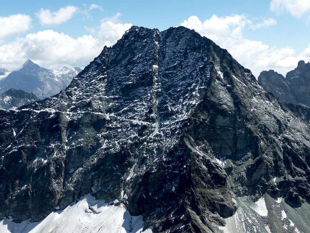
 Southern, Southwestern Slopes & West Wall (profile), by marco 979