La montagna chiama i suoi figli, ed essi rispondono fedelmente al suo appello…
Osvaldo Cardellina, Diario alpinistico, 1964-65
Page texts: @ OsvaldoCardellina"Osva", passed away on May 2, 2022. Page owners: Christian Cardellina e Osvaldo Cardellina. Any updates from September 12, 2022: Antonio Giani, page administrator, friend and climbing companion.
Testi della pagina: @ OsvaldoCardellina "Osva", scomparso il 2 maggio 2022. Proprietari pagina:Christian Cardellina e Osvaldo Cardellina. Eventuali aggiornamenti dal 12 settembre 2022: Antonio Giani, amministratore della pagina, amico e compagno di salite.
Overview
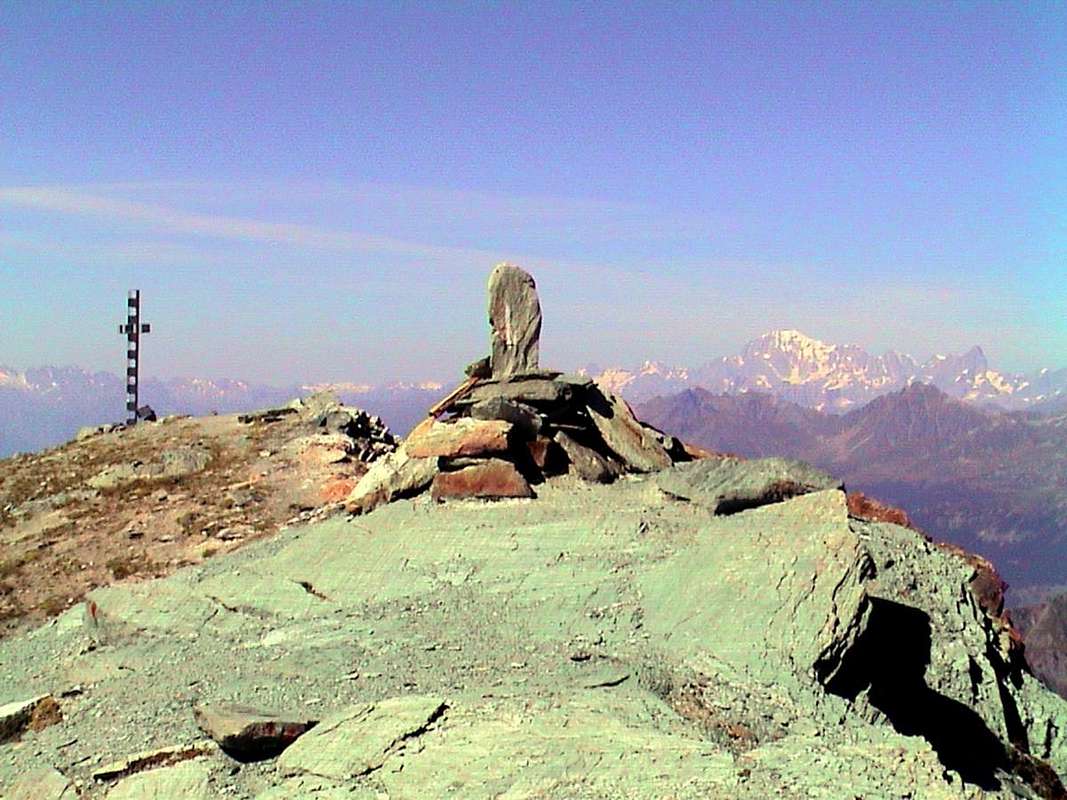
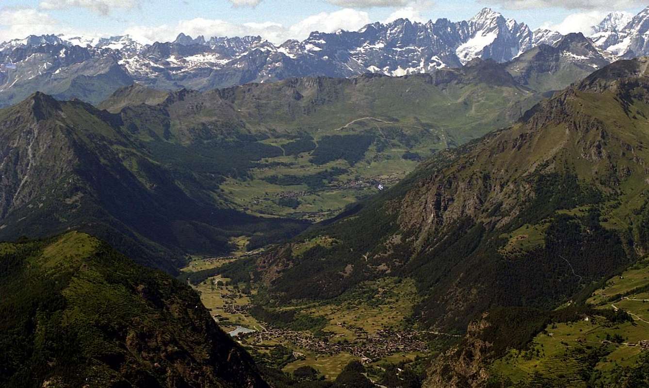
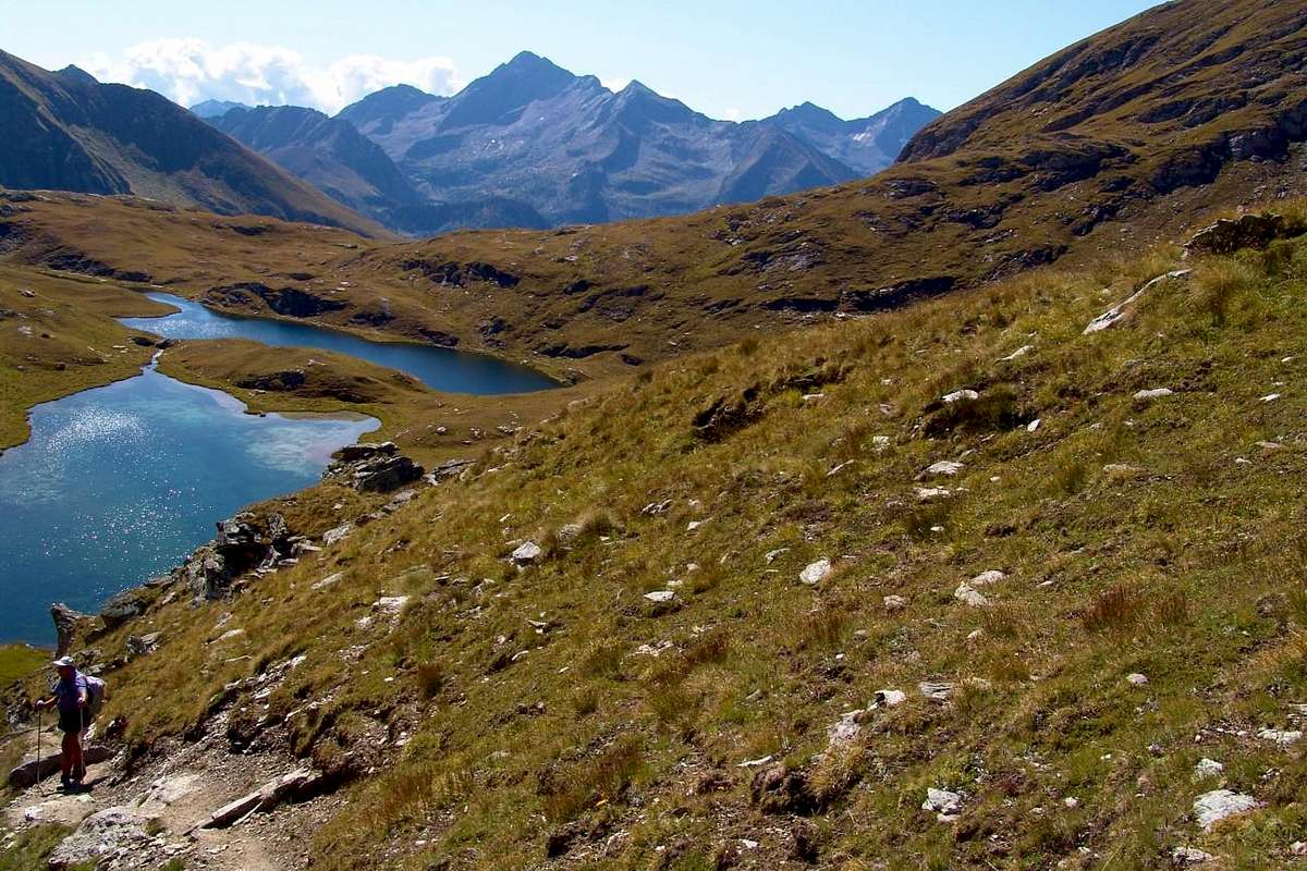
Is a Horn or a Sedan? Both because of a massive mountain in the shape of horn above the Commons of Brusson and Champoluc in Ayas Valley also corresponds with an ideal location that makes it useful as a compass in the identification of all the mountains that mark as the circular 360° boundaries of the whole Valley of Aosta. This Summit is as the highest (3.023m) of the whole area including the Palasina Lakes or Palasinaz, just to the Northwest of the District of Estoul (1.812m) and inside the middle part of the Valley of Ayas just above the Municipality of Brusson (1.332m). Formed by three ridges and as many slopes rising above the Vallons of Mascognaz to the North, Palasina in Southeast and above the valley floor in the section between the Municipalities of Brusson and Champoluc. The first two crests are positioned on the axis East / West tying this top with Punta del Lago (2.816m) and Tips Palasina (2.782m) to the East until you reach the Valfredda Pass (2.805m) of the same name tip and the Corno Vitello (Horn Calf or Kalberhorn), while on the other side, after a small shoulder, the crest splits with one branch to West over the Alpe Cleva Bella and the other further North-northwest that, after forming the Punta Ruines (2.824m), Punta Piure (2.902m) and the Cross of Bequet, ends above the Mascognaz Alpage in the Common of Champoluc. The third ridge down towards the Passo Bussola (2.807m) and where above it passes the Normal Route; even after this ridge splits Quote from 2.899 meters with a branch that falls to the Southwest in the direction of Punta of the Gua or the Guà (2.778m) just above Brusson, while another goes in the opposite direction towards the Monte Chiappa (2.684m) not far from the Resort of Estoul. The same contain beautiful Lake Bringuez (2.519m), outing matched to that of the Horn Compass (best downhill and then to return). Even the East Ridge, departing from the Refuge de l'Arp (2.439m), knows a certain attendance, as evidenced by the abundant traces of passage, beginning on Palasina Hill (2.668m) and climb over the Punta del Lago (2.816m) or starting from the altitude 2.920 meters also climbing the Punta Palasina, while it is rarely a long journey starting from Corno Vitello (3.057m) and even more longer and perhaps the only one from and towards the Tip of the Gua stepping over a range of altitudes, such as the Quota 2.899 meters and the next Mont Palon (2.779m). This first altitude, the highest among the Guà Summit Corno Bussola has been uphill, beginning on the same hill, by Osvaldo Cardellina July 7th, 2002 after solo complete traverse from Corno Vitello/Tops Palasina/Punta del Lago Lungo/Bussola Horn with up and down through the short but steep North Slope (EE/A; AD-; II°/II°+, a passage of III°- about a band, however avoidable left; difficulty in finding the path with the danger of falling rocks. In total 1h'30/1h'45 round trip from pass). Regarding the traverse to the Palòn or vice versa there is no news, but not easy to predict climbing and exposed in several sections. In any case the best route and certainly more known and visited remains the first moreover that allows the visit of a whole series of very beautiful lakes such as Lake of Battaglia, Pòcia and just above or Long.
Un Corno oppure una Bussola? Entrambi, perché ad una montagna massiccia a forma di corno soprastante gli abitati di Brusson e Champoluc in Val d'Ayas corrisponde anche una posizione strategica e tale da renderlo utile come una bussola nell'individuazione di tutte le montagne che circolarmente a 360° segnano i confini della Valle di Aosta. Questa Sommità risulta come la più elevata (3.023 m) dell'intera area comprensiva i Laghi di Palasina oppure Palasinaz, appena a Nordovest del Comprensorio di Estoul (1.812 m) ed internamente alla parte media della Valle di Ayas appena al di sopra del Comune di Brusson (1.332 m). Formata da tre creste ed altrettanti versanti s'innalza sopra i Valloni di Mascognaz a Settentrione, di Palasina a Sudest e sopra il fondovalle nel tratto tra i Comuni di Brusson e Champoluc. Le prime due creste sono posizionate sull'asse Est/Ovest legando questa Cima con la Punta del Lago (2.816 m) e le Punte di Palasina (2.782 m) ad Oriente fino a raggiungere il Passo di Valfredda (2.805 m) tra l'omonima punta ed il Corno Vitello o Kalberhorn, mentre sul lato opposto, dopo una piccola spalla, la cresta si sdoppia con un ramo ad Ovest sopra l'Alpe Cleva Bella e l'altro più a Nord-nordovest che, dopo aver formato la Punta Ruines (2.824 m), la Punta Piure (2.902 m) e la Croce di Bequet, termina sopra l'Alpeggio di Mascognaz nel Comune di Champoluc. La terza cresta scende verso il Passo Bussola (2.807 m) e sopra di essa passa la Via Normale; successivamente anche questa cresta si sdoppia dalla Quota 2.899 metri con un ramo che scende verso Sudovest in direzione della Punta della Gua o Guà (2.778 m) appena sopra Brusson, mentre un altro scende in direzione opposta verso il Monte Chiappa (2.684 m), non lontano dal Comprensorio d'Estoul. Gli stessi contengono lo splendido Lago Bringuez (2.519 m), gita abbinabile a quella del Corno Bussola (meglio in discesa e quindi al ritorno). Anche la Cresta Est, con partenza dal Rifugio de l'Arp (2.439 m) conosce una certa frequentazione, come testimoniano le abbondanti tracce di passaggio, con inizio dal Colle di Palasina (2.668 m) e scavalcamento della Punta del Lago (2.816 m), oppure dalla quota 2.920 metri salendo anche la Punta di Palasina; mentre risulta molto rara la lunga traversata partendo dal Corno Vitello (3.057 m) ed ancora di più, e forse unica, quella dalla e verso la Punta della Gua scavalcando una serie di altitudini quali la Quota 2.899 metri nonché il successivo Mont Palon (2.779 m). Questa prima Quota, la più elevata tra La Punta della Guà ed Corno Bussola è stata raggiunta in salita, a partire dallo stesso colle, il 7 Luglio 2002 da Osvaldo Cardellina dopo solitaria e completa traversata dal Corno Vitello/Punte di Palasina/Punta del Lago Lungo/Corno Bussola con saliscendi attraverso la breve ma ripida Paretina Nord ( EE/A; AD-; II°/II°+, un passaggio di III°- su d'una fascia rocciosa, tuttavia evitabile sulla sinistra e con difficoltà nel trovare il percorso con il pericolo di caduta massi. In totale 1h'30/1h'45 con andata e ritorno dal passo). Per quanto riguarda la traversata completa insino al Mont Palon o viceversa non s'hanno notizie, ma è facile prevedere un'arrampicata non semplice ed esposta in diversi tratti. In ogni caso la via migliore e sicuramente più conosciuta e frequentata rimane la prima o Via Standard che tra l'altro consente la visita di tutta una serie di bellissimi laghi comprensivi di quello della Battaglia, Pòcia e del Lago Lungo, quest'ultimo appena al di sotto del Passo Bussola.
Getting There
BY CAR:
From TORINO, MILANO, etc: Motorway A5. Exit at IVREA or Quincinetto (PIEDMONT).
From IVREA Town: in West (Southern side) to Pont Saint Martin, Verrès Municipalities in East from Aosta Town. From Courmayeur Resort: in East-southeast to Aosta, Nus, Chatillon, Saint Vincent, Verrès Municipalities.
From Verrès to Val d'Ayas Valley From Verrès(549m), with Regional Road, to Challant Saint Victor (765m), Challant Saint Anselme (1.060m), Brusson(1.332m) Municipalities; wanting, continuing to Northwest to Antagnod-Ayas (1.709m) Commune, below Mounts Tantané and Zerbion also in North towards Champoluc (1.570m) and Saint Jacques (1.670m) Communes at the end of Evançon or Ayas Valley and under the Western side of Monte Rosa (Rollin Hump, Breithorns, Pollux and Castor).
Specific Road Brusson (1.332m), turning right (East) through the Regional Road, towards Estoul Resort (1.812m); from this with the dirt roads in Northwest along Palasinaz wide Valley.
From FRANCE: through the Mont Blanc Tunnel to Entrèves/Courmayeur. By Little Saint Bernard Pass, closed since November until half May to La Thuile Valley - Pré Saint Didier - Aosta - Verrès Municipalities. It is not necessary to take Motorway A5: you can drive on SS.26, in the direction of AOSTA - IVREA - TURIN.
BY PLANE:
Aeroporto "Corrado Gex" Saint Christophe (Aosta).
Route Description
Corno Bussola (3.023m)
Approach through Palasinaz Vallon:
from Brusson to Estoul Village (+; 1.812m; great parking; variaous signals) with Regional Road; from this, in North through dirt road and paths n° 5/4/105, towards Fenillettaz (1.840m), following alternative (1.882m; signal no transit), Fontaine (1.903m), Chanlochère (2.012m), junction 2.029 meters, Chavanne (2.107m) Pastures, alternatives (2.103m, 2.209m) nearby Litteran Lake (2.226m), fork 2.231 meters. From this
A) - in Northwest towards Chavanne (2.347m), Palasinaz (2.402m) Pastures, to
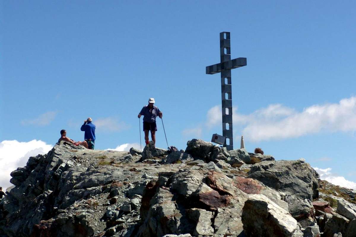
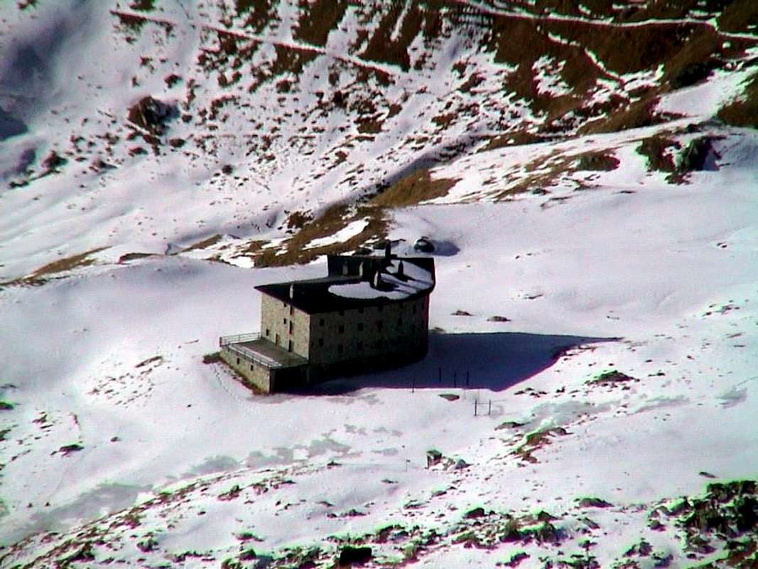
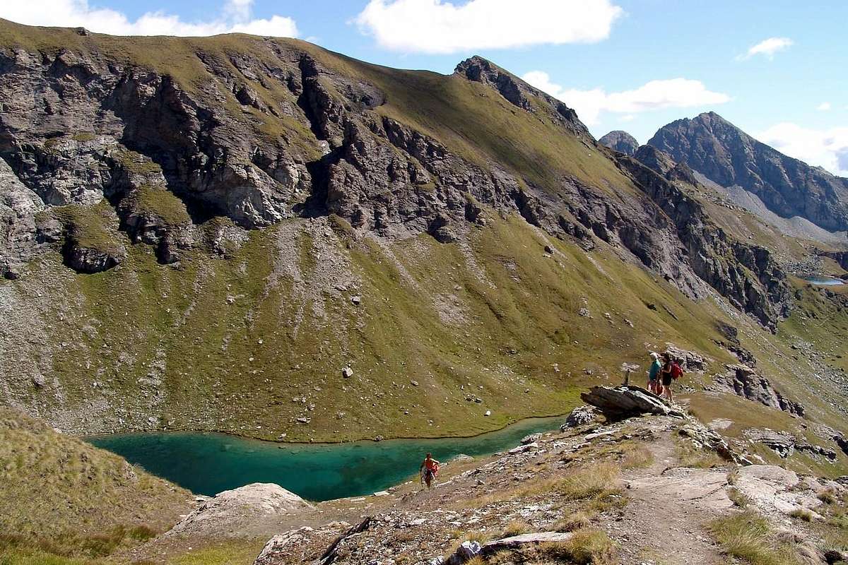
1) -"Baita Dino" (about 2.435 meters; private house); from the same, with path n° 4/105 before along an effluent into a small vallon and after North shore of Battaglia (Battle) Lake, to Pòcia and Long Lakes. Through path n° 3C in West-northwest over a debris promontory to Bussola Hill (2.807m); from tyhis in Northwest on Southeast Crest to
2) - Corno Bussola (+; 3.023m; EE/F+, a shorth passage equipped with chain; 3h'30/4h'00 from Estoul; 1h'45/2h'15 from "Baita Dino").
Corno Bussola (3.023m)
Avvicinamento dal Vallone dal Vallone di Palasina:da Brusson salire al Villaggio di Estoul (+; 1.812 m; ampio parcheggio con pannelli e varie segnalazioni) tramite la Strada Regionale; da qui, verso Settentrione con la poderale dapprima concomitante ai sentieri n° 5/4/105, verso i vari Alpeggi di Fenillettaz (1.840 m), il successivo bivio (1.882 m; segnale di divieto per i mezzi), Fontaine (1.903 m), Chanlochère (2.012m), bivio 2.029 metri, Chavanne (2.107m), le due alternative (2.103 m, 2.209 m) viciniori al Lago Litteran (2.226 m), bivio 2.231 metri. Da questo punto
A) - a Nordovest in direzione delle Alpi Chavanne (2.347 m) e Palasinaz (2.402 m) verso la
1) -"Baita Dino" (circa 2.435 metri; casa privata); dalla stessa, dapprima con sentiero n° 4/105 in un valloncello e lungo l'emissario e quindi presso la sponda Nord del Lago della Battaglia verso i Laghi Pòcia e Lungo. Con sentiero n° 3C ad Ovest-nordovest al di sopra d'un promontorio detritico raggiungere il largo Colle Bussola (2.807 m); continuare a Nordovest sulla facile Cresta Sudest con sentierucolo sino al
2) - Corno Bussola (+; 3.023m; EE/F+, breve passaggio attrezzato con catene; 3h'30/4h'00 da Estoul; 1h'45/2h'15 dalla "Baita Dino").
Difficulty & Essential Gear
Gear For Hiking.
da Escursionismo.
This route can be considered EE/F+.
L'itinerario è da classificare in EE/F+.
Mountain Conditions
You can get meteo information at the official site of the Regione Valle d'Aosta:


 2270 Hits
 78.27% Score
 9 Votes