Toggle navigation
Mountains
Routes
Images
Trip Reports
Forum
What's New
People
Areas & Ranges
Articles
Trailheads
Canyons
Huts & Campgrounds
Albums
Logistical Centers
Fact Sheets
Lists
Custom Objects
Gear
Plans & Partners
WELCOME TO SUMMITPOST
SIGN IN
REGISTER
Long Trail/AT southbound
Additional Parents
Image
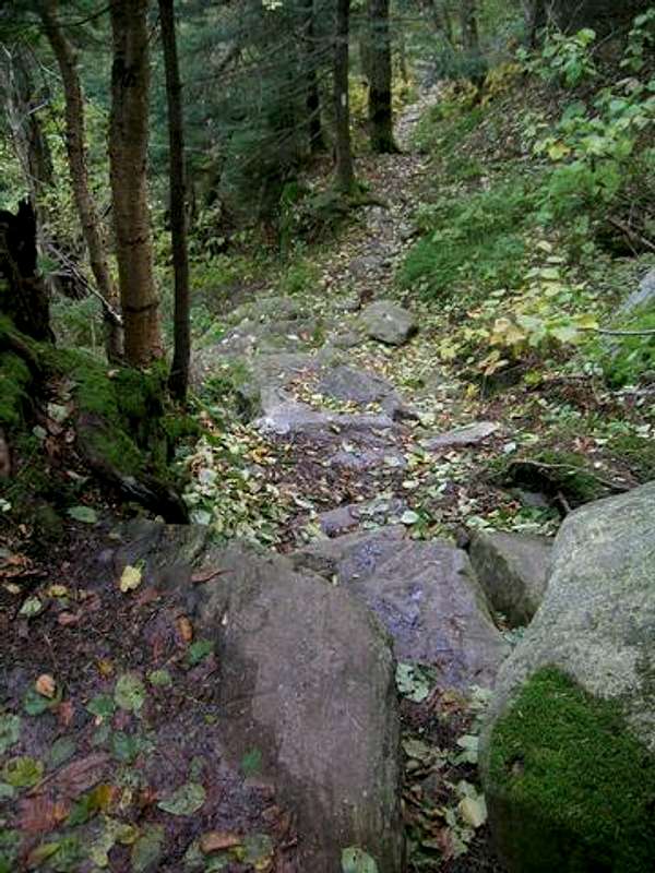
Another "route" photo. This...
View High-Resolution Image
Another "route" photo. This...
Another "route" photo. This is the AT/LT north of the summit. It was taken looking northbound at a rock step. Other than the distance, this is about the only obstacle to be found along the way.
30 Sep 2005
« PREV
NEXT »
big_g
on
Nov 4, 2005 12:56 pm
Comments & voting
Other parents
Lat/Lon:
42.97800°N / 73.072°W
Image ID:
134616
4754 Hits
71.56
% Score
4
Votes
Log in to vote
Comments
No comments posted yet.
to post!
Don't have an account?
Long Trail/AT southbound
(Route)
You are at
the First
Image
Viewing
#1 of 1
GALLERY
You are at
the Last
Image
big_g's Image Gallery
« PREV
Viewing
#590 of 698
GALLERY
NEXT »
Glastenbury Mt.
(Mountain/Rock)
Loading....
×
You need to login in order to vote!
User Name
Password
Remember me
Forgot your password?
Log me out when I close my browser.
Keep me logged in all the time.
sign in as a user
Don't have an account?
Register now for FREE
Rating available
Suggested routes for you
People who climb the same things as you
Comments Available
Create Albums
Register Here


