
|
|
Area/Range |
|---|---|
|
|
45.28770°N / 5.78800°E |
|
|
Hiking, Mountaineering, Trad Climbing |
|
|
6830 ft / 2082 m |
|
|
Overview

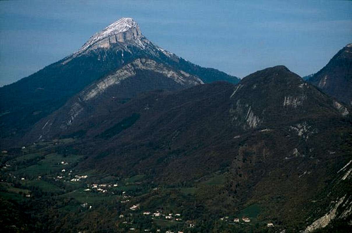
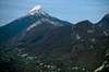
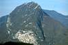
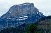
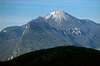
These are the mountains behind the Monastery of the same name-La Grande Chartreuse. They also inspire the well known drink which is made by the monks in their spare time. Some of the summits include Dent de Crolles, Chamechaude 2082 m, Grand Som 2026 m and Mont Granier. These are limestone mountains with rather large precipices, but appear to have walk up routes. St. Bruno founded La Grand Chartreuse Monastery in 1085 in the forest beneath the Grand Som.
[The Massif de la Chartreuse forms an elongated mountainous area some 40 miles north to south and 15 from east to west , situated between Chambéry to the north, and Grenoble to the south. The east flank falls abruptly almost 2,000 metres to the Isère valley, while to the west, the high ground falls away towards the Rhône valley. It is separated from the Vercors upland area to the south also by the Isère river, which swings round to the west at Grenoble on its way towards the Rhône Above the meadows in the valleys, wooded ridges rise up steeply towards steep limestone cliffs. Above these, may be found a hidden world of high altitude plateaus and valleys, vegetated with grassland and dwarf forest.]* The Chartreuse Monastery has been at the foot of Grand Som 2026 m for 900 years. Mont Granier 1933 m caused a huge land slide in 1248. Henri IV sent the monks a recipe for the drink in about 1600 and they have been working on it ever since.
You may reach the Grand Som by walking up east of the monastery to the Col du Frenay and then following the ridge north. The approach to the summit involves some scrambling.
*see link
 |  |  |  |  |
Getting There
Travel by air to Lyon or Geneva. From there go to Grenoble from Genoble travel a few miles or a few more Km to La Grande Chartreuse. I Thank Claude Mauguier for his good route description.The western most peak is La Grande Sure. This rises 1 mile above the town of Voiron 6 miles further west: One can take the D-105 north from Saint-Egreve(Just across the river Isere from Genoble) toward the Col de la Charmette(1261 meters). Distance: St. Egreve to Col is about 18km. The col ol is east of La Grande Sure and one has a further 2000 ft of climbing.
Seasonal road closures for snow:
Please note that the road(D-105) is closed to all vehicles for works about 3 km before getting to the col, until the end of june 2006. This road is NOT cleared from snow above the village of Pomarey. Only hikers or skiers might then use it.
This col may also be approached north to south from the church at Saint-Laurent(about 10km distance). This road is quite narrow and one must park the car around the Tunnel of Les Agneaux about 850m. and continue south to the col on foot or mountain bike up the narrow and exciting road with the Gorges du Guier on your left(north east).
Here is Claude Mauguier's account of his ascent to La Grand Sure:
elevation: 1920 meters.
Starting from Col de la Charmette (Nat. Forest road & Hut, 1270 m.), a faint track (a few yellow stripes, not visible in winter) goes gently SW, until the first rock barrier is met. Steeper section from here - about midway - until an up and down portion finally leads to a large alpine meadow around 1600 m high. If you expect to spend a night in the little Bannettes hut, go on SSW keeping above timberline, and the little shelter is there, afoot a large limestone wall, and dominating the Isère valley around Voiron. It is strange to spend an evening in deep darkness while electrical fireworks and car lights are shining far away under your feet...!
Otherwise, turn NNE towards Hurtières pass, and aim for a level faint path running N to col de la Sure, just under the cliffs at your right hand (the large Hurtières cwm hosts also a comfortable shepherd hut : Cabane d'Hurtières). From La Sure pass, a track climbs W, then after a few alternating curves goes frankly SW keeping well under the skyline. A final large rock covered "doline" will mark the start for the last 10 minutes hike. Large wooden cross on the top. Mind...the west wall is a vertical 200 m drop !!! Modest altitude (1920 m.), but very large pano : Mt Blanc, Gd Combin, Meije, Arves, Central Massif, etc...
Getting to the Col:
Col de la Charmette
When To Climb
May through September looks good. In the winter there is skiing.The maps include the well known Michelin road maps. Essential are the IGN 1:25000 scale "top 25" maps :
- 3333 OT "Chartreuse Nord"
- 3334 OT "Chartreuse Sud".
Available almost in every newspaper/bookshop in the immediate surroundings. Grenoble, Chambéry and Lyon large booksellers are of course a good option.
Camping
The area is included in the Chartreuse Regional Nature Park.Camping at: Camping de la Martinière - Route du Col de Porte - 38380 St Pierre de Chartreuse
Chartreuse Camping
24 Refuges= huts:
Refuges, Huts
Prominence
Chamechaude has 1770 meters of ProminenceWeather
Weather ChamberyAltitude above Sea Level
Om added the following on February 28, 2005East :
Dent de Crolles 2062m
Crête de l'Alpette 1975m
L'Aup du seuil 1920m
Grand Manti 1818m
Rochers de l'Alpe 1843m
Mont Granier 1933m
Lances de Malissard 2045m
Roches de Fita 1737m
Sommet du Pinet 1867m
Mont Saint Eynard 1359m
Les Grands Crêts 1489 m
Bec Charvet 1738m
Mont Rachais 1046m
L'Ecoutoux 1406m
Middle:
Chamechaude 2082m
La Scia 1791m
Roc d'Arguille 1768m
Charmant Som 1867m
La Pinéa 1771m
Grand Som 2026m
Rochers d'Arpison 1556m
Dent de l'Ours 1820m
Petit Som 1772m
L'Aliénard 1618m
Néron 1298m
West :
Grande Sure 1920m
Rochers de Lorzier 1822m
Mollard de la Chaleur 1776m
Rocher de l'église 1300m
Mont Outheran 1676m
Mont Joigny 1556m
Pointe de la Bornée 1507m
Pointe de la Gorgeat 1485m
Roche Veyrand 1428m
Le Corbeley 1419m
Mont Grelle 1425m
Climbing Guide Book

External Links
- Chartreuse and More
Nicolas Gamby's Mountain Page
- Pilier Tobey
Climb the Tobey pillar on Chamechaude
See Nicolas Gamby's provided photos at this site.
- breamoor.co.uk
Walking in the Chartreuse
- Mont Granier
Mont Granier and the Chartreuse
- Charmant Som ascent
- Grande Sure ascent
- Grand Som ascent
- Chartreuse mountains geology
Geo-alp.com
- Gérard Dallin Chartreuse Photos
- Chartreuse Regional Park site
- Chartreuse Balades
Hiking routes - clic on ICI to access to a clicking map-
Daniel du Lac ice climb on the south west face of La Dent de Crolles
Photos
Photos
desainme - Mar 8, 2005 5:37 pm - Hasn't voted
Untitled CommentI added the altitudes in a separate altiude category. They have been removed from the prominence category.
om - Mar 8, 2005 12:18 pm - Voted 10/10
Untitled CommentWhat i added is the list of Chartreuse main summits with their altitude not their prominence.
desainme - Mar 8, 2005 5:37 pm - Hasn't voted
Untitled CommentI added the altitudes in a separate altiude category. They have been removed from the prominence category.
Josh - Nov 20, 2005 1:14 pm - Hasn't voted
Untitled CommentPlease note that the road is closed to all vehicles for works about 3 km before getting to the col, until the end of june 2006. This road is NOT cleared from snow above the village of Pomarey. Only hikers or skiers might then use it.
Claude Mauguier - Nov 27, 2005 8:28 am - Voted 10/10
Untitled CommentEssential are the IGN 1:25000 scale "top 25" maps :
- 3333 OT "Chartreuse Nord"
- 3334 OT "Chartreuse Sud".
Available almost in every newspaper/bookshop in the immediate surroundings. Grenoble, Chambéry and Lyon large booksellers are of course a good option.
In the past, I often got myself trapped into some tricky situations, having followed the "Didier-Richard" indications....But well, they perhaps made some progress...
BorisB - Oct 25, 2006 9:29 pm - Voted 9/10
Wrong section?You should move this article to the "areas & ranges" section. Chartreuse is more than a rock or a mountain, it is a "massif"
andybryant - Sep 9, 2010 1:52 pm - Hasn't voted
Add link requestHi guys, Could you add a link to my page on Chartreuse hikes? http://andy.bryant.name/hikes/tag/chartreuse Thanks, Andy.
visentin - Dec 19, 2010 10:46 am - Voted 10/10
Alps as parentPerhaps you could attach it to the Western Alps ?