
|
|
Area/Range |
|---|---|
|
|
36.00000°N / 51.50000°E |
|
|
18406 ft / 5610 m |
|
|
Overview
Also known as "Elburz Mountains".
PURPOSE OF THIS PAGE
A search on the internet reveals very little useful information about the Alborz Mountains. This page will hopefully introduce the reader to these mountains and provide an interactive map that will allow the reader to zoom on pre-selected areas. A partial list of those peaks whose elevations exceed 4000 meters has also been provided. I am not aware of any other source that provides such a list. Most of these peaks have been linked to a page or at least a picture. As new pages/pictures are added, new links will be made.
NOTES
With few exceptions, all elevations are per the 1:50 000 maps (see Maps section below).
With few exceptions the names of all of the peaks between Karaj/Chalus and Haraz Rivers are as they appear on “Guide map of Climbing the Peaks of Central Alborz” and the names of the peaks of the Takhte Soleyman Massif are as they appear on “The Guide Map of Takhte Soleyman & Alam Kuh Region”. The names of other peaks are as they appear on the 1:50 000 maps or otherwise commonly used names. 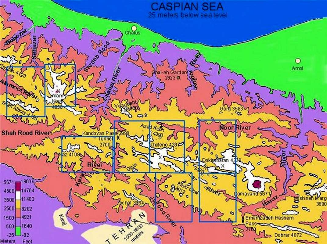
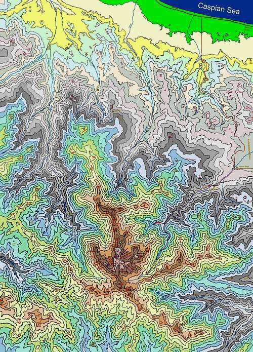
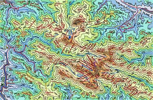
Click on above map to zoom on selected areas.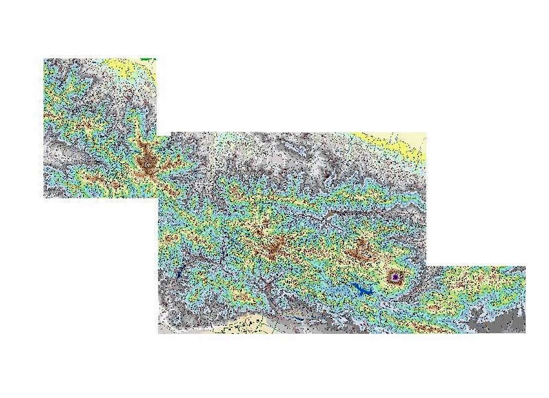
Click on the above image and click again to see a Large/detailed Map of Central Alborz
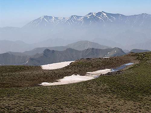
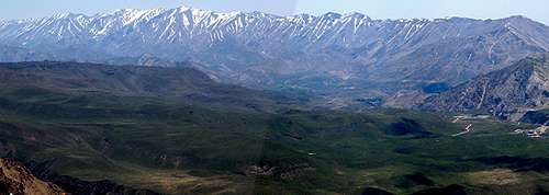
ALBORZ MOUNTAINS OVERVIEW
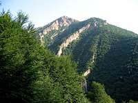
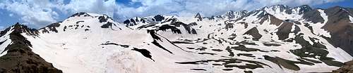
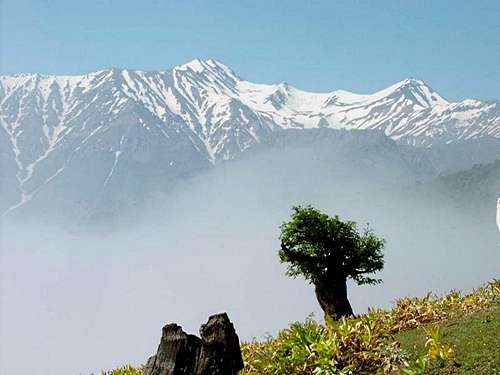
The lush north slopes

The lush north slopes
The term “Alborz Mountains” has been loosely used in reference to all of the mountains of northern Iran, from the Turkish border to the northwest, to the border with Afghanistan to the northeast (a distance of more than 1500 km). The Alborz Mountains gain their maximum height and density along the southern shores of the Caspian Sea where they create a formidable barrier that separates the coastal plains from the internal plateau of Iran. Close proximity to the Caspian coast has created a steamy lush environment on the coastal plains and the northern-most slopes of the mountains. In some places (near the coastal towns of Ramsar and Noshahr), the strip of land between the mountains and the sea is no more than one kilometer wide.
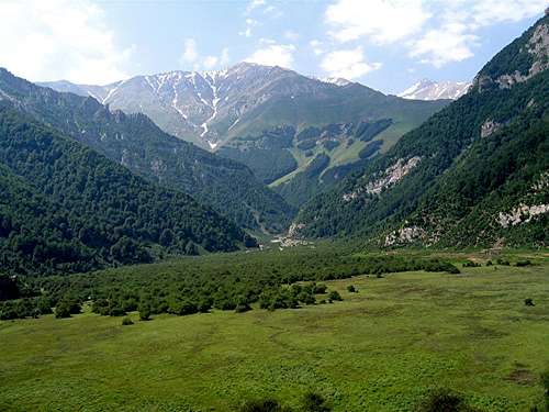
The southern slopes of the Alborz drop onto the central plateau of Iran. The average elevation of this plateau at the base of the mountains is around 1500 m (Please be aware that the plateau itself is covered by other scattered mountains. In fact, there are few places in Iran where mountains can not be seen on the horizon). In contrast to the lush northern slopes, the southern slopes of the Alborz Mountains are barren. Trees can be found only on stream banks at the bottom of the valleys. Grasslands, alpine tundra, and permanent snow cover the higher slopes of the Alborz. Evidence suggests that in the past, glaciers used to cover a much larger area of the Alborz Mountains than they do today. At the present time, glaciers can be found on Mt. Damavand, Takhte Soleyman Massif, Mt. Sabalan, and to a much lesser extent on some of the higher peaks of the range. Winter brings a heavy coat of powdery snow that creates an ideal environment for skiing. The abundance of snow gives rise to fairly large mountain streams that provide fresh water for the nearby cities including the 10 million-plus mega-city of Tehran. When viewed from space, some of these streams appear to have dug deep gorges that penetrate into the heart of the mountains. The distance between the 5671 m Mt. Damavand and the bottom of the Haraz Valley to the northeast of it where the elevation is only 1000 m is no more than 17 kilometers.
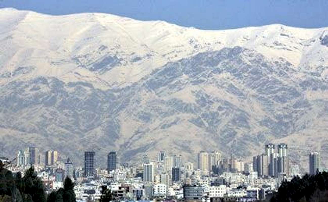
TEHRAN AND THE ALBORZ MOUNTAINS
The capital city of Tehran sits on a plain at the foot of the Alborz Mountains. The 3964 m Mt Tochal creates a dramatic background for Tehran's skyline.
PEAKS HIGHER THAN 4000 METERS
Peaks higher than 4000 meters can be found in two areas in the Alborz Mountains (Please note that this discussion excludes the Zagros Mountains of western/southern Iran that also have many groups of peaks higher than 4000 m):
1) A few peaks around the 4811 m summit of Mt. Sabalan in northwestern Iran
2) Depending on how you count them, around one hundred in Central Alborz
CENTRAL ALBORZ OVERVIEW
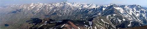
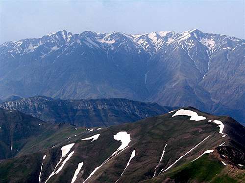
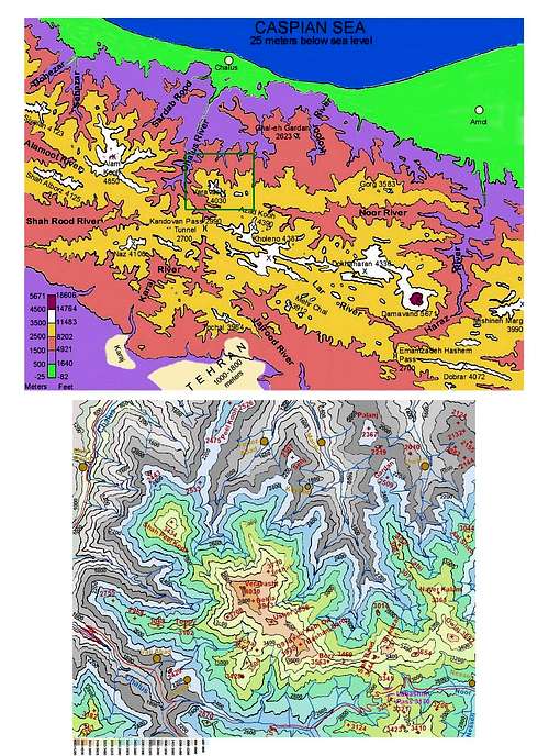
The boundaries of Central Alborz can be defined as follows (300 km E-W by 90 km N-S. See Signature Photo):
-South of the Caspian Sea
-North of the Capital city of Tehran and vicinity
-East of the Coastal town of Rasht
-West of the coastal town of Sari
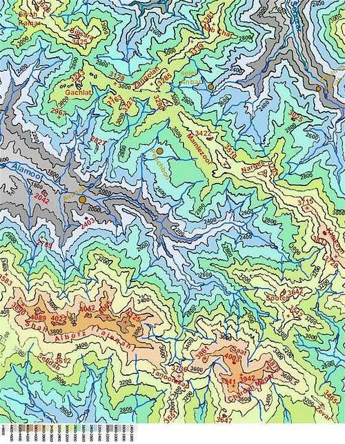
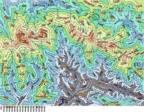
Much of Central Alborz consists of very long parallel ridgelines that generally run east-west (parallel to the coast of the Caspian Sea). Deep valleys divide these ridgelines into distinct “groups”. Defining individual peaks along the length of these ridgelines that might be many tens of kilometers long and entirely above 3500 or 4000 m, can be arbitrary. Except for the prominent peaks, it appears that traditionally names have been used in reference to whole groups of peaks rather than individual ones. While many peaks remain nameless, others might be known by different names. The most accurate maps of the Alborz Mountains are those with a scale of 1:50 000 (see below). These maps provide exact elevations for hundreds of peaks/high points on each sheet but they leave most peaks without a name. It seems that the climbing community in Iran has recently started to publish maps that identify individual peaks and provide them with names (that will hopefully standardize). I am not aware of the criteria used for identifying these “Peaks” but looking at the 1:50 000 maps reveals that most of these peaks are at least 50 m higher than their surrounding saddles (most are much more than that).
The higher than 4000 meters peaks of Central Alborz can be divided into several groups as below:
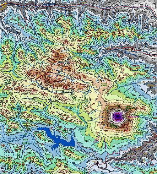
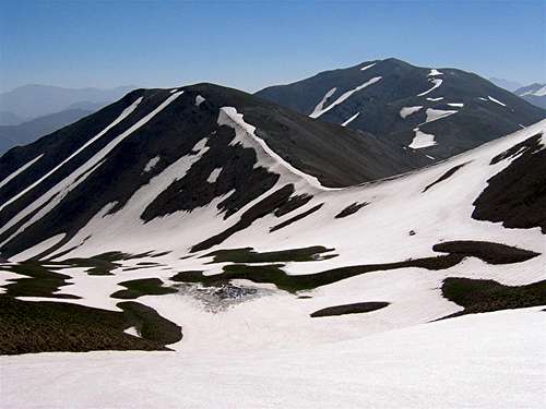
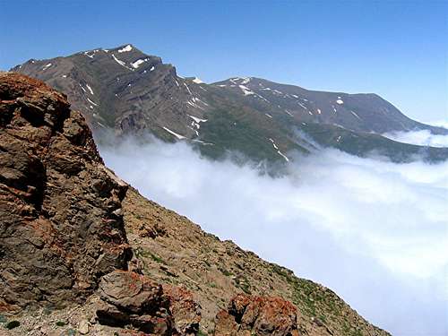
a) ALAM KOOH/TAKHTE SOLEYMAN MASSIF
 Alam Kooh & part of the Takhte Soleyman Massif to the south of it
 Alam Kooh & part of the Takhte Soleyman Massif to the north of it
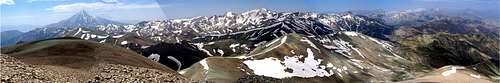
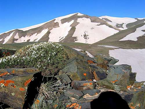
After the single volcanic cone of Mt. Damavand that rises to 5671 m (see below), the Takhte Soleyman Massif contains the highest peaks of Central Alborz (and the only place where the elevation of the peaks exceeds 4400 m). The crest of the massif consists of a 19 km long ridgeline that runs (unlike the rest of the ridgelines in Central Alborz) north-south and is entirely above 4000 m. Two branch ridgelines (the Haft Khan and the Chaloon/Siah Kaman ridgelines) bring the total length of the interconnected ridgelines that are entirely above 4000 m to 30 km (there are other connecting ridgelines that are partially above 4000 m).
Deep “V-shaped” valleys that surround the massif to the east, north and west of it, are heavily forested and drop steeply to the Caspian Sea. Sheer walls and high “U-shaped” valleys point to extensive glacial activity in the area. In fact, the massif contains the largest collection of glaciers in Iran.
In his “Takhte Soleyman Massif” page, Summitpost member “nomad” gives a list of 160 peaks that are higher than 4000 m. I simply do not have enough detailed information to know how many of these peaks pass the rule of “91 meters (300 ft) above the surrounding saddle” that is used in the Colorado Mountains of western United States for defining individual peaks. My personal experience in the massif and consulting the 1:50 000 maps seem to indicate that there are at least twenty peaks higher than 4400 m that probably meet the rule of 91 meters as listed below. Lower than 4400 m, the peaks become too numerous for me to count.
1) Alam Kooh 4850 m
2) Alam Kooh Shakhak #3, 4782 m (excludes #1, #2 & #5)
3) Alam Kooh Shakhak #4, approx. 4750 m
4) North Kersan 4680 m (excludes Middle Khersan & Viran Kooh)
5) South Khersan 4659 m
6) Takhte Soleyman Peak 4659 m (excludes many other sub-peaks around it)
7) Siah Sang 4604 m
8) Marji Kesh 4580 m (excludes Marji Kesh #2)
9) Haft Khan # 1, 4537 m (excludes #3, #4, #6…)
10) Haft Khan #2, 4528 m PIC 1
11) Chaloon 4516 m
12) South Siah Gook 4510 m
13) North Siah Gook 4505 m
14) Siah Kaman 4472 m
15) Shaneh Kooh 4465 m
16) Haft Khan #5, 4457 m PIC 1
17) Rostam Nisht 4426 m
18) Kalahoo 4412 m
19) Gardooneh Kooh 4402 m
20) A series of crags known as “Dandaneh Ejhdeha” (Dragon’s Tooth” 4400 m? PIC 1
Some of the more prominent peaks of the massif below 4400 m that are represented on Summitpost by a page or a picture are as follows: (by no means a complete list)
- Ghobi 4399 m, PIC 1, PIC 2
- Menareh 4378 m
- Langari (Haft Khan) Peaks 4376 m & Peak 4324 m PIC 1
- Mian-Se-Chal 4348 m
- Looy Na (Kalchal) 4340 m
- Tange Galoo 4335 m PIC 1
- Hezar Cham 4317 m
- Setareh 4296m PIC 1 PIC 2
- Avidar 4260 m PIC 1 PIC 2
- Lashgarak the Great 4256 m
- Takhte Rostam 4245 m
- Zard Gel 4231 m PIC 1 PIC 2
- Zarrin Kooh (Aband or Maseh Chal)4198 m
- Lashgarak the Small 4184 m
- Mazi Gardan 4140 m
- Kalvan 4078 m
- Meeshchalak 4067 m
- Alaneh Sar 4065 m
- Nezar 4047 m
- Khers Char 4030 m
- Korma Kooh 4020 m PIC 1, PIC 2
- Passand Kooh 4000 m
b) MT. DAMAVAND AND THE MIDDLE WALL OF CENTRAL ALBORZ
The spine of this area consists of an 80 km long ridgeline that starts with Mt. Damavand (to the west of the Haraz Valley) and stretches west to near the Kandovan Pass on Karaj-Chalus Road. Except for the 3420 m Kabood Pass, the elevation of this ridgeline never drops below 3500 m. If you add the length of the many branches of this ridgeline, you will come up with more than 150 km of interconnected ridgelines whose elevations are entirely above 3500 m (except for Kabood Pass). High glacially carved valleys can be found near some of the higher peaks (especially Kholeno and its nearby peaks). I am not a geologist but these valleys seem to point to glacial activity in the distant past. While today, some snow remains in the valleys year-round, by late summer, the remaining snow patches are probably not large enough to be classified as “glaciers”.
The 5671 m summit of Mt. Damavand that rises on the eastern-most part of this ridgeline is by far the highest peak of Central Alborz (and the Middle East). Damavand is an almost perfect volcanic cone whose superior height makes it visible from miles away. After Mt. Damavand, the highest peaks of this area are in the low 4000-meter range as listed below. The 4000 m peaks can be lumped into two distinct groups: The Kholeno Massif to the west and the Dokhaharan Massif to the east. (I have tried to limit the list to only those that seem to rise at least 50 meters above their surrounding saddles)
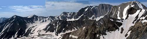
Part of the Kholeno Massif
Mt. Damavand & part of the Dokhaharan Massif
1) Damavand 5610 m
2) Azad Kooh 4390 m
3) Kholeno the Great 4387 m
4) Kholeno the Small 4350 m
5) Dokhaharan West 4338 m (& East 4310 m)
6) Borj 4325 m
7) Shekar Leghas (Nazer the Great) 4278 m
8) Harzeh Kooh 4268 m
9) Chapakro (Makhroot Sar) 4260 m (& sub-peak 4080 m)
10) Paloon Gardan 4256 m
11) Khers Chal 4253 m (and Farakhe No 4230 m)
12) Meeshchal 4253 m (& sub-peak 4039 m)
13) Kaman Kooh 4234 m
14) Sarakchal 4210 m (& sub-peaks 4152 m, 4124 m & 4120 m)
15) Siyoonza 4208 m (& Asbi Chal 4200 m) PIC 1, PIC 2
16) Narges 4206 m
17) Sarkharsang 4203 m
18) Yakhchal 4194 m
19) Sar Kooleh 4188 m PIC 1, PIC 2
20) Takhte Khers 4178 (& sub-peak Yakh Kamar PIC 1 4110 m)
21) Sarmahoo 4165 m
22) Erim 4160 m PIC 1, PIC 2
23) Koloon Bastak 4156 m
24) Kahoo 4150 m PIC 1, PIC 2
25) Sesang #1, 4135 m
26) Sesang #2, 4130 m PIC 1
27) Dalkoli 4130 m
28) Palvan 4126 m
29) Bandalkoli 4118 m
30) West Narges 4103 m
31) Sesang #4, 4089 m PIC 1
32) West Darreh Khooni 4089 m (& sub-peak 4019 m) PIC 1, PIC 2
33) Koheno 4082 m PIC 1, PIC 2
34) Kaoon 4075 m
35) Kooleh 4074 m PIC 1, PIC 2, PIC 3
36) North Narges 4073 m
37) Peak 4051 m PIC 1
38) Sesang #5, 4050 m PIC 1
39) Varzab #1, 4036 m PIC 1
40) Darreh Khooni #2, 4029 m PIC 1
41) Varzab #2, 4028 m (& sub-peak 4013 m)
42) Peak 4018 m (between Sarak Chal & Harzeh Kooh) PIC 1
43) Haft Saran 4007
c) SHAH ALBORZ (Taleghan Peaks)
A 21 Kilometer long east-west running ridgeline that rises entirely above 3500 m. The 4000 m peaks are as follows:
1) Shah Alborz 4125 m
2) Taleqhan Peak 4089 m
3) Saal Barf 4065 m
4) Sefid Ab 4042 m
5) Siah Darreh 4022 m
6) Saat 4003 m PIC 1
d) SIYALAN AREA
This area contains a series of peaks with elevations above 3500 m in the northwestern corner of Central Alborz close to the Caspian Sea. There are three peaks here with elevations higher than 4000 m:
1) Siyalan 4190 m
2) Siyalan's subpeak 4050 m PIC 1, PIC 2
3) Kandigan 4015 m
Siyalan rises more than 3000 m above the upper portions of the Dohezar River Valley which is a heavily forested valley that drops steeply into the Caspian Sea.
e) NAZ/KAHAR AREA
|
|
A long chain of peaks forms a line that runs east-west in western-Central Alborz north of the Karaj River Valley and south of the Shah Rood River Valley. The elevations of these peaks are mostly above 3700 m. Only two peaks are higher than 4000 m:
1) Naz (Sikzo) 4108 m (and its 4050 m sub-peak)
2) Kahar the Great 4015 m
f) DOBRAR/GHAREH DAGH AREA
A 52 km long ridgeline that runs east-west in the southeastern part of Central Alborz. The elevation of 32 km of this ridgeline is entirely above 3500 m. Depending on how you count them, there are at least 5 peaks higher than 4000 m. West to east, these include:
1) Angemar II 4020 m
2) Angemar I 4047 m
3) West Dobrar 4072 m PIC 1, PIC 2, PIC 3
4) East Dobrar 4070 m PIC 1, PIC 2
5) Ghareh Dagh 4057 m PIC 1
g) VERAVAST (DEHLA) AREA
A number of peaks higher than 3500 m that tower above the southeastern Chalus River Valley. The 4030 m Veravasht (Dehla) is the only local peak higher than 4000 m.
Getting There
ROADS
Four main roads cross the Central Alborz Mountains. West to east, these include:
1) Qazvin-Rasht Road
2) Karaj-Chalus Road
3) Tehran-Amol (Haraz) Road
4) Tehran-Sari (Firooz Kooh) RoadMany other side roads provide access into the mountains.
Red Tape
Much of Central Alborz is a protected area. Camping is allowed but hunting will require a license.
Click here https://iranianvisa.com/ for info about obtaining a visa to visit Iran.
Visa:
The following is a quote from SP member BigLee:
"As for Iranianvisa.com they're definitely worth using. You apply online. The visa only takes a couple of weeks to obtain and you don't have to pay anything if you are declined. Their service charge was $30 in 2004 which you just pay at an Iranian bank once you are in Iran. The chances of getting a visa are far better than going directly to the embassy. They pretty much guaranteed they could get me a visa despite the London embassy being problematic for visas. You can also collect your visa at an embassy of your choice which is handy if you are traveling around (I got mine in Istanbul). Once the visa has been authorised, Iranianvisa give you the authorisation code from Tehran which you take it to your chosen embassy with your passport and then the following day you collect your visa. Doddle!
When To Climb
Mid-June to early October. I prefer late June/early July when there is still much snow on the mountains. On the lower slopes, the grass is green and flowers are in bloom. Too much snow, however, will obviously make the climb harder.
Many people climb these mountains in winter. That obviously requires training and special equipment. CampingGenerally, camping is allowed anywhere. You will also find mountain huts in the more popular areas.
Mountain Conditions
In summer, the weather is generally clear. Isolated thunderstorms (sleet/snow at higher elevations) do happen.
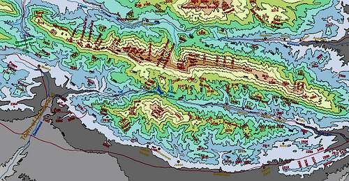
Maps
The most accurate topographic maps of the area are those with a scale of 1:50 000 produced by the Iranian armed forces, These maps are available in Tehran at the Geographical office of the armed forces on Moalem St. (Tel 98 21 88408088). Outside of Iran, the same maps can be purchased at www.cartographic.com for a very high price. These maps are in Farsi. While they provide accurate/detailed topographic info, these maps do not necessarily provide a name for each and every peak. For the Takhte Soleyman Massif, “The Guide map of Takht-e-Soleiman & Alam Kuh Region” by Iran Kuhro and for the mountains between the Karaj/Chalus and Haraz Rivers the “ Guide Map of Climbing the Peaks of Central Alborz” by Gitashenasi provide additional information and names for most of the peaks. These maps are schematic (cartoon-like) and distort distances and relative positions but can be useful when used with the 1:50 000 maps. The maps provided here have been created by me based on the 1:50 000 maps and are to scale.