
|
|
Area/Range |
|---|---|
|
|
36.41244°N / 25.41138°E |
|
|
1854 ft / 565 m |
|
|
Overview

Profitis Ilias from Kamari
Santorini is a small island (the southernmost) in the Cyclades island complex. His lenght is 18 kilometres and width 2-6 kilometres. Her name is officially Thera but Santorini is what the island is called most of the time. In ancient times the island of Thira was called Strongyli, which means Round Island. After the first eruption of the volcano, that resulted in the island's present shape, Thira was named Kallisti, meaning the Fairest One. During the 10th Century B.C., the Dorians invaded the island and settled seven villages. They named it Thira, after their ruler from Sparta (probably Theras, son of Antesion). In the 13th and 16th centuries, Venecian crusaders named the island Santorini, after the island's patron, Saint Irene, who died here in 304 A.D. The legend of Atlantis is associated with the island of Santorini. This is because Plato writes about an island, with a very advanced civilization, that disappeared under the sea. Santorini was also believed to have had a very advanced civilization and most of the island disappeared under the sea.
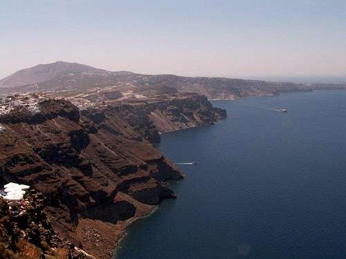
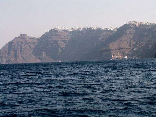
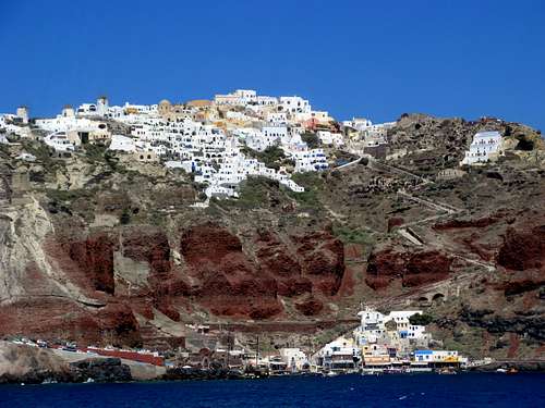 Image by Lodewijk
The western part of Santorini is made by the famous Santorini caldera. The island group of Santorini (Thira, Thirassia and Aspronissi) is what left over from the volcanic eruption 3 600 years ago.
 |
 |
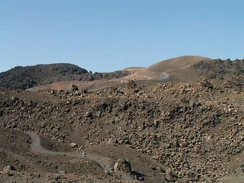
The island formed a solid mass from Faros to Aspronisi. From a small opening between Faros and Aspronisi, the sea flowed into an inner caldera. Between 1600 BC and 197 BC a series of periodic submarine effusions led to the creation of a large underwater volcano whose peaks are the Palea and Nea Kameni. The first emergence of an island from the sea was documented in 197 BC by the great Greek geographer Strabo. Eight more eruptions have been documented from then till today (46-47, 726, 1570-1573, 1707-1711, 1866-1870, 1925-1928, 1939-1941, 1950). After the last eruption in 1950, the Santorini volcano remains dormant till today. Caldera covers approximately 32 square miles and height of the Santorini caldera is 150 to 350 metres. At the western end of the caldera, we find the island of Therasia and an inhabitant island, Aspronissi.


 Image by Lodewijk
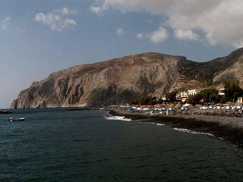
The biggest mountain of the island, Mesa Vouno (369 m) lays southwest. In the area of Mesa Vouno Baron Hiller von Gaertringen begun in 1896 excavations and discovored ruins of Ancient Thira, ruins of town which bore evidence of settlement as early as 9th century BC.
 Mesa Vouno
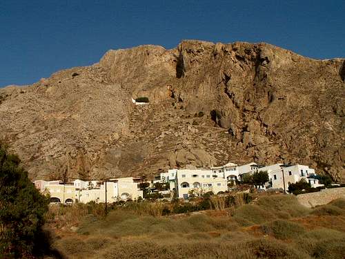
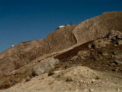
The mountain of Profitis Ilias, Santorini's highest peak runs eastward into the lower rocky outcropping of Mesa Vouno. These two mountains are joined by a ridge named Sellada, where is a parking site. Mesa Vouno, with an altitude of 369 metres, extends from west to south and its steep slopes plunge to coast at Kamari to the north side and Perissa to the south. This naturally fortified spot was an ideal place for the Spartan colonist to found their city, and they built two roads, one to beach Kamari, where they had their port (ancient Oia), and the other to Perissa. The strategic location of the town was appreciated later by the Ptolemies. In the 4th century BC, the most important era in the history of the island, Ancient Thira was transformed into an Egyptian naval base with the installation there of a large garrison.
 Profitis Ilias
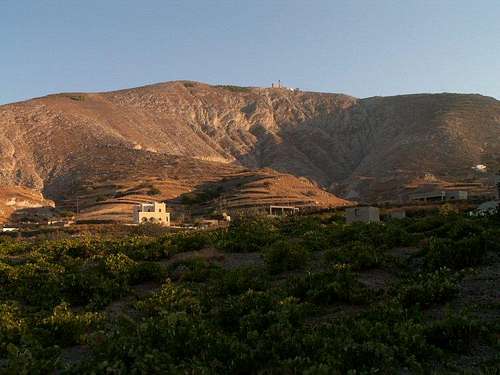 Profitis Ilias
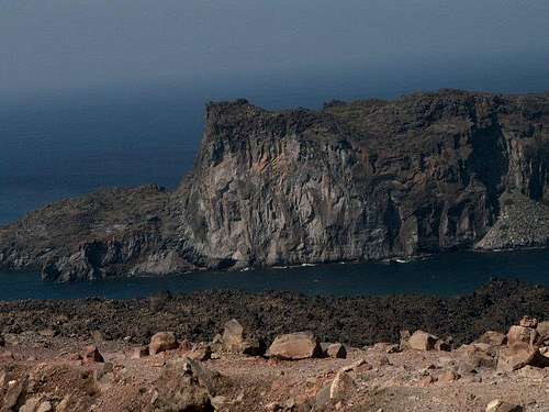
Profitis Ilias, its highest peak, is 565 meters high. On the top of this mountain there is a monastery built in 1771 dedicated to the prophet Elijah and some military facility. The monastery's decline began in 1860; buildings suffered serious damage in the 1956 earthquakes. To the south of Santorini island lies Gavrilos (140 m) and to the north Megalo Vouno, 330 meters high and Mikros Profitis Ilias, 340 meters high. The highest peaks of other islands are: on Thirassia Viglos (294 m), on the Nea Kameni (New Burned Island) - Ag. Georgios 124 m and on the Palea Kameni (Old Burned Island, 103 m).
 Giorgios
 Palea Kameni
Getting There
Only by plane (airport in Monolithos) or by ferry (seaport in Athinios). Very popular are one-day visits of this island (mostly from Crete).A distance between Santorini and Pireus in Greece is about 128 nautical miles. This travel lasts about 10 to 15 hours.
Transport in Santorini is cheap and regular. All buses go to Fira (central bus terminal) and from there to the all villages and cities on this island.

Monolithos airport
Route Description
At the highest peak of this island leads a trail from Kamari, Perissa or from Pirgos. Better choice is the trail from Kamari (more mountainous). From Kamari leads the trail to the Sellada (parking site near the excavations of an ancient city Thira), small pass between Mesa Vouno peak and Profitis Ilias peak. To this pass leads a trail from Perissa too (you can go from there by donkey). This pass is very windy as well as whole ridge leading to the highest point. We can see from there a monastery of Saint Elijah and military facility on the neighbouring Profitis Ilias.
To the left is a path leading to the excavations of Ancient Thira.
From Sellada we take right and follow a beaten track (good visible). When we reach the ridge we can see from there a whole island (caldera, airport, inland villages, islands of Santorini etc.). To the summit leads a road from Pirgos. First we descend by the road and in certain spot we take right (into bushes) and descend towards Pirgos.


Water
The island of Santorini is almost dry. There is a very few wells, one on the foothills of Profitis Ilias mountain, other - Vryssakia - to the east of this mountain and the third is located in the west part of the island near a bay of Athinio.
On the island there are hot springs too. In the area of Megalohori there are three springs known as Atherma or Thermi, Plaka and Kokkina Nera. One more spring is located in the village of Emporio.
External Links
Info
Web camera - Caldera view
Web camera - Volcano view
Info 2
Info 3-wikipedia
Maps
 |
 |
The myth about Atlantis
The origins of this myth we can find in Plato´s dialogues Timaeus and Kritias. The state of Atlantis was a kingdom of two islands - Meison (Bigger One) and Elasson (Smaller One). This kingdom was formed by ten city-states. Plato describes in Kritias two of this cities - Metropolis (probably the island of Strongyli, present Santorini) and Vasiliki Politeia (probably the island of Crete).
Research works of two archeologists Spyros Marinatos and Nikos Platon convinced the scientists, that mythical Atlantis was -according to Marinatos- the Santorini island and according to Platon the island of Crete.
Both agreed that Atlantis was destroyed by volcanic eruption in 1500 BC. Angelos Galanopulos compares eruption of Santorini´s volcano to the eruption of the volcano of Krakatoa. In case of Krakatoa disappeared approximately 2/3 of this island (33.52 sq.km) at a depth of 200 to 300 metres. In case of Santorini dissapeared 83.52 sq.kilometeres at a depth of 300 to 400 metres.
Upheaval of gigantic water mass (41 875 cubic meteres) caused a massive tsunami. This tsunami were - on Krakatoa 100 m high, on Santorini 210 m high and reached the island of Crete. The eruption of Thera was four times stronger than Krakatoa. During this eruption was destroyed an entire island´s civilization and probably the Minoan civilization in Crete too. A dust from the volcano was found in Egypt too.