
-
 69513 Hits
-
 99.42% Score
-
 110 Votes
|
|
Area/Range |
|---|---|
|
|
41.91140°N / 111.6747°W |
|
|
Hiking, Mountaineering, Trad Climbing, Sport Climbing, Toprope, Ice Climbing, Scrambling, Skiing |
|
|
Spring, Summer, Fall, Winter |
|
|
9979 ft / 3042 m |
|
|
Overview
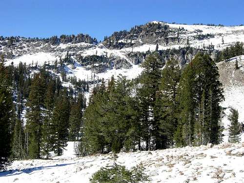
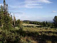
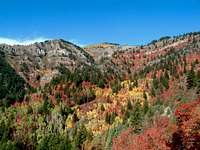
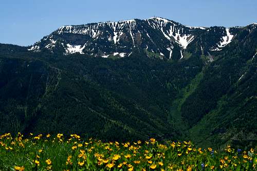
The Bear River Mountains are located in northern Utah and southeastern Idaho. The mountains form the northern extension of the Wasatch Range. They run in a north to south direction from Soda Springs, Idaho to Ogden Valley, Utah. This area is a gem and has many beautiful mountains and lakes. The highest peaks are over 9,000 feet in elevation. They vary from rolling hills to summits surrounding by rugged cliffs. Some of the more interesting peaks remain unnamed and are seldom climbed.
The mountain range is near by cities and towns but does not feel crowded. One of the biggest attractions of the range is the flower covered meadows on the hills and mountain slopes from late spring through summer. Several of these flowers are unique to the region. There are also large populations of moose, elk, and deer. Many smaller animals can be found including marmots, pikas, and beavers are well established in several streams.
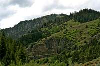
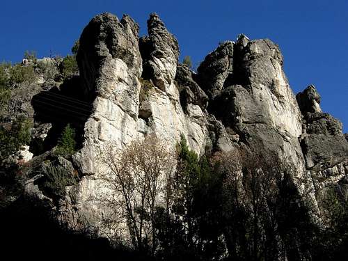
The range is composed mostly of limestone and dolomite that varies in age and has different layers of thickness. Other rock layers include quartzite and shale. The rock has eroded and formed caves, sinkholes, ponds, and streams that seem to disappear. Many of these caves are simply holes in the ground that appear in the least likely of places. It is a good idea to watch where you are walking anytime you are hiking off-trail in these mountains.
The name of the mountains comes from the Bear River, which loops around the range on its east, north, and west sides. Cache Valley forms the western boundary of the range and Bear Lake Valley forms the eastern boundary. The summit views are extensive and the Teton and Uinta Mountains can be seen on a clear day. The Wellsville Mountains can be seen off in the distance to the southwest. The topography of the range consist of ridges with large rounded summits which is typical of the Northern Wasatch Mountains.
The Wasatch Range
The Wasatch Range is part of the Rocky Mountains. The Wasatch Range rises to elevations of more than 11,000 feet and stretches for over 200 miles from Soda Springs, Idaho to Nephi, Utah. It starts with the Bear River Range in southeastern Idaho and northern Utah, then the Wellsville Mountains near the city of Mendon and Sardine Canyon, the Northern Wasatch above the cities of Ogden and Bountiful, the Central Wasatch above Salt Lake Valley, and Southern Wasatch, which has the highest mountains, from Provo to Nephi. The Wasatch Range is an imposing and important geographic feature in the western United States. From a geologic perspective, the mountains are a complex mix of igneous, sedimentary, and metamorphic rocks.
From a demographic perspective, these mountains, and their western base, is a corridor known as the Wasatch Front. Over 80 percent of Utah's population lives within 15 miles of the Wasatch range. Salt Lake City lies between the Wasatch Range and the Great Salt Lake. Not only those that live in the areas around Salt Lake City but Logan, Ogden, and Provo have the Wasatch Mountains as a spectacular backdrop each morning. Hiking, rock climbing, skiing, camping, mountain biking, and fishing are a few things that the Wasatch Mountains have to offer. This mountain playground is an ideal place for all kinds of outdoor enthusiasts.
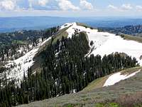
 Naomi Peak is the highest in the Bear River Range
Getting There
Idaho Access
Bear River Range
There are cities located along both sides of the Bear River Mountains in Idaho. Access to the eastern side is from US-89 and US-30. Montpelier is the largerst city on this side of the range. Smaller towns south of Montpelier include St. Charles, Paris, Bloomington, and Ovid.
Soda Springs is located at the northern end of the range. South of Preston is the city of Franklin which is on US-91. Access to the western side of the range is primarily from ID-34 north of the city of Preston. The small of towns of Niter and Grace are located between Preston and Soda Springs.
State Road ID-36 crosses the range from west to east. It is passable to regular vehicles during dry weather. It starts north of the city of Preston and gets very windy as it travels through the mountains. This road eventually meets up with US-89 near the town of Ovid.
Utah Access

Naomi Peak
Logan is the largest city near the Bear River Mountains in Utah. North of Logan are the cities of Richmond and Smithfield. South of Logan are the cities of Providence, Millville, and Nibley. All of these cities are accessed from US-91.
Logan, Utah Directions:
If you are coming from the north drive on US-91 into Logan. If you are coming from the south exit onto I-15
North of Brigham City on I-15 take exit 362 (US-91/Logan).
Keep driving on US-91 through Sardine Canyon. After 25 miles US-91 will merge into Main Street in Logan.
Logan Canyon Directions:
Starting in Logan:

Bear River Foothills
Start from the intersection of Main Street and 400 North in Logan. Turn east on Hwy 89 into Logan Canyon.
Continue on this route, Highway 89, as it winds up the canyon. The Logan River parallels Hwy 89 much of the way.
About 45 minutes after you enter Logan Canyon, you will reach the Summit and soon see Bear Lake. Garden City is at the foot of the long slope. A staffed visitor center in town has information and brochures which interpret the Byway.
Starting at Bear Lake:
The northern portal begins in Garden City, on the shores of Bear Lake, at the junction of Highways 30 and 89.
Hwy 89 turns sharply right at the intersection with Hwy 30. Follow Hwy 89. The Byway will climb a few miles up a steep and winding road. Bear Lake Overlook is near the summit, and the rest of the way through the canyon and into Logan is generally downhill.
You will emerge from the canyon and climb a short rise to see southern Logan below you. You will end up at the corner of Main Street and 400 North in Logan.
 Saint Charles Mountain - by D-bo
Idaho Mountains
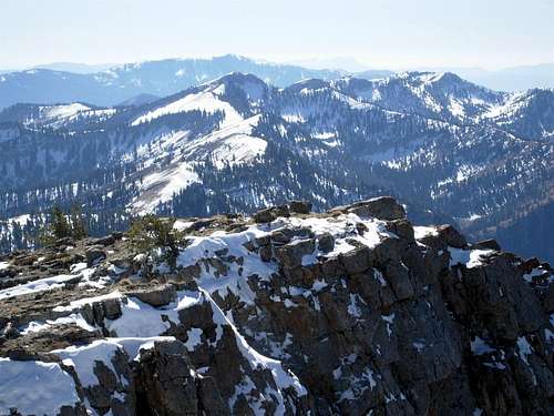
The Idaho portion of the range is 43 miles long and more than 20 miles wide. There are many points reaching above 9,000 feet. All mountains are rated class 2 or easier by their regular routes. Much harder variations can be found throughout the range. Access to this area usually requires driving long distances on dirt roads. A high clearance vehicle or 4-wheel drive is needed to reach many trailheads. The Bear River Mountains in Idaho are ignored by many climbers but this shouldn't be the case because the area has a lot of great mountains.
The Highline National Recreation Trail runs for 55 miles along the Bear River Range and affords wide open views of the Cache and Bear River Valleys. Emigration Campground serves as an intermediate trailhead. The trail runs north and south from Soda Point, with access from Nelson Canyon to Beaver Campground near the Utah stateline. This is the premier trail in the range and offers several options for climbing mountains. The trail can be broken up into sections and can also be a fun backpacking trip.
The area is administered by Caribou-Targhee National Forest. The Bear River Range is only a fraction of what this large forest area covers which is over 3 million acres across southeastern Idaho, from the Utah, Wyoming, and Montana borders. There is a small section west of St. Charles is managed as roadless land. There are several dirt roads, many of which are too rough for a regular vehicles, that go across the range.

Soda Peak
Soda Peak - (8,921 feet)
This is the northernmost peak in the Bear River Range. It is located due south of the city of Soda Springs. Soda Peak can be seen to the east of the cities of Grace and Niter and sits just below 9,000 feet in elevation. The mountain is also known as Soda Point and visited often by people who live nearby.
To get there drive down Eightmile Creek Road in Soda Springs. Turnoff at Wilson Creek Road which is 1/2 mile from Eightmile Guard Station. The road forks with the right fork leading north and the left fork leading south. Either of these two roads can be taken to get to the North Fork or South Fork of Wilson Creek Trailheads.
The South Fork located past Camp Ho-Nok provides the shortest route to the summit. They both meet up with the Highline Trail where you can scramble up the eastern slopes of Soda Peak. The North Fork is longer but still an easy climb.

Sherman Peak
Sherman Peak - (9,682 feet)

Sherman Peak
This is the highest mountain in the Idaho portion of the Bear River Range. It is located about twelve miles south of the city of Soda Springs. It is a large twin summited mountain with a long ridgeline. It was originally named Soda Peak but another peak located north of Sherman would be called that. The mountain was renamed later after the famous Civil War General, William T. Sherman.
The trailhead is reached by turning onto Eightmile Creek Road from the city of Soda Springs. This is a gravel and dirt road in good condition. A campground is passed after 12 miles of driving. After driving 0.4 miles, the trailhead for Sherman Peak will be on the left labeled as Trailhead Parking.
It is a 3.5 mile hike from here to the summit. The trail is not well maintained but is adequate for this area. It follows Mill Fork Creek as it starts to climb up the mountain. The south summit is higher than the north summit. The mountain can also be climbed from the south up Skinner Canyon. This route is shorter but steeper and is a 1.2 mile hike to the summit.

Paris Peak
Paris Peak - (9,575 feet)

Paris Peak
Paris Peak is located north of Bloomington Creek. The mountain is about 18 miles south of Sherman Peak. It is a rounded peak that is on the north side of Bloomington Canyon. Paris Peak is the second highest mountain in the Idaho portion of the Bear River Range. It was named for its location near the small town of Paris, Idaho.
Bloomington Creek Road is accessed from the town of Bloomington off US-89. The road to the trailhead is passable to cars when it is dry. There will be a trailhead parking area off to the right signed as the Paris Peak trail.
This trail leaves near the confluence of the North Fork and Middle Fork of Bloomington Creek. It is actually a jeep trail that heads west and then north into a canyon. The trail makes two long switchbacks across the mountain. From here you can leave the trail and go up the west face of Paris Peak. I found three old jars on the summit. They contained crumpled up cards and papers from hikers. The summit was rocky with a cliff and I was surprised to find an emergency radio equipment station on top.

Bloomington Peak
Bloomington Peak - (9,311 feet)

Bloomington Peak
Bloomington Peak is a gentle mountain when viewed from the south. The other side of the mountain has a more rugged appearance. It is three miles southwest of Paris Peak. It was named for its proximaty to the town of Bloomington, Idaho and for its location at the head of Bloomington Canyon.
Blooming Creek Road off US-89 provides access. Take the Middle Fork when the road divides into three forks. A high clearance vehicle is recommended to get to the trailhead because the road is washboarded but cars can usually make it if you go slow. You can also hike from Willow Flat on the west side.
There are several easy routes up the south side of the mountain. All routes are entirely off trail. The most enjoyable route is the north ridge. The north face is made up of broken cliff bands. This is rated class 2 off-trail hiking. The south face is an easy hike from the road.

Saint Charles Mountain
Saint Charles Mountain - (9,245 feet)

Saint Charles Mountain
This is the mountain that is seen as the backdrop of Bloomington Lake. It is definitely one of the most beautiful lakes in the range. The mountain is located two miles southeast of Bloomington Peak. It has three summits and the central summit has impressive cliffs.
Access is from Bloomington Creek Road off US-89. Take the South Fork of Bloomington Creek where the road divides into three forks. Continue 2.5 miles on the main road.
The easiest route is from the Highline Trail which goes near the west ridge of the mountain. Saint Charles Canyon is on the east side of the range and is a longer more scenic route. You can leave the trail toward Bloomington Lake and traverse all three summits of the mountain. The eastern summit, located the farthest behind, is the highest.
The fun and interesting route climbs directly from Bloomington Lake. There are three gullies that lead to the ridge near the middle summit. They are steep but not difficult. From the ridge go east toward the highest summit.

Cub Peak
Cub Peak - (9,216 feet)

Cub Peak
Cub Peak is located 4 miles south of Bloomington Peak. It is indentified by the benchmarker on its summit. It can be climbed from the Willow Flat or Bloomington Lake trailhead along the Highline Trail or from the east side of the range.
The longest route is from the east. To get there turnoff US-89 at Saint Charles Canyon Road. This road is paved because it also leads to Minnetonka Cave. It goes past the Big Creek Picnic Area. At about 7 miles from US-89 turn right onto North Fork Road FS-716 and follow it a short distance to the trailhead.
The trail goes up the North Fork of Saint Charles Creek. Follow FS Trail 318 for two miles to a junction with FS Trail 319. The trail leads west to Snowslide Canyon and then south to the Highline Trail in 2.6 miles. It continues following the creek and the Highline Trail until it is just north of Cub Peak where it is an easy walk to the summit. Franklin Cohp is located on the other side of Snowslide Canyon.

Franklin County Highpoint
Franklin County Highpoint - (9,484 feet)

Franklin Summit Plateau
This unnamed peak is the highpoint of Franklin County. This is the main reason why the mountain is climbed. The summit provides of good view of the area. It can be climbed from Egan Basin on the west side or Snowslide Canyon on the east side which is a longer and more scenic hike.
The mountain can be reached from Logan Canyon by turning off at the road going toward Franklin Basin. This will get you to the junction with Egan Basin near the mountain. A high clearance vehicle is recommended on this dirt road. Another way to access the mountain is from Preston, Idaho near the road to Danish Pass and Egan Basin.
It may take a little time to pinpoint the exact location of the summit since it is located on a broad plateau. The hike is a couple miles round trip with some off trail hiking and will take a few hours. The actual highpoint is a large rock outcropping located among the trees. Bear Lake can partially be seen to the east.

Wilderness Peak
Wilderness Peak - (9,460 feet) : Maple Creek Route

Wilderness Peak
Wilderness Peak is the highpoint of Andrew Nyman Mountain. It is the second highest peak in Franklin County. The long summit ridge goes in a north to south direction. The Gibson Lakes are to the east of the mountain and can be reached by a rough dirt road. The best route from the west side is from Maple Creek.
The easiest way to drive there is from Logan Canyon. You can also get there from the city of Preston. In Logan Canyon, take the turnoff for Franklin Basin and drive down this dirt road. Drive over the Idaho border. There will be a junction to White Canyon that goes west. Keep driving and you will see a sign for Gibson Lakes Road. Follow this road for two miles to the end. A four wheel drive vehicle is recommended.
Wilderness Peak will be above the highest Gibson Lake. I saw several moose and deer near both lakes. From here climb up to point 8,966. This is on a spur ridge and not the summit ridge. Climb up toward the mountain and the top of the ridgeline. The mountain consists of several large rock slabs. From here you can hike south toward the summit. I found a small cairn on top.

Sugar Creek Mountain
Sugar Creek Mountain - (7,682 feet)

Sugar Creek Mountain
Sugar Creek Mountain is a lower elevation foothill located near the city of Preston, Idaho. It can be climbed year round when other peaks are still buried in snow. The mountain received its name from Sugar Creek located below its slopes. The mountain has three summits and the highest is 7,682 feet.
The trailhead can easily be reached in dry weather after all the snow melts. The hike is about five miles round trip. During winter, the trailhead can be reached by snowshoeing or skiing. This will add mileage to the overall hike. The route begins as an ATV trail and follows the creek. Then you will leave the trail and head toward the peak. About half the hike is on a trail and half is off trail.
This is not a major peak in the range and isn't hiked often. You’ll get a good view of southeast Idaho from the summit. This includes the cities of Preston and Franklin and also areas south of the Utah border which is not that far away. The mountain is located in the Mount Naomi Roadless Area. This is near Cub River Road which is used to access the area.
 Dry Canyon near Flat Top Mountain
Utah Mountains
The Utah portion of the range is more popular than the mountains in Idaho. There are better access roads and trails. More people doesn't necessarily mean crowded though. On summer weekends you will see people hiking the maintained trails to Naomi Peak and alpine lakes. Almost everywhere else is quiet and and several mountain ridges can be hiked without seeing a single person. Trailheads located on the west side of the range are short drives from the city. Trailheads located on the east side of the range can be reached from Logan Canyon.
The Mount Naomi Wilderness was designated in 1984 and has over 44,500 acres of land. All of the wilderness is entirely in Utah and is managed by the Forest Service. It is located between the Logan River and the Utah-Idaho state line located northeast of Logan, Utah. Naomi Peak is the area's highest point, and the mountain for which the wilderness is named after. There are several other peaks towering above 9,000 feet. There are many deep, scenic canyons that provide access to the area.
Logan Canyon is the large canyon that cuts its way through the Bear River Mountains. It connects the Cache and Bear Lake valleys and is traversed by U.S. Highway 89. The canyon is popular for both summer and winter activities, especially hiking, rock-climbing, camping, snowmobiling, and skiing. The canyon rises to an elevation of approximately 7,800 feet after a vertical climb of about 2,900 feet. Just beyond the summit is a steep road leading into Bear Lake Valley and scenic overlooks of Bear Lake. The western side ends at Logan and the eastern side ends at Garden City. The Logan River runs south to southwest through most of the canyon into Cache Valley and is a popular fishing attraction. The river is dammed in three locations near the western mouth of the canyon.
Bridger Peak
Bridger Peak - (9,255 feet)

Swan Peak
Bridger Peak is the highpoint of Rich County. The peak was named after mountain man and fur trapper Jim Bridger. If it were not for this status the mountain would probably not be climbed very often. It is the lowest county highpoint in Utah, but the highest of the lowest county highpoints in the U.S.
Access is from Logan Canyon north of Beaver Mountain Ski Resort. Turn onto the dirt road labelled for Swan Flat Road. The trailhead is located at a pullout on the side of the road 3.5 miles from its junction with Logan Canyon. The mountain is located very close to the Idaho and Utah border.
The route to the top goes up an ATV track up the hillside. Then it leaves the track and start heading north while following the ridge toward the summit. The highest point is difficult to see from a distance but is marked by a large cairn. There is a register which is signed often by county highpointers. The mountain is covered in trees and sagebrush. From the summit, Bear Lake Valley can be seen below.
Cove Mountain
Swan Peak - (9,082 feet)
Swan Peak is located on the ridge southeast of Bridger Peak. The large valley below the mountain is known as Garden City Meadows. Swan Flat Road allows easy access to this area. In summer, the standard route up the mountain is to use the same approach as Bridger Peak. At the top of the ridge instead of going north, you'll want to hike south. The best thing to do is to climb both of them if time allows.
I found a cairn on the summit and an American flag attached to a pole. Swan Peak has the best view of Bear Lake that I have seen so far. Swan Flat Road is not plowed in winter. However, there is usually a pullout on the side of the road where you can park. Snowmobiles use this area so keep that in mind.
The Swan Peak Formation in the Bear River Range ranges in thickness from 400 feet to 200 feet and thins out as it travels eastward. It consists of interbedded dark gray to white quartzite and finely crystalline black limestone or dolomite. This layer consists of three units that include a lower unit of interbedded quartzite, shale, and limestone, a middle unit of interbedded quartzite and shale, and an upper unit of nearly homogenous quartzite. Fucoidal markings within the middle unit appear to be feeding burrows filled with reworked sediment.

Doubletop Mountain
Cove Mountain - (8,157 feet)
Cove Mountain is located on the north ridge of High Creek Canyon. On the west side of the peak is South Canyon and to the northwest is Oxkiller Canyon. Oxkiller Canyon shouldn’t be confused with Oxkiller Hollow which is located farther south near Prater Mountain. There seem to be a lot of features named Oxkiller in the Bear River Range. The mountain received its name from the town of Cove which is to the west. It is also close to the city of Franklin, Idaho.
There are no maintained trails that go to the summit of Cove Mountain. The mountain is directly north of High Creek Trailhead which is around 6,000 feet elevation. It can be accessed from the North Fork of High Creek but the most direct route may be from the trailhead. Point 7,405 is to the north and that ridge leads to Cove Mountain at 8,157 feet. This isn’t the highest peak in the area but the summit does give an unobstructed view of Cache Valley.
Cove Mountain is not far from the Idaho and Utah border. Mountain man and fur trapper John Henry Weber spent a significant amount of time in Utah. His brigade crossed South Pass and the Green River Valley during the summer of 1824. They descended upon the Bear River Range for the fall hunt. In winter, they went to Bear Lake, then to the Bear River's north bend and south to Cache Valley. Weber's brigade spent the winter of 1824-1825 in Cache Valley on Cub Creek which is near the present-day town of Cove.

Doubletop North Summit
Doubletop Mountain - (9,873 feet)
Doubletop is south of the Utah border on the main Bear River Mountains ridge crest. The mountain is true to its name and has twin summits. The south summit is a little higher than the north summit.

Pika Peak
Steep Hollow is the most direct route from the east. It is accessed by driving about 4 miles up Franklin Basin Road. There is a dirt road on the left signed for Steep Hollow that continues for 1.5 miles. There is no trail in upper Steep Hollow but the ridge can be climbed anywhere. You'll end up south of Doubletop where you can follow the ridge and a trail north to the summit.
The other route from the east is Steam Mill Canyon located farther south. To get there drive 0.25 miles up Franklin Basin from its junction with Logan Canyon. There is a faint trail that goes up the canyon. Steam Mill Peak is located to the north above Steam Mill Lake. Climb up to the ridge at the upper end of the canyon and continue north to the summit of Doubletop.
On the west side of the mountain is High Creek Canyon which has north and south forks. Drive approximately 2.5 miles north of Richmond on US 91. Continue about a mile and look for forest service road 408 on the right. The trailhead is at the end of the road. The north fork trail climbs up to the ridge into Idaho. The summit is reached by hiking back south into Utah.

Pika Peak
Pika Peak - (9,736 feet)

Steam Mill Peak
Pika Peak is located on the ridge that separates Steam Mill Canyon and White Pine Basin. The highpoint is located on a non-descript ridge like several other peaks in the range. This peak is unofficially named on some maps and because of its location it is not climbed often.
The north face of the peak rises steeply above a large basin. The rock in the area is made mostly of dolomite over quartzite formed from ancient tidal mud and coastal beaches. There are small caves near the peak and fossils can be found in the rock and soil. The upper subalpine slopes are near timberline and support open forests of limber pine, whitebark pine, subalpine fir and spruce, with occasional Douglas fir.
The shortest routes to this summit start from Tony Grove Trailhead. From here, hike towards White Pine Lake. You’ll want to leave the trail before reaching the lake and continue north below the east face of Mount Gog into the basin between Gog and Pika Peak. The mountain can also be accessed from the ridge leading south from Doubletop Mountain and combined together as a nice day hike. A more direct route would be from Steam Mill Canyon. A longer hike would be to combine Steam Mill Peak and Pika Peak.

Steam Mill Peak
Steam Mill Peak - (9,282 feet)
Prater Mountain
Steam Mill Peak is southeast of Doubletop Mountain and northeast of Mount Gog. It is located east of the main Bear River Range crest. The mountain is not as well known as nearby peaks. It is a nice mountain to climb year round.
The name of this mountain comes from an old steam engine located in Steam Mill Canyon. The canyon is approached from Franklin Basin Road. At the end of the last century the area was the site of a sawmill. The lake was built for the mill. A steam engine was later hauled up along the road and was used at the sawmill until the boiler blew a hole in the side. The boiler is still on the side of the trail and in fairly good condition. There were some Civil War-era shell casings found at the site of the mill.
The best route in summer is up Steam Mill Canyon which is on the south side of the mountain. The trail starts climbing west of the dirt road along rising, open country and then it turns right and follows a ravine that is parallel to Steam Mill Canyon. Eventually the trail becomes more level and turns west into the canyon, following an old road to Steam Mill Lake at 8,700 feet. The trail goes beyond the lake for about a mile and climbs up to the ridge. You can also hike to Doubletop Mountain which is located to the north.
The preferred route in winter is up Hells Kitchen Canyon which is on the northeast side of the mountain. There is a yurt located in the canyon which can be reserved ahead of time. It is popular with skiers so the mountain is one of the few high peaks that can be accessed easily during winter. The head of Hells Kitchen Canyon is around 8,200 feet elevation. Steam Mill Peak will be located to the southwest.

Prater Mountain
Prater Mountain - (9,384 feet)

Cougar Mountain
Prater Mountain is located southwest of Doubletop Mountain and northwest of Cherry Peak. The name of the mountain comes from its location at the top of Prater Hollow. There are a number of different routes that can be climbed.
One route starts from Cherry Creek Canyon and climbs up the mountain’s southwest ridge. It goes over two other summits along the way. There is a trail shown on the map that goes to the top. I'm unsure about the condition of that trail though. The most difficult routes climb up Prater Hollow or Oxkiller Hollow from the west. They are shorter is distance but involve route-finding and steep hiking.
Another possible route goes up the South Fork of High Creek on the west side of the range. There is a maintained trail up the canyon. It is signed for High Creek Lake but you don’t have to hike that far to climb the mountain. At approximately 7,000 feet elevation you can hike up the east face. This involves over 2,000 feet elevation gain in about 1.2 miles.

Cougar Mountain
Cougar Mountain - (9,420 feet)

Cherry Peak
Cougar Mountain is located east of the city of Richmond. It is west of Naomi Peak and connected to the southwest ridge of Cherry Peak. The summit consists of three points on a long ridgeline. The northernmost is the most prominent one seen from the valley. The south summit is just a little shorter than the actual summit.
The mountain is also known as City Creek Peak because City Creek Canyon cuts into the mountain from the west. There is a dirt road that goes toward the mountain from the southeast corner of Richmond into the canyon. This provides the most direct route up the mountain. A trail ends at a mine and Smith Spring is located west of Point 8,041. You can hike up the southwest face of the mountain.
The easiest route follows the trail up Cherry Creek Canyon. The trail climbs up to a saddle between Cherry Peak and Cougar Mountain. You can go up the east ridge from here. Another route is from Smithfield Canyon. A trail goes up the canyon until you arrive at The Grotto. There is 2,900 feet of elevation gain from here. Backcountry skiers know this peak as Cougar Mountain.

Cherry Peak
Cherry Peak - (9,765 feet)

Bullen Hole Peak
This peak is located west of the main Bear River Mountains ridgeline. It is seen by hikers using the regular trail up Naomi Peak but few of them take the time to climb it. At the saddle below Naomi Peak is a trail that goes over the ridge toward Cherry Peak. High Creek Lake is in a basin to the east of the mountain and is worth a visit.
From Tony Grove trailhead hike the regular trail towards Naomi Peak. From the junction below the Naomi Peak summit ridge take the trail toward Cherry Peak. The trail loses a lot of elevation as it descends to a saddle. You can also get there by traversing the ridge that connects the two peaks. Once you get to the saddle, you can descend and climb up toward the east side of the mountain and follow the ridge to the top.
The mountain can also be approached from Cherry Creek Canyon on the west side of the range. This offers the easiest access in winter. The trailhead is located two miles east of the city of Richmond. To get there drive to Third East, and then turn north. The road turns east and continues to the trailhead. The Cherry Creek trail goes across the southeast slope of Cherry Peak and then towards Naomi Peak. You can hike up to the ridge directly to the summit.

Bullen Hole Peak
Bullen Hole Peak - (9,828 feet)

Castle Rock Peak
Bullen Hole Peak is the inconspicuous peak located west of Mount Gog. It was named after the canyon that is located to the northwest. The steepest part of the mountain is anchored by Peak 9,558 and Peak 9,105 to the north. Bullen Hole Peak is also known as Ezekiel Peak from the relation of Gog and Magog to Ezekiel in religion.
From Mount Gog, I saw a good route up Bullen Hole Peak. Start at Tony Grove and hike to White Pine Lake. From the lake, climb up to the sadde that is on the west side of Mount Gog. From here you will see that the two mountains are seperated by a large valley and basin. This is class 2 and probably the easiest route up the mountain. You can also traverse the ridge from Naomi Peak with some scrambling.
Bullen Hole Peak can also be approached by hiking to High Creek Lake. The shortest route starts from Tony Grove trailhead. Hike up the standard route toward Naomi Peak. At the saddle on the north side of the mountain, take the trail that goes toward Cherry Peak. It descends down toward High Creek Lake which is located in a basin. You can also get to the lake from Cherry Canyon or High Creek Canyon south fork. The route directly above the lake is steep and is surrounded by cliffs. The south ridge is the recommended route.

Castle Rock Peak
Castle Rock Peak - (9,700 feet)

Naomi Peak
Castle Rock Peak is situated in one of the most visited areas in the Bear River Range. This mountain doesn't seem to draw much attention. This is due to a number of reasons. The obvious being its proximity to Naomi Peak. Unlike its neighbor, there is no trail to the top. The summit isn't visible from Tony Grove Lake because large cliffs block a complete view of the mountain.
This mountain isn't officially named but known locally as Castle Rock Peak especially by skiers. Avalanches can sometimes be spotted on its steep east face during winter. It received this name because of a rock formation called Castle Rock near the main ridgeline. From the summit is a unique view of the south face of Naomi Peak. You can also see Mount Magog and Mount Gog to the north, and Mount Elmer and Mount Jardine to the south. On the east side of the peak is a dry lake basin.
Castle Rock Peak is approached from Tony Grove just like several other peaks in the area. It starts at the end of a side road from Logan Canyon where Tony Grove Lake is located. Tony is an informal term meaning, fashionable among wealthy or stylish people. The name derives from its popularity with wealthy residents of the Logan and Cache Valley area in the late 19th and early 20th centuries. Some of those affluent families would spend several weeks staying there and socializing within the grove of lush green trees in the mountains.

Naomi Peak
Naomi Peak - (9,979 feet)

Mount Magog
Naomi Peak is the highest and most well known mountain in the Bear River Range. It is also the highpoint of Cache County. For these reasons, many people hike to the summit each year. The first ascent of Naomi Peak was made by the Hayden Survey. They climbed many peaks in the area. The name of the mountain is unique as with other peaks in the range. It originates from the Bible. Naomi was mother-in-law of Ruth in the Old Testament.
To get there drive up Logan Canyon and turn onto Tony Grove Road. Drive up this windy paved road for seven miles to the trailhead. The roads ends near Tony Grove Lake. It is a 3.5 mile hike to the top of Naomi Peak. This trail is well traveled and easy. Elevation gain is gradual so the hike is suitable for anyone. It goes to a saddle and then toward the summit.
There are two longer routes from the west side of the mountain. The first route is from Cherry Canyon. The trail goes along the south side of Cherry Peak and then to Naomi Peak. The other route is from the south fork of High Creek. This route takes you to High Creek Lake and then continues toward Naomi Peak. Both of these routes would take all day to climb. Another good hike is located to the southwest of Naomi Peak. This is a longer route that goes up Smithfield Canyon.

Mount Magog
Mount Magog - (9,750 feet)

Mount Gog
Mount Magog is a peak with a commanding presence. It is the neighboring mountain to Mount Gog. The two peaks form a barrier around White Pine Lake. Mount Magog has a striking appearance when viewed from the lake. Its north face has a huge limestone cliff. Mount Magog is more easily approached from the other side from the Naomi Peak trail. Magog is a biblical name.
The standard route begins at Tony Grove trailhead. Hike the regular trail towards Naomi Peak until Mount Magog is directly north of you. On the south side of the mountain you'll have to do some off trail hiking and a little routefinding to find your way up through the trees and cliffbands. The summit is a large rectangular block with a steep drop down toward White Pine Lake. Gog Peak can be seen farther across the canyon divided by White Pine Basin.
The mountain can also be climbed directly from White Pine Lake. This involves 3rd and 4th class scrambling. It is easier to climb up the ridge above the lake and then traverse between the two mountains. The ridge located between Gog and Magog has several cliffs that block the way. You will have to find a way around these obstacles. This route meets up with the south ridge below the summit.

Mount Gog
Mount Gog - (9,714 feet)

White Pine Knob
Mount Gog is south of Doubletop and north of Mount Magog. It is seen by everyone that hikes to White Pine Lake. Despite its location, the mountain is not climbed much. Gog is a large broad mountain with a long ridgetop. The south side of the mountain is guarded by steep cliffbands. Like other peaks in the range, Gog is a biblical name.
The regular route starts from Tony Grove trailhead. The approach is on a nice four mile hike to White Pine Lake. This trail goes over a ridge that is 400 feet high and then down to the lake. You must climb back up this on the return trip. The standard route goes around the north side of the lake and climbs up boulders and talus up the tree covered ridge on the southwest side of the mountain. The summit view includes the highest peaks in the range.
The main crest of the Bear River Mountains is located west of Mount Gog. It is connected to Mount Magog by the ridge above White Pine Lake. There is some 3rd class scrambling if you traverse directly between the two mountains. The easier traverse is located between Naomi Peak and Mount Gog. The ridgeline between Doubletop to Mount Gog is a long hike that goes across several unnamed peaks.

White Pine Knob
White Pine Knob - (9,134 feet)

Flat Top
White Pine Knob is located among the highest peaks in the range. It's northwest of Mount Magog and southwest of Mount Gog. The mountain forms the divide above White Pine Creek to the north and Bunchgrass Creek to the south. It doesn't stand out much and has a knobby appearance so White Pine Knob is what most people call it.
White Pine Knob is an easy hike. I went there during fall season and it was really nice. It probably sees skiers during winter too. White Pine Knob is accessed from Tony Grove trailhead. It's not hard to get to in summer. Follow the trail to the first junction. Take the trail leading to White Pine Lake. Hike toward the saddle that overlooks the area with Mount Gog across the valley. This is before the descent down into White Pine Basin.
I left the trail before the saddle and hiked up the southwest face. You'll be walking through sagebrush and trees and there isn't a trail. The actual summit didn't look like it had been visited much. This may be because it is surrounded by trees. There were cobwebs in the rocks and not much else. You can walk around the knob to the north side to get good views. I took a different way down. I descended the west ridge which goes around trees and rock outcrops. I was able to get a good view of the high peaks such as Mount Magog from here.

Flat Top
Flat Top - (9,539 feet)

Mount Elmer
Flat Top received its name for obvious reasons. The summit is on top of a long flat ridge and labeled as Peak 9539 and Peak 9515 on maps. Its name is spelled as Flat Top or Flattop. I guess it doesn't really matter since it is unofficially named. The mountain is located north and a little west of Mount Jardine and is directly east of the city of Smithfield. Flat Top is one of the most visible mountains of the entire range as it is right in front with no other peaks obscuring your view.
The standard route goes up Dry Canyon. The road up the canyon begins at the southeast corner of Smithfield. A good trail follows the canyon for about two and a half miles until it arrives at Red Ledge Spring. Above the spring is a series of switchbacks that climbs up the mountainside. At the top of this section is a trail junction at a saddle. One trail goes south toward Mount Jardine. The other trail goes north. Continue until you are below the east face of Flat Top Mountain. The highpoint on the summit ridge is located on the north side.
The canyon located on the north side of the mountain is named Birch Canyon. The road into the canyon begins just south of Smithfield Canyon. The trails travels for 3.5 miles along the canyon before it changes directions and starts heading south. The mountain is steep and has cliffs on its north side so the east face is the only logical route. At 8,000 feet you can leave the trail and hike the final part up the mountain.

Mount Elmer
Mount Elmer - (9,676 feet)

Mount Jardine
Mount Elmer is on the ridgeline north of Mount Jardine. They are located south of the main group of mountains near Naomi Peak and Tony Grove. Mount Elmer is shaped like a triangle with a cliffband on its south side. The mountain has a good view from its summit that includes Doubletop Mountain to the north all the way to Logan Peak to the south.
The best route to climb Mount Elmer is from Green Canyon. To get to the trailhead for Green Canyon drive to North Logan to 1800 North next to the K-Mart. Turn east and drive into the canyon past the forest service boundary on a good dirt road to the parking area at the end. A hiking trail continues toward the saddle between the two peaks. Mount Elmer will be to the north along the ridge. The mountain is not visible until you get near the false summit which is on the main ridge to the south.
Birch Canyon and Dry Canyon near Smithfield provide access on the west side of Mount Elmer. Birch Canyon trailhead is located east of Smithfield at the end of 100 North. South of Birch Canyon is Dry Canyon. To get to Dry Canyon drive to 300 South in Smithfield and continue east toward the trailhead These two canyons meet together on a high pass northwest of Mount Jardine and southwest of Mount Elmer. Another possible route starts from Cottonwood Canyon in Logan Canyon on the east side of the mountain. This is the longest route to the summit and provides good views of Logan Canyon.

Mount Jardine
Mount Jardine - (9,566 feet)

Beirdneau Peak
Mount Jardine is located on the ridgeline south of Mount Elmer. They are located south of the main group of mountains near Naomi Peak and Tony Grove. Mount Jardine has a rugged profile when viewed from the north. The mountain was named after Secretary of Agriculture, William M. Jardine. Beirdneau Peak is located southeast of Mount Jardine.
The best route to climb Mount Jardine is from Green Canyon. To get to the trailhead for Green Canyon drive to North Logan to 1800 North next to the K-Mart. Turn east and drive into the canyon past the forest service boundary on a good dirt road to the parking area at the end. A hiking trail continues toward the saddle between both peaks. Mount Jardine will be to the south and Mount Elmer will be to the north. It is a fun ridge walk between both mountains. There are steep cliffs on the west side.
From the west there are two canyons that provide access to Mount Elmer. They are Birch Canyon and Dry Canyon near Smithfield. Birch Canyon is a very beautiful and scenic approach. The trailhead is located east of Smithfield at the end of 100 North. South of Birch Canyon is Dry Canyon. To get to Dry Canyon drive to 300 South in Smithfield and continue east toward the trailhead These two canyons meet together on a high pass northwest of Mount Jardine and southwest of Mount Elmer. You can also climb Flat Top Mountain from here.

Beirdneau Peak
Beirdneau Peak - (8,914 feet)
Jardine Juniper Peak
This peak has a peculiar name. It was named after Nehemiah Wood Beirdneau who was an early Logan setter in Cache Valley. The Beirdneau rock formation in Logan Canyon is about a thousand feet in thickness and easily noticeable. The Bear River Range consists mostly of layers of limestone and dolomite rocks that range in age.
The most common route up Beirdneau Peak is from Green Canyon. A dirt road to the lower trailhead is gated during winter and spring. In summer, you can drive farther up the canyon and park at the upper trailhead. You'll want to follow the trail until you are near 8,000 feet in elevation. There is a sign pointing the way toward the north ridge.
Another good route is from Preston Canyon. You'll notice that Wood Camp in Logan Canyon was also named after Nehemiah Wood Beirdneau. The Beirdneau Campground is located south of the mountain. A more strenuous route goes up Beirdneau Hollow is located above an area of summer homes. There are also several other canyons that can be ascended directly from Logan Canyon.

Jardine Juniper Peak
Jardine Juniper Peak - (7,427 feet)

Saddleback Mountain
This mountain would go by unnoticed if it were not located near a popular trail in Logan Canyon. It received its name from the Old Jardine Juniper tree which is where most people are hiking to. The tree is one of the oldest juniper trees in U.S. so that in itself is a reason to visit the area. It was named after William M. Jardine. He served as Secretary of Agriculture in the U.S. during the 1920s.
The easiest way to reach the mountain is from Wood Camp trailhead and the trail leading to the Old Jardine Juniper. A maintained trail crosses a stream bed near the beginning and again at about 1.5 miles. Then the trail starts to gain elevation through a series of switchbacks. The trail divides at the ridge above Cottonwood Canyon. The left fork goes to the upper part of the canyon. Take the right fork to the juniper. The trails rejoin just above the spur trail leading to the juniper, and switchbacks take you down to the tree.
The hike to the summit is about at least ten miles round trip with just over 2,000 feet elevation gain. The final part does not have a trail and requires easy off trail hiking. This is a good hike to do in early season because of the low elevation. You’ll get a good view that includes Logan Canyon and the peaks across the valley, Mount Elmer, and Beirdneau Peak. If you are looking for a longer hike, then I suggest the trail up Cottonwood Canyon. You can reach Mount Elmer from the south fork which would take most of a day.

Saddleback Mountain
Saddleback Mountain - (7,475 feet)

Logan Peak
Saddleback Mountain is located east of Utah State University. It is above the north side of the entrance to Logan Canyon. It's unnamed but most people call it Saddleback Mountain. This is a good local training peak to stay in shape and can be hiked earlier than other peaks because of its lower elevation.
This mountain is surrounded by higher peaks but stands out because of the large reflectors on its summit. They are similar to what is on the summit of Mount Wire (Big Beacon) in the Northern Wasatch Mountains. There are two main points that make up the summit. The northern point is 7,475 feet on maps while the point farther south on the ridge above the reflectors is a little higher.
The trailhead is located near the electric power substation that is on the side of the road leading to Green Canyon. There is a trail that can be followed all the way to just below the reflectors. From there, just hike up to the ridge and follow it north. The trail isn't maintained but is easy to follow. This is a steep hike and doesn't mess around with any switchbacks. There are a few rock outcrops along the way and the trail basically follows the northwest ridge of Saddleback Mountain.

Logan Peak
Logan Peak - (9,710 feet)

Providence Peak
Logan Peak is east of the city of Providence. It is the highest mountain in the range that is located south of Logan Canyon. The mountain was named after fur trapper Ephraim Logan. The river and canyon were also named after him. The Logan River flows through Logan Canyon. The mountain is also known locally as Mount Logan.
This is one of the few mountains in the Bear River Range with a road to its summit. The road is only open during the summer months of the year. This makes it a long snowshoeing and ski route during winter. On the west side of the mountain are Little Baldy and Temple Baldy. Providence Peak is located south of Logan Peak.
For hikers there is a trail that leads to the summit. The most popular trail is up Dry Canyon. The trailhead is located east of Center Street in Logan in River Heights. This road turns into Mountain Road which goes to the trailhead for Dry Canyon. The trail starts out as a 4-wheel drive track and then turns into a fairly good trail. There are switchbacks higher in the canyon. When the trail starts to fade just head in a general direction toward the top. Providence Canyon provides an alternative route. It is a rough and narrow 4-wheel drive dirt road.
Providence Peak
Providence Peak - (9,598 feet)

Logan and Millville Peak
Providence Peak is located directly south of Logan Peak. At an elevation 9,598 ft. it is nearly as tall as its more popular neighbor and can easily be climbed in combination with it. The summit offers nice views into Providence Canyon and Cache Valley as well a view of the south side of Logan Peak. Other nearby peaks include Millville Peak, Little Baldy, and Temple Baldy.
Providence Peak was named after the town of Providence located to the west. Nearby Providence Lake is located below the east side of the mountain. Providence was first settled by early Mormon pioneers in 1859. The settlers got logs to build their cabins from Providence Canyon. Several limestone quarries were also built there. The town of Providence was originally named Spring Creek for the creek that flows through the canyon. The name was later changed because they thought it was a providential and lovely place to live. The town of Providence is still a fairly rural community in Cache Valley.
There are several ways to approach the mountain. Many people choose to drive to Logan Peak via a dirt road starting from the Right Fork of Logan Canyon. You'll need a 4-wheel drive vehicle to make it to the summit of Logan Peak. From here you can continue to Providence Peak. For hikers the best route from the valley is from Dry Canyon. Providence Canyon provides the most direct route to the summit if starting from the quarry. Millville Canyon, to the south, is a longer option that can be taken. The road farther up that canyon requires a 4-wheel drive vehicle. So that's why I recommend Providence Canyon as the standard route and Dry Canyon as a more challenging hike. The Syncline Trail makes a big loop around Logan Peak and Providence Peak.

Providence Canyon
Millville Peak - (9,282 feet)

Temple Peak
Millville Peak is south of Logan Peak. It was named for its location due east of the city of Millville. It is located at the top of Providence Canyon and Millville Canyon. Big Baldy is on the west side of Millville Peak.
The northern approach goes up Providence Canyon. Access is from the city of Providence which is south of Logan. The dirt road continues east in the canyon until it gets to a large quarry. There are large boulders and rocks in the road. Most people will want to start hiking here. It would probably take the same amount of time to hike to the peaks as it does to drive. The road is only recommended for 4-wheel drive vehicles. At the top of the ridge, you can go north to Logan Peak or south to Millville Peak.
The southern approach route is from Millville Canyon. From the city of Millville drive east to the end of the canyon. Bring a high clearance 4-wheel drive vehicle for the dirt road. This is as an old jeep trail and then turns into a hiking trail farther up canyon. It goes near Ferry Spring before heading north along the same trail that branches south from Providence Canyon. Near 8,000 feet you reach the ridge above. There are several dirt roads in this area that go near the east face of the peak where you can hike to the summit.

Temple Peak
Temple Peak - (9,026 feet)

James Peak
Temple Peak is a tri-summited mountain located east of Temple Fork in Logan Canyon. It is the highest mountain on the east side of the canyon. It was named because stone for the Logan LDS Temple was quarried there.
In Logan Canyon, drive until you get near the highpoint of the road near the pass. Turn here and drive south on the road signed for Hardware Ranch. This is a good gravel road that any vehicle can drive. Drive along it and you will get to Temple Peak road turnoff. There are two roads that can be taken.
The northern road may be gated shut. This was the case in late October but I'm not sure about the rest of the year. Another road located farther south is also labeled for Temple Peak. You can drive up this road as long as your vehicle can handle it. A four wheel drive vehicle will be needed in some of the steeper sections. Many people will want to park and hike the rest of the way up the narrow and rocky dirt road leading toward the summit.

James Peak
James Peak - (9,422 feet)
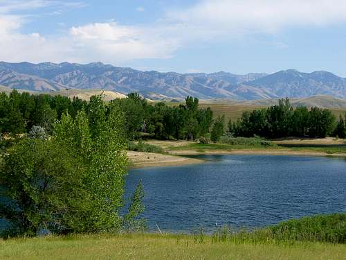 Bear River Range seen from Foster Reservoir - by mtybumpo
James Peak is the highest mountain in the area of Powder Mountain Resort. It is located at the southern tip of the Bear River Range and near the junction of the Northern Wasatch Mountains. James Peak is also known as Wolf Creek Peak. It is situated above the tourist town of Wolf Creek. This is one of the Utah prominence peaks.
The mountain is easy to get to in all seasons. It is reached by a steep and narrow paved road. The road ends at a large parking area on top of a pass. It is usually plowed during winter. Ski lifts are located within a short distance of the pass with James Peak to the north. It is climbed more often in winter during ski season. At other times of the year, the resort is a quiet place where hikers and mountain bikers can come.
The area of Powder Mountain is spread over 5,500 acres of terrain covering three mountains. These mountain hold snow for several months. The resort is open to both skiing and snowboarding from mid-December through March. It averages about 500 inches of snow a year and is usually not very crowded either. It has access to one of the best beginner runs in Utah. There are several runs for intermediate and advanced skiers. This place is also known to be one of Utah's most affordable resorts. All runs are open at night.

Crescent Lake
The Lakes
Bear Lake is the largest body of water in the area. It is located on the border Utah and Idaho. Hyrum Reservoir is located on the southern end of the city of Hyrum. There are several alpine lakes in the Utah portion of the Bear River Range. Most of them are located in the area south of the Idaho border and north of Tony Grove. Bloomington Lake is one of the few mountain lakes in Southern Idaho. There are also many reservoirs near the range.

White Pine Lake
High Creek Lake
Crescent Lake is located in the next canyon north of Steep Hollow. This is on the east side of Doubletop Mountain. The lake is most easily reached by driving or walking, depending on your vehicle, to the unmarked turnoff before the Steep Hollow trailhead. There is a dirt road that branches off from here. The lake is located over the ridge in a small basin.

Johnson Reservoir
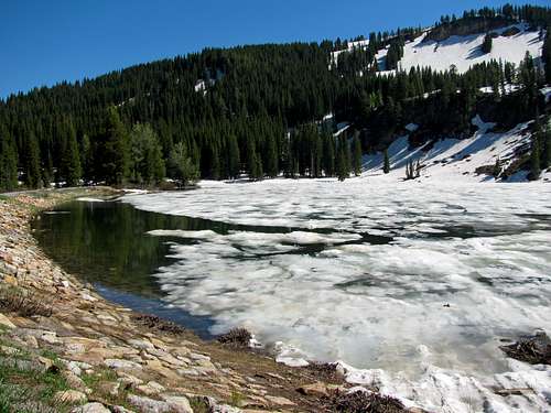
Steam Mill Lake

Bloomington Lake Cirque
This lake is located in appropriately named Steam Mill Canyon. It sits at the upper end of the canyon to the southwest of Steam Mill Peak, 9,284 feet. The lake is on the east side of the Bear River Range crest in between Doubletop Mountain and Mount Gog.
 Tony Grove Lake in early July - by Rocky Alps
Tony Grove Lake
This is the most accessible lake in the range. There is a nice boardwalk in the area. It is located near the trailhead for Tony Grove. This is where the trail to Naomi Peak begins. Everyone knows that the shorter the distance the more people there are. It is a nice place for fishing, swimming, and just hanging out.
White Pine Lake
White Pine Lake is the most popular lake hike in the Utah portion of the range. It is very scenic and has easy elevation gain making it a great hike to take the family on. The lake is located below the northeast face of Mount Magog and the south face of Mount Gog. They form a steep cirque below limestone cliffs. Both mountains can be climbed from here.
High Creek Lake
High Creek Lake is on the west side of the Bear River Range crest. It is directly east of Cherry Peak. There is a trail that descends from the saddle to the north of Naomi Peak. It is signed and goes over the east ridge of Cherry Peak. There are two other routes that go to the lake from High Creek Canyon and Cherry Canyon on the west side of the range.
Providence Lake
Providence Lake is nestled below the large east face of Providence Peak. A rugged jeep trail is located near it and can be reached directly from Providence Canyon to the southwest. This trail also goes to the summit of Logan Peak to the northwest.
Gibson Lakes
The Gibson Lakes are two small lakes in a very nice setting. They are located in Idaho north of the border. This is east of Andrew Nyman Mountain below Wilderness Peak. They can be reached by a 4-wheel drive dirt road. You can also walk along this road for two miles to the lakes.
Worm Lake
Worm Lake is located east of Bloomington Lake. Access is from the south fork of Bloomington Creek. A side road goes to the Midland Trail and Worm Lake. The trail is difficult to find. The lake is small and dries up by mid-summer. There is about a thousand feet of elevation gain.
Bloomington Lake
I consider this lake to be the alpine jewel of the Bear River Range. It has a deep blue color. The lake is located below the steep cliffs of Saint Charles Mountain. Although, the actual summit can not be seen from here. The lake can be reached by hiking from the east and west side of the range by driving down Bloomington Creek Road. You can also hike to the lake from Willow Flat or the north fork of St. Charles Canyon.

Jardine Juniper
Logan Canyon
Logan Canyon is the large canyon that cuts its way through the Bear River Mountains. It connects the Cache and Bear Lake valleys and is traversed by U.S. Highway 89. The canyon is popular for both summer and winter activities, especially hiking, rock climbing, camping, snowmobiling, and skiing. Just beyond the summit is a steep road leading into Bear Lake Valley and scenic overlooks of Bear Lake. The western side ends at Logan and the eastern side ends at Garden City in Rich County. The Logan River runs south to southwest through most of the canyon into Cache Valley and is also a great place to go fishing.
There are several hiking trails located in the canyon. The shorter trails are hiked often but many other trails have more solitude. You are guaranteed to not see anyone if you travel off trail in these mountains. I listed a few recommended hikes below.

Logan River

Logan River in Fall
Logan River Trail

Crimson Trail
Jardine Juniper Trail
The Logan River Trail is open to hikers and mountain bikers. It is located near the mouth of Logan Canyon. To get there, drive through the canyon and look for a turnoff on the right with parking about 0.6 miles up the road. The trail begins at the gate near the trailhead. It passes Stokes Nature Center along the way and goes toward Spring Hollow Campground. The first two miles are a wide gravel track. It is suitable for small children. Then it becomes a narrow trail along the mountainside. The trail offers great views and is one of the easiest hikes in the area. It is a little over seven miles round trip with about 300 feet elevation gain.

Old Ephraim
 Fucoidal Quartzite in Logan Canyon
Crimson Trail
The Crimson Trail climbs steeply up to limestone cliffs on the east side of Logan Canyon. This cliffband follows the mountainside for several miles. There are good views of the canyon from here. The trail begins at Guivanah-Malibu Campground and ends at Spring Hollow Campground. You can make it a loop hike by returning 1.5 miles along the Riverside Trail. The trailhead is five miles up Logan Canyon from the First Dam Bridge on US 89 to Spring Hollow Campground across the bridge at the upper end of the Third Dam or a mile farther to Guinavah Campground near the Amphitheater. Park in the free parking area near the entrance to the campground.
Jardine Juniper
This is one of the most hiked trails in Logan Canyon. The trail ends at an overlook of one of the oldest trees in Utah, the Jardine Juniper. The tree is still alive but growing at a very slow rate. It is thought to be over 3,000 years old but no one really knows for sure. A good view of the main ridge of the Bear River Range can be seen from the trail. The trailhead is located at the parking area near Wood Camp. It goes up the canyon and divides at about 4 miles to go around a hill; the left fork overlooks Cottonwood Canyon, the right fork overlooks the Logan Canyon area. The trails rejoin about 1000 feet from the juniper, and switchbacks take you down to the tree. It sits on the edge of a limestone cliff. The tree was named after Secretary of Agriculture, William M. Jardine.
Old Ephraims Grave
The last known grizzly bear in Utah was known as Old Ephraim. He was a giant bear that lived in the Bear River Mountains. Old Ephraim was killed on August 22, 1923, and there have been no grizzly bear sightings ever since. A dirt road and mountain bike trail can be taken to see a stone monument for Old Ephraim. The road can be reached by 4-wheel drive vehicles. You can get there from Temple Fork or the Right Fork of Logan Canyon near the Lodge Campground. A long mountain biking loop may also include Steel Hollow, Ricks Canyon, or Cowley Canyon.
Limber Pine Trail
The Limber Pine trailhead is located at the highest point of the scenic byway. The trail goes up to an elevation of 7,800 feet. It is an easy hike that the whole family can do. It passes through fir and aspen forest and meadows filled with wildflowers. Informational signs are along the way. The highlight of this short hike is one of the oldest limber pine trees in the U.S. Its name comes from the tree's ability to bend easily and to be tied into knots. There are also great views of Bear Lake below to the northeast.

Fucoidal Quartzite
Rock Climbing
Logan Canyon is a great place to rock climb. The canyon cuts through the Bear River Range providing access to all of these areas. While driving down the canyon you'll notice steep limestone cliffs on both sides of the road. There are routes of every difficulty but Logan Canyon is known for its hard routes. The majority of routes are bolt-protected but there are also trad routes and multi pitch climbs. Many of the moderate routes are also great for toproping. The limestone rock varies in quality. Many of the routes that are not climbed often are loose and chossy while popular climbs are very clean.
Because of the nature of the rock, several overhanging caves can be found, and this is where some of the hardest routes are located. Over 300 routes are located in the canyon. The amount of crags is innumerable but the popular ones are generally close to the road. As with most areas, the longer you hike, the less climbers there are. Listed below are a few of the areas.

Logan Canyon

China Cave
First Practice Wall - (5.5 - 5.11) - This area is the first large wall that you will seen on the west side near the mouth of the canyon. It has some beginner routes mixed with a few harder ones. The Lost Bolt, rated 5.7, is one of the best routes of its grade. Slant Crack is a trad route that climbs from right to left. Other routes include: Jolly Mon 5.10b, One-Eyed Rosie 5.11a, and Short Handed Goal 5.11a. The routes on this wall can also be toproped.
China Cave
Second Practice Wall - (5.4 - 5.11) - This is also known as Toproping Wall. It is located on the west side of the canyon. There are six sets of anchors located on top of the crag. Due to the short approach, the wall is a very popular place to climb. There are several routes that are rated above 5.10 that are climbed less often. Moderate routes include: Overhang Bypass 5.4, Cruisin 5.6, Free Solo 5.6, and Beginner's Luck 5.7.
 Mount Elmer, Mount Jardine, and Logan Peak
Preston Valley Pinnacle - (5.7 - 5.10) - This is one of the most unique rock climbs in the canyon. The pinnacle hangs over a huge cliff that drops down into Logan Canyon. All of the routes are trad climbs. A steep but short approach goes up to the base of the pinnacle. There may be a few rappel slings located on top left from other climbers. The South Face is the easiest route but you can expect a lot of exposure looking down into the canyon. It is rated 5.6. The East Face and North Face are both rated 5.7. The steep overhanging West Face is rated 5.10a.
Fucoidal Quartzite - (5.7 - 5.13) - This crag has the shortest approach in the canyon and this makes it very popular. There are dozens of routes along its length. The large rock buttress to the left has three routes that aren't climbed as often. The rock is good quality with both sport and trad routes. Moderate routes include: Drilling in the Dark, Errors of Our Ways, and Gully Route, all rated 5.7. Tennis Ball, Jam Crack, Lieback Crack are all rated 5.8. The majority of routes are between 5.10 and 5.12 in difficulty.
China Cave - (5.11 - 5.14b) - This area is also known as China Wall and sits right next to the Logan River. It is the area that made Logan Canyon more well known to rock climbers. It is located right next to the Logan River. The wall is over 300 feet long with climbs lining its entire length. The most difficult routes are located on the large overhanging alcove. The routes are almost always in the shade even during summer. The left side may be closed due to the presence of the Maguire's Primrose. This flower is only found in Logan Canyon. Be sure to check at the ranger station about closures and regulations. The route Super Tweak on the main wall was the first 5.14b in America.
 Wind Cave in Logan Canyon - by kerock
Ice Climbing
Logan Canyon is a popular limestone rock climbing area. In winter, there are several ice routes that form although the Bear River Range isn’t known for its ice climbing. There are over 20 established routes in Logan Canyon. Most of them are between 1 to 2 pitches long. Some of these ice routes do not form at all depending on the temperature and snow pack. These routes tend to run up frozen water lines running out of the limestone rock. Some mixed climbing has been done but not often due to the loose nature of the rock in the range. Many of these routes were first climbed in the 1960's and 1970's but information is limited. The best time to climb is from December through January.
The Hydro Park
The Hydro Park is located about 4 miles up Logan Canyon on the north side of the road. Most of the routes are behind the power station that can be seen while driving up the canyon. The Weeping Wall can have multiple routes when conditions allow. Ice routes in this area include: Five Fingers: I, WI2-3 - 150 feet, Weeping Wall: I, WI3 - 60 feet, and Power Alley: I, WI2-3 - 40 to 160 feet.
Logan Canyon
At the bridge near the first dam is the route Frigid When Wet: I, WI2-3 - 30 to 60 feet. It is a short hike north along the base of the limestone cliff. Near Mile Marker 381 are a few routes. Co-Dependent Chicks: I, WI3-4 - 160+ feet, is about a half mile downstream from the bridge parking area on the south side of the road. The routes Snowboard Chicks Dig Skiers: I, WI4 or M4 - 50 to 80 feet, and How Do You Like Them Apples, I, WI2 - 80 feet, are located farther up in the canyon from Mile Marker 381.5. Upper Logan Canyon has more routes. Sweet Surrender: I, WI2-3 - 60 to 80 feet, is located near the yellow cliff band above Mile Marker 382. China Cat Sunflower: I, WI4 - 150 feet, is located 0.25 mile up canyon from Fucoidal Quartzite near the Alcove route. Drinking On Borrowed Time: I, WI-3 - 115 feet, is located near the route Gully Washer in a gully just before China Wall near Mile Marker 383.6.
Right Hand Fork
The Right Hand Fork of Logan Canyon has ice during winter. Last Chance Falls: I, WI3 - 90 feet, is one of the better and well known routes located here. The approach goes near the summer picnic area depending on snow conditions in the canyon. The route is located in a notch in the limestone cliffs high above the south side of the canyon.
Providence Canyon and Blacksmith Fork
Providence Canyon is located south of Logan Canyon and has a few routes. A 4-wheel drive vehicle is needed to get near the ice. Angel’s Tiers: I, WI3 - 100-150 feet, is located across the canyon from Providence Falls. The route Providence Falls: I, WI2-3 - 100-150 feet, also known as Let Providence Guide Us, is located after the quarry on the south side. In Blacksmith Fork is an 800 foot route called Urban Haze: I, WI2.
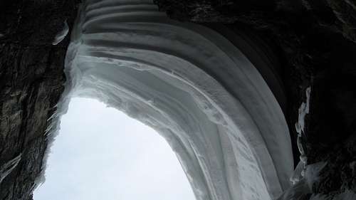
Wind Cave
Caves and Arches
This is a list of some of the well known caves and arches in the Bear River Mountains. There are a lot more places to explore all over the area but I'm not going to write any info about lesser known caves. Most of the caves and sinkholes remain unnamed.

Wind Cave
Wind Cave
Wind Cave
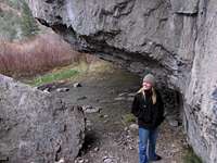
The Wind Cave is among the most visited places in Logan Canyon. It is a great family hike of 2.6 miles round trip and 900 feet elevation gain to the cave. The cave hangs over the side of a cliff. Years of wind and water have worn a delicate triple arch and natural cave into the limestone outcropping at the top of this trail. This outcropping is known as the Witch's Castle. From here you get a great view of the cliffbands across the canyon. The Wind Cave trailhead is located 5.3 miles up Logan Canyon.

Bloomington Arch
Minnetonka Cave
Paris Ice Cave
Minnetonka Cave is 10 miles west of the city of St. Charles, Idaho. This beautiful cave has a half-mile of limestone stalactites, stalagmites and banded formations. There are a total of nine rooms. The cave stays at about 40 degrees all year so it may be a good idea to bring a jacket. Guides conduct daily tours from mid-June through Labor Day. The tour includes climbing over 400 stairs. There is an entry fee of $8 for adults and $6 for children 6-15 years old. Children under 5 years old get in free. The cave is open 7 days a week from 10 a.m. to 5:30 p.m during the summer months.
 Paris Ice Cave - by Russ Durrant
Paris Ice Cave
The Paris Ice Cave is a smaller cave located in Paris Canyon in Idaho. This is west of the small town of the same name. The water from the surrounding mountains formed a small stream during spring and runs down the doline into the cave. The cave is most accessible in summer but can be visited year round. The cave has two entrances both leading downwards, along with the height of the cave, making it very cold so there is usually ice during the summer. The cave is not developed and is self guided. There is a track through the cave and a visit is not dangerous with appropriate warm clothes and footwear. It is a good idea to also bring a headlamp and helmet.
Bloomington Arch
The limestone cliffs above the Bloomington Lake are 600 feet high. There is an arch located on the side of one of the walls. The rock in the Bear River Range is susceptible to weathering from wind and water so arches, caves and sinkholes are a common sight. This is one of the larger unnamed arches in the area. These cliffs make up the most interesting feature on the central summit of Saint Charles Mountain. The large shallow lake that is northwest of Bloomington Lake is unofficially named. Some people who visit the area sometimes mistake it for Bloomington Lake which is located farther in distance below the cirque.

Maples in Fall
Local Flora
In the Bear River Range, mountains and plateaus are covered with gnarled juniper trees, pinion pines, and limber pines. In the higher elevation mountains there is an abundance of blue spruce, ponderosa pine, lodgepole pine, Douglas fir, alpine fir, and fields of aspen. Willows grow along mountain streams, and in the valleys several species of cottonwoods line the banks of streams and canals. In the lower mountains sagebrush mixed with maple oak, chokeberry, and serviceberry can be found. Juniper and Mahogany dominant the south and west facing slopes.

Limber Pine Cones

Juniper Tree
Pine trees are located on almost every mountain in the range. The Limber Pine is typically a high elevation pine. It can be found near tree line by itself or with other trees such as the Whitebark Pine, Bristlecone Pine, or Lodgepole Pine. In good conditions, the tree is about 20 meters tall but rarely over 25 meters tall. On exposed mountainsides they are only 5 to 10 meters tall. Limber Pines usually have intact cones lying next to them and Whitebark Pines almost never do. Pine Trees are an important source of food for several species, including Red Squirrels and Clark's Nutcrackers. Black Bears may be seen trying to raid squirrel caches for Limber Pine nuts. Squirrels, Northern Flickers, and Mountain Bluebirds often nest in these trees.

Spruce Cones

Aspen and Pine Trees
 Maples with autumn colors in Logan Canyon
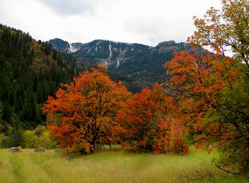
Maple Trees can be found throughout the mountain range. They are a small to medium sized deciduous tree growing to 10 to 15 meters tall and a trunk of 20 to 35 cm. diameter. The bark is dark brown to gray, with narrow fissures and flat ridges creating plate-like scales; it is thin and easily damaged. The leaves are opposite, simple, 6 to 12 cm. long and broad, with three to five deep, bluntly-pointed lobes, three of the lobes large and two small ones at the leaf base. The three major lobes each have 3 to 5 small subsidiary lobules. The leaves turn golden yellow to red in fall. The Big Tooth Maple is a species of maple native to the Western U.S. and is common in the Wasatch Mountains. The Bear River Range has many because it grows well in limestone soils but can also adapt to a wide range of other soils.
Juniper Trees live in the higher elevations of these mountains. The most well known is the Jardine Juniper in Logan Canyon. It is one of the oldest trees in the area. In exposed and windy places, their branches can have a twisted and gnarly appearance. Junipers vary in size and shape from tall trees, about 20 to 40 meters tall, to columnar or low spreading shrubs with long trailing branches. They are evergreen with either needle like and scale-like leaves. In some species, the berries are red-brown or orange but in most they are blue. The seed maturation time varies between species from 6 to 18 months after pollination. Juniper berries are a spice used in a wide variety of food dishes and best known for the primary flavor in gin.
Aspen Trees are located along the entire mountain range. They can also be seen in Logan Canyon. They are also known as Quaking Aspen. It is not fully understood why these trees quake. The unusual ability of their leaves to twist and bend due to the flattened petioles helps protect the trees from severe winds and to help dissipate energy more efficiently. All the species of aspens typically grow in large colonies starting from a single seed and then spreading their roots. New stems in the colony may appear at up to 30 to 40 meters from the parent tree. Some aspen tree colonies become very large over time and spread out over a long distance. They are able to survive forest fires as the roots are below the heat of the fire and new sprouts grow after the fire has gone.
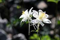
Columbines
Bear River Range Flowers
The Bear River Range is known for its beautiful wild flowers. Wild flowers cover the mountainsides with color from April to September. Lupines, Sego lilies, Indian paintbrush, dogtooth violets, monkshood, clematis, mallow, geraniums, columbine, wild rose, prickly pear, sweet pea, iris, western wallflower, flax, yarrow, mountain aster, and scarlet monkey flower are only some of the varieties that are abundant.
There are also several endemic plant species located in the Bear River Range. That means they can only be found here. I listed most of them below. The flower photos below are from SP members D-bo, Rocky Alps, and mtybumpo.

Yellow Wildflower
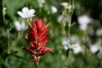
Indian Paintbrush
Maguire Primrose: (Primula maciuirei)
This is probably the most well known endemic plant in the area. It grows on rock walls, most notably on China Cave, where rock climbing is not allowed in some areas. It is a perennial herbaceous plant with showy, reddish lavender flowers about 1 inch across, born on leafless stems up to 6 inches high. It has an estimated population of about 3,000 individuals in 6 known locations in Logan Canyon. The species has a high degree of vulnerability based on its small, restricted habitat and small population size.

Blue Wildflower
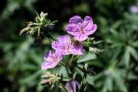
Geraniums
Maguire Draba: (Draba maguirei)

Wind Cave Flowers
A perennial small mustard colored flower that grows between 5 to 10 cm. and has delicate yellow flowers. It can be found in damp and shady north facing areas at higher elevations along Logan Canyon. The best time to see the flower is in early June. It lives at an elevation of 4,800 to 5,500 feet.

Sego Lily

Logan Canyon Flowers
Cache Beardtongue: (Penstemon compactus)
The Cache Beardtongue is a penstemon that is found near the area of Tony Grove. It has purple colored leaves. Its habitat is usually in meadows. It is much shorter than other penstemons in the area. It can be found blooming in mid to late July. It lives at elevations of 6,700 to 9,500 feet.
 Flowers and Logan Peak on route to Beirdneau Peak - by D-bo
Owl’s Foot: (Orthocarpus tolmei)
Owl's Foot is a small and fragile plant that has only been found along a particular segment of the road to Tony Grove Lake. It is light purple in color with capsule size fruit. It is found in dry southern facing soil with grasses. It can be seen blooming from early to mid July. It lives at 6,500 feet elevation.
Cronquist Daisy: (Erigeron cronquistii)
The Erigeron is a small daisy-like flower that is about 1 to 4 cm. in height. It is white or light pink in color. The flower can be found in rock crevices at higher elevations in the mountains. The best time to see the Cronqiust Daisy is in late July. It lives at elevations of 5,800 to 8,800 feet.
Cache Musineon: (Musineon lineare)
The Cache Musineon is a thin grass-like plant. The flower is white or yellow in color. It grows up to 3 to 14 cm. in height and lives in rock crevices at higher elevations in the mountains. It can be seen blooming in late July. It lives at elevations of 6,000 to 9,300 feet.
Frank’s Violet: (Viola frank-smithii)
This wildflower is a small violet that can be seen in clumps. The flower is usually blue, purple, or white in color. It grows along rock walls in the canyon and most notably on dolomite. The flower of the violet is similar to the common violet found in many other places. Frank’s Violet usually blooms in early June. It lives at elevations of 5,000 to 6,000 feet in Logan Canyon.

Porcupine
Mountain Wildlife
There are a wide range and variety of animals living in the Bear River Range. Bear, elk, moose, deer, and mountain goats are among the larger animals. Mountain lions, bobcats, coyotes, fox, porcupines, raccoons, beaver, badgers, rabbits, weasels, squirrels, and pikas make up many of the smaller animals. Birds are abundant too, including eagles, owls, and hawks. Closer to the ground are lizards and rattlesnakes.
Birds

Mule Deer
The Bear River Range is home to several different bird species. The large number is due to its marshes. These birds include: Northern Oriole, Yellow Warbler, Red-Winged Blackbird, Northern Harrier, Yellow headed Blackbird, Spotted Sandpiper, Great Heron, Song Sparrow, Black Crowned Night Heron, Mallard, and Cliff Swallow.

Elk Herd
The entire valley is a great place to see a wide variety of raptors any time of the year and there are several roads which access the raptor country north and west of Logan. West of Logan on Utah Highway 30 is Cutler Marsh, an excellent place to see marsh birds including both Clark's and Western Grebes and Sandhill Cranes. There are also several wooded streams in this area that support a variety of songbirds. In Logan Canyon, the area is full of songbirds like tanagers, towhees, warblers, and flycatchers.

Bull Moose
Bears
In the state of Utah, black bears are present in most of the forested mountain areas and canyons. In Idaho, both grizzly and black bears are common, although you are more likely to see a black bear in the Bear River Range. There are about 8.7 million acres of black bear habitat that is mostly on National Forest land. Utah has a low black bear population of about 800 to 1,000 black bears. About 80% of bear sightings in the Wasatch Mountains have occurred between 7,000 feet and 10,000 feet in elevation.
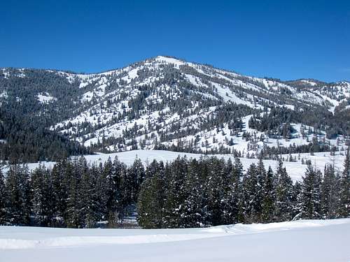 Beaver Mountain in early winter
The last known grizzly bear in Utah was known as Old Ephraim. He was a giant bear that lived in the Bear River Mountains near Logan. Old Ephraim was killed on August 22, 1923, and there have been no grizzly bear sightings ever since. A dirt road and popular hiking and mountain bike trail can be taken to see the bear's grave. A stone monument stands at 9 feet 11 inches tall and represents the height of Old Ephraim when he stood up on his hind legs.
Deer
The mule deer is seen throughout the Bear River Range. They can be found in many types of habitat, ranging from open meadows to high mountains to urban areas. Mule deer often migrate from high mountainous areas in the summer to lower elevations in the winter to avoid deep snow. The white-tailed deer is rarely seen in Utah but the mule deer population is high.
You are more likely to see a doe in these mountains but bucks are abundant too. Deer move between various zones from the forest edges at higher elevations to the valley, depending on the season. In winter, they try to stay at lower elevations. Mule Deer do not run as other deer, but have a peculiar and distinctive bounding leap. Most noticeable about them is their large ears that move constantly and independently. This is where they receive their name, "mule" or "burro" deer.
Elk
Elk are common in most mountainous regions of the Bear River Range, where they can be found in mountain meadows and forests during the summer, and in foothills and valley grasslands during the winter. The seasonal changes in elevation allow elk to avoid deep snow and find food year-round. Elk may be active during day and night, but most activity occurs at dusk and dawn.
A great place to see elk is at the Hardware Ranch in Blacksmith Fork Canyon. From Logan, travel south on State Road 165 to Hyrum. Then drive east on Highway 101 to Hardware Ranch. Signs along the way will help lead you to the ranch. Check weather and road conditions before visiting. Winter snowstorms can make the paved road slippery on the short drive up Blacksmith Fork Canyon. The road is usually plowed and sanded by noon after each snowstorm. It is open year round with sleigh rides available from December 15 to March 15.
Moose
The moose population in the mountains above Bear River Range and the rest of the Wasatch Mountains is plentiful. If you do enough hiking in the area you are guaranteed to see a few of these animals. Moose are docile animals and do not usually bother people. There are circumstances when moose can become dangerous when getting too close to a cow moose and her calf. Their parental instincts make the cow moose very protective of its offspring.
Not only are the cow moose dangerous, but a bull moose commands respect as well. If you see one it's a good idea to keep a safe distance away. The four-county area above Salt Lake City is home to 1,000 of Utah's estimated 4,000 moose. The big animals have been spotted in some residential areas along the Wasatch, leading experts to believe that the moose herd needs thinning. Although, some people have built their homes right below the mountains.
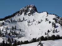 Mount Magog
Skiing & Snowshoeing
The Bear River Range is far enough away from the rest of the Wasatch Front that many skiers and snowshoers will enjoy solitude. There are several excellent trails in winter. The Sinks Trail starts heading north from Hardware Ranch and enters into a huge area of backcountry. The Temple Canyon Trail starts right off of the road in Logan Canyon and is easily accessible. Tony Grove is usually groomed in winter. Skiers and snowshoers can follow this route. Franklin Basin is a great place with options for longer tours. The yurt system offers overnight camping and access to the highest peaks in the range.
<bordercolor="993300"> <cellspacing="2"> <cellpadding="2">
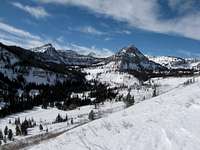 Magog and Gog Magog and Gog |
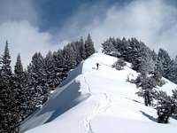 Cougar Mountain Cougar Mountain |
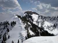 Mount Elmer Mount Elmer |
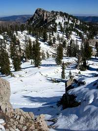 Mount Magog Mount Magog |
|---|
Beaver Mountain Ski Resort
Beaver Mountain is the northernmost ski resort in Utah. It is located about twenty seven miles up Logan Canyon on US-89. It has been family owned and operated since 1939. The resort is open to skiers and snowboarders. The area recieves an average of 300 to 400 inches of snow a year. It is above 8,500 feet in elevation. Beaver Mountain ski resort is open from mid-December to mid-March depending on weather.
Powder Mountain Resort
Powder Mountain is located at the southern end of the Bear River Range and near the Northern Wasatch Mountains. Ski lifts are located on James Peak which is also known as Wolf Creek Peak. There is 5,500 acres of terrain covering three mountains. The resort is open to both skiing and snowboarding from mid-December through March. It averages between 300 to 500 inches of snow a year and is usually not very crowded either. It has one of the best beginner runs in Utah and several runs for intermediate and advanced skiers. This place is also known to be one of Utah's most affordable resorts. All runs are open at night.
<bordercolor="993300"> <cellspacing="2"> <cellpadding="2">
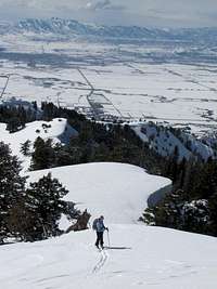 Cougar Mountain Cougar Mountain |
 Woodcamp Ridge Woodcamp Ridge |
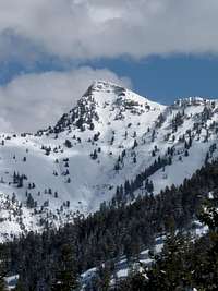 Cherry Peak Cherry Peak |
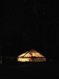 Bunchgrass Yurt Bunchgrass Yurt |
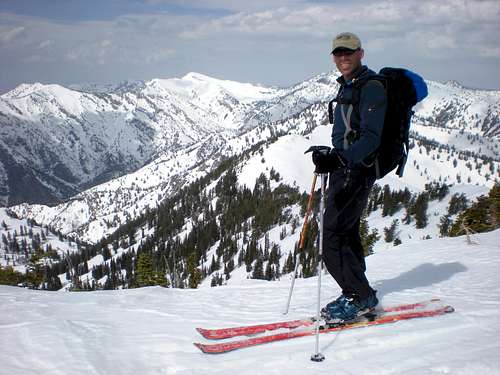 Summit of Mount Elmer in winter - by highpeakskier Summit of Mount Elmer in winter - by highpeakskier |
|---|
Logan Area Ski Trails and Snowshoeing
The Bear River Mountains have great winter recreation. Logan Canyon provides easy access to many areas. The canyon is plowed during winter but carrying chains in your vehicle is advised. Snowmobiles are popular on many of the side roads. On dirt roads in both Utah and Idaho it would be a long backcounty ski or snowshoe to get to most of the higher peaks. Tony Grove Road is usually packed down pretty well and is a good hike in winter.
Bear River Range Yurt System
The Bear River Range has a yurt system that gives access to great ski terrain. The ORC and Powder Ridge Ski Touring allow the general public and USU students to rent these yurts. The yurts have wooden floors, wood burning stoves, kitchens, and bunks for six to twelve people depending on the yurt. There are four yurts in the range that are located at Blind Hollow, Bunchgrass, Green Canyon, and Steam Mill aka Hells Kitchen Canyon. Green Canyon is the only yurt that is assembled during winter. The other yurts are there year round. Reservations are required and maps are available on the website.

Franklin Hill
Cache Valley

Northern Cache Valley
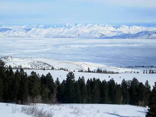 Bear Lake seen near Swan Peak in winter
Cache Valley forms the western boundary of the range. This area was part of the Plains Culture and later it was Shoshone territory. The name of the valley is derived from the french word "cacher" meaning to hide. This is because early trappers in Cache Valley hid their fur pelts and trapping supplies for safekeeping. Among the early trappers in the area were James Weber and Jim Bridger in 1824 and then Peter Skene Ogden and James Beckwourth in 1825.
Cache County was formed in 1856 by the territorial legislature and its boundaries were redefined in 1864 when part of Cache County became Rich County. The Bear River flows through the northwestern corner of Cache County. The Little Bear, Blacksmith Fork, and Logan Rivers add their water to the Bear River. The city of Logan is located 80 miles northeast of Salt Lake City, and 20 miles south of the Utah-Idaho border.
Logan was settled by three groups of Mormon Pioneers, the Ralph Smith Company, David Reese Company and the John P. Wright Company. Some of the first people who were influential in Logan were Peter Maughan, Ezra T. Benson, John P. Wright, William B. Preston, Moses Thatcher and Thomas E. Ricks. The city of Logan was incorporated in 1866 by the Utah Territorial Legislature. In 1866 telegraph lines linked Logan to the rest of Utah. The Utah Northern Railroad was completed to Logan in 1873.
The Logan River flows through Logan Canyon. The Shoshone Indians called the river "Kwagunogwai" meaning river of the cranes. More settlers began to arrive and four more towns were settled including Providence, Mendon, Richmond, and Smithfield. Cache Valley is rich in agriculture and farming. The area continues to be one of the state's leaders in dairy products. Today there is a population of approximately 20,000 students who attend Utah State University and the Bridgerland Applied Technology Center. Logan benefits from being in a valley away from the main stream of traffic. Like the other cities on the Wasatch Front, the city of Logan was built on the lakebed of ancient Lake Bonneville.
SP member mtybumpo provided the following info: The Logan River was originally named the Little Bear River by a French-Canadian trapper named Michael Bourdon who discovered it. Five years later he was killed by the Blackfeet Indians in Idaho and the river was renamed the Bourdon River in honor of him. That name was only in usage a little more than 3 years until it was renamed the Logan River after another trapper, Ephraim Logan. In the fall of 1827, Ephraim Logan was sent with 3 others from the main party of the Rocky Mountain Fur Company in Cache Valley, to trap on the Snake River near Twin Falls, Idaho. All 4 of the trappers were killed by the Shoshone there and when they didn't return the following summer the men in Cache Valley renamed the Bourdon River in honor of Logan. It is unknown why he but they obviously held him in high regard. It is after Ephraim Logan that Logan River, Logan Canyon, and Logan Peak are named.

Bear Lake
Bear Lake Valley

Bear Lake
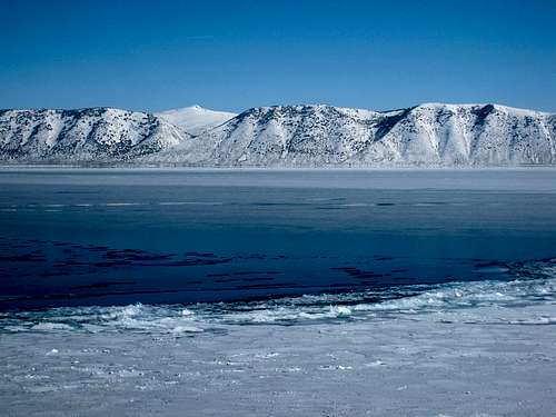 View from Bear Lake in winter
Bear Lake Valley forms the eastern boundary of the range. Bear Lake is the main attraction of the area. It is a natural fresh water lake. The first thing you will notice is how large it is. The lake is 20 miles long and 8 miles wide. Bear Lake is located on the Utah-Idaho border in the upper northeast corner of the Bear River Range. It is 48 miles away from Logan over the mountains. Garden City, population 300, is the main town at the lake. The town's specialty is raspberry shakes, which is offered everywhere.
The second thing you will notice about Bear Lake is its intense, deep, blue color. The unique color is because of the reflection of the limestone deposits in the lake. It is surrounded by low forested mountains to the east and west, wet marshland to the north, and the cottonwoods flatlands to the south. Many boaters and fisherman come to the lake every year. Fishing in the lake includes cutthroats, rainbows, mackinaw, and whitefish.
The Bear Lake Valley was first inhabited by the Shoshone Indians and other Native Americans. It was originally called Black Bear Lake by Donald Mackenzie. He was an explorer for the North West Fur Company who discovered the lake in 1819. The name was later changed to Bear Lake. There were many mountain men, including Jedediah Smith and Jim Bridger, who met on the south shore of Bear Lake with Native Americans to swap goods and stories. This was the beginning of the mountain man rendezvous which still continues to this day in the middle of September on Rendezvous Beach every year. It is from these trappers that Bear Lake received its well deserved reputation for very cold temperatures and harsh winters.
Thomas Pegleg Smith, a mountain man, had the first permanent settlement. During the 1840s, he set up a trading post to provide supplies to the emigrants on the famous Oregon Trail. The first pioneers settled in the valley in 1863. This group was led by Charles C. Rich. The county now bears his name and its highpoint is now officially named after Jim Bridger. The town of St. Charles would also be named after Rich as well as the nearby canyon and mountain. He told a story about a Bear Lake monster that lived in the lake. He later admitted to making it all up but people continue to report sightings today.
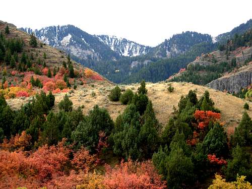 Logan Canyon with Fall Colors
Area History
Native Americans
Much of northern Utah and southeast Idaho was inhabited by Native Americans. The nearby Bannock Range was named after the Bannock Indians. They speak the Northern Paiute Language and are closely related to the Northern Paiute people. The Bannock are well known in American history due to the Bannock War of 1878 where they bravely fought a final battle for traditional existence. After the war, the Bannock moved onto the Fort Hall Indian Reservation, where they live with the Shoshone and Lemhi Indian tribes. The reservation is located near the cities of Pocatello and Blackfoot. Pocatello is the largest city in the area. The name Pocatello comes from an Indian chief of the Shoshone tribe who granted the railroad a right-of-way through the Fort Hall Indian Reservation.
The ancestral lands of the Shoshone and Bannock Indians included parts of Montana, Idaho, Yellowstone National Park, Northern Utah, Nevada, and California. The Shoshone and Bannock tribes were granted 1.8 million acres in southeastern Idaho under the Fort Bridger Treaty of 1868. There were survey errors, treaties, and promises that were kept and broken over time. The boundaries of the tribal lands were reduced to as little as 418 thousand acres. The area is now occupies 544 thousand acres. The Indian tribes inhabited southeastern Idaho for hundreds of years before Lewis and Clark came across Idaho in 1805. This is where they met a Lemhi Shoshone woman named Sacagawea. Their reports of this beautiful region attracted fur trappers and traders to come to Idaho.
The Shoshone are a Native American tribe with three large divisions: the Northern, the Western and the Eastern. The Northern Shoshone are concentrated in eastern Idaho, western Wyoming, and north-eastern Utah. The Eastern lived in Wyoming, northern Colorado and Montana. Then conflict with the Blackfoot, Crow, Lakota, Cheyennes, and Arapahos pushed them south and westward after about 1750. The Western Shoshone ranged from central Idaho, northwestern Utah, central Nevada, and in California around Death Valley and Panamint Valley. This group is often called the Panamint. The Idaho groups of Western Shoshone were called Tukuaduka meaning the sheep eaters, while the Nevada/Utah ones were called the Goshute or Toi Ticutta meaning the cattail eaters.
Chief Washakie - (1804 or 1808 - February 20, 1900) - was a renowned Shoshone warrior who first appears in 1840 in the written record of the American fur trapper, Osborne Russell. Washakie became an ally of white settlers and fur trappers including Jim Bridger and assisted U.S. Army operations. In 1851, Washakie led a band of Shoshones to the council meetings of the Treaty of Fort Laramie in 1851. In 1863 and 1868, he signed the Treaty of Fort Bridger establishing Shoshone land where the borders extended eastward to the crest of the Wind River Mountains in Wyoming. Essentially from that time until his death, he was considered the head of the Eastern Shoshones by the representatives of the United States government.
Chief Pocatello - (1815 - October 1884) - was a leader of Shoshone. He led attacks against early settlers during a time of increasing strife between emigrants and Native Americans. After making peace with the United States, he moved his people to Fort Hall Reservation and led the Shoshone during their struggle to survive following their relocation. The city of Pocatello, Idaho is named in his honor. After the massacre, Chief Pocatello decided it was better to give up then have all his people killed. He and eight other chiefs signed the Treaty of Box Elder on July 30, 1863. Some of the Shoshone Indians would eventually settle near present day Brigham City in Utah.
Chief Bear Hunter - (died January 27, 1863) - was a Shoshone chief who resided in Cache Valley and along the lower reaches of the Bear River and strongly resisted white colonization of the area in the 1860s. He and his war parties attacked Mormon colonists, telegraph workers, and wagon trains heading west while federal troops were preoccupied with the American Civil War. In 1862, a Californian volunteer infantry lead by Patrick Edward Connor established a fort on the Wasatch Range near Salt Lake City. In January 1863, they attacked Bear Hunter's village during the Bear River Massacre. Bear Hunter was among those who were killed.
Chief Sagwitch - (1822 - 1884) - was a Shoshone chief who traveled extensively through northern Utah, southern Idaho, and western Wyoming. He survived the Bear River Massacre. He found his dead wife and two of his four children dead. His infant daughter survived and was placed in a cradleboard and hung on a tree with the hope someone would find her and take care of her. His son was shot seven times but also survived and lived to tell the story to the young Shoshone. Chief Sagwitch then moved his tribe to Fort Hall Reservation. He decided that the best chance his people had to survive was to learn to live like the settlers and develop new farming techniques. Many of the Shoshone later became members of the LDS Church.
Chief Buffalo Horn - (died 1878) - was chief of the Bannocks. He had participated as a scout for General Howard in the Nez Perce War. As he looked over the Camas Prairie, land given to the Bannocks in the Fort Bridger Treaty of 1867, he saw the slow encroachment of white poachers grazing cattle on the land that supplied his people. In 1869, the Bannock were starving and had no access to their hunting lands. The Bannock began leaving the reserve in the spring of 1878. By June they had joined with the Northern Shoshone to revolt against their conditions. This resulted in the Bannock War of 1878 where Chief Buffalo Horn was killed. Suppressed, his tribe returned to the reservation soon thereafter. Today, the Bannock share the Fort Hall Reservation in Idaho with the Shoshone.
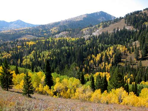 Bloomington Peak Fall Colors
Bear River Massacre
The Bear River Massacre took place on January 29, 1863, between the United States Army and the Shoshone Indians. It stands as the bloodiest Indian battle in the western United States with more killed than in any other battle. It is also one of the sad chapters in our history and should not be forgotten. The Bear River Massacre was also known as the Battle of Bear River and the Massacre at Boa Ogoi. The U.S. army was led by Colonel Patrick Edward Connor. He was sent to Cache Valley and tried to keep peace between early settlers and Indians but had little success. Conner actually identified himself more with the non-Mormon settlers but thought the Mormons were slightly better than the savage Indians. He was given the assignment to attack the Shoshone after several earlier ambushes had occurred.
A band of over 450 Shoshone were led by Chief Bear Hunter. They watched uneasily as Mormon settlers had moved into their home of Cache Valley in the spring of 1860 and now, three years later, had appropriated all the land and water in the valley. The young men of the tribe had struck back at the white settlers. There were several incidents that made many of the northwestern Shoshone restless and concerned. They felt that trouble was brewing and could soon break out. The settlers around Franklin, Idaho, were beginning to call the Indians stealing savages and beggars. They did not seem to understand that the Indians were also human beings with feelings and emotions like anyone else. This prompted Utah territorial officials to call on Connor's troops to punish the northwestern band. Before the colonel led his men from Camp Douglas at Salt Lake City north to Bear River, he intended to take no prisoners.
In late January, Connor and his army of 200 California volunteers planned an attack on a northwestern Shoshone winter village located at the confluence of Beaver Creek and Bear River, twelve miles west and north the present day city of Preston. This is just a short distance north of the Utah-Idaho border. As the army approached the Indian camp in the early morning darkness at 6:00 a.m., they found the Shoshone warriors entrenched behind the ten-foot eastern embankment of Beaver Creek which is now called Battle Creek. The U.S. volunteers suffered most of their twenty seven casualties in their first charge across the open plain in front of the Shoshone village. Colonel Connor soon changed tactics, which resulted in a complete envelopment of the Shoshone camp by the soldiers who began firing on men, women, and children indiscriminately. After two hours the Indian men were out of ammunition, and over the next two hours it became a massacre as the soldiers used their revolvers to shoot down all the Indians they could find hiding in the dense willows of the camp. The number of U.S. casualties was 27 dead and 40 wounded.
There were between 200 to 400 Shoshone that died during the massacre, including 90 women and children. More recent reports have said that the total is much higher but exact numbers are still unknown. The most notable to survive was Chief Sagwitch. He was able to help gather the remaining survivors and attempt to keep his community alive. Sagwitch was shot twice and attempted to flee on horseback only to have the horse shot out from under him. Eventually he escaped and tumbled down into the Bear River near a hot spring until nightfall. After the slaughter ended, soldiers went through the Indian village raping women and using axes to bash in the heads of women, children, and babies who were already dying of wounds. Chief Bear Hunter was killed along with sub-chief, Lehi. The troops burned the seventy-five Indian lodges, recovered 1,000 bushels of wheat and flour, and appropriated 175 Shoshone horses. While the troops cared for their wounded and took their dead back to Camp Douglas for burial, the Indians' bodies were left on the field for the wolves and crows.
The Mormon reaction to the massacre was generally positive. They expressed their gratitude for "the movement of Colonel Connor as an intervention of the Almighty" in their behalf. The northern part of Cache Valley then opened to Mormon settlement. Cache Valley also offered up a staging area for additional settlements in southern Idaho and areas farther north. The Bear River Massacre has been overlooked in the history of the American West because it occurred during the Civil War when a very important struggle was taking place in the East. Of the six major Indian massacres in the West, from Bear River in 1863 to Wounded Knee in 1890, the Bear River Massacre resulted in the most victims. It is an event which deserves greater attention than it has received in the past. Today, there is a small historical landmark located at the site which is north of the cities of Franklin and Preston.
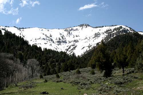 Wood Camp Hollow and Point 9,065 - by D-bo
Mountain Men
Cache Valley was originally called Seuhubeogoi by the Shoshone meaning Willow Valley. It was the traditional hunting grounds for the northern Shoshone, particularly as a gathering place for grain and grass seeds, as well as hunting both small game like woodchuck and ground squirrel; large game animals including deer, elk, moose, and buffalo; as well as trout from the rivers. This mountain valley had also attracted the attention of fur traders and trappers. The name Cache Valley derives its name from the fact that these fur trappers left stores of their furs and goods, in other words: a cache of furs, as a central staging area for hunting trips in the surrounding mountain ranges. The trappers were so impressed by the region that they recommended to Brigham Young that he consider the valley as a location for the original settlement of Mormon pioneers. Instead, Brigham Young chose Salt Lake Valley, even though Mormon settlers would eventually move to Cache Valley.
The fur trade reached its peak sometime between 1830 and 1832. At that time, pelts brought trappers an average of $4 to $6 per pound. A resourceful Mountain Man could trap 400 to 500 pounds per year. By 1840, the price had fallen to $1 or $2 per pound, and depletion of the beaver reduced the average trap to 150 pounds which was hardly worth the time of an experienced man who could otherwise be earning $350 to $500 per year. By 1840, only about 50 to 75 trappers remained in the West. This was a long way from the 500 to 600 who worked in the region during the late 1820s. By the late 1830s, the well known organization and vast resources of the Hudson's Bay Company bested the other businesses and proved superior to the American rendezvous system.
Jim Bridger - (March, 1804 – July 17, 1881) - was among the greatest and foremost mountain men. He was a trapper, scout, and guide who explored the Western United States during the decades of 1820-1840. He was also well known as a teller of tall tales. He made several trips out West to the Rocky Mountains. During one of his ventures he saw the Great Salt Lake. Bridger was opposed to the Mormon settlements in Utah. Such settlements had lowered a considerable portion of Bridger's trade, including that of the Native Americans, causing economic hard times for the post and bad relations in the future. He would spend much of the next 60 years at the head of groups of trappers and fur hunters for the Rocky Mountain Fur Company, of which he was a founder, and the American Fur Company. In 1842, however Bridger and fellow trapper Pierre Luis Vasquez set about building a settlement on Black’s Fork of the Green River in what is now Wyoming. The settlement, known as Fort Bridger, would become a vital stopping off point for people on the overland trail west.
Jedediah Smith - (January 6, 1799 - presumed death May 27, 1831) - was an important hunter, trapper, fur trader. He was an explorer of the Rocky Mountains, the American West Coast, and the Southwest during the nineteenth century. Jedediah Smith's explorations were significant in opening the American West to expansion by white settlers. Smith was the first white man to cross the state of Nevada, the first to traverse Utah from north to south and from west to east; the first American to enter California by the overland route, and so herald its change of masters; the first white man to scale the High Sierras, and the first to explore the Pacific from San Diego to the banks of the Columbia River. Prospectors and settlers later traveled to the areas that he had trail-blazed as a trapper and fur trader, during the subsequent Gold Rush. In his lifetime, Smith traveled more extensively in unknown territory than any other single mountain man. Much of the wilderness on the western slope of the Teton Range is named after him. It is presumed that Smith was killed by Comanches near the Cimarron River. The body of Jedediah Smith was never found.
Peter Skene Ogden - (February 1790 - September 27, 1854) - was a fur trapper and an explorer of the American West and Canada. From 1824 to 1825, Ogden led a fur brigade that expanded the influence of the Hudson Bay Company along the Snake River east to Montana's Bitterroot River and south to the Bear River in Utah. From 1825 to 1826, Ogden went south from the Columbia River to the Deschutes River in Oregon. He then turned east and traveled through the Blue Mountains to the Snake River. From 1826 to 1827, he led an expedition that explored the Deschutes River, following it to Klamath Lake and an area near Mount Shasta in northern California. From 1828 to 1829, Ogden explored the Great Salt Lake and the Weber River drainage, where the Ogden River, and then subsequently the area where present-day Ogden, Utah is located. The Ogden River, Ogden Canyon, Ogden Valley, and the city of Ogden would later be named after him. He also explored areas of the Great Basin in Nevada. Peter Skene Ogden later retired in Oregon and died in 1854.
John Henry Weber - (1779 - 1859) - was a fur trader and explorer of the Rocky Mountains and areas in Utah. Weber was active in the early years of the fur trade. He was born in the German community of Altona and later immigrated to the U.S. Weber joined a Rocky Mountain Fur Company expedition which left St. Louis, Missouri in the spring of 1822. They became the first party of American trappers to cross the continental divide. Weber was the leader of one of the brigades and during the summer of 1824, they crossed South Pass and the Green River Valley and descended into the Bear River Range in time for a fall hunt. As winter approached, the company journeyed to Bear Lake, and then finally into Cache Valley. John Henry Weber's brigade explored much of southeastern Idaho and northern Utah. By 1833, Weber was assistant superintendent of government mines in Galena, Illinois, and served briefly as superintendent until his retirement in 1840. Weber later moved to Bellevue, Iowa where he died in 1859. In Utah, Weber Canyon, Weber River, Weber County, and Weber State University were named after him.
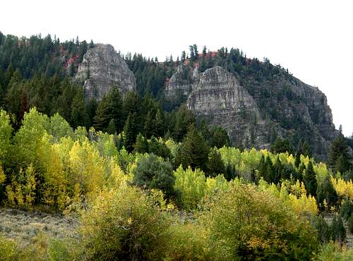 Logan Canyon Fall colors
Early Settlers
In 1856, Peter Maughan was chosen by Brigham Young to take a small colony into Cache Valley and commence the settlement of it. Peter Maughan, and several other settlers arrived in Cache Valley over Sardine Canyon in July 1856. They were impressed with the valley and decided to locate in the south end of it. They returned at once to Tooele County for their families. In September, the following arrived in Cache Valley and became the first real settlers to colonize Cache Valley: Peter Maughan, his wife and sons, William H. Maughan and John Maughan, Zial Riggs, George Bryan, Francis Gunnell, Orange D. Thompson and families. They went to work cutting wild hay and building their log houses. The settlement was originally known as Maughan's Fort but later renamed Wellsville in honor of Lieutenant Daniel H. Wells.
After Wellsville and Mendon were settled the Mormons began looking farther north. The largest city near the Bear River Range is Logan. It is located north of Ogden and the main crest of the Wasatch Mountains near the Logan River. The easiest way to get there from the south is through Sardine Canyon. The city was founded in 1859 by Mormon settlers and is the location of the Logan Utah Temple which was dedicated in 1884. It is home to the main campus of Utah State University, which was founded in 1888. The city of Providence was basically an extention of North Logan. Farther north are the cities of Richmond and Smithfield. Farther south the Mormons settled the cities of Millville and Nibley. The area is a major producer of cheese and other dairy products.
Southeastern Idaho was also settled by the Mormons. The city of Franklin was settled in 1860 and was the first and oldest settlement of Idaho. Twelve years went by before the Mormons found out they were actually in Idaho and not Utah. They named the city in honor of Franklin Richards. It is located in the southeast corner of the state just across the Utah-Idaho border. The city of Preston was settled in 1888 and named after William B. Preston. The city has its annual Festival of Lights during December. The cities of Dayton and Weston are located west of Preston. The southern portion of Bannock Range is located due west while the northern part of the Bear River range is to the east. Several other smaller cities would be settled in the area over the next dozen years.
Highway 34 travels north through Preston and is known as Pioneer Historic Byway. The Bear River Range can be seen above toward the east. The scenic byway goes around the hills and mountains through the cities of Thatcher, Niter, and Grace. It then goes near Last Chance Canal which is used by farmers to help grow crops. The highway then goes toward Chesterfield. This settlement is now without residents, but is not abandoned. Each summer work crews of descendants of its founders come back to continue its preservation. Chesterfield is unique in LDS history because it is the only church settlement that the Oregon Trail passed through. The highway proceeds to Soda Springs on US 30 near a summer home built for Brigham Young. The Portneuf Range can be seen off in the distance.
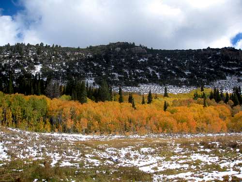 Bay Ridge with Fall colors
Cache Valley Logging
The first sawmill in Cache Valley was built in 1859 by Esias Edwards and Leroy Kent. It was located in Millville. There were dense stands of timber covered the slopes of the Bear River Range and grew along the moist meadowland and stream banks skirting its foothills. The canyons and streams were very important resources for early settlers in Cache Valley. Much of the timber was cut for ties in Logan and Blacksmith Fork Canyons for the railroad. Also much timber was cut and used for most of the buildings in all the settlements including the Logan Temple and Tabernacle. The timber was used for years for firewood until the railroad bought coal here. Much of the rock was quarried in Logan Canyon, Green Canyon, Temple Fork Canyon and Blacksmith Fork Canyon and other places in the valley for building purposes.
The tall Cottonwoods and sprawling Box Elders and the trees found near stream banks at the base of the mountains were easy to get to. This timber was among the first utilized for temporary shelter and fuel. Later, after the settlers started farming and planted crops, they began the arduous work of cutting roads up into the canyons. From the west-facing slopes they soon harvested various species of juniper and decided to call the wood "cedar." From the moist, north-facing slopes they harvested the taller conifers, most extensively the abundant stands of towering, lance-like Douglas Fir. The settlers called these trees a "Red Pine" because of their reddish heartwood and, sometimes, "White Fir." Many houses, granaries, and barns still standing in the valley today have been built of this wood. There has been considerable prospecting for minerals in the mountains of Cache Valley.
The economy in Cache Valley was starting to decline as some economies tend to do. There were a number of reasons behind the sudden change that Cache Valley experienced in the latter half of 1883. One reason was the winding down of railroad building which depressed agricultural prices and spelled the end to off season income. Another reason was the decimation of Cache Valley's forest. Today, most of the forest has now regenerated. Those certain specimens, and the inaccessible stands on the high ridges managed to drop their seed on the bare, sunny slopes below and around them. After nearly a hundred years of protection, the forest is almost back to where it was when the settlers first entered the valley. There is still some untouched growth on many ridges. There are many trees up there that are over 200 to 300 years old. The best evidence of this is the Jardine Juniper which is the oldest tree in the area.
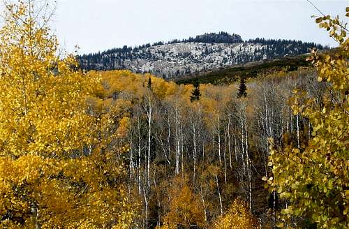 Paris Peak in Autumn
The Railroad
Hudson's Bay Company established one of the first permanent settlements at Fort Hall in 1834, which is only a few miles northeast of Pocatello. When over-trapping and a change in fashion to silk put an end to the fur trade, Fort Hall became a supply point for immigrants traveling the Oregon trail. The discovery of gold in Idaho in 1860 brought the first group of settlers to the region. The area became an important meeting place for transportation of goods and freight. In 1877, Jay Gould of the Union Pacific Railroad acquired and extended the Utah and Northern Railway, which had previously stopped at the Utah border, into Idaho through Portneuf Canyon. Pocatello Junction was founded as a stopping place along this route during the gold rush.
By mid 1887, the Utah & Northern Railway was ready to convert its line between Pocatello and Butte to standard-gauge, which took place, amazingly, on a single day. To minimize the disruption in service, men, tools, and materials were distributed along the line over the preceding months, and the changeover was done on Monday, July 25, 1887. The preparation included new bridges, new longer ties, and many general improvements of the grade itself. The line south from McCammon to Ogden, 111 miles long, took another three years to convert because it required more than 50 miles of new right-of-way construction, including a new line through the Bear River Gorge. The construction of the new standard-gauge line also included an 8.58 mile Cache Valley connection between the former Utah & Northern narrow-gauge line at Mendon and a station on the new line to be called Cache Junction.
The conversion to standard-gauge of the original 1873 Utah Northern line across the Cache Valley, between Mendon, Logan, and Preston, was completed on October 26, 1890. The entire line between Cache Junction and Preston then became the Cache Valley Branch, which is still being used today by Union Pacific. The remaining 15 mile section of the old narrow-gauge main line ran north from Preston to Oxford, Idaho, was abandoned upon completion of the standard gauge line. Oxford, Idaho was also once a very large railroad hub, one of the largest towns in Idaho at the time. It is now almost a ghost town. Another abandoned line ran 12 miles between Dewey and Mendon, by way of Collinston Summit. This original route over Collinston Divide was used 25 years later by the Ogden, Logan, & Idaho Railway to build an interurban electric line between Ogden and Logan in 1915.

Flat Top Mountain
The Weather
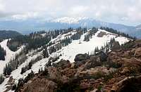
Powder Mountain
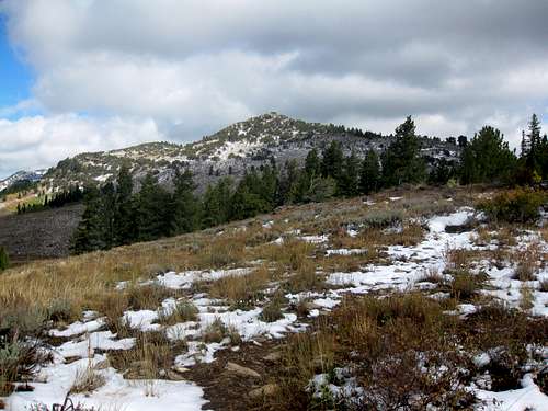 Limber Pine Peak
The Bear River Range has a four season climate. There are warm, dry, and sunny summers and cold and snowy winters. The climbing season in Idaho is a little shorter than in Utah. Dirt roads may become impassable after the first big snow storm of the season.
Springtime weather is variable, sometimes with nice weather and sudden showers. Fewer people hike here is spring so it is a good time to visit. During spring, temperatures start to warm up drastically and days are marked by the highest humidity and some of the wildest daily temperature swings of the year. Significant amounts of snowfall may occur in late spring into early summer. This also brings the beginning of mosquito season in the Bear River Mountains.
The summer season last from July through mid-September. Daytime temperatures can reach around 90 °F, followed by cool nights. Summer thunderstorms can occur, with wet weather and occasional downpours. The low humidity and the altitude combine to produce a large daily range in temperatures, and rather cool nights in summer. The warmest months are July and August with an average temperature in the 70's.
The season of Autumn begins in the month of September and ends in November and settled weather can be experienced. The wet weather doesn't last long and it is usually a pleasant season with warm, sunny days and cool nights. The first winter-like weather is usually experienced in early-to-mid October. This is one of the best times to visit the range. The fall colors in these mountains rival other areas in the Wasatch.
Winter in Logan lasts from November through early April. The coldest months are December and January, when daytime temperatures are in the 30's. The area can get very cold in winter. Peter Sinks above Logan Canyon has the distinction of having the record for the coldest temperature in Utah. It was -69 °F on February 1, 1985. Cache Valley is known for having bad inversions in winter because the area sits in a valley and tends to hold in a thick layer of fog and haze.

Winter Storm
Mountain Conditions

Beirdneau Peak Twilight
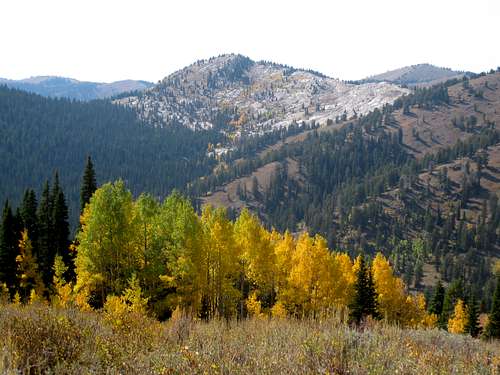 Whiteface Peak above North Bloomington Fork
Summer is the normal hiking season for these mountains. This is usually from July through mid-September. Temperatures can range from near 90 degrees in the daytime to 30 degrees at night. Occasional summer thundershowers can be expected in the mountains above 9,000 feet.
Experienced climbers can climb year round. In winter, temperatures are 30-40 degrees but can be much colder in the higher elevations. Check avalanche conditions and be prepared with full winter gear if you plan on climbing any mountains.
Utah weather forecast for Logan and another one from the NWS website
Idaho weather forecast for Soda Springs and Montpelier and Preston
Webcams may not work in stormy conditions. This is a webcam for Bear Lake the city of Logan and of Logan Summit
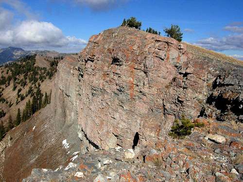
Fudd Peak on the Mount Elmer and Mount Jardine Ridge
Red Tape
The Bear River Mountains are located in Wasatch-Cache National Forest
The Idaho portion of the range is administered by Caribou-Targhee National Forest
There is no fee for driving through Logan Canyon.
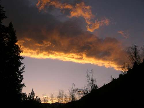 Sunset in the Right Fork of Logan Canyon - by mtybumpo
There is a $6.00 parking fee at Tony Grove Trailhead.
The following rules apply:
1) Group size of 10 people or less when hiking
2) No shortcutting of any trails or switchbacks
3) No disposing of garbage or waste in a wilderness area
Contact Information:
Montpelier Ranger District
322 North 4th Street
Montpelier, Idaho 83254
(208) 847-0375
Soda Springs Ranger District
410 Hooper Ave.
Soda Springs, Idaho 83276
(208) 547-4356
Logan Ranger District
1500 East Highway 89
Logan, UT 84321
(435) 755-3620

Cub River Canyon
Camping
Idaho Camping:
In the Montpelier Ranger District there are a dozen campgrounds. The largest campground is Willow Flat with 51 sites. Emigration Canyon campground has 23 sites. Cloverleaf and Summit View have 18 sites and Porcupine campground has 17 sites.
The Soda Springs District has five campgrounds on a first come, first serve basis. They are all small. Mill Canyon and Gravel Creek are the largest with 10 sites. The rest of the camgpgrounds have 5 sites. There are many more primitive sites available.

Wilderness Peak
Caribou-Targhee National Forest Campgrounds
Reservations can be made at the following campgrounds:
Willow Flat Campground - Willow Flat is located at 6,300 feet elevation. This campground has 51 single campsites available. It is open from May 15 through October 15.
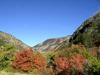
Logan Canyon
Saint Charles Campground - Saint Charles Campground is located at 6,100 feet elevation. This campground has 6 single campsites available. It is open from June 1 through September 30.
Porcupine Campground - Porcupine Campground is located at 6,800 feet elevation. This campground has 17 single campsites available. It is open June 8 through September 30.

Logan River
Cloverleaf Campground - Cloverleaf Campground is located approximately eight miles up St. Charles Canyon at 7,100 feet elevation. This campground has 18 single campsites available. It is open from May 15 through October 15.
Utah Camping:
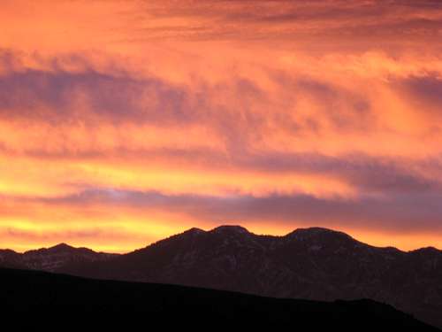 High Creek Sunrise - by Russ Durrant
There are nine campgrounds located on the scenic byway. Many of these campgrounds are usually open from Memorial Day through mid-October. They cost between $13 to $15 a night. The campgrounds in Logan Canyon usually fill up during summer weekends so try to get there early. Primitive campsites can also be found in Logan Canyon.
Reservations can be made at the following campgrounds:
Spring Hollow Campground - Spring Hollow is 4 miles up the west side Logan Canyon. It is located near the Logan River and Spring Hollow Creek. There are 12 sites available.
Guinavah Campground - This campground is 5 miles up the west side of Logan Canyon. It is located in the forest near the Logan River. There are three loops that have a total of 40 sites.
Tony Grove Campground - This is one of the most popular places to camp in Logan Canyon. It is about 18 up Logan Canyon at an elevation of 8,100 feet. The campground has 37 sites.
Sunrise Campground - Sunrise Campground is located 6 miles west of Bear Lake and 1 mile east of Bear Lake summit. It sits at an elevation of 7,800 feet. There are 27 sites available at this campground.
Backcounty Camping Regulations:
Camp 1/2 mile from any road, 200 feet from any water source, and 200 feet from any trail.
Camping is allowed for a period of 3 days at an individual site.
Try to camp in existing camping areas whenever possible.
Pack in and Pack out garbage. Practice leave no trace techniques.
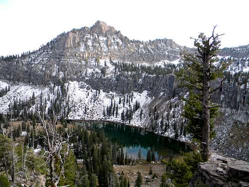 Mount Magog and White Pine Lake - by mrh
Peak Lists
Here are links to several Utah and Idaho Peak Lists. For the Bear River Range, this includes mostly county and prominence peaks lists.
Utah County Highpoints List
This is a list of the Utah County Highpoints by SP member Dean. This includes Naomi Peak and Bridger Peak.
Utah’s 2,000 foot Prominence Peaks List
This is a list of Utah’s 2,000 foot Prominence Peaks by SP member redsplashman23. There are over 80 of these peaks in Utah.
Utah’s 100 Most Prominent Peaks List
The 100 most prominent peaks in Utah by SP member redsplashman23. Some are located on private land so this is difficult to complete.
Idaho County Highpoints List
This is a great list of Idaho County Highpoints made by SP member SawtoothSean. There are over forty peaks on this list.
Idaho Prominence Peaks List
This website has information for Idaho Prominence Peaks. Sherman Peak is the most prominent in the Idaho portion of the range.
This is a list of mountains in the Bear River Range. This includes all of the major peaks in the range and several others. Many of the peaks have pages on Summitpost. The standard routes up these mountains are class 1 to 2 hiking with occasional class 3 scrambling.
* Many of the peaks in the Bear River Range do not have official names. I listed those peaks in quotations. Feel free to let me know about peak names or if there are names already commonly used.
| BEAR RIVER RANGE | |||
| Mountain | Location (State) | Elevation (Feet) | Summitpost Page |
|---|---|---|---|
| 9,000 foot Peaks | |||
| Naomi Peak | Utah | 9,979 | Page |
| Doubletop Mountain | Utah | 9,873 | Page |
| "Bullen Hole Peak" | Utah | 9,828 | Page |
| Cherry Peak | Utah | 9,765 | Page |
| Mount Magog | Utah | 9,750 | Page |
| "Pika Peak" | Utah | 9,736 | Page |
| Mount Gog | Utah | 9,714 | Page |
| Logan Peak | Utah | 9,710 | Page |
| "Castle Rock Peak" | Utah | 9,700 | Page |
| Sherman Peak | Idaho | 9,682 | Page |
| Mount Elmer | Utah | 9,676 | Page |
| Providence Peak | Utah | 9,598 | Page |
| Paris Peak | Idaho | 9,575 | Page |
| Mount Jardine | Utah | 9,566 | Page |
| "Flat Top" | Utah | 9,539 | Page |
| Franklin County HP | Idaho | 9,484 | Page |
| Wilderness Peak | Idaho | 9,460 | |
| James Peak | Utah | 9,422 | Page |
| "Cougar Mountain" | Utah | 9,420 | |
| "Prater Mountain" | Utah | 9,384 | |
| "Cottonwood Peak" | Utah | 9,380 | |
| Midnight Mountain | Idaho | 9,328 | |
| Bloomington Peak | Idaho | 9,311 | Page |
| "Paris Ice Cave Peak" | Idaho | 9,283 | |
| Steam Mill Peak | Utah | 9,282 | |
| Millville Peak | Utah | 9,282 | |
| "Limekiln Peak" | Idaho | 9,276 | |
| "North Paris Peak" | Idaho | 9,270 | |
| Bridger Peak | Utah | 9,255 | Page |
| "Saint Charles Mountain" | Idaho | 9,245 | Page |
| "Hidden Lake Peak" | Idaho | 9,237 | |
| Cub Peak | Idaho | 9,216 | Page |
| "Hyde Park Peak" | Utah | 9,208 | |
| "Swan Flat Peak" | Utah | 9,161 | |
| "White Pine Knob" | Utah | 9,134 | |
| Powder Mountain | Utah | 9,105 | |
| Sharp Mountain | Utah | 9,082 | |
| Swan Peak | Utah | 9,082 | |
| "Red Sinks Peak" | Idaho | 9,054 | |
| "Smithfield Peak" | Utah | 9,041 | |
| Temple Peak | Utah | 9,026 | Page |
| "Green Pass Peak" | Idaho | 9,006 | |
| Cobabe Peak | Utah | 9,004 | Page |
| 8,000 foot Peaks | |||
| "Whiteface Peak" | Idaho | 8,963 | |
| "North Canyon Peak" | Idaho | 8,939 | |
| Soda Peak | Idaho | 8,921 | |
| Beirdneau Peak | Utah | 8,914 | Page |
| Big Baldy | Utah | 8,881 | |
| Beaver Mountain | Utah | 8,853 | |
| "Bloomington Forks Peak" | Idaho | 8,852 | |
| "Birch Canyon Peak" | Utah | 8,819 | |
| "Peter Sinks Peak" | Utah | 8,815 | |
| "Bay Ridge" | Utah | 8,802 | |
| Little Baldy | Utah | 8,780 | Page |
| "Horse Lake Peak" | Utah | 8,700 | |
| "Gibson Basin Peak" | Idaho | 8,616 | |
| "Emigration Peak" | Idaho | 8,594 | |
| Porcupine Ridge | Utah | 8,540 | |
| "Paradise Peak" | Utah | 8,529 | |
| "Blacksmith Peak" | Utah | 8,455 | |
| "Dry Basin Peak" | Idaho | 8,371 | |
| "Tin Cup Peak" | Utah | 8,260 | |
| "Cove Mountain" | Utah | 8,157 | |
| Temple Baldy | Utah | 8,122 | Page |
| Jean Benchmark | Utah | 8,056 | |
| Peaks below 8,000 feet | |||
| "Dry Peak" | Idaho | 7,980 | |
| "Hull Valley Peak" | Idaho | 7,951 | |
| Morgan Ridge | Idaho | 7,718 | |
| "Sugar Creek Mountain" | Idaho | 7,682 | Page |
| Scare Benchmark | Utah | 7,671 | |
| Mahogany Range | Utah | 7,586 | |
| Boulder Mountain | Utah | 7,582 | |
| "Saddleback Mountain" | Utah | 7,475 | Page |
| "Jardine Juniper Peak" | Utah | 7,427 | Page |
| Mineral Point | Utah | 7,328 | |
| Middle Mountain | Utah | 7,078 | |
| McKenzie Mountain | Utah | 7,001 | |
| Bald Head | Utah | 6,976 | |
| Devils Hill | Idaho | 6,691 | |
| "P Mountain" | Idaho | 6,186 | |
Mount Magog and White Pine Lake - by mrh
Here are two lists showing the most prominent peaks in the Bear River Range. The first one is for Utah prominence peaks. The second one is for Idaho prominence peaks. The prominence rank is based on peaks in the state with over a thousand feet of prominence.
| UTAH PROMINENCE PEAKS | ||||
| Mountain | Elevation (Feet) | Prominence Rank | Prominence (Feet) | |
|---|---|---|---|---|
| Naomi Peak | 9,979 | 34 | 3,159 | |
| Logan Peak | 9,710 | 40 | 2,995 | |
| James Peak | 9,422 | 66 | 2,261 | |
| Paradise Peak | 8,529 | 116 | 1,709 | |
| Blacksmith Peak | 8,455 | 221 | 1,235 | |
| Temple Peak | 9,026 | 229 | 1,216 | |
| Sharp Mountain | 9,082 | 291 | 1,102 | |
| IDAHO PROMINENCE PEAKS | ||||
| Mountain | Elevation (Feet) | Prominence Rank | Prominence (Feet) | |
|---|---|---|---|---|
| Sherman Peak | 9,682 | 68 | 2,302 | |
| Soda Peak | 8,921 | 228 | 1,501 | |
| Paris Peak | 9,575 | 237 | 1,475 | |
| Midnight Mountain | 9,328 | 338 | 1,268 | |
| Franklin Cohp | 9,484 | 376 | 1,224 | |
| Hidden Lake Peak | 9,237 | 436 | 1,137 | |
| Paris Ice Cave Peak | 9,283 | 468 | 1,103 | |
| Hull Valley Peak | 7,951 | 570 | 1,011 | |
| P Mountain | 6,186 | 574 | 1,006 | |
There are three county highpoints in the Bear River Range. This includes Franklin County High Point in Idaho, and Naomi Peak, the highpoint. There is also Bridger Peak in Utah which is not far from the Idaho border.
| COUNTY HIGHPOINTS | |||
| Mountain | Location (State) | County | Easiest Route |
|---|---|---|---|
| Naomi Peak | Utah | Cache | From Tony Grove : Class 1 |
| Bridger Peak | Utah | Rich | From Swan Flat Road : Class 2 |
| Franklin Cohp | Idaho | Franklin | From Egan Basin : Class 2 |
Books and Maps
1) Idaho: A Climbing Guide: Climbs, Scrambles, and Hikes
By Tom Lopez. The best book available on Idaho mountain climbing. It has four pages on all of the major peaks in the Bear River Range. There is information on road access and trails to this area.
2) Utah Mountaineering Guide
By Michael R. Kelsey. Good book that has many of Utah's most well known mountains. There are about seven pages that talk about the Bear River Range. It also has information on winter climbing and photos of some of the peaks.
3) Idaho Atlas and Gazetteer
Great atlas that is especially helpful for the Idaho portion of the Bear River Range.
External Links
Utah Avalanche Center - Logan
Advisories and information on avalanche conditions on the mountains above Logan.
Bear 100 Mile Endurance Run
This is a strenuous mountain run through the Bear River Range. It gains 18,000 cumulative feet in elevation. Runners are attracted to the beautiful area it travels through and its generous 35-hour time limit. Race directors and assistants have participated in the race and many participate each year.
Logan Peak Trail Run
This Trail Run is 28 miles long with over 7,000 feet cumulative gain. The race starts at Gibbons Park and ascends Dry Canyon. This is also the standard hiking route up the peak. The race goes to an aid station at about 7,700 feet elevation. The route goes toward Providence Canyon and around the backside of Logan Peak. It is another two miles to the summit. The route then travels north. It then goes west to Dry Canyon and back down to finish the race.