
|
|
Area/Range |
|---|---|
|
|
46.18363°N / 7.58949°E |
|
|
Hiking, Mountaineering, Trad Climbing, Sport Climbing, Toprope, Bouldering, Ice Climbing, Mixed, Scrambling, Via Ferrata, Skiing |
|
|
Spring, Summer, Fall, Winter |
|
|
14784 ft / 4506 m |
|
|
Overview
 Val d'Anniviers East side, including from left to right, Weisshorn (4506m), Zinalrothorn (4221m), Besso(3668m), Obergabelhorn (4063m). Winter 2006.
 Ober Gabelhorn (4063m) from the upper reaches of the Val d'Anniviers/Val de Zinal.
The Val d'Anniviers is the furthest East of the French speaking valleys in the canton of Valais (Wallis) the next main valley East being the German speaking valley of Mattertal, of Zermatt and Matterhorn fame.
The Val d'Anniviers is orientated north southwards and is a tribute of the Rhone Valley. The valley starts at Sierre on the Rhone river at 525m (1722') and runs Southwards as it climbs from Sierre for 13Km (8 miles) up to the village of Mission at about 1300m (4264')before forking into two.
The Western upper fork of the Val d'Anniviers is also known as the Val de Moiry and is first headed by the Moiry dam and Lac de Moiry followed by the Glacier de Moiry with the Grand Cornier mountain 3962m (12995') heading the valley.
The Eastern upper fork of the Val d'Anniviers is the most spectacular because of its 'Imperial Crown' of 4000m plus mountains. This upper reach is also known as the Val de Zinal after the village of Zinal (1675m 5494') at the end of the road heading southwards. Behind Zinal, that is dominated by mount Lo Besso (3668m, 12031'), lies the Imperial crown that is made up of the Bishorn (4153m), Weisshorn (4506m), Schalihorn (3975m), Pointe Sud de Moming (3963m), Blanc de Moming (3657m) and Zinalrothorn (4221m). This line of peaks swings round to the southern end that includes the Trifthorn (3728m), Ober Gabelhorn (4063m), Mont Durand (3713m), Pointe de Zinal (3789m), Dant Blanche (4357m), Grand Cornier (3963m), Bouqutins ridge and the Pigne de la Le (3396m).
 The not so well-known west-face of Weisshorn (4506m) is a rocky wall. There are some long and difficult routes. The best known is the Young ridge to the Grand Gendarme in the left part, right from summit you see the long Schali-ridge.(Michael Prittwitz August 2004)
Suggested Maps

map.search.ch is a great interactive familiarisation tool for Switzerland. If you click the entertainment tab then mountain refuges, summits and passes are included.
The excellent Swiss Topo 1:50 000 map, Carte nationale de la Suisse/Landeskarte der Schweiz 273T Montanna covers the northern section of the valley and map 283T Arolla covers the southern section (Lac de Moiry and Zinal southwards). The Weisshorn spills over onto the 284T Mishabel map. Ski touring versions of these maps are also available (273S, 283S and 284S).
There is also a larger scale Val d'Anniviers map but this does not include all the hut information on the back of it.
All maps are widely available in the valley.
Getting There
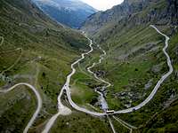 Looking North from Barrage de Moiry towards Grimentz with the post bus making it's way. This road is closed in winter. Taken September 2006.
Val d'Anniviers is easy to get to by both public and private transport. All forms of transport go via Sierre.
By Public Transport:
Sierre at the foot of the valley is the nearest and only train station. From Sierre train station Post Buses link up to Vissoie with onward Post bus connections to all points in the valley including the end of the road head at Zinal and depending on the season (road closed in winter), up to the Southern end of the Lac de Moiry in winter or as far as Grimentz all year around.
By Car:
From the West the A9 motorway from Lake Geneva/Grand St. Bernard Pass currently goes as far as Sierre East (Est). From the East the main road number nine comes from the Simplon/Brig direction also to the Sierre Est junction. The road East of Sierre appears to be in the process of being upgraded. From Sierre the main road leads up steeply from the Rhone Valley and vines to alpine meadows and the charming cross roads of Vissoie village. From Vissoie roads lead to all points in the valley. The roads have been substantially improved over the last few years. Geneva to the road head at Zinal takes about two hours. From Sierre to the end of the road heads is about forty minutes by car.
By Plane:
The nearest airport is Sion that has seasonal (winter) flights from London City and Gatwick Airports.Sion Town website
The most connections for flights is via Geneva-Cointrin Airport. Geneva Airport From Geneva Airport Direct trains are available to Sierre at the foot of the valley.
Zurich-Kloten or Basle-Mulhouse and Bern are also further away possibilities.
All of the airports require onward connection by public transport or car as above to reach the valley.
Red Tape
No Permits required, just common sense and a love of the mountains!Climbing
 from left to right, Dent Blanche, Grand Cornier & Pigne de la L�.June 1999
 Besso (3668m)dominates the skyline looking South from Zinal village
 North face of Blanc de Moming (3657m)
 Besso (3668m)dominates the skyline looking South from Zinal village as the valley floor leads to the Glacier de Zinal. April 2006.
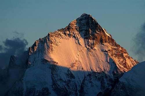 Northern face of Dent Blanche 4367m. (OM)
 Dent Blanche and Grand Cornier
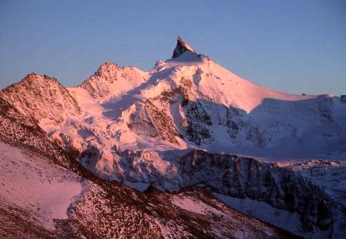 Sunset on Zinalrothorn, the View from the Tracuit-Hut. The pink was incredible ...(Michael Prittwitz August 2004)
The climbing possibilities of all styles and levels are almost limitless and too extensive to cover fully here.
A great generalisation but the Val de Moiry tends to have the easier climbs and the Val de Zinal has some of the harder North face climbs of the Alps.
The following gives list gives an indication of what possibilites there are with some links and a rough idea of the grades covered that published litrature is available for.
Mountains include:
Aigguilles de la Le 3190m AD
Becs de Bosson 3149m
Bella Tola 3025m
Besso 3668m PD/AD SW Ridge
Bishorn 4153m F/D NW Face
Blanc de Moming 3657m PD/AD
Bouquetins 3627m PD
Brunegghorn 3833m F/TD
Corne de Sorebois 2896m
Couronne de Breona 3159m PD+AD
Dent Blanche 4357m AD/ED2 S Ridge N Face
Diablon des Dames 3538m
Frilihorn 3124m
Garde de Bordon 3310m
Grand Cornier 3962m AD/TD nw-ridge-normal S ridge
Grand Gendarme 4331m
Les Diablons 3609m
Mammouth 3215m AD (traverse)
Mont Durand 3713m PD
Ober Gabelhorn 4063m N Face AD/TD-
Pigne de la Le 3396m F+/AD
Pte d'Ar Pitetta 3132m
Pte du Bandon 3074m
Pte de Bricola 3658m PD-
Pte de la Forcletta 3076m
Pte de Moiry 3303m
Pte du Mountet 3877m?
Pte de Mourti 3564m F+/D-
Pte Nord de Moming 3863m
Pte Sud de Moming 3963m
Pte du Prelet 3000m
Pte du Tsate 3078m
Pte de Zinal 3789m PD/D
Roc d'Orxival 2853m
Roc Noir 3144m
Sasseneire 3254m W2 Moiry Barage La Forclaz
Schalihorn 3975m F+/PD
Schalijoch 3750m AD
Tete de Milon 3693m
Trifthorn 3728m F/AD S Ridge Mountet route
Tsa de l'Ano 3368m
Wangerhorn 3096m
Weisshorn 4506m AD/TD- Schali
Wellenkuppe 3903m PD
Zinalrothorn (Rothorn) 4221m AD-/TD SE normal route North ridge
Cols and passes include:
Into the Turtmanntal (Gruben) valley to the East:
Col des Arpettes 3008m (not of Mont Blanc fame)
Col de Vijivi 2953m
Forcletta 2874m
Illpass 2482m
Meidpass 2790m - the main pass down to Gruben
Pas du Boeuf 2700m?
Pas de l'Illsee 2544m
Into the Mattertal (Zermatt) valley to the East and South:
Bisjoch 3547m PD
Bruneggjoch 3365m F/PD
Col Durand 3443m F/PD - the main pass down to Schonbielhutte and Zermatt
Col de Moming 3777m
Col de Tracuit 3250m W2
Col de Zinal 3490m PD/AD
Schalijoch 3675M F
Weisshornjoch 4058m
Into Val d'Herens (Arolla/Evolene) to the West:
Col de Breona 2915m W1/F
Col de Bricola 3622m
Col de la Dent Blanche 3531m PD/PD+
Col de la Couronne 2987m
Col de Mourti 3259m
Col dr Torrent 2916m W1 - the main pass
Col du Tsate 2868m
Pas de Lona 2787m
Between Val de Zinal and Val de Moiry:
Col de La Le 3061m? F
Col du Pigne 3141m?
Col de Sorebois 2840m W1 - the main pass - top of Zinal ski slopes.
Also between the Tracuit and ArPitetta huts is the Col De Milon 2990, W2/F.
Some of the connected links give further climbing details. The Valais Alps West book by Lindsay Griffin of The Alpine Club covers this area in english (ISBN 0-900523-61-1).Club Alpine Suisse (CAS) guides are available in French and German.
Further details of the more popular climbs can be found on many of the cabine website pages. (See the accomadation section for links to cabin websites).
Via Feratta

There is a via ferrata just to the North East of the Moiry Dam. There is a second somewhat more contrived via feratta that commences at Vercorin.
Skiing
This area is well suited to off piste skiing and ski touring with almost limitless opportunities. Some itineraries are suggested on specialised ski touring maps (see map section below). Most of the mountain cabines have a winter room if they are not are fully open. Some of the huts have a guardian from early March onwards. (See the accomadation section below for contact details). There a couple of promoted multi day ski tours, called the "Haute Route Imperiale" and "Tour Du Ciel" (Sky Tour) that are primerly concentrated on the Eastern part of the Anniviers valley. Further information can be found in German and French at www.haute-route-imperiale.ch .There is an extensive lift system to 220Km of piste through much of the valley, also the Zinal ski area has a growing reputation for it's gated freeride area and Zinal Freeride Festival. There is also a substantial avalanche training center on the Zinal ski slopes. In past years there has been a usefull free sixty page "Hillexplorer, The Freerider's Guide" booklet covering the whole valley that has been available locally in French (well illustrated) with suggested lift access freeride initiaries.
The lifts normally open to the public first in Zinal in early November followed by midweek and the rest of the valley in the run up to Christmas. End of season for the lifts is usually a fortnight after Easter. A number of the lifts are in use in summer and autumn also. see www.rma.ch There are a number of cross country prepared ski tracks from the main resorts just as there are a number of recommended snow shoe tracks.
Local avalanche risk information can be found at the Swiss Federal Institute for Snow and Avalanche Research Davos
Snowslider blog
Hiking
 Typical Walliser sheep. On the descent of Roc de la Vache, a nice viewpoint at the end of Val d'Anniviers offering views towards Weisshorn, Zinalrothorn, Besso, Dent Blanche, and Grd. Cornier . The latter two are in the left background, Pigne de la Le is in the right center
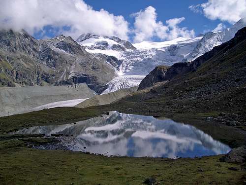 Val de Moiry, just below the Col de Torrent (2919m), that is crossed by the Walkers Haute Route and the Tour of the Matterhorn. Looking Southeastwards towards Glacier de Moiry. September 2004.
There are great hiking trails all year round for all capabilities. There are some locally available suggestion maps. All of the normal trails are well sign posted by typical swis yellow signs. There are also various well marked snow shoe trails.
Both the Walkers Haute Route from Chamonix to Zermatt, (the way I first stumbled across this area) and the harder Walkers Tour of the Matterhorn/Cervino pass through from the Val d'Herens, to the West, over Col de Torrent down to Lac de Moiry, Col de Sorebois/Grimentz,Zinal, Hotel Weisshorn and then over the Meidpass or Forcletta pass to Gruben in the Turtmantal valley. This route has traffic either way.
Sierre Zinal Mountain Marathon
The Sierre Zinal Mountain Marathon starts in Sierre and climbs eventually to Zinal. Extending over a distance of 31km, and rising 2,000 metres before falling 900 metres, it is one of the foremost challenges that a long-distance mountain runner can face. As such, it has it's own special aura, as demonstrated by the sheer numbers of runners who take part: Since this extraordinary course started in 1974, nearly 80,000 runners have pitted themselves against the mountains, urged on by some 200,000 spectators. Nowadays, the 'five 4,000s course', as it is called, is well-known throughout the world. Some even call it the 'New York Marathon of the Alps'. For this reason, most participants come in advance to check out the lie of the land, which means that, since it was created, the Sierre-Zinal course has been run more than 150,000 times!Mountain Biking
The Grand Raid from Verbier to Grimentz takes place every year. Click here for the offical link.History
 Grimentz old town, 1572m. (Mathias Zehring)
 Weisshorn. On the way to the Schali Bivouac from Zinal (Alpenkalb)
Sierre has a long history with the rest of the people of the Val d'Anniviers. Val d'Anniviers literarily translates as the seasonal valley. Seasonally people have come down from the higher reaches of the valley in spring to work in the vineyards. People would return to the upper valley in mid June to tend their flocks. September saw decent to Sierre for the harvest of the grapes before ascent again to the villages for winter. Each village had its own area of Sierre that they made theirs. Better transport links has reduced this nomadic migration but the valley is considered the last in Switzerland to follow a genuinely nomadic lifestyle.
Just like the neighbouring Val d'Herens that has always used heavy stone roof tiles, Val d'Anniviers has the tradition of cladding the roofs of its timber buildings in wooden roof tiles.
There is a history of Copper mineing in the valley that started in 1832 and finished in 1902.
Accommodation.
 Cabine De (Grand) Montet (2886m) and Dent Blanche (4357m)
 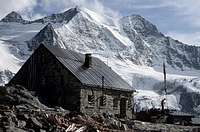 Cabane de Moiry (2825m) (Mathias Zehring)
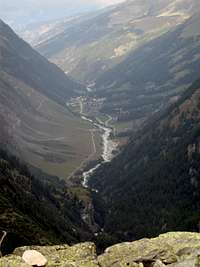 Zinal Village from the Cabine du (Grand) Montet path. Looking northwards, the left side shows the bottom of the Zinal slopes and the right shows the Zinal too Hotel Weisshorn track as followed by the Walkers Haute Route and Tour of the Matterhorn. September 2006.
Every type of accomadation is available to suit every budget and style.
Mountain Cabins and refuges include:
Cabane d'Arpitettaz CAS (2786m)
Cabane Becs de Bosson (2983m)
Cabane Bella Tolla (2340m)
Bimak SAC (3750m)
Dent Blanche Bivouac Hut (3540m)
Cabine Illhorn SAC (2146m)
Cabane de Moiry (2825m) As of 1st October 2008 the cabin is still being extended.
Cabine du (Grand) Mountet (2886m), try also this unoffical site.
Cabane Petit Mounte (2142m)
Cabane de Sorebois (2440m)
Cabane de Tracuit CAS (3256m)
Chalet du Barrage de Moiry (2300m) - at present being extended, open.
Further details on CAS Val d'Anniviers Huts can be found here for those CAS huts that do not have their own website's.
Hotel Weisshorn (2337m) is a Victorian hotel (1884) of note purched well above St. Luc.
There is also a camp site at the southern end of Zinal.
Dormatory accomadation is available in the friendly Zinal Auberge Alpina.
Additional External Links
Sierre and Val d'Anniviers websiteLive web cameras of area , Grimentz town , Grimentz ski slopes and Zinal village old town.
Snowslider - local skiers blog
Please Note This Above Page Is Still Under Construction! Below I've attached and had some photos attached to give ideas of the area. Thank you for the use of the pictures. Please feel free to attach further pictures!