
-
 29735 Hits
-
 88.19% Score
-
 26 Votes
|
|
Area/Range |
|---|---|
|
|
41.96670°N / 108.965°W |
|
|
Hiking, Scrambling |
|
|
Spring, Summer, Fall, Winter |
|
|
8683 ft / 2647 m |
|
|
Overview

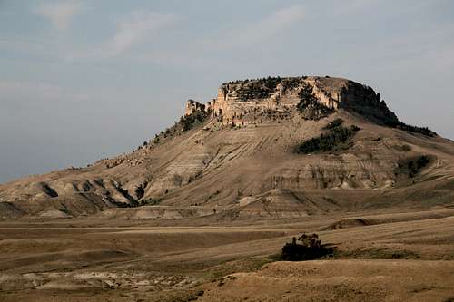
On Continental Peak

Cliffs and towers on North Oregon Butte
Between North Oregon Butte (in the vicinity of South Pass) and Bridger Pass (near Rawlins) in Wyoming, the Continental Divide does a strange thing—it splits and forms a ring around a vast desert-like area called the Great Divide Basin. In fact, it is considered a cold desert (like the Great Basin), and it is one of the largest such tracts in North America remaining essentially undeveloped. At over 7000’ in elevation throughout much of it, the region sees winters that are cold and long but summers that are hot and dry. A day here without almost-constant wind is like a summer day in the South bereft of stifling humidity—not likely.
From within the Great Divide Basin, there is no outlet to either the Atlantic or the Pacific Ocean; water that flows here, and even that is rare and brief, evaporates or gets swallowed up by the thirsty earth. When streams do run, the water is alkaline—this is no place into which one should venture without a good supply of water.
Although much of the Great Divide Basin seems to be a flat, featureless sagebrush sea, sections of this vast area boast some of America’s least-known mountains, badlands, and sand dunes. The entire area is also a massive and mostly unprotected wildlife refuge, home to golden eagles and other raptors, elk, mule deer, mountain lions, wild horses, and pronghorn. Incidentally, the pronghorn is supposed to be North America’s fastest land animal, and the pronghorns here, not as used to humans as many others of their kind are, will show you why—they bolt at full speed, and with attendant grace, from approaching cars. They accelerate to top speed seemingly instantaneously, and it is a riveting sight.
Humans, too, have long used the area. Those who know where to look can find petroglyphs that are hundreds of years old, and other sites indicating activity by the Ancients have been discovered.
The Great Divide Basin is part of the larger Red Desert, which stretches across much of southwestern Wyoming. On average, the Red Desert sees around 10 inches of precipitation in a year, which hardly qualifies it as a Death Valley-like setting, but it is still downright parched compared to the areas that most people call home. Most of that precipitation falls during just a few storms.
People driving I-80 between Rawlins and Rock Springs probably set the cruise control, load up on caffeine, put in something good to listen to, and consider what they’re seeing to be the driving equivalent of flyover country, but they are bypassing a Technicolor treasure of rugged solitude.
This is not the Wyoming of postcards and travel guides. This is the Wyoming that most people never bother to notice. All the better.
South Oregon Butte
Honeycomb Buttes
Areas of Interest
Summit lovers will find the best offerings to be along the rims of the basin. The Oregon Buttes, Continental Peak, Steamboat Mountain, Essex Mountain, and Boar’s Tusk (an old volcanic neck) are on or very near the Continental Divide. Some of these peaks, especially the Oregon Buttes and other peaks in the Jack Morrow Hills area, are even little islands that feature fragile communities of limber pines and aspens.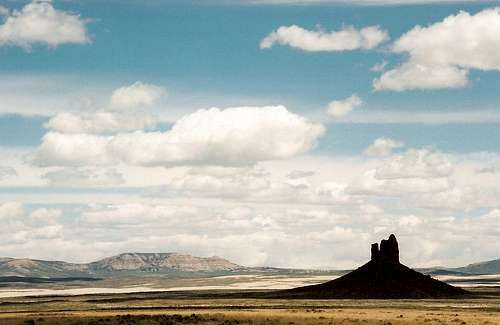
Boar's Tusk
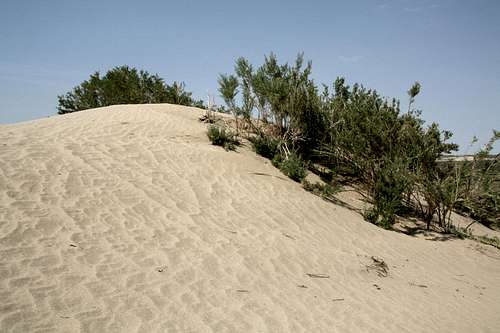
Red Lake Dunes
Accessing the Great Divide Basin
This section will identify some principal access points and the major destinations closest to them. It WILL NOT give detailed directions to those destinations. For that, please see the pages attached to this one as children and/or obtain (and use) the sources for which this page provides links. Also, know that the main roads through the Great Divide Basin, though unpaved, are passable to most vehicles except when wet, when the roads may become impassable even to vehicles equipped with 4-Low; side roads, marked as jeep roads, vary from being passable to most cars to being passable only to true 4WD vehicles. •Just west of South Pass on WY 28, turn south onto Oregon Buttes Road. This is the fastest and easiest way to access the Oregon Buttes, Continental Peak, and the Honeycomb Buttes. •From Eden, drive a few miles south on U.S. 191 to a gravel road signed for Boar’s Tusk and Chicken Springs. This road leads to Chilton Road, from which one can access the Killpecker Dunes. •Along I-80 between Rawlins and Rock Springs, several exits provide quick access to the Great Divide Basin and the Red Desert. Exit 130 connects to Nine Mile Road, which links with the Killpecker Dunes area. Exit 152 connects to Bar X Road, which heads north to the Red Lake Dunes and to Oregon Buttes Road (see above). Exit 158 puts one on the Tipton Road, which also offers easy access to the Red Lake Dunes area.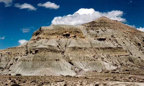
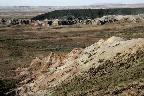
Badland butte along Oregon Buttes Road