La montagna chiama i suoi figli, ed essi rispondono fedelmente al suo appello…
Osvaldo Cardellina, Diario alpinistico, 1964-65
Page texts: @ OsvaldoCardellina"Osva", passed away on May 2, 2022. Page owners: Christian Cardellina e Osvaldo Cardellina. Any updates from September 12, 2022: Antonio Giani, page administrator, friend and climbing companion.
Testi della pagina: @ OsvaldoCardellina "Osva", scomparso il 2 maggio 2022. Proprietari pagina:Christian Cardellina e Osvaldo Cardellina. Eventuali aggiornamenti dal 12 settembre 2022: Antonio Giani, amministratore della pagina, amico e compagno di salite.
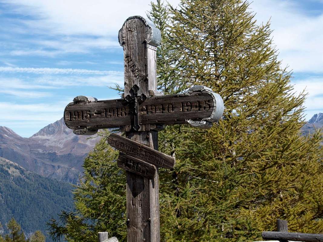
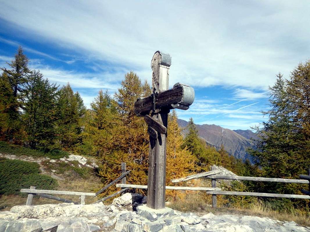
Head Cross Loch Overview
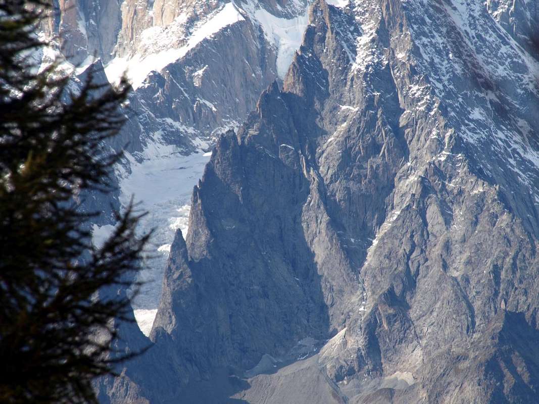
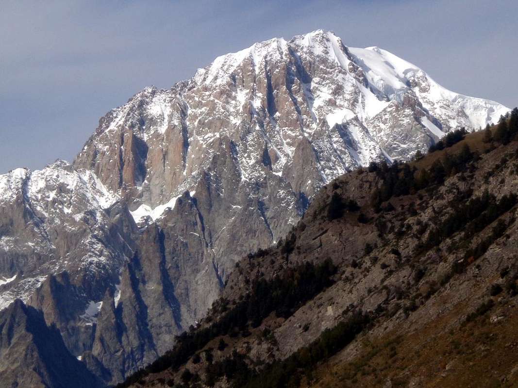
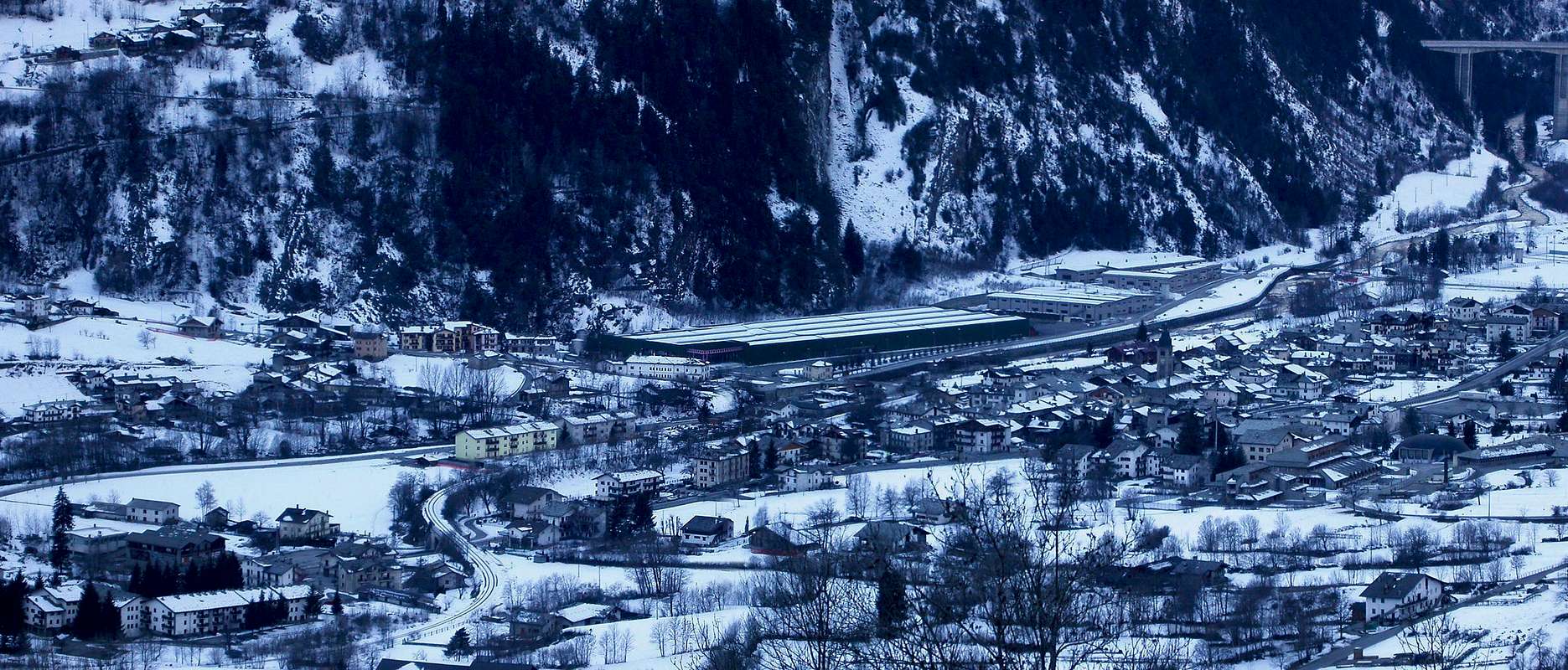
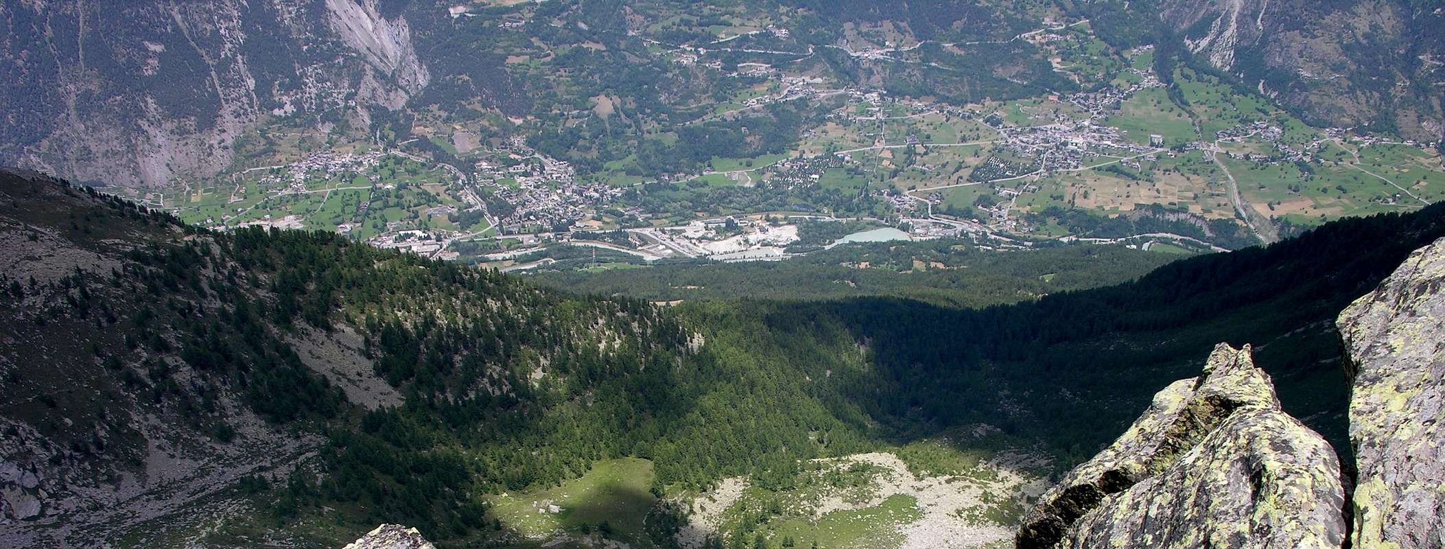
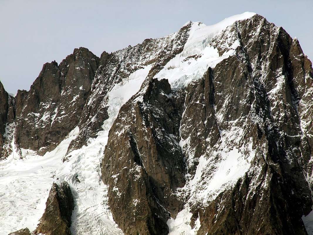
Arpy Basin. This small basin that looms over the Municipaly of Morgex (920m), can be divided into three specific areas of which the first from this center up the hill with the Regional Road first reaching the Village of Arpy (1.680m; small Church of Notre Dame des Neiges) and then, via a private dirt road to the South, the Pastures of Arpy Dèsott and Dessus (1.743m) in front of a beautiful waterfall that comes from the eponymous lake. From the village the road asphalt continues to the right, or the Southwest, reaching the Colle San Carlo (1.971m), important pass that leads to the Valley of La Thuile. Just below the pass there is the Hôtel-Restaurant "La Genzianella", very well known and frequented by Tourists in the summer, as well as starting point for the Lake Arpy (2.063m) where the site is in a large plateau with the lake of the same name and which is the second section of this small valley. Subject of attendance by the masses, thanks to its convenient and large farm road, offers exceptional views of the Mont Blanc Mountain Chain, during the first part of the ascent, and then across the divide that by the Colle del Gigante reaches the Gr. Jorasses to then head up to Pt. Jorasses, Aiguille de Leschaux, Mont Greuvetta, Aiguilles de Talèfre, Triolet and Dolent until the end of Val Ferret. This last part is a little "blanket" from the pyramid of Grande Rochère (3.326m).
Testa d'Arpy (2.022m) towards the Southern sector of Mont Blanc Chain, by Osw
In this "double" route suggest two small tours that leave from the Colle San Carlo (reachable from Morgex Common and by La Thuile Resort) become two scenic walks, while, starting further down, they become two beautiful excursions. We can recommend the appropriate to the Eastern side of the departure from the holiday Village of Arpy (1.680m) with the path leading to the lake of the same name and then "come down" to Colle San Carlo and the "La Genzianella" finally crossing at the Belvedere and the Testa (Head) Arpy (2.022m) with great views on the Grandes Jorasses first and then on the Southern side of Mont Blanc. Regarding instead the opposite side or Western should to begin instead from the junction 1.897 meters immediately after the "Trenches Prince Thomas", at the Village of Petosan (1.753m) and back through a real small unnumbered path through the Bois (Wood) de Petosan reaching l' Seiser Saint Maurice (1.994m) just above the dirt road to Lake Arpy. On the way back, as for the previous route, you can go to the splendid Belvedere's Tête d'Arpy. Two beautiful hiking or walking to be done in the same day and with the possibility to vary the combination of the various routes.
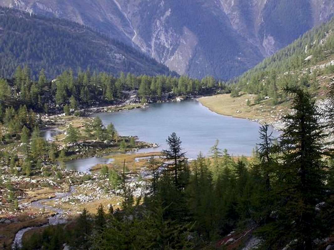
Lago d'Arpy in the second sector of Arpy Vallon from South-southeast, by Antonio
Conca d'Arpy. Questo piccolo bacino che incombe sopra il Comune di Morgex (920m), può essere suddiviso in tre specifici settori, dei quali il primo da questo centro risale la collina con la Strada Regionale raggiungendo dapprima il Villaggio di Arpy (1.680 m; piccola Chiesa di Notre Dame des Neiges) e successivamente, tramite una strada poderale verso Sud, gli Alpeggi di Arpy Dèsott e Dessus (1.743 m) di fronte ad una bella cascata proveniente dall'omonimo lago. Dal villaggio la strada in asfalto continua verso destra, o Sudovest, arrivando al Colle San Carlo (1.971 m) importante valico che conduce nella Valle di La Thuile. Appena al di sotto del passo esiste l'Albergo-Ristorante "La Genzianella", molto conosciuto e frequentato dai Turisti in estate, nonché punto di partenza, presso un parcheggio con adiacente fontana in legno, per il Lago di Arpy (2.063 m), dove é sito in un grande pianoro il lago dallo stesso nome e che costituisce la seconda sezione di questo vallone. Oggetto di frequentazione da parte delle masse, grazie soprattutto alla sua comoda e larga strada poderale, offre eccezionali vedute sulla Catena del Monte Bianco, durante la prima parte della salita, e poi su tutta lo spartiacque che dal Colle del Gigante raggiunge le Grandes Jorasses per poi dirigersi verso le Petite Jorasses, Aiguille de Leschaux, Mont Greuvetta, Aiguilles de Talèfre, Triolet ed al Mont Dolent insino al termine della Val Ferret italiana. Ma l'ultima parte rimane leggermente occultata, se non si sale più in alto, dalla piramide rocciosa della Grande Rochère (3.326 m).
Ascending on San Carlo Hill (1.971m) to the Eastern sector of Mont Blanc, by Osw
In questa "doppia" route consigliamo due gitarelle che, partendo dal Colle San Carlo (raggiungibile sia da Morgex che da La Thuile) diventano passeggiate panoramiche, mentre, iniziando più in basso, si trasformano in due belle escursioni. All'uopo possiamo consigliare pel versante Orientale la partenza dal Villaggio turistico d'Arpy (1.680 m) con il sentiero che raggiunge l'omonimo lago per poi "scendere" al Colle San Carlo ed alla "La Genzianella" ed attraversare al Belvedere ed alla Testa d'Arpy (2.022 m) con grandiose vedute dapprima sulle Grandes Jorasses e poi sul versante Meridionale del Monte Bianco. Per quanto concerne invece il versante opposto od Occidentale conviene prendere l'avvio dal bivio 1.897 metri subito dopo le "Trincee del Principe Tommaso", presso il Villaggio di Petosan (1.753 m) e risalire tramite un sentierucolo non numerato attraverso il Bois de Petosan raggiungendo l'Alpe di Saint Maurice (1.994 m) appena al di sopra della poderale verso il Lago di Arpy. Al ritorno, come per l'itinerario precedente, si può andare al Belvedere della Tête d'Arpy. Due belle escursioni o passeggiate da compiere nella stessa giornata e con la possibilità di variare la combinazione dei vari percorsi.
Getting There
BY CAR:
From TORINO, MILANO, etc: Motorway A5. Exit at IVREA or Quincinetto (PIEDMONT).
From IVREA Town: in West (Southern side) to Pont Saint Martin, Donnas, Bard, Champdepraz, Pontey, Fénis, Saint Marcel, Grand Brissogne, Pollein, Charvensod, Gressan, Jovençan, Aymavilles, to Villeneuve, Arvier, Avise and Morgex Municipalities.
From Courmayeur Resort: in East towards Morgex Municipality. Internal Dora Baltea Areas from Morgex to Arpy Conca From Morgex(920m), crossing the bridge above Baltea with Regional Road in South, towards Liarey, Pre Villair, Mont Rotie small Villages, alternative around 1.275m) just before Tirecagne Pasture (1.532m) and the Main Roads to Arpy Basin up to the San Carlo Hill (1.971m) with descent towards la Thuile-Resort. From Pré Saint Didier(1.010m), with Regional Road in South, towards the Villages of Elévaz (1.322m), La Balme (1.309m; two fountains) and Revers (1.338m) reaching La Thuile-Resort at the Chapel of St. Nicolas (1.447m); from this point, always through another Regional Road, towards Thovex-Moulin, Bouic (1.524m), Preylion (1.552m), Granges (1.838m), Théraz small Hamlets and the "Trenches Prince Thomas" in Petosan location just below San Carlo Hill (1.971m), located at the entrance in Arpy Basin.
From FRANCE: through the Mont Blanc Tunnel to Entrèves-crossroads to Vény/Ferret Valleys - Mountain Guides of Courmayeur - La Saxe Rock Gym - Courmayeur. By Little Saint Bernard Pass, closed since November until half May to La Thuile Valley - Pré Saint Didier - Courmayeur. It is not necessary to take Motorway A5: you can drive on SS.26, in the direction of AOSTA - IVREA - TURIN.
BY PLANE:
Aeroporto "Corrado Gex" Saint Christophe (Aosta).
Routes Description
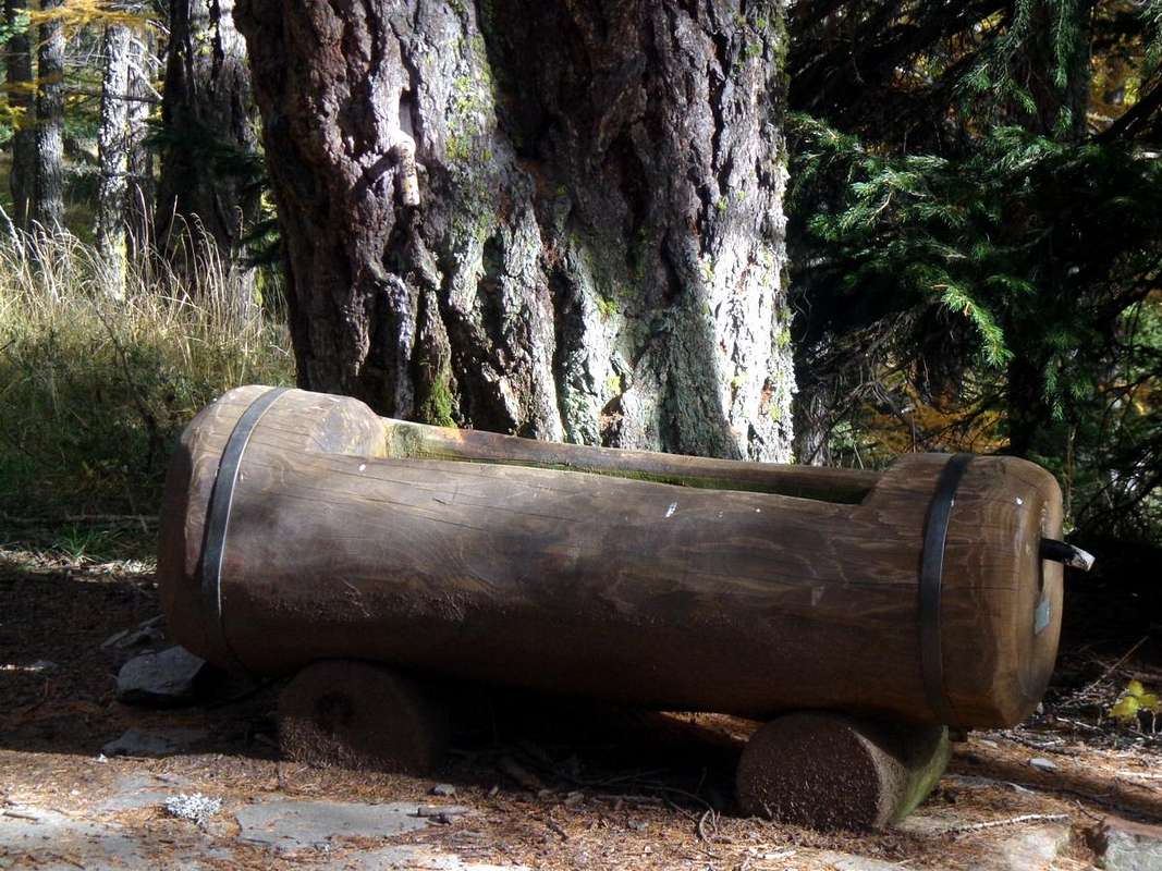
Route A (From Arpy Hamlet) From Morgex cross the bridge over the Dora Baltea (right behind the church) and the Regional Road to San Carlo Hill (towards the Valley of La Thuile) transit through the Villages of Liarey, Pre Villair, Biolley, Tirecagne, Arpy Dessous, Prariond -Prés Rionds reach the Hamlet of Arpy (1.680m; Church of Notre Dame des Neiges). Take the trail n° 14 which, with a Southerly direction, to the West of the salt Torrent Arpy reaching Fond of Arpy Desot and immediately after Damon (1.743m), from this point the same, after crossing the torrent, goes slightly further to the Southeast bringing against the Western Slope of Mont Charvet, then, crossed two secondaries streams side, cross again Torrent Arpy taking and passing beside a waterfall in sight, to Lake Arpy (2.063 m; E/F; 1h'15/1h'30). From the lake back to the Northwest through the farm road concomitant with the path n° 15 to reach the parking lot of the Hôtel "La Genzianella" with wooden fountain; from here continue with the next farm road towards the North and unnumbered path into the forest. Discarded the deviation to the left (West) at the junction 1.978 meters you continue through the main path first reaching the renowned Belvedere and then, after a short ascent, the wooden Cross of the small Summit (2.022m; T/E; 0h'20 from Colle San Carlo; 1h'30 from Lake Arpy; in total 3h'00/3h'30).
Via A (Dal Villaggio di Arpy)Da Morgex attraversare il ponte sulla Dora Baltea (subito dietro la Chiesa) e con la Strada Regionale per il Colle San Carlo (verso la Valle di La Thuile) transitare per le Frazioni di Liarey, Pre Villair, Biolley, Tirecagne, Arpy Dessous, Prariond-Prés Rionds raggiungere il Villaggio di Arpy (1.680 m; Chiesa di Notre Dame des Neiges). Prendere il sentiero n° 14 che, con direzione Sud, sale ad Ovest del Torrent d'Arpy raggiungendo Fond d'Arpy Desot e subito dopo Damon (1.743 m); da questo punto il medesimo, dopo avere attraversato il torrente, si dirige leggermente più verso Sudest portandosi contro il Versante Occidentale del Mont Charvet per poi, attraversati due torrentelli secondari, attraversare nuovamente il Torrent d'Arpy portandosi, passando a fianco di una cascata bene in vista, al Lago di Arpy (2.063 m; E/F; 1h'15/1h'30). Dal lago rientrare verso Nordovest tramite la strada poderale concomitante al sentiero n° 15 raggiungendo il parcheggio dell'Hôtel "La Genzianella" con fontana in legno; da qui continuare con la successiva poderale verso Settentrione e sentiero non numerato dentro la foresta. Scartata la deviazione verso sinistra (Ovest) presso il bivio 1.978 metri si continua tramite il percorso principale raggiungendo dapprima il Belvedere e poi, dopo breve risalita, la Croce della Cima (2.022 m; T/E; 0h'20 dal colle; 1h'30 dal lago; 3h'00/3h'30 in totale).
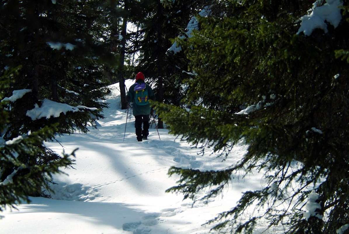
By snowshoes at the beginning from San Carlo Hill towards Arpy Loch, by emilius
Route B (From San Carlo Hill) From San Carlo Hill park at the renowned Hôtel "La Genzianella" (1.971m; wooden fountain) on the road that crossed the same, down to La Thuile Municipality. Take the private dirt road (plenty of signs at beginning in the nearby parking) towards the Lake Arpy (2.063m), into the second sector of the Arpy Vallon, concomitant with the trail n° 15/16 and with direction South continue towards the old and isolated Alpage of Saint Maurice (1.994m) who is immediately above to the West. After a hairpin bend where the direction changes significantly Eastward, you reach a junction, leave the path n° 16, which continues through higher towards the Hill of the Cross, continuing instead with the private dirt road that direction with more reach in the Southeast, after a small ascent at the end, the lake (E/T; 2h'00/2h'15). On the way back from the lake to proceed with the same way as in the previous route continuing towards the magnificent Belvedere and following Tête d'Arpy (T/E; 0h'20 by San Carlo Hill; 1h'20 lake; 3h'45/4h'00 in total).
Via B (Dal Colle San Carlo)Dal Colle San Carlo parcheggiare presso il rinomato Hôtel "La Genzianella (1.971 m; fontana) sulla Strada che, oltrepassato il medesimo, scende al Comune di La Thuile. Prendere la strada poderale (abbondante segnaletica all'inizio presso il parcheggio) per il Lago di Arpy (2.063 m), all'interno del secondo settore del Vallone di Arpy, concomitante con il sentiero n° 15/16 e con direzione verso Mezzogiorno proseguire verso l'antico ed isolato Alpeggio di Saint Maurice (1.994 m) che si lascia appena al di sopra ad Ovest. Dopo un'ansa dove la direzione cambia decisamente verso Oriente, si raggiunge un bivio; abbandonare il sentiero n° 16, che prosegue passando più in alto verso il Colle della Croce, continuando invece con la poderale che con direzione maggiormente a Sudest raggiunge, dopo una piccola salita nella parte terminale, il lago (E/T; 2h'00/2h'15). Al ritorno con la stessa strada continuare come nell'itinerario precedente verso il magnifico Belvedere e la Tête d'Arpy (T/E; 0h'20 dal colle; 1h'20 dal lago; 3h'45/4h'00 in totale).
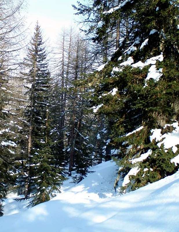
Crossing Southeast into the Arpy Forest, by SalVal
Route C (From Petosan Village in La Thuile Valley) From La Thuile-Resort at the Chapel of St. Nicolas (1.447m) to reach, always through Regional Road, towards Thovex-Moulin, Bouic (1.524m), Preylion (1.552m), Granges (1.838m), Théraz small Hamlets and the "Trenches Prince Thomas" in Petosan locality (1.971m). From here, just before the junction to 1.897 meters, the first in the direction of Southeast and then North-northeast a small path that is not numbered, traversing the Bois de Petosan, crosses the watershed with the Vallon Arpy reaching the ancient and isolated Pasture of St. Maurice (1.994m; 0h'45/1h'00). A short descent into the forest back to the routes earlier with the right to choose between the various combinations.
Via C (Dal Villaggio di Petosan nella Valle di La Thuile)Dal Villaggio Turistico di La Thuile presso la Cappella di St. Nicolas (1.447 m) raggiungere sempre tramite Strada Regionale verso i Villaggetti di Thovex-Moulin, Bouic (1.524 m), Preylion (1.552 m), Granges (1.838 m), Théraz le "Trincee del Principe Tommaso" in località Petosan (1.971 m). Da qui, appena prima verso il bivio 1.897 metri, parte in direzione dapprima Sudest e poi Nord-nordest un piccolo sentiero non numerato che, attraversando il Bois de Petosan, oltrepassa lo spartiacque con il Vallone di Arpy raggiungendo lo antico ed isolato Alpeggio di Saint Maurice (1.994 m0h'45/1h'00). Una breve discesa dentro la foresta riporta alle vie precedenti con facoltà di optare tra le varie combinazioni.
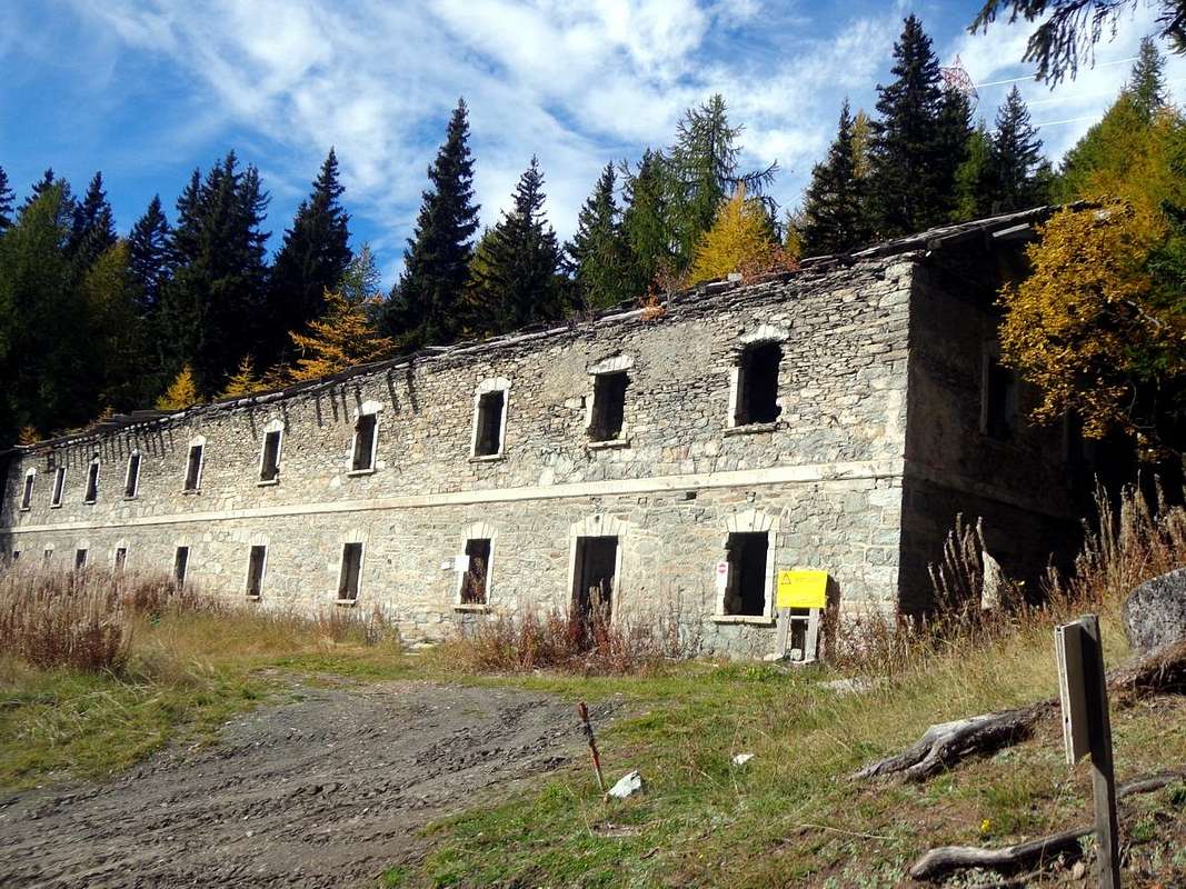
Old barracks nearby "La Genzianella" at beginning path towards "Belvedere", by Osw
Essential Gear
Equipment: For Hiking.
Equipaggiamento: Da Escursionismo
Difficulty: For T = Tourists and E = Hikers.
Difficoltà: per Turisti ed Escursionisti
Mountain Conditions
Meteo: you can find all the needed informations at the official site of the Valle d'Aosta Region:
"Guida dei Monti d'Italia – Alpi Graie Centrali" di Alessandro Giorgetta - Club Alpino Italiano/Touring Club Italiano, (1985), in Italian,(384 p. with maps and pics).
"Valdigne gli itinerari escursionistici" di Alessandro Giorgetta Ed. Zanichelli, (1981), in Italian.
"Diari Alpinistici" di Osvaldo Cardellina e Indice Generale accompagnato da Schedario Relazioni Ascensioni 1964-2019 (inediti).
MAPS:
Kompass, "Massiccio del Monte Bianco Valle d'Aosta" Sentieri e Rifugi" Carta turistica 1:50.000.
Kompass, "Gran Paradiso Valle d'Aosta, Sentieri e Rifugi" Carta turistica 1:50.000.
L'Escursionista "La Thuile-Piccolo San Bernardo" (n° 2) 1:25.000.
Enrico Editore Ivrea-Aosta, "Gruppo del Gran Paradiso" 1:50.000.
I.G.M. Istituto Geografico Militare Maps. 1:25.000.
Hapax "Mont-Blanc Les sentiers", Comunità Montana Valdigne Ed. 2001 1:50.000.


 3499 Hits
 79.04% Score
 10 Votes