
Viewing: 1-4 of 4

hiltrud.liu - Apr 20, 2007 10:23 am - Voted 10/10
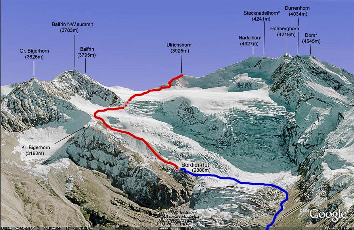
Thanks...for the informative picture!
Cheers, Hiltrud

Bor - Jul 30, 2007 5:09 am - Voted 10/10
Where do you find this?Where do you find this in Google earth??
Thanks!

Rick B - Jul 31, 2007 2:44 pm - Hasn't voted
Re: Where do you find this?I'm not sure that I understand the question. In google earth you find this where the mountain is? (obviously ;-) Perhaps you are using a web interface which does not allow you to view 3D? Or are you using the application but don't know how to go to 3D view? In this latter case, hold down the middle mouse button and move the mouse. Finally, I drew the route and peak names manually with photoshop...
I hope that I answered your question like this?
Cheers,
Rick
Bor - Aug 1, 2007 4:25 pm - Voted 10/10
Re: Where do you find this?I think I use a web interface but I will check. Thanks for explanation.
Cheers!
Viewing: 1-4 of 4


Comments
Post a Comment