
-
 14654 Hits
-
 81.84% Score
-
 14 Votes
|
|
Mountain/Rock |
|---|---|
|
|
28.91868°N / 13.78422°W |
|
|
Hiking |
|
|
Spring, Summer, Fall, Winter |
|
|
1995 ft / 608 m |
|
|
Overview
 Atalaya de Femes as seen from the south Atalaya de Femes as seen from the south |
The Los Ajaches mountain range is one of the oldest areas of the island of Lanzarote among the Islas Canarias. It got created during the first burst of volcanic activity on the island, which happened roughly 16 million years ago. Together with Risco de Famara in the north of Lanzarote it formed a little archipelago of two islands. Several volcanoes got created during that time, among which Hacha Grande (561m), Pico Redondo (561m) and Atalaya de Femes (608m) remain the highest ones today. The whole mountain range almost has hidden all traces of volcanic activity and only if you look closely or dig deeply will you realize the origin of the range.
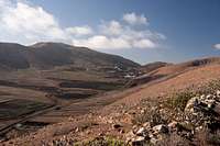 |  |  |
Atalaya de Femes is the highest of these mountains. At 608m it is the second highest mountain of the island and it dominates the whole south of Lanzarote. Atalaya means lookout - and that is what it was used for in former centuries. The Canaries, especially Lanzarote, often were victims of pirate raids and the mountain served sentinels who in turn warned the local residents of imminent attacks. Therefore, long ago a road was established, which leads to the summit, a road which nowadays has turned into a maintenance road for a forest of radio, tv or mobile phone antennae on top. The dominant position of the mountain results in a good visibility and thus more than half the island is served by the installations on its summit.
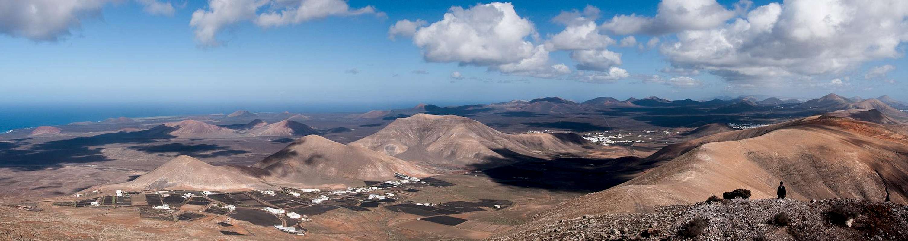
 Atalaya de Femes as seen from the summit of Montaña de la Cinta
Luckily there is more to the mountain than just the antennae. It possesses a long north-east ridge, which can be used as ascent route. The trailhead is Yaiza, the village at the base of neighbouring Montaña de la Cinta. The route quickly reaches the ridge at about 400m and then turns into one of the most beautiful panoramic trails of the island. It offers good views of the Montañas del Fuego as well as the east and west coasts of the island.
Atalaya de Femes itself also boast one of the best views of Lanzarote. On a good day neighbouring Fuerteventura can be seen in the south across Punta Pechiguera, Lanzarote'S southern cape. Indeed, to the north of the summit you can still distinguish a small crater, which betrays the volcanic origin of the mountain
A summit Panorama
  |
Getting There
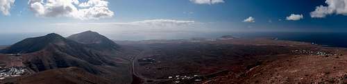 Lanzarote's southern tip with Pico Redondo and Hacha Grande to the left
Though there are ferries from the Spanish mainland to the Canary Islands, they take more than 24h for the trip. Therefore most visitors therefore go by plane. Every travel agency in Europe offers flights, hotel rooms, apartments, rental cars etc. so that reaching the Canaries is rather a matter of money than opportunity. During the summer season flight fares can be reasonable but during the Easter and Christmas holidays you have to be prepared for additional fees of 500€ per person.
Lanzarote has its own airport between the capital Arrecife and one of the main tourist centres, Puerto del Carmen. There are public bus lines but – like on all the islands – they don't run too regularly. If you plan to stay on your own, better take a rental car right at the airport.
There are two trailheads for Atalaya de Femes. The shortest route starts in Femes but runs along the maintenance road for the radio antennae on top. Not exactly recommendable imho. The second route starts at Yaiza and follows the long east ridge of the mountain. It is one of the most panoramic hikes of the island and - due to its length - not crowded.
The best itinerary (not the shortest but most impressive one) is as follows (the shortest one is simply to follow LZ2 from Arrecife to Yaiza and LZ702 to Femes):
- From Arrecife follow LZ20 through San Bartolomé.
- At the Monumento del Campesino turn onto LZ30 west.
- Drive through Masdache and ignore all intersections until you reach a roundabout.
- For Yaiza take the first exit which takes you onto LZ2. After about 1 km you'll reach another ((huge!) roundabout. Take the second exit, which will take you into Yaiza. Park your car near the church.
- For Femes take the second exit onto LZ702 which winds up to the village. Also park the car near the church.
Red Tape
 Newly hatched baa-lamb at the base of Atalaya de Femes
Though Atalaya de Femes is the highest mountain of the Los Ajaches mountain range, it is located just outside the Monumento Natural de los Ajaches, The natural monument, established to protect the mountain range. Consequently all kinds of activities are allowed on the mountain. It is most popular among paragliders who drive up using the dirt road from Femes. To the west of the volcano - on a side summit - there is Lanzarote's largest quarry for red Lapilli, the decorative volcanic cinder which is used to cover the flower beds of town and village squares. On weekdays there can be a whole lot of noise.
Accommodation
 |
For holiday homes, hotels or apartments either consult your nearest travel office, or – search for lodgings on Google. There are several sites on the web, dedicated to rent privately owned houses or apartments. Prices are generally a bit less expensive than for tour operators but you don't have as much security.
Weather Conditions
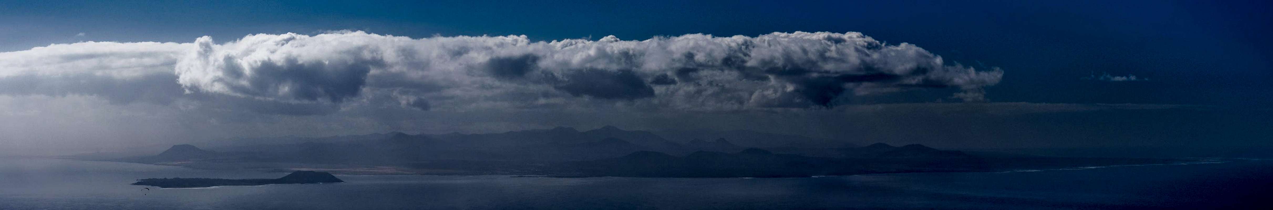 |
Lanzarote is usually swept by fierce north-western trade winds. Though they deposit their humidity on almost all of the other Canary Islands, Lanzarote is simply too low to form a decent obstacle. Therefore the climate is very arid. However, winds regularly are pretty strong,, especially on the mountaintops. It pays to take warm wind-stopping clothes with you.
For some time of the year, eastern winds prevail, which almost always carry clouds of Sahara dust with them. Usually this means reduced visibility but in some occasions "Calima" occurs. Fierce storms take up the dust from the Sahara and sweep it across the islands. In these times visibility is nil and sometimes even the planes are grounded.
Maps And Books
Maps
Regular Maps
- Lanzarote
Kompass Map WK241
Kompass Verlag
1:50000
ISBN 3-85491-175-0
Digital Maps
Kompass is the only company known to me which offers GPS digital Maps. In addition for those of you with Garmin GPS receivers there is a map source map set of all Canary islands out there.
- Lanzarote
Kompass GPS4241
Kompass Verlag
ISBN 3-85491-223-4
- Islas Canarias
Map Source custom map
By Manfred Pepper
downloadable zip-file
Books
My recommendation is a guidebook by Rother Verlag, available in German. The book is an excellent hiking guide covering all the interesting areas of the island. Since it comes with small maps for each excursion it might even be used without a map to support them.
- Lanzarote
Rolf Goetz
Rother Verlag
ISBN 3-7633-4302-4