
-
 5521 Hits
-
 82.69% Score
-
 16 Votes
|
|
Mountain/Rock |
|---|---|
|
|
46.23539°N / 7.79437°E |
|
|
Hiking, Mountaineering, Skiing |
|
|
Spring, Summer, Fall, Winter |
|
|
9747 ft / 2971 m |
|
|
Overview
Augstbordhorn as seen from the ascent to Bordier hut
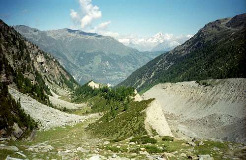
Being among the ice free third or fourth row summits within Valais Alps, Augstbordhorn nevertheless gives its name for a whole range, the so called Augstbord Region.
Located between Rhone valley to the north, Turtmann valley to the west, Mattertal to the east and the Barrhörner to the
south, the Augstbord Region is an area for hikers and, in wintertimes, ski touring activities.
valley. To the north this eastern subridge ends at “Die March”, also known as Violenhorn, a broad secondary summit to Augstbordhorn, locared high above Rhone valley but only about 60 m higher than the col between Violenhorn and Augstbordhorn, called Grätji.
Augstbord region (center left) as seen from Walliser Weißhorn
To the east, another ridge drops down to the mountain village of Törbel an to the Mattertal.
The third ridge to the south goes down to Chumminilicke col and then bends to the west to reach the junction point with the western branch; this part of the ridge is called Augstbordgrat. Ginalspass col separates Augstbordgrat
from the conjunction point of the two subridges, the Dreizehntenhorn.
As a mountain, Augstbordhorn does not look neither bold nor challenging. The summit is a broad ridge, the whole mountain is more a huge mound, a monstrous hill of scree, pebbles, slates, talus and boulders. It is nevertheless an excellent outing for hikers and ski touring. It is a lonely, pristine and remote landscape with poor grasslands on the lower slopes. These meadows generate an incredible abundance of
wildflowers in june and july, many, many Arnica montana among them. This alone is worth a hike in the area.
Unforgettable moments!
Getting There
Nadelhorn ascent: Augstbordhorn is the dark ridge to the left
Trailheads for Augstbordhorn are:
- Embd
- Moosalp
- Brand / Unterbächen
- Unters Sänntum
You reach Visp
- from Geneve and France region by highway number 9, Autoroute du Rhone until its end at Sierre. From there follow road number E62;
- from Bern via highway A6, from Luzern and Zürich via highway A4, A14 and A8 to Spiez, on road number 273 to Kandersteg. The Lötschberg car shuttle train brings to to Rhonetal. Follow road E62 to Visp.
- from Germany, Rhine valley and Chur follow highway A13 to Domat / Tamins and road number 19 via Oberalppass to Andermatt. Use the Furka car shuttle train to Obergoms or traverse Furkapass on road number 19. Follow this road until you reach Visp.
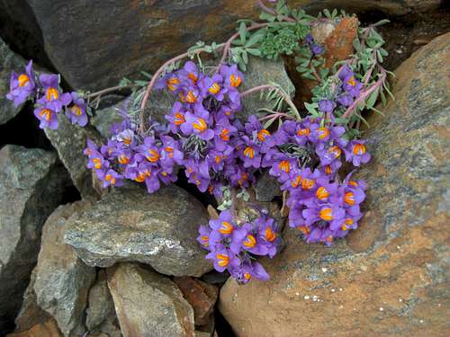
Augstbordhorn is a botanic treasure
Moosalp, Brand / Unterbächen or Unners Sänntum can be reached directly from Visp, following the road to Eischoll and the different signposts to the villages / trailheads.
For Embd leave the road to Törbel at the fifth switchback to the left and follow this narrow road to the village.Moosalp can be reached, too, by following the road to Stalden. At Stalden turn right on the
road to Törbel before the main road crosses the bridge over Matter Vispa creek. Proceed to Törbel and go on to Moosalp (signposts).
Embd can be reached, too, with a cable car, starting at Kalpetran in the Matter valley. To minimise the altitude difference between Embd (about 1400 m) and Augstbordhorn (2972 m) you may use a second cable car from Embd to Voralpe Schalb (about 1900 m).
Routes Overview
 Augstbordhorn Trailheads (T) and Routes
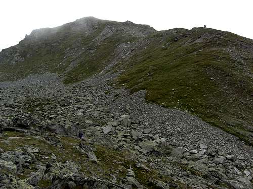 Gentle Augstobordhorn slopes | 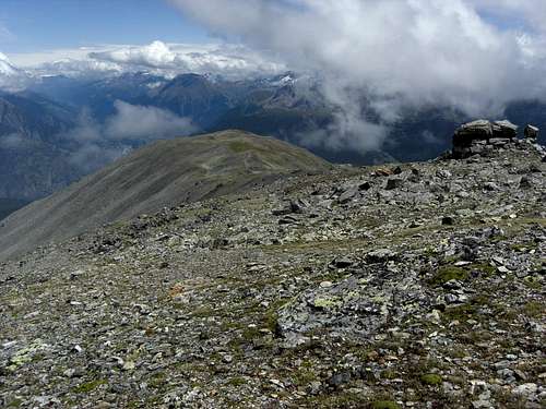 The long east ridge to Violenhorn | 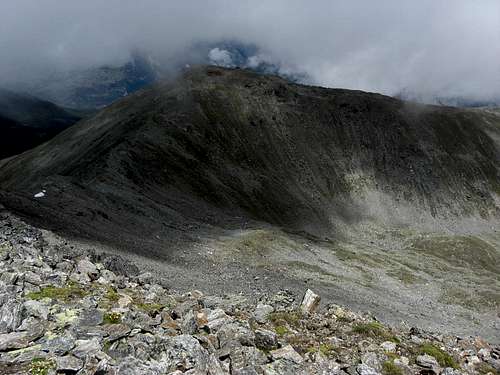 Violenhorn (March) |
Hiking routes:
- Moosalp – March or Violenhorn – Grätji – Augstbordhorn, or
- Moosalp – Törbeltälli – Augstbordhorn (partly off-trail)
- Brand / Unterbächen – Moosalp - March or Violenhorn – Grätji – Augstbordhorn
- Embd – Schalb – Roedberg – Chuminilicke – Augstbordhorn (partly off-trail)
- Unners Sänntum – Obers Sänntum – Große See - Chuminilicke – Augstbordhorn
- Traverse Augstbordhorn – Augstbordgrat – Dreizehntenhorn (partly off-trail)
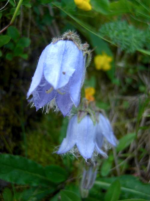 rare Campanula barbata | 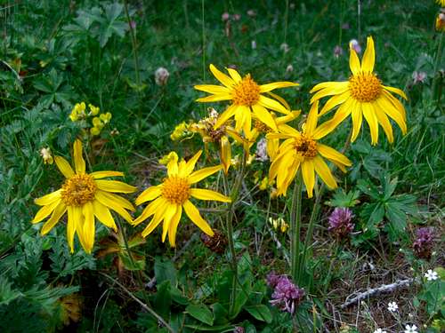 Arnica montana | 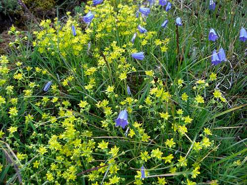 Wildflower meadows on the slopes of Augstbordhorn |
Ski routes:
- Moosalp – Törbeltälli – Augstbordhorn
- Bürchen - Nässjere - Chaltebode - Unnerrat - Arb - Törbeltälli – Augstbordhorn
- Brand - Gibidum - March - Augstbordhorn
- Sänntum - Seefeld - Grosse See - Augstbordhorn
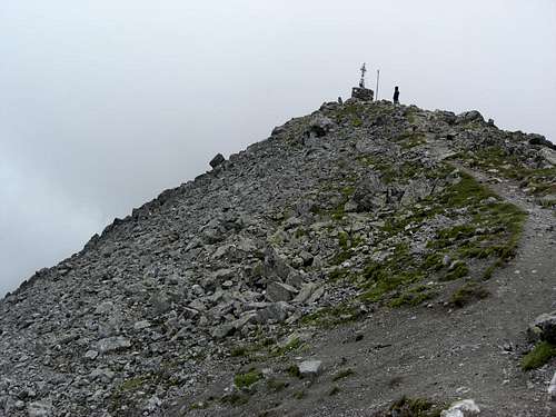 Augstbordhorn summit | 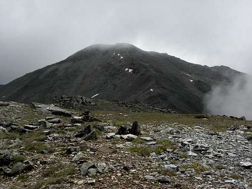 Augstbordhorn as seen from Violenhorn | 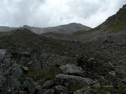 Augstbordhorn as seen from Moosalp |
Red Tape
![Augstbordhorn]()
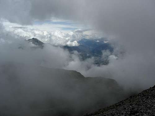
Dramatic views on the way to Augstbordhorn summit
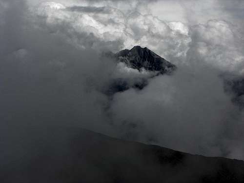
Dramatic views on the way to Augstbordhorn summit
Red Tape
Parts of Moosalp is a nature protection area.
Besides that there are no special regulations known to me.
Accommodation
All kinds of accommodation can be found mainly at:
Gear & Mountain Condition
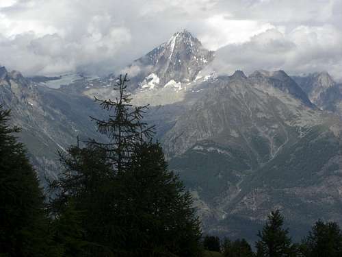
Bietschhorn view from Augstbordhorn ascent (18-07-2011)
Augstbordhorn is a year round summit.
In summer and autumn Augstbordhorn is an easy hiking summit, which requires normal hiking gear. Hiking poles are recommended, especially for the partly off-trail routes.
The summit is easy, nevertheless you are in a rather remote area with mostly narrow or sometimes no trails. A knack for orientation is required and secure walking in off-trail terrain.
In winter and spring Augstbordhorn seems to be a perfect ski tour summit. The routes are easy to moderate difficult.
Full ski tour gear and avalanche gear is required.
See the Swiss avalanche bulletin here .
Current Weather:
Maps & Guide Books
![Augstbordhorn]()
View to Brig and the Oberwallis
View to Brig and the Oberwallis
Maps
- Landeskarte der Schweiz, scale 1 : 25.000, number 1308, Sankt Niklaus
- Landeskarte der Schweiz, scale 1 : 25.000, number 1288, Raron
These two excellent maps cover nearly the whole of the Augstbord hiking region.
- Landeskarte der Schweiz, scale 1 : 50.000, number 274, Visp
Guide Book
- B. Banzhaf, H. Biner, V. Theler: SAC Clubführer Matterhorn / Dent Blanche / Weißhorn; vom Col Collon zum Theodulpass;
Schweizer Alpenclub 2010
- Michael Waeber:
Gebietsführer Walliser Alpen;
Bergverlag Rudolf Rother