
Comments
No comments posted yet.
|
|
Trip Report |
|---|---|
|
|
38.61870°N / 22.05680°E |
|
|
Sep 30, 2020 |
|
|
Hiking, Scrambling |
|
|
Fall |
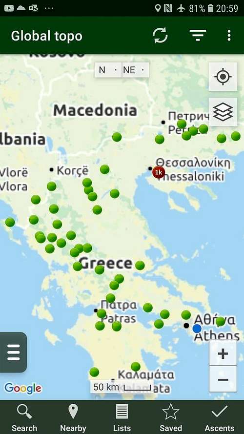
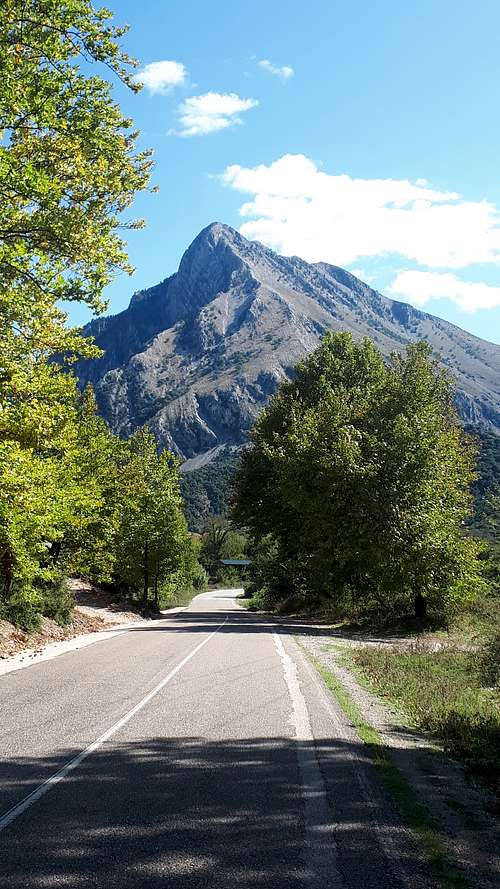
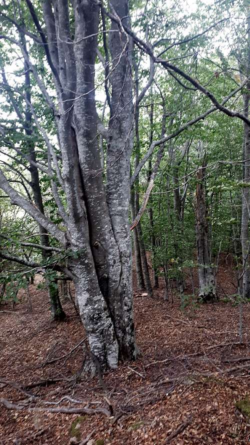
A 26 day trip focussing on high-prominence peaks, including 28 P1000m summits, +13 P900s, +3 P800s, +2 P600s – my fifth trip to the country, completing my collection of all peaks on the Greece mainland with 900m of prominence (re-ascent), except for a military P1000 near Thessanoniki. A lovely place to spend Autumn; some fine peaks, a few adventures, no disasters. Peakbagging is generally straightforward In Greece, with most peaks having mapped paths, and few access issues except for a small number of military summits, although reaching the trailheads can be a little challenging, with high clearance recommended.
I had little or no information for many of the peaks: key sources were OpenStreetMap and Google Satellite view. A few had existing reports, mainly on Peakbagger.com, and all are now detailed via my Peakbagger ascent list.
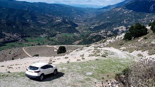
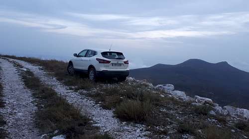
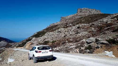
Weather was mostly dry and sunny but with several wet days; weather was quite unpredictable in the North and several times it changed completely with only a day’s notice, but generally the yr.no and meteoblue apps performed well. Mountain navigation relied mostly on the Peakbagger app using the OpenStreetMap layer, which in Greece has a good coverage of roads and paths, mostly accurate. I also had OpenMTBMap on my Garmin Etrex, used mainly when weather and/or terrain was bad. Road navigation used Google’s Maps app (I forgot to include an offline mapping app): the routeing often can’t distinguish between paved and good and bad unpaved roads, which led to a few sub-optimal routes! Most peaks are approached via unpaved roads, generally of reasonable quality but some would be difficult or impossible without high clearance: I used an SUV. Many of these roads are signposted public roads. The remainder, often forest or wind farm roads, are generally ungated with public access. There’s a good network of mostly quiet and reasonably priced toll motorways. Covid-19 was quite well managed in Greece at the time but I didn’t mix much, mostly sleeping in the car and relying on a weekly Lidl shop for food. This nomadic approach made two different ascents possible most days; occasionally three. The longest outings involved around 25km and 2000m ascent.
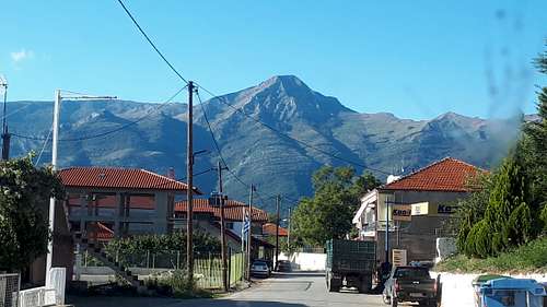
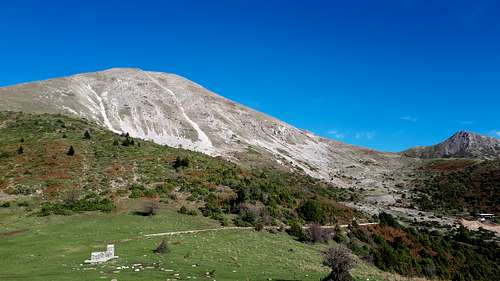
Tue 22 Sept 2020, arriving at Athens airport early afternoon, I headed straight for Makriplani, a peak I’d visited in 2011 with Andrew Tibbetts, but Andy Martin had subsequently found a higher summit, prompting a revisit. The approach is on a reasonable unpaved road. Google Maps offered me a substandard shortcut route and I fell for it, not for the last time. The Covid-19 regulations required an address for the first night; with my late arrival in Aigio I didn’t get best value from what was a nice and rather inexpensive apartment. Óros Chelmós was my 700th P700m summit worldwide, involving some beautiful mountain roads, a quite reasonable unpaved road and some nice steep sunny limestone summits.
Google chose a bad route up Panakhaikon Óros; the peak itself was easy, albeit in the mist; in descent I drove the excellent wind farm road.
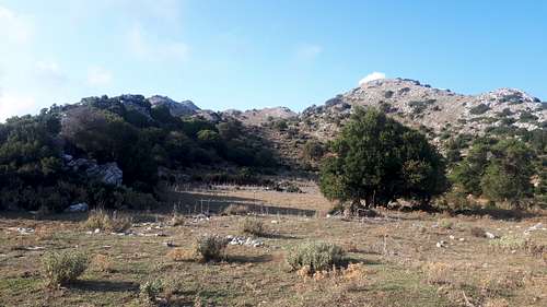
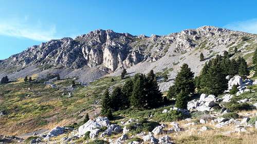
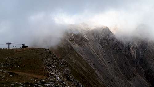
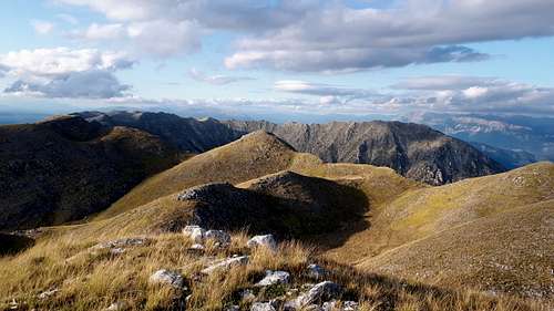
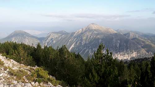
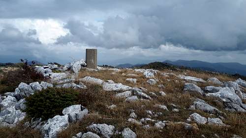
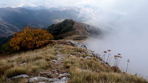
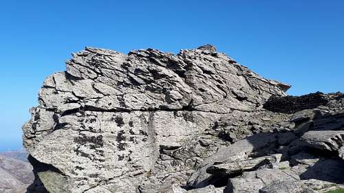
Olonos is a fine rocky peak in a wild area, the first proper walk of the trip: another tricky approach drive with the peak itself fitting into a half-day gap in the first rainfall of the trip. A good traverse path with good views, leads to a col then a steep climb with a little scrambling took me to a misty triangulation pillar.
Agios Konstantinos is a short hike with a quite tricky approach drive and a small church on the lower north summit.Halfway to the trailhead I had joined a good unpaved road. It seemed a fair bet that the good gravel road joins with the paved road further south, avoiding the need to drive the rough road over the pass. I drove back that way, as per my posted GPS track, but lost the bet. The last couple of km are missing: perhaps the (EU) funding ran out. So, I had to drive back out over the pass after all, in the dark. The descent was a trial, with fog and 10m visibility increasing the chances of driving off one of the many hairpin bends!
Megala Tourla was a lovely early morning ascent, my last Peloponnese summit.
The motorway took me quickly north, with a glimpse of the Corinth canal, deep and narrow, as I left the peninsula.
Paliovouna turned out to be accessible via a wind farm road, a long roughish unpaved road and a short, rocky and very windy hike.
Trikorfon involved a dirt road drive up through beautiful oakwoods and a very short walk to a wind turbine, just before a thunderstorm started. I was thankful for the wind farm road down, as the dirt road would have been impossibly muddy.
A detour east escaped the rain and added the bonus P827m Kithairón Óros.
Next morning I climbed Korakas, an excellent peak, wild and rocky with summit cloud treating me to a Brocken spectre as it reluctantly cleared. I met a group of 23 Greek hikers, some of whom had driven higher than I managed, without even high clearance – I’d been out-drive-upped!
Pirgos was a short drive away, but on rough forest roads. By the time I reached the trailhead turnoff I was short of fuel and first spent an hour or so finding a filling station – a good decision as it's not easy on a Sunday in rural Greece.
With rain forecast, I made a detour east for Yerakovouni. In the dark I managed a quarter of the unpaved approach before reaching a section of road I didn’t fancy, and parked for the night. Overnight rain was distinctly worrying, but by morning the dirt road was dry enough and I drove down to the river crossing. The next 100m wasn’t sensibly driveable but the interesting limestone summit was now only a 3 hour round trip.
Afterwards I drove back west in heavy rain, but managed a dry late afternoon ascent of Tymfristos from a high ski-resort start.
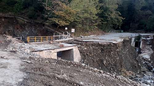
Next morning I planned to climb Skhizokaravo, but seemingly all bridges had been destroyed by cyclone Ianos a few days before I arrived in Greece (there had been two fatalities in Karditsa) and I couldn't find a way to the trailhead.
So in the afternoon I settled for a rainy ascent of Kokkinolakka.
The next day in sunshine I climbed the beautiful Aetoi. Passing a Jeep Wrangler I soon realised I’d driven a little further up the rough track than was ideal - but no harm done.
In the afternoon I climbed Kanala, an imposing peak with a steep rough ascent, a little exposed in places, with a rugged summit ridge looking down on the impressive Acheloos reservoir; the trickiest peak of the trip so far. It’s also my 100th P1000m summit of the year, although whether it quite has 1000m of prominence seems unclear.
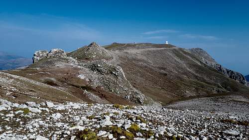
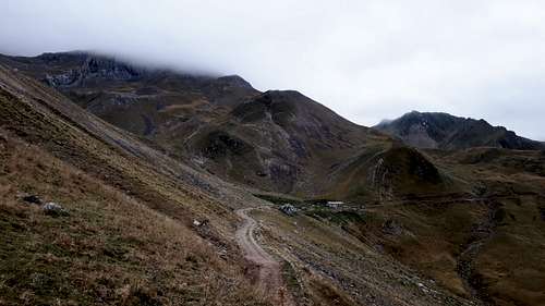
At the Óros Tomaros trailhead I encountered a locked gate: for the first time I found myself walking a good unpaved road. It’s a fine limestone peak with near-twin summits and some easy scrambling.
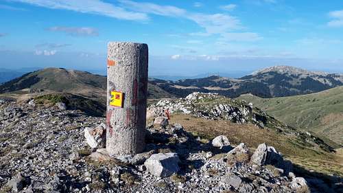
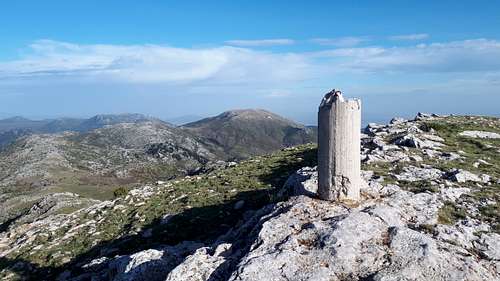
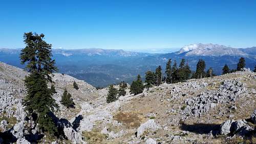
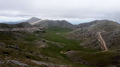
I’d been unsure how to approach Xerovouni, but the unpaved road visible on aerial imagery was good enough. It has a long undulating ridge with several grassy summits: my hand level couldn’t distinguish between the highest pair.
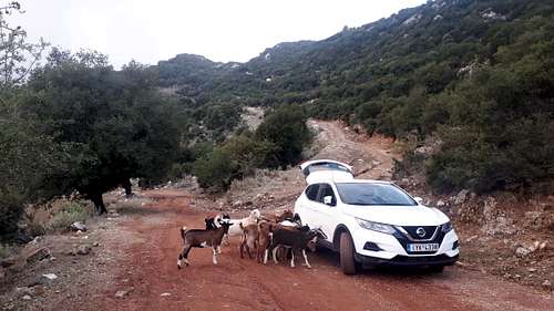
After Mitsikeli, the cattle-dogs didn't approve of my driving the public road even - unusually one of them mis-timed its run and found itself bouncing off the car wing! The dogs employed to guard sheep, goats and cattle can be intimidating, but seem trained to bark but not bite. It’s fascinating to see them managing their flocks, often with no human in sight. I was amused to see dogs sleeping in the road, with cars driving around them. I recall passing one sleeping in the middle of a hairpin bend. Half a day later it was still there, apparently still alive.
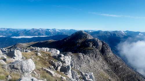
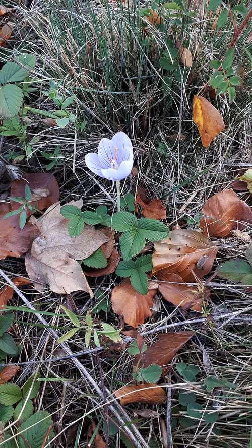
Just across the valley, Khionistra is only a little lower and less prominent, and a more serious undertaking for the afternoon, with some prickly scrub and plenty of steep ground. Wildlife included a tortoise and a stick insect.
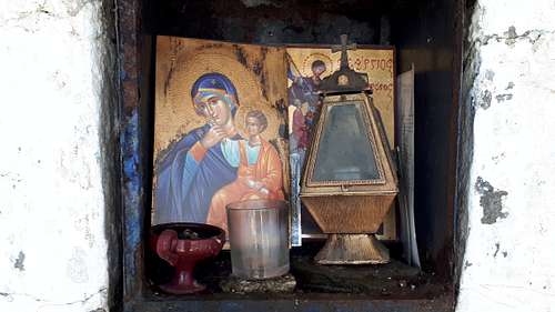
With the peaks close together, I managed a third for the day, Metsitia. The approach drive passed through a farmyard, where I waited while the daughter of the house watched the last few sheep down for the evening. Higher up I was stopped by a forest ranger, likely checking for poachers: seeing I was a tourist he gave me the OK, used to people visiting the little church, a popular Greek pastime.
Next morning I took an early ferry across to Corfu for Pantokrator, the only island highpoint of the trip.
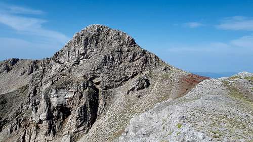
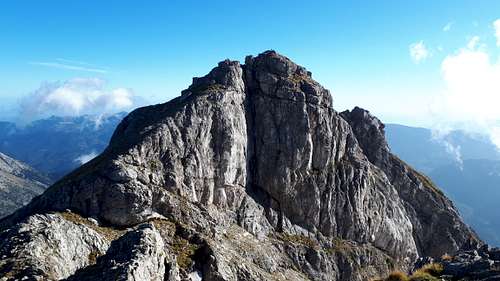
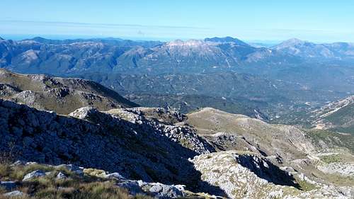
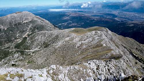
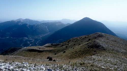
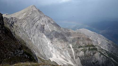
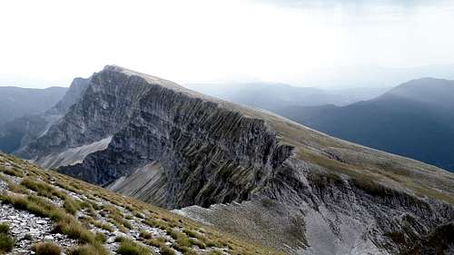
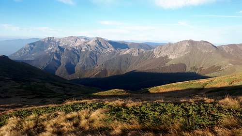
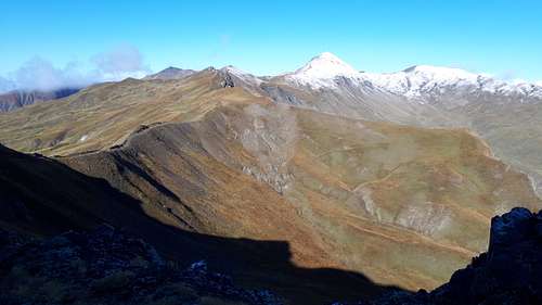
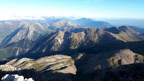
The early ferry enabled me to climb steep scrubby Albanian border peak Maja E Murganes in the afternoon, and then the impressive Nemerçka the following day before bad weather arrived. Nemerçka was the longest and best outing of the trip, involving 2000m of ascent and a 25km round trip. Having previously failed from the west, this time I followed the long undulating ridge from the south, initially via a good track, then contouring past half a dozen summits (and avoiding three separate dog-protected sheep flocks) before reaching the steep drop where I’d turned back in my 2016 attempt. Now with better weather and more time, I found a scrambly gully descent, and then a gap in the crags led easily up to the remote summit, impressively situated at the brink of a 10km line of cliffs. I returned via the summits I’d avoided, battered by squalls and rewarded by rainbows and stunning light.
I’d planned to climb Gamila next, but it’s too good a peak to climb in the rain, so I headed east, climbing Mavrovouni the next day, navigating a maze of forest roads to a wooded summit with old stone structures keeping the trig point company.
Relocating east was perhaps not the best decision in retrospect, as I was to run into unforecast rain in the northeast 3 days later. Boz Dag is the first of several Turkish-sounding peaks, a long roughish drive-up, with a slow puncture forcing a tyre change partway up, a sunset summit then a careful descent nursing a doughnut space-saver tyre.
Next day I made an early morning ascent of ski-resort Falakron
I then tracked down a tyre repairer – in the town of Drama
Then with heavy rain due the next day, I squeezed in namesake Ahlat Chal before nightfall. The long rough drive-in was complicated by a broken-down van halfway, with barely room to pass.
Next day my least-worst option in heavy rain was wind-farm drive-up Kodzhaele on the Bulgarian border. I should ideally have climbed Papikion Óros next, but knew the approach track would be too muddy to drive. So I drove west past it, and next day climbed Óros Orvilos on the Bulgarian border
and nearby Sivri; both peaks good half-day hikes.
I then doubled back east to at last climb the much-delayed Papikion Oros, a multi-summitted scrambly ridge which was well worth waiting for.
With time spent working around the unexpected wet weather, I was now under some pressure to complete the remaining peaks, with just a week to go and more wet weather due. The afternoon’s challenge was to reach and climb Porta on the North Macedonia border before nightfall. The drive north from Thessanoniki was quite eerie: with the North Macedonia border closed (Covid-19), for the last 10km of wide dual carriageway mine was the only vehicle. I turned off just before the border, which presumably was manned by a few bored armed guards. With a long tricky drive-in, Porta wasn’t climbed until the next morning
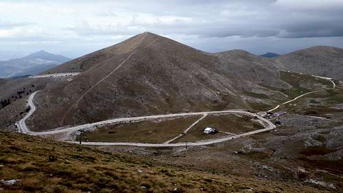
followed in the afternoon by Tsanatksi, an interesting limestone peak approached by an unpaved road with an unexpected steep rocky ramp which tested my driving skills. I’d also hoped to bag Sinaitsikon that afternoon, but I first tried the wrong road and then was turned away by the wind-farm security as the site closed at 7 PM - the peak would have to wait a day or so. Next day I climbed Pieria Ori (bad road, nice hike)
and in the afternoon, Drisinikos via its fine rocky NW ridge.
Then with forecast rain luckily falling overnight, next day I summited 3 easy peaks; beautiful easy Vounasa
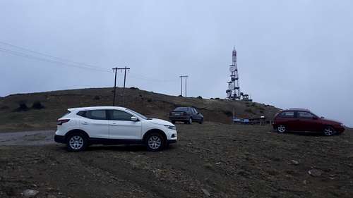
and wind-farm peaks Siniatsikon (postponed from the day before last)
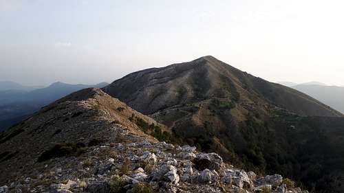
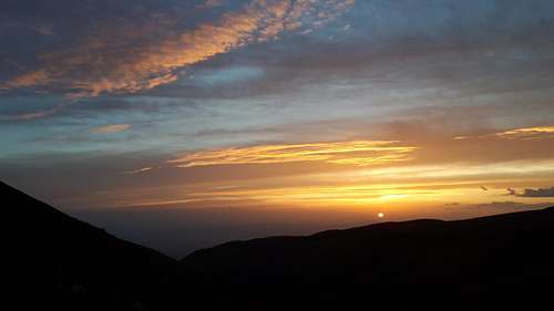
Siniatsikon looked very good in the late afternoon sunshine
My final few days took me west then south to collect a few peaks missed on the way up. I’d climbed the previous day's three peaks in sunshine while rain persisted further west, clearing away in time for me to climb Albanian border peak Gramos the next day, a good 24km outing with some nice ridge walking. There I encountered the first snow of the winter, and at the summit I met a couple who had driven their VW Transporter almost to the foot of the peak – I’d been out-drive-upped again!
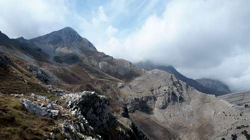
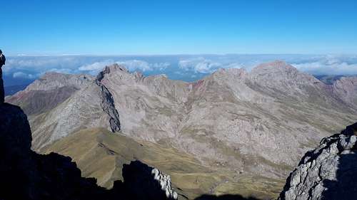
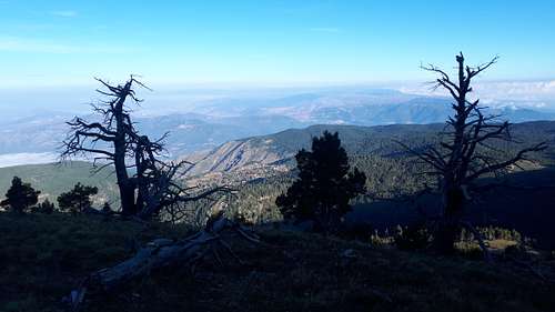
Before the Gramos ascent I had to fit the spare wheel – another slow puncture. Luckily Google Maps found me a tyre repairer in Konitsa at the foot of my next peak, Gamila. My repair man recommended a stroll along the Aoos Gorge, which has a fine old stone bridge and a view up to the summit of tomorrow’s peak. Gamila was the peak I’d postponed 8 days earlier as it was too good to climb in the rain. I was to climb it in the rain after all. One of Greece’s best peaks, it is approached via a long distance path, climbing in easy zigzags beneath impressive cliffs to reach the Astraka refuge, closed for the season and providing scant shelter as I cowered outside to put on extra layers and waterproofs. After a steep 200m descent, I left the LDP for a cairned route passing through nice limestone scenery, albeit in mist, before climbing more steeply to reach the cold windy summit, perched above the cliffs I’d looked up to from the gorge the previous afternoon. Next, I headed south for my other postponed peak – Skhizokaravo - having found a route to the trailhead that didn’t involve washed-out bridges. It wasn’t until next morning, when I awoke to a thunderstorm, that I realised the forecast had changed. So, after some prevarication, I made a six-hour drive southeast to the south end of Euboea, Greece's second largest island, for Okhi Oros. A new wind-farm road made this an easy ascent, to an interesting summit with two nearly-equal rocky tors.
That evening I made it back to Skhizokaravo, climbed next day (third time lucky) in good conditions, with a view which was worth the wait.
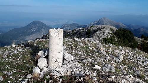
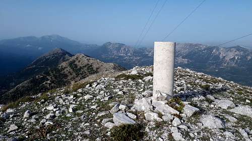
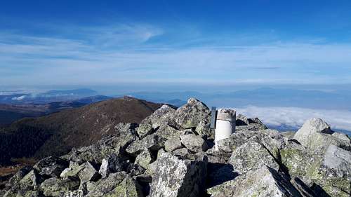
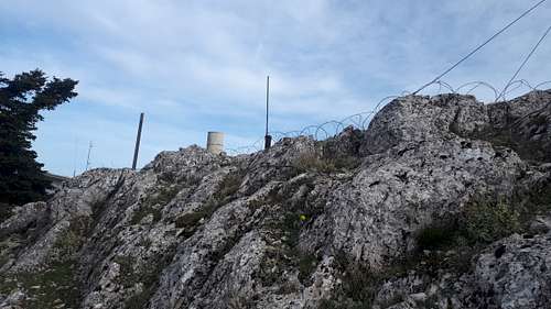
My final peak Óros Párnitha on the outskirts of Athens, was one I’d failed to summit in 2011, arriving after dark to discover it was a secure military site. In daylight, and with a useful Peakbagger report by Robert Murray, I discovered that the highpoint is accessible, on the fenceline just next to a Radome.
An unexpectedly good end to an excellent trip. I flew home, to a UK suffering rapidly increasing Covid-19 infections, sadly to be followed before too long by Greece.