
-
 9414 Hits
-
 75.81% Score
-
 6 Votes
|
|
Route |
|---|---|
|
|
46.51160°N / 11.57600°E |
|
|
Download GPX » View Route on Map |
|
|
Hiking |
|
|
Summer, Fall |
|
|
A long day |
|
|
Hike |
|
|
Overview
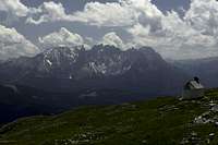
 Rosengarten and Latemar from Tschafatschsattel Rosengarten and Latemar from Tschafatschsattel |
The Bärenfalle trail (= bear's trap) is one of the more strenuous hikes to the Schlern plateau. It starts at around 1200m and tops out at 2563m thus covering an elevation gain of 1300m, which with ups and downs will amount to roughly 1600m overall. It is a very steep trail and thus is very hard to descend. Bärenfalle is a narrow gorge on brittle ground and in its middle section a system of bridges and staircases has been set up to protect it.
After exiting Bärenfalle in Tschafatsch Sattel a traverse leads to a second but less steep slope, which gradually turns into the meadows surrounding Schlern's central highpoint, Petz. The route can be combined with the route through Bärenloch (bear's hole) into a very strenuous loop, especially if you take Maximiliansteig, the ferrata between Roterdspitze and Großer Roßzahn, to connect the two.
Approach
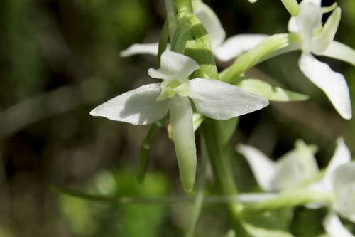 Platanthera bifolia
The trailhead is at Weisslahnbad (Bagni di Lavina Bianca) in Eggental. You can reach it as follows:
- Take Brenner Motorway A22 to the exit Bozen / Bolzano Nord
- Switch to SS12 northward until you reach Blumau / Prato Isarco
- Switch to SP24 for a little more than a kilometre, then follow the signs to Tiers / Tires
- Drive through the village to the end of the road at Weißlahnbad / Bagni di Lavinia Bianca
Route Description
- General:
- Start altitude: 1200m
- Summit altitude: 2563m
- Prevailing exposure: S
- Type: Hike
- Protection: Bridges and some chains in the steepest section of Bärenfalle
- Start altitude: 1200m
- Effort: 3 - 1350m elevation gain
- Power: 3 - Long and Strenuous
- Psyche: 2 - Some exposure before you reach the bridges exposure
- Difficulty: 2 - Very steep ascent
- Orientation: 1 - Marked and easy.
You start from the road, which leads from the St. Cyprian / San Cipriano Chapel towards Tschaminschwaige / Rifugio Monte Cavone. The Bärenfalle Trail turns off some 100m west of a road intersection (parking space here, also a busstop). It quickly gains ground, then turns eastward, following the road to the hut for a brief time. Soon, however, it turns northward and negotiates the south sllopes of the Schlern / Sciliar Massif, heading for the Bärenfalle notch. A long traverse leads into the mouth of the gorge which is climbed very steeply.
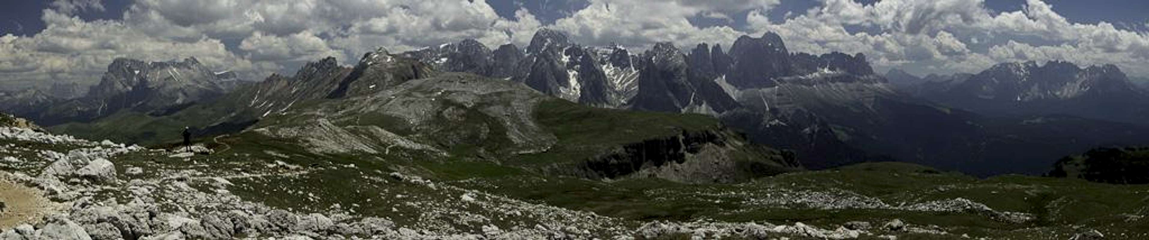
 |  |  |
First, the trail stays on the eastern side but soon starts switching back and forth through the gorge. It climbs a promontory in a multitude of switchbacks, which offer better and better views through the gorge towards the Latemar Group. Once above the cliff the trail heads for a very brittle passage, which has been secured by a multitude of bridges and staircases. With their help you reach above the most serious section, now heading for the western side of the upper gorge. Here it gradually climbs ro the topmost saddle, Tschafatschsattel / Sella Cavaccio.
 |  |  |
Traverse to the other side of the saddle and at the trail intersection a few steps beyond, take the right hand trail (the left hand one would lead you to Sesselschwaige / Rifugio Alpe di Seggiola, which is also a possible route but you lose some 150m elevation). The path now runs north-eastward, following the bounding slopes of the saddle underneath, often offering good views down upon the hut.
 |  |  |
Finally, you head out of the cauldron into a shallow valley, which more or less heads northward across beautiful flower meadows. To the left (west) you can see a waterfall cascading down from the plateau. The path passes it on its northern side to reach a small subplateau with a little chapel on it (St. Kassian / San Cassiano). Now heading north-westward you'll see the destination of the next stage, Schlernhäuser / Rifugio Bolzano, which is reached from the south-east. From Schlernhäuser / Rifugio Bolzano a few steps take you to Petz / Monte Pez for the obligatory panorama.
You can head on towards Burgstall / Monte Cavallo and the ultimate end of the Schlern / Sciliar Plateau, right above the Euringerspitze / Punta Euringer and Santnerspitze / Punta Santner.