
|
|
Route |
|---|---|
|
|
37.95539°N / 107.10288°W |
|
|
Hiking |
|
|
Spring, Summer, Fall, Winter |
|
|
A long day |
|
|
Class 2 |
|
|
Driving Directions
These are some of the easiest driving directions ever. From Lake City, take SH-149 south to Slumgullion Pass. From there it's another 7 miles or so to Spring Creek Pass. Park at the campground on the west side of the highway. During the snow season, this campground is closed, but there is usually a small pullout that is open for parking. You can also access Spring Creek Pass from Creede. Drive SH-149 to Spring Creek Pass; you can't miss it!Route Description
 Climbing PT 13,162
RT Distance: 14.0 miles
Elevation Gain: 5000'
This route allows you to hike to the summit of all four 13ers in the Baldy Cinco group. From Spring Creek Pass, start hiking the Colorado Trail east. With deep snows, the trail isn't going to help you much, so you may elect to hike directly on the Continental Divide instead. Another option is to use the series of roads just south of the pass that also lead to Snow Mesa, which you may find have been packed by snowmobile traffic. Just don't get turned around on the roads, if you choose this option! After a 1400' ascent through the forest, you'll find yourself at the western edge of Snow Mesa's flat expanse.
Here you have to make a choice: do you want to start bagging peaks first, or do you want to make the trek across Snow Mesa to start? If you're hiking these peaks when Snow Mesa is covered in snow, I'd like to gently suggest that you traverse the mesa first. In the afternoon, once the sun has had time to bake the snow's surface, you could end up with over six miles of postholing hell, whereas if you cross the mesa in the early morning, the snow might be crusty enough to support your weight. Either way, snowshoes are a must!
Cross Snow Mesa – all 4.5 miles of it! You'll see Colorado Trail signposts poking up from the snow, and it's not a bad idea to follow them. You'll pass by three of your four 13ers. As you approach Snow Mesa's eastern edge, you'll see a buttress protruding from PT 13,162. Once you've passed this feature, you can begin heading north, and you'll catch a fleeting view of the first peak you'll summit, PT 13,510. Enter the small hanging basin southeast of the saddle between PTs 13,162 and 13,510. Here you have another decision. You can climb 13,510's south slopes, or you can climb its southwest ridge directly. When dry, the southwest ridge's difficulty doesn't exceed Class 2+, but there is some loose rock and some minor routefinding to contend with. Going either way, you'll reach a minor 13,180' subpeak before you can climb the last 370' up 13,510's south ridge. Finally, after seven miles of hiking, you've reached your first summit!
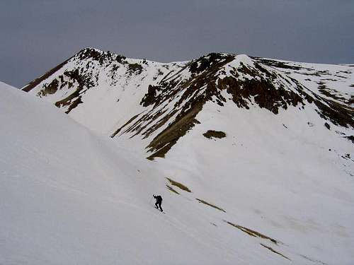
Descend back down 510's south ridge. Again, you face the same choice as before: descend 510's south slopes, or descend the southwest ridge directly to the 12,540' saddle between 13,510 and 13,162. If you're hiking during the snow season, you'll now face the crux of your day, the steep climb of PT 13,162's east slopes. Climbing the peak's east ridge directly isn't a good option because of the cornices that guard the top of the ridge, so you'll want to make southward ascending traverse before you can turn west and climb toward 162's upper heights. The maximum angle of this slope is somewhere around 28 degrees, so an ice axe isn't a bad idea. Once the slope's angle relaxes, it's just an easy walkup to 162's summit.
Next, hike the Continental Divide to Baldy Cinco's summit. There are no obstacles to speak of along the way. From Baldy Cinco, leave the Divide and proceed northwest to the final summit, PT 13,313. This peak is perhaps the most dramatic of the four with its steep, glacially carved west face.
Now it's time to return to Spring Creek Pass. Descend 13,313's south slopes to the East Fork of Cebolla Creek, and then make a short ascent back to the top of Snow Mesa. Turn southwest to return to the Continental Divide, and return to the pass via your ascent route. Congratulations! You just climbed four thirteeners in a day!