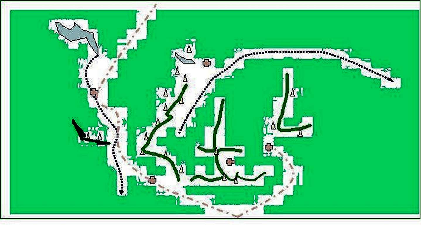
This is a diagram of southern Baxter Park. The two roads originate at the southern gate house and are shown in pink. The short one goes to Roaring Brook campsite-a swiss cross. The longer one goes past Katahdin Stream Campground and through Nesowdnehunk Field near Newsowdnehunk Lake. Russell Pond campsite is the swiss cross in the middle by Wassataquoik Lake. The green ridge looking like a Chinese Character is Katahdin. The right L is Turner. The mountains to the far left are the Doubletop complex. The L shaped ridge in the middle is the Katadinough including Owl, OJI, Brothers.
The left stream is Newsowdnehunk and the right stream is Wassataquoik.
The Swiss Cross in the middle of Katahdin is Chimney Pond Campsite


