Comments
No comments posted yet.
|
|
Trip Report |
|---|---|
|
|
44.13804°N / 73.84438°W |
|
|
Nov 16, 0000 |
|
|
Mountaineering, Trad Climbing |
|
|
Fall |
Upper Wolfjaw's Beaver Brook slide (https://zoom.earth/#view=44.138182,-73.843811,18z) is a rubble-strewn streambed that leads to a series of cliffs and ledges for a couple hundred vertical feet before the upper slabs. The White Slide, also a technical slide, and Beaver Brook slide meet at their tops.
This was typical early-season ice hunt at the upper Adirondack elevations. No ice had formed in the usual roadside haunts. We expected to get into some scrappy, thin climbing and it didn't disappoint. I generally look on the NW aspects this time of tear, but decided to roll the dice on this target since Loren Swears, my long-time partner in this, had expressed interest two years ago. As usual, I was unsure at what elevation the ice would begin, or in this case, whether there would be ice at all. Its southerly aspect makes it prone to baking though it seemed like a reasonable bet given recent rains and cold temperatures at elevation.
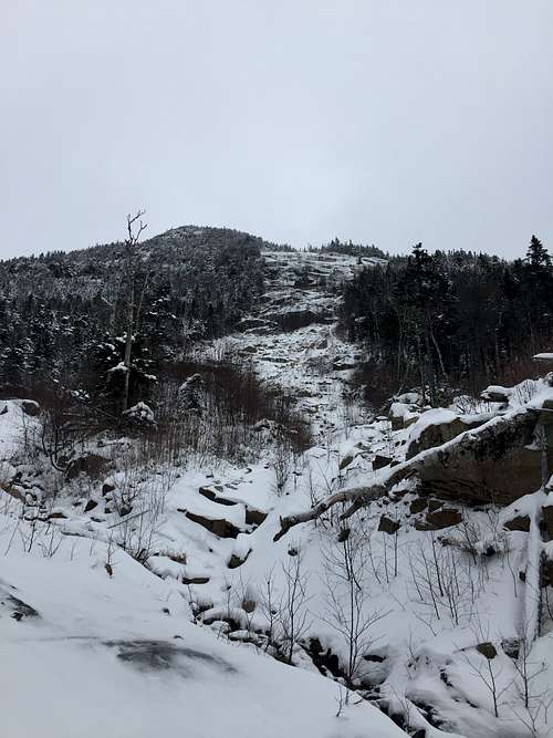 Above: The slide as viewed from below.
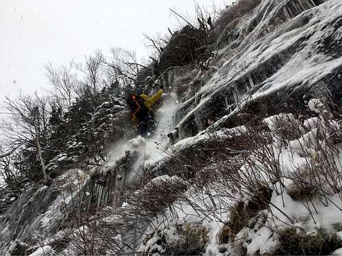
 Loren and I started from the AMR at 7:30. Mud and eventually some snow could be found on the trail and in the drainage. The rocks were still warm enough that they weren't coated with ice--rock-hopping was easy if not tedious. We passed the White slide drainage, then Armstrong's East Face drainage. Beaver Brook's cliffs then came into view. I held my breath as I scanned for ice. Loren spotted a line on the footwall that looked ok from afar. It was clear that this was a challenging way to start the season, but a good way to ascend the first pitch. I studied the mostly-bonded smear and a slightly thicker and better bonded flow along a crack. A constriction would take a nut, a pod a tricam, and cracks higher and on the left would project what looked like the crux of the WI4ish line. Whether I had the fire to start the season with a narrow run was a different story.
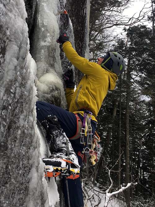
Dialing in the layers, gear, and my lead head are always "interesting" on each first winter outing. It had only taken 3.5 hours to arrive at the climb, so we had ample time to work things out as we progressed. A half dozen feet off the ground I arrested a fall when my left foot ripped a sheet of ice off. Using wide feet to stabilize was not an option. The climbing wasn't straight forward kicking and swinging. It involved using various techniques with the tool to keep my feet stable. Gravity constantly pulled me to the left and the crux kicked me back a few degrees from vertical. While the ice was fine for climbing and well bonded to the cliff along the crack, it was still forming elsewhere, so pieces tore off easily. Solid hooks below the crux and good protection allowed me "trust" the thin sticks above. A couple big moves placed me atop the cliff and safely near a large birch.
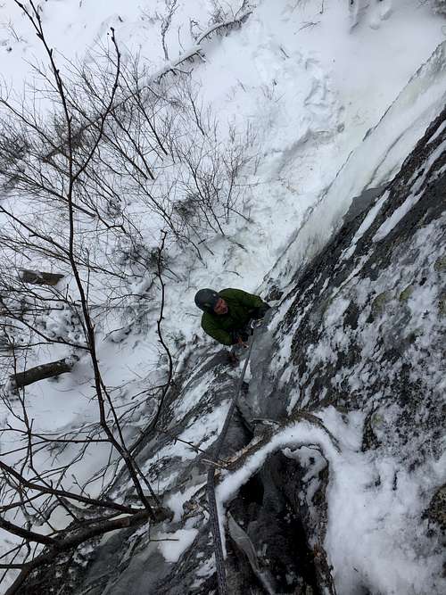
I pulled the packs up and then belayed Loren. He expressed the same sentiments about the climb; though short, it was engaging. Next, we climbed small ledges to the center of another wall. There were three options on the 200'-wide wall. I feared possibly unbonded ice atop the newly forming smears. After trying a few moves on the center line, I walked left where the ice looked thicker. The next hundred feet of elevation gain involved a series of sketchy short climbs with meager protection via slung trees...mixed with thrashing at each top-out (the moss and blueberry bushes were not frozen yet). We made progress over two more rope lengths using all the tricks I knew for scrappy climbing and arrived at the bottom of the slab. I stayed close to the edge on the snow covered, 40 degree sloped slab. Scratchy. My final belay was at the junction of the White and Beaver Brook slides. Steeper, snow covered slab was above.
A traverse along a southerly-aspect slab through thigh-deep snow led to a nearly vertical corner involving krummholz climbing. I set up an anchor from a pine and we ended the climbing portion in the dense summit forest of the false summit of Upper Wolfjaw. Thirty minutes later via dead-reckoning we located the summit. A few minutes' rest and repacking found us scooting down the trail to the UWJ/LWJ col. Darkness settled as we exited east; the car was 4.5 miles away. We were well below the ice zone, so snow over mud was the normal until the West River trail. The Ausable thundered in the chasm below...the last wild memories of a good day. Some 11.5 hours after starting, we arrived back at the cars.
The trip ended up being an ideal way to dial the systems and start the season on a good note.
Above: Loren following P1. Below: Kevin leading P1, Kevin on the ledges. Photos by Loren Swears.