
|
|
Mountain/Rock |
|---|---|
|
|
47.77713°N / 120.64439°W |
|
|
Chelan |
|
|
Hiking |
|
|
Spring, Summer, Fall, Winter |
|
|
2665 ft / 812 m |
|
|
Overview
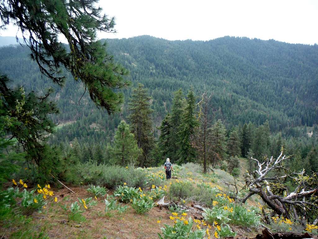
Fields of Balsamroot
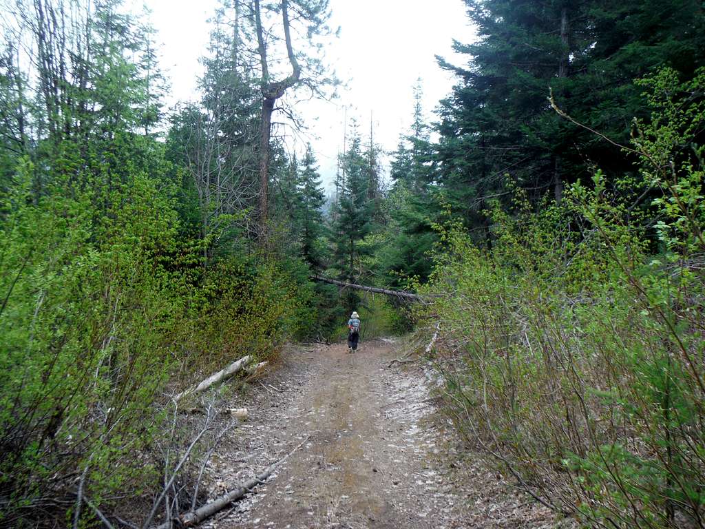
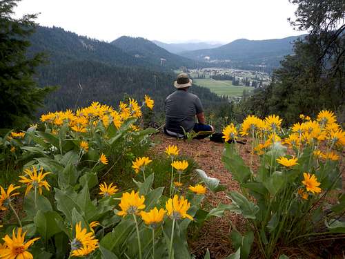
Bee Sting Hill right by Plain, Washington is one of the neat hole in the wall type summits that often surprise peakbaggers with good views. The hill itself has 625 feet of promenence and at least by the northern route it will be 3 miles and 600 feet of elevation gain provide one does not want to take the road up to the gap. That is rough road and 4 wheel drive is required to drive it. There is a short parking area actually on the road right by the main road. If one does it can shorten the actual hiking considerably and make the elevation gain more like 300 feet. It is a special little summit that is not very popular with hikers but it does seem popular with locals. Once on the summit of Bee Sting Hill there is an excellent view south towards the town of Plain. The summit actually even as a summit sign on it to mark the location. This would be a great summit to visit in winter and spring. On a clear days views one can also get a good view of Plain Ridge, Natapoc Mountain, Beaver Hill and Icicle Ridge in the background.
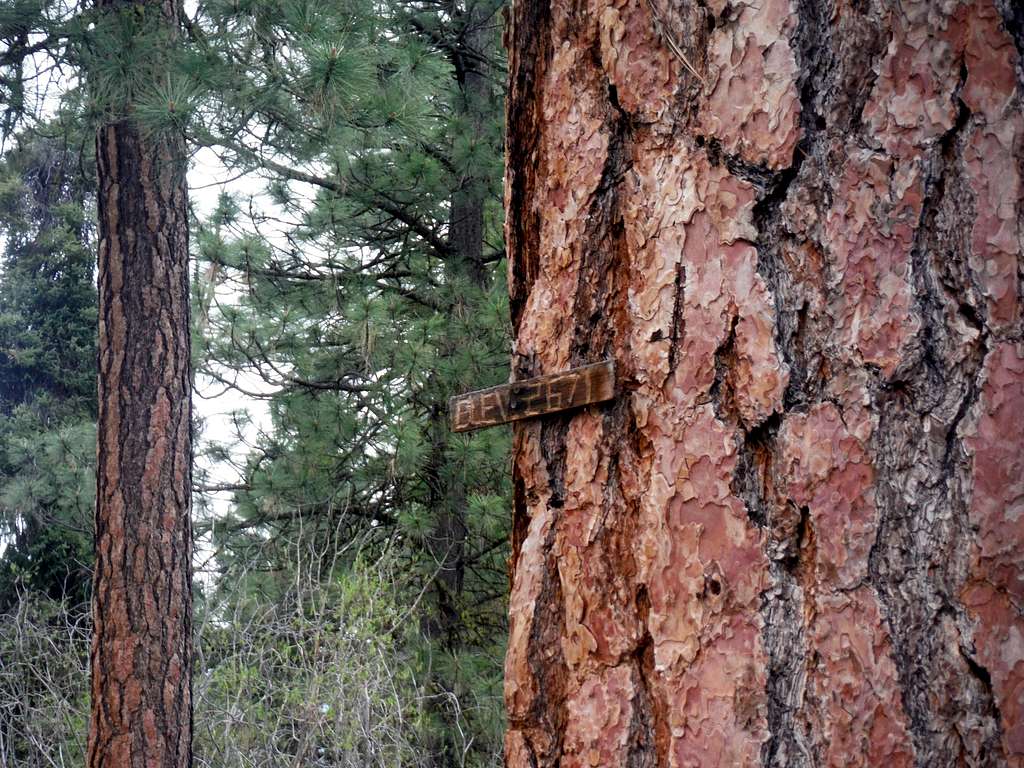
The summit sign
Bee Sting Hill is also one of those very changable summits. As of right now one can access the true summit without crossing any No Tresspassing Signs though this may change in the future if the area around the peak continue to develop. There is a road on the north side of Bee Sting Hill that goes up quiet a ways up. From there one can intercept a bootpath that will go all of the way to the true summit where the good view to the south awaits. There is also a well defined bootpath that is coming from the west as well though I have no current information on this bootpath from the west.
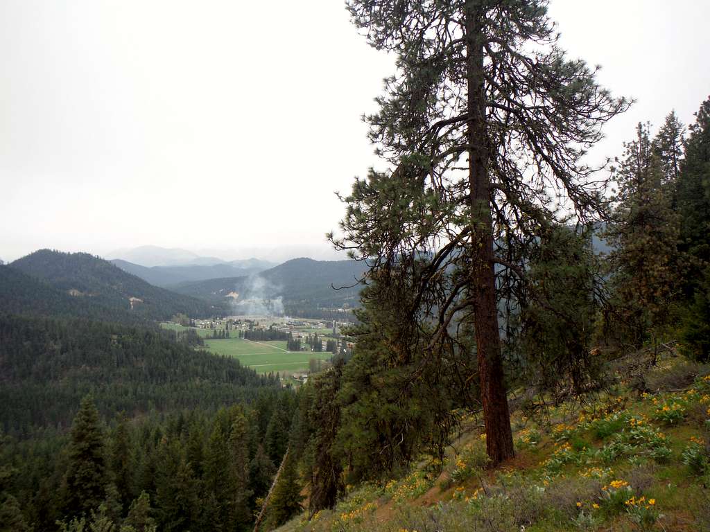
The town of Plain. This is the classic shot from Bee Sting Hill.
Getting There
If coming from Stevens Pass take US 2 20 miles east from Stevens Pass. Make a left onto Highway 207 and head east for 3.8 miles until you reach the town of Plain. On the north side of town make a left onto Route 22 (Chiwawa River Road) and take that 2.1 miles until reaching the intersection with Shugart Road. There will be an unmarked jeep path on your left hand side turn there. Go on as far as you feel comfortable.If going north from Leavenworth take 209 north all the way into the town of Plain which is 14 miles. Veer right on the north end of town onto Route 22 (Chiwawa River Road) and take that 2.1 miles until reaching the intersection with Shugart Road. There will be an unmarked jeep path on your left hand side turn there. Go on as far as you feel comfortable.
![Main route to the summit]()
Main route to the summit
This route is a standard walk up. There is also a well defined bootpath coming up from the west though I don't have any information on it at the present time.
Route
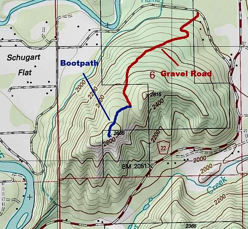
Main route to the summit
Going down the Gravel Road
Red Tape
No red tape as of now. Stay on route though because there is private property all around this summit.When to Climb
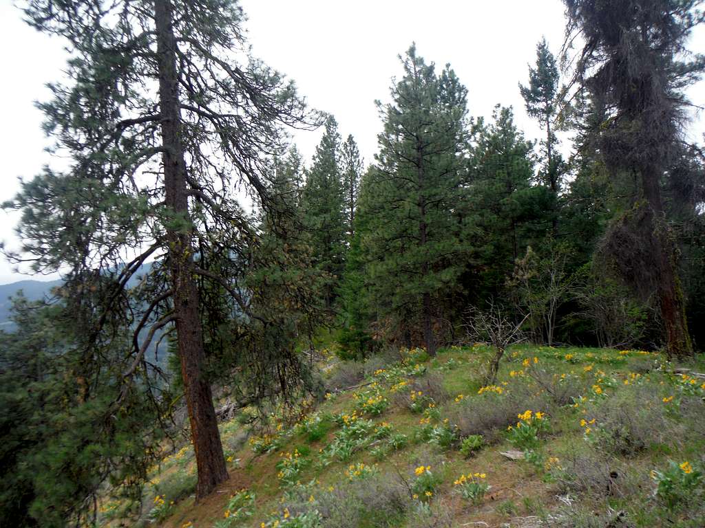
More slopes of balsamroot. This is a great sign on spring in the eastern Cascades!
Flower Patch