|
|
Route |
|---|---|
|
|
39.98430°N / 112.5406°W |
|
|
Hiking |
|
|
Half a day |
|
|
Class two mainly |
|
|
Overview
North Pine Canyon has a road, rough, requiring high clearance and ear plugs. The ear plugs are for the awful scratching noises you will hear when you take your vehicle up that road. If you cherish your paint job, park just after you pass the last fence post you see and just before you enter the woods (such as they are). It adds about a mile each way but could save you a big bill on your paint job. My truck proves it.
I found the way I had studied to work out fine and offers a good way to
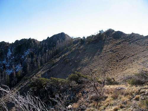
get to the top of not only Black Crook Peak, but also Peak 9257. Even with this route report, you will still need to do your homework. Study the map and plot a way up the ridge. I kept to the left of the ridgeline most of the time but in several places you will find your self on top of the ridge.
More detail forthcoming (I'll provide some topozone links to coordinates I took on route)
Getting There
As mentioned on the front page, head for Vernon, Utah. Highway 36 is your magic carpet and whether you choose to come from the north or the south, you need to get to Vernon. Just a bit east of Vernon where the road curves to the east and Eureka, a paved road comes in at an angle. This is Sharp Road. Take it and head west, passing Main St. and continuing on until you reach Harker Road. On the right side of the road is a sign forYates Road. Turn left (south) on Harker road (still paved at this point) and follow it south. The paved road will turn into a dirt road and you stay on that until you reach a dirt road that goes west. That will be FS 559. Follow it until it reaches a junction and take FS 601 and stay on this one right up into the canyon. From Vernon at Sharp Road until where I parked my truck (with lots of new scratches), it was 10.1 miles. I could have driven further up the road but I had had enough. I parked and walked up the road another 4/10's of a mile before I cut off the road into the brush and upwards as I sought out the ridgeline.
Route Description
Initially you have to work your way through the brush and I shudder to think what this would be like during tick season (Another reason why I love fall hiking).You could park at any point along the road and start walking or you could drive to the end, your call. The road isn't terrible, it has its rocks and ruts but the shrubbery (call them bushy trees) will exact a price in your paint job unless you have a very narrow vehicle like a jeep or an atv.
UPDATE Topozone was the basis of the following and is now not available (except for a fee) so I will just publish the GPS readings which are
lat / long nad 27
I left the road here:
39.99744 -112.52365
and started up through the brush until it eased off and then I hit this spot:
39.99546 -112.52648
Continuing on, my next waypoint was taken:
39.99352 -112.52814
I just kept following natural lines and took my next waypoint here at 8100 feet:
39.99183 -112.53137
My next waypoint was taken at 8700 feet:
39.99053 -112.53592
Merely 400 feet higher, I stopped and waypointed again
39.98867 -112.5395
Of course, at this point, I was near my real objective, the saddle between both Black Crook Peak and Peak 9257. From this point it was a matter of following the logical contour to put me at the base of Black Crook Peak where I began a class three (easy) scramble to put me on the summit.
This line worked well for me and I pass all the waypoints along as an aid if you like to work with a GPS. The total distance isn't that great as you can see from the stat's but if you are solo as i was, this is not a place to break an ankle or a leg. I'd recommend you take a friend and it will not only safer, but more enjoyable. For those with good cross country skills, I think you will enjoy this route.
Round trip: 6 miles
Elevation gain: 2200 feet
Time: Plan on half a day (4 to 6 hours)
Update: Recently Ken Jones and John Hamaan went up this route. You can find his trip report and GPS track HERE.
Pics
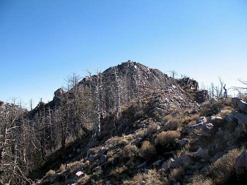
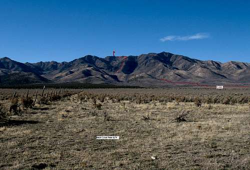
The ridge I followed is in the center of this picture. I ended up staying mostly to the left side of the ridge except at those times when the ridge narrowed considerably.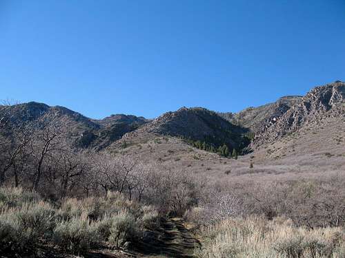
Essential Gear
If by yourself, carry survival gear, meaning lots of water (this area is dry) unless snow available, warm clothes and extra food. Let someone know where you have gone and leave a trip itinerary. You'll need a high clearance vehicle to get close to the peak and I found that my cell phone worked near Vernon and on the summit. Not anywhere else.Good boots are a necessity. I also found trekking poles to be super important to me.
Maps

Area map

Route Map
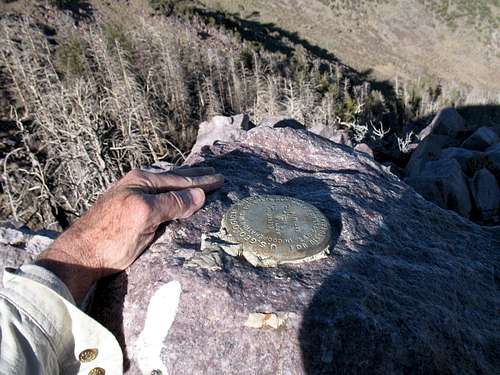
Atop the summit, the holy grail is hidden