
|
|
Mountain/Rock |
|---|---|
|
|
33.82005°N / 111.49436°W |
|
|
Maricopa |
|
|
Hiking |
|
|
Spring, Fall, Winter |
|
|
3570 ft / 1088 m |
|
|
Overview
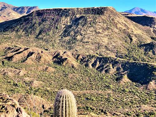
Black Mesa South is the unofficial name of Peak 3570, a mesa off of the Beeline Highway. There are plenty of small summits along the Beeline Highway, but what makes Black Mesa South stand out is that it makes for an excellent day hike.
First of all, it has a very accessible trailhead. In addition, a road leads to the base of the mesa within 310 feet of the summit. It isn’t crowded like popular Phoenix trailheads, and it isn’t too far from east valley communities like Mesa and Scottsdale and Tempe. Best of all, when you're there, you don't see rows of homes and civilization common for hikes in the Phoenix valley.
There are some drawbacks. The trailhead isn’t particularly easy to find unless you know what you are looking for, and the route is unmarked. In addition, the final stretch to the summit is off-trail, and while there is a summit register, the actual summit isn’t completely obvious. However, just a little bit of review of maps should mitigate these drawbacks.
All this being said, Black Mesa South is a pretty attractive, albeit obscure, summit that offers an easy day hike without crowds. There are some other summits accessible from the same trailhead, including Peak 3020 to the south and Peak 3052 to the west. However, both of those summits require bushwhacking.
Black Mesa South is 0.7 miles south of the more prominent Black Mesa 3,832’. The two are not normally hiked together because of a steep drop off between them and different primary access points.
Hiking Black Mesa South in summer is not recommended. Ideal times are November through March.
Getting There
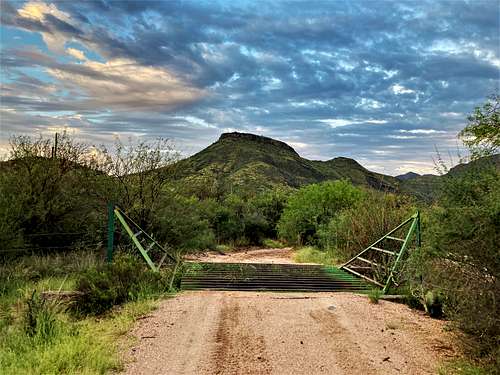
From the Phoenix metro area, take the Beeline Highway (87) for 23.8 miles north from the junction between Shea Blvd and 87. There is a turn off on the left, which is easy to miss. It is a little over two miles past the Ballantine Trailhead. Cross over 87 Southbound lanes and take a left to park at a large dirt trailhead.
Route
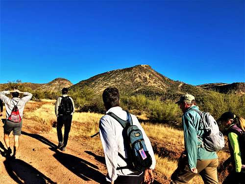
From the trailhead, walk down the road which curves to the right, and then take a right. There is a road, which is pretty much a wash. It’s not great for vehicles, but totally fine for hikers. After about a quarter mile, the road curves to the right. Take this road as it heads up to a small ridge. Continue along this ridge past the west side of Black Mesa South. After about 2 ¼ miles from the trailhead, a saddle is reached. From here, go off trail towards the mesa. The first bit is easy walking through high grass. The second bit has some steep and rocky terrain, but nothing particularly treacherous. The off-trail section to the summit plateau is only 250 yards long, with the first 150 yards in the high grass gaining about 105'. The last 100 yards is rocky and steep, gaining about 135’.

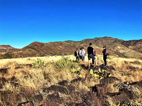
Once on top of plateau, continue to what appears to be the highest section and look around for a register. It is about 230 yards the southeast once on top of the plateau if going directly up there from the saddle. There are a few rock piles in the summit area that could be the actual summit and are at a similar height. It’s generally pretty obvious to find the summit once on the plateau. Watch out for cactus, which is plentiful on the off-trail section, but easy to avoid.
The total hiking distance is a little over 2 ½ miles, with an elevation gain of approximately 1,250’.
Once back at the saddle, you can continue along the road up and over a saddle to the north. On the other side are a couple hills covered in quartz rock that are worth a visit if time permits.
Red Tape
There is no red tape of note. The trailhead and the route are within Tonto National Forest.