-
 16198 Hits
-
 85.87% Score
-
 21 Votes
|
|
Mountain/Rock |
|---|---|
|
|
43.63521°N / 110.69299°W |
|
|
Hiking, Sport Climbing |
|
|
Spring, Summer, Fall, Winter |
|
|
7688 ft / 2343 m |
|
|
Overview
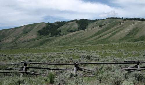
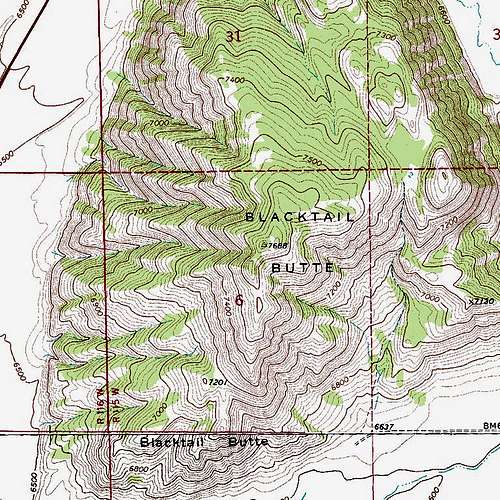
Blacktail Butte is a sage- and tree-covered peak in the Jackson Hole portion of Grand Teton National Park. I’m not positive it’s technically part of the Mount Leidy Highlands, but it for certain is not in the Teton Range, and I’ve attached it to the former because of its proximity and because it resembles that region in character.
This little peak has good views from its lower summit (trees cover the higher summit). The views include the Mount Leidy Highlands, the northern end of the Gros Ventre Range, and the southern portion of the Teton Range. The Teton views aren’t any different than those from the road except for being higher up, but it is more enjoyable to see the peaks from the position of solitude up here than it is from the crowded pullouts along the park road below. The reason I haven’t posted any pictures of those Teton views is that it was overcast the morning I headed up and all the Teton pictures I got were pretty ugly.
This is not going to be the big destination of the day for most people, but it has its appeal. It can be a good day hiking objective during months when snow and ice bar easy access to the Tetons, it can be something fairly quick and easy to do after work, or it can be a nice choice on a rest day. When I hiked up, I had just gone hard for eleven straight days and felt I could use an easy day before resuming the rigors of the high peaks.
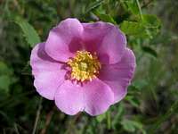
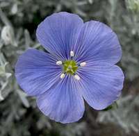
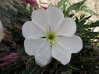
What I liked best about the hike on an early-July day were all the wildflowers. There was a pleasant mix of montane and prairie blooms on the peak.
There are a lot of ways one could approach Blacktail Butte. The route I used, and the one I describe here, seems to be the shortest.
Because it was a short hike, I did not bother to make a GPS track. Based on the time it took me, I estimate that the route to the summit is between two and three miles, closer to two. The elevation gain is around 1000’.
Sport Climbing
Purely by accident, while searching for climbing information on some crags along the North Fork Shoshone River, I discovered that Blacktail Butte is a popular location for challenging moderate and difficult sport climbs. Apparently, there is a near-vertical limestone wall somewhere by the northwestern corner of the butte. I don't know how many times I have driven by here and not even noticed that wall!
Anyway, it is beyond the scope of this page as present to document the climbing routes and conditions, but information is available at the Blacktail Butte pages on Mountain Project and rockclimbing.com.
It would be great if someone with experience on these walls would do some documentation here so I can remove to links to SP's competition!
Getting There and "Climbing" Information
Northern approach: From the main park road, turn onto Antelope Flats Road just south of the Blacktail Ponds Pullout. Drive east for approximately two miles and turn right onto Mormon Row, a dirt road passable to regular vehicles. Drive south for about three miles and find a parking area on the right. Along the way, you will pass some historic buildings and some privately owned buildings and land.South Approach: At Gros Ventre Junction, which is shortly after a bridged crossing of the Gros Ventre River, turn right from the main park road onto Gros Ventre Road. Drive about five miles to Gros Ventre Campground. About half a mile past the campground, turn left onto Mormon Row. The parking are isn’t even a quarter-mile up the road.
The hike: From the parking area, follow a trail to the base of the butte, and then find a trail climbing steeply up the ridges. Maps show a trail following a drainage up to a saddle east of the summit, but the trail I used stuck more to ridges than it did to any drainages. Regardless, the trail took me to a meadow area east of the summit and then vanished. I hiked across the meadow and into the trees in the direction of the summit and found a trail leading south; this trail is definitely not on the maps. The trail did not reach the actual summit but instead continued south, and from it I made a very short cross-country hike up to an open summit at 7600’, where I found the best views of the outing. Instead of retracing my route, I headed cross country south and east until I reached the sagebrush flats and returned to my car.
Red Tape
Because you do not have to pass through any entrance stations to get here, you are not responsible for paying the $25 park entry fee. However, other park regulations still apply, and you should check here on the park’s website to know what they are.You will usually see bison out here. Keep at least 100 yards away from bison as much as possible; they can be dangerous and have trampled and gored people before.


