Toggle navigation
Mountains
Routes
Images
Trip Reports
Forum
What's New
People
Areas & Ranges
Articles
Trailheads
Canyons
Huts & Campgrounds
Albums
Logistical Centers
Fact Sheets
Lists
Custom Objects
Gear
Plans & Partners
WELCOME TO SUMMITPOST
SIGN IN
REGISTER
West Fork
Additional Parents
Image
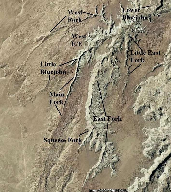
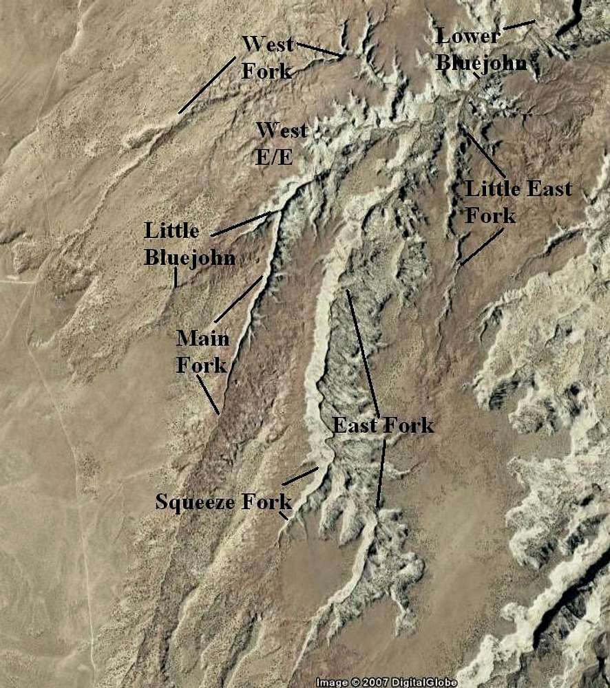
Bluejohn Canyon Forks Identification
View High-Resolution Image
Bluejohn Canyon Forks Identification
These are the major forks of Bluejohn Canyon. This map is for identification purposes and not to be used for navigation. Google Earth image.
« PREV
NEXT »
Scott
on
Jun 14, 2007 10:15 am
Comments & voting
Other parents
Lat/Lon:
38.39460°N / 110.2601°W
Image ID:
301330
18448 Hits
78.27
% Score
9
Votes
Log in to vote
Comments
No comments posted yet.
to post!
Don't have an account?
West Fork
(Route)
« PREV
Viewing
#2 of 15
GALLERY
NEXT »
Scott's Image Gallery
« PREV
Viewing
#525 of 8082
GALLERY
NEXT »
Little Bluejohn
(Route)
Loading....
Lower Bluejohn (Horseshoe Canyon exit)
(Route)
Loading....
Squeeze Fork Bluejohn
(Route)
Loading....
East Fork Bluejohn
(Route)
Loading....
Main Fork Bluejohn
(Route)
Loading....
West E/E Route
(Route)
Loading....
Bluejohn Canyon
(Canyon)
Loading....
×
You need to login in order to vote!
User Name
Password
Remember me
Forgot your password?
Log me out when I close my browser.
Keep me logged in all the time.
sign in as a user
Don't have an account?
Register now for FREE
Rating available
Suggested routes for you
People who climb the same things as you
Comments Available
Create Albums
Register Here


