Overview
![Boundary COHP]() View from the top looking west/southwest
View from the top looking west/southwestThe highpoint of Boundary County, Idaho lies on the ridge between Fisher Peak and Pyramid Peak just northeast of Big Fisher Lake. This is also the highest point in north Idaho (depending on what exactly you want to call "north Idaho", Rhodes Peak in Clearwater County is higher). Although the elevation is said to be 7709', it is probably a few feet higher, as the summit ridge is slightly higher the further south you go in the closed 7,680+ contour.
As well as being a county highpoint, this peak is an
Idaho Prominence Peak. It is
#20 on this list.
Getting There
![Boundary COHP]() North face of the highpoint, looking from near the saddle just east of the peak
North face of the highpoint, looking from near the saddle just east of the peakIn Bonners Ferry, take Main Street west off of Hwy 95, this will eventually become Westside Road. Go just over 15 miles, turn left on FR 634 up Trout Creek. Go 5.2 miles to the Fisher Trail 27 trailhead. These are all good roads. The trail starts at 4413' and switchbacks up the southwest side of the southeast ridge of UN 7680+. It crosses a spur of FR 2428 in the bottom of an old clearcut at about 5600'. The trail is faint as it continues up through the clearcut. Where the trail crosses the ridge at 7,400', you can either sidehill west on the south side of UN 7,680+, or walk up and over the top of it. When you reach the saddle between this point and UN 7709', make your way up through the boulders to the top. It is class 2 if you choose the correct route. Views from the top are spectacular. I climbed this peak over Memorial Day weekend of 2005. This was a very weak snow year in north Idaho, and I didn't reach any snow until 6500' By the time I reached the saddle though I was sinking in over my waist with every step. On an average snow year you would be better off climbing the peak a little later in the season.
Red Tape
![Boundary COHP]() Another zoomed photo looking southwest from the top
Another zoomed photo looking southwest from the topThis is a Grizzly Bear habitat area, so motorized vehicles are not allowed off of the main roads during certain times of the year. FR 2428 climbs higher on the mountain in the Ham Creek drainage, but it is overgrown and has a lot of downfall (don't ask me how I know), and is gated and closed to motorized vehicles, so it is not much help unless you are some type of rogue.
Camping
I camped at the bottom of FR 2428. It is not the greatest spot in the world but it works. There are other camp spots further up the Trout Creek Road.
External Links

 19665 Hits
 80.49% Score
 12 Votes
 View from the top looking west/southwest
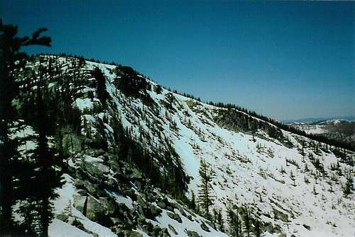 North face of the highpoint, looking from near the saddle just east of the peak
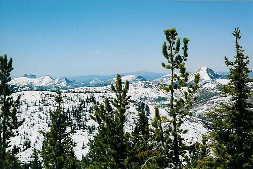 Another zoomed photo looking southwest from the top