
|
|
Mountain/Rock |
|---|---|
|
|
25.13818°S / 48.82157°W |
|
|
Hiking, Mountaineering, Sport Climbing, Scrambling |
|
|
Winter |
|
|
5459 ft / 1664 m |
|
|
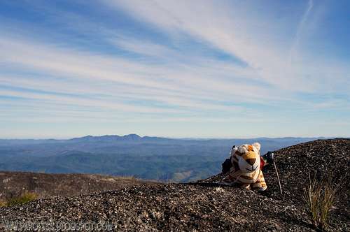
Summit

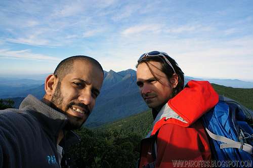
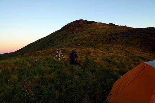
Sunset and Pedro Hauck.
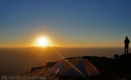
The sunset as seen from our camp.
The other summits are Capivari Mirim, Medium and Capivari IV, the highest one, Capivari Grande, has exclusive access and it's easier, since much of the path is traveled by car all the way up to the antennas at 1.277m high, steep road, though paved. The walk is in the open half the time and half in Foggy woods, where there are several tracks. Anyway you can't be lost since the main trail is marked by ribbons every 25 feet ahead.
Capivari Mirim is accessed from a supermarket next to the BR 116 road, where you can leave the car. The beginning of the walk is marked by old mines of extraction of granite. The trail is wide, and it has been used by trucks long gone. There is no water on the trail to the mountain, it is necessary to take everything with you.
When eventually the old road ends, you can find several blocks of granite of great beauty not yet explored by climbing. These chaos of blocks ends too and it begins the altitude fields, well maintained due to fires that occur on the mountain. The summit is also open grassland and there is the main access to Capivari Médio, which is the furthest mountain of the small Sierra.
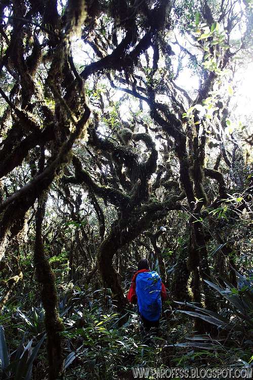
The trail to Capivari East was opened in 2008 and stays half closed due to little use. It is a beautiful path through the forest that requires little attention due to the lack of presence of people. If open, the trail to the Middle Capivari can be covered in just over an hour. If closed, then the situation becomes more difficult and will take approximately 3 hours.
Back to Capivari Grande, very, very beautiful mountain, little use of the trail although the past 12 months, after we published a page about it in Rumos, our website to share GPS files, people have been in the mountain more often, and the summit register is almost full!
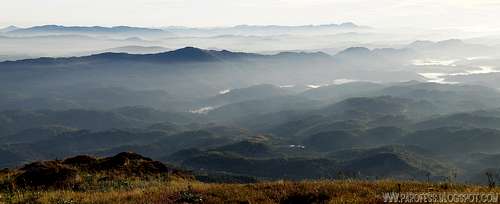
Summit informative view towards SOUTH

To access Ibitiraquire mountains page here in SP: https://www.summitpost.org/ibitiraquire-sierra/679828
These are the mountains you can see on that panorama! Almost all of them have a mountain page here on summitpost.
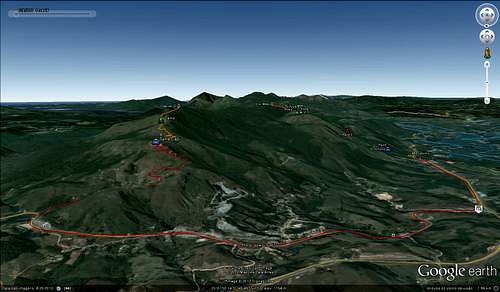
Getting There
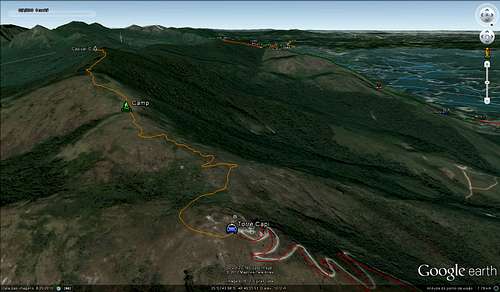
Follow the instructions on the kml file and you'll be fine, as easy as it can be.Helpfull images:
ZOOM IN TO LOOK BETTER TO THE WHOLE VIEW
A brazilian alpenglow I must say.AT 1.460m high.Comments
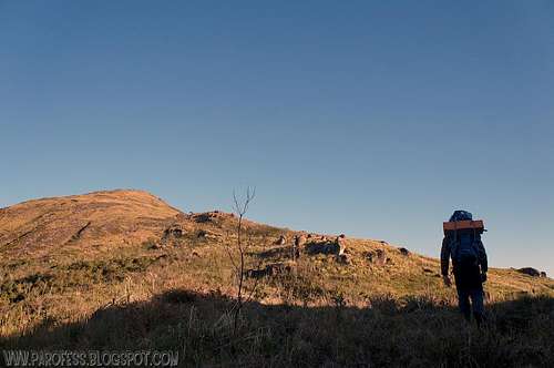
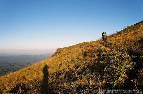
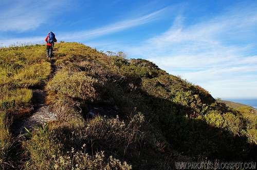
Starting to hike up.
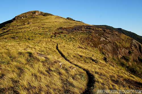
At 1.400m high, close to the camp spot.
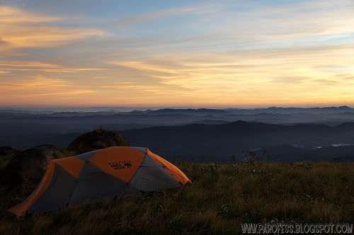
That is our place for the night.
The sunsrise.
Red Tape
Parking lot at the antenna;Well marked trail;
No fees at all.
What’s forbidden:
At all costs, don't make fire or deforest any places. Respect the nature and wildlife please!
Camping
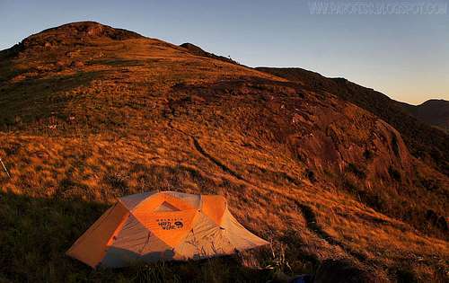
Anywhere you want, there is a very good place at 1.460m high with scenic view to sunrise and sunset.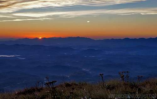
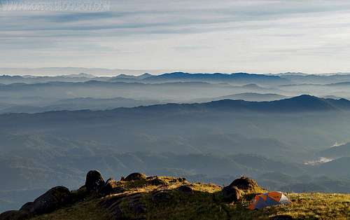
As seen from our camp.
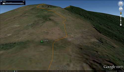
View from the point we chose to camp.
KML for download
Feel free to download the KML for that mountain in RUMOS.BRClick over the image to jump to Capivari page on Rumos.

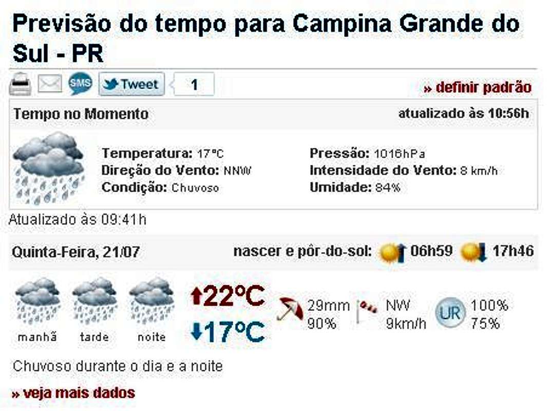
Weather Forecast
You can hike this mountain in all seasons, but in summer there are rains every day. In winter is cold, but the days are clearer. The temperatures going from -10°C to 15°C.Best time to climb: May to September.
Legal Issues
To hike/ climb is a dangerous activity and requires proper equipment and clothing, the owner of this page cannot be blamed by injuries caused to anyone who read this page for its info about the mountain, and eventually got hurt by doing so with reckless behaviour or bad weather conditions.
Paulo Roberto Felipe Schmidt – AKA: PAROFES
External Links
My youtube channel: www.youtube.com/parofes - Now with 250+ videos online!
The biggest brazilian website about climbing and mountaineering, for which I'm a columnist: