
-
 1327 Hits
-
 73.06% Score
-
 3 Votes
|
|
Route |
|---|---|
|
|
37.45579°N / 106.79503°W |
|
|
Hiking |
|
|
Summer, Fall |
|
|
Half a day |
|
|
1+ |
|
|
Overview
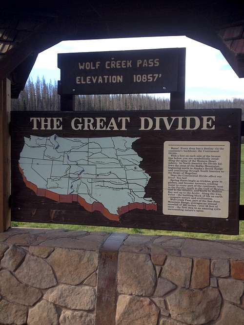
Wolf Creek Pass Signboard
Route Description
The trail starts to the left (east) of the signs at the parking lot when you are facing them. Follow the trail through an initial meadow for several hundred feet until you encounter a wooden bridge across a small drainage. Cross the bridge and the trail forks. Avoid the right fork and head left. You know you are on the correct trail because of the CDT marker. Follow this trail through spruce-fir forest as it heads east then south to hit the northern ridge of the ski area.
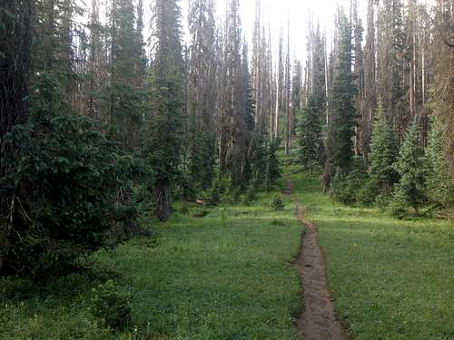
Spruce-Fir on the Way to Alberta
In about ½ mile the trail cuts west and starts ascending the ridge. You are not far from a ski run, but you cannot see it except for a few glimpses as the trail continues. Soon you come out of the trees to a valley filled with a rock glacier. A few more switchbacks and you will be near the top of a ski-lift, and have spectacular views of the rock glacier.
Overlooking the Rock Glacier
From here the trail once again heads back into the trees and levels out. This is Treasure Pass. The trail heads west and then south. Views of Treasure Mountain to the west start coming through the trees. Very soon you will come across a cairn and a trail sign for Treasure Mountain nailed to a tree. When I was there the Treasure Mountain trail was so vague it looked almost non-existent.
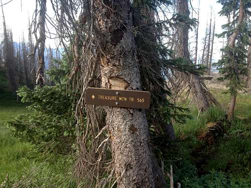
Treasure Mountain Trail
Keep heading south past a spectacular cliff, and views of 12,000 and 13,000 foot peaks. Pretty soon the trail traverses to the east side of the ridge where there is another ski-lift, a log snow-fence, and great views of Alberta Peak. The trail follows the snow-fence and eventually cuts southwest through a break in the fence.
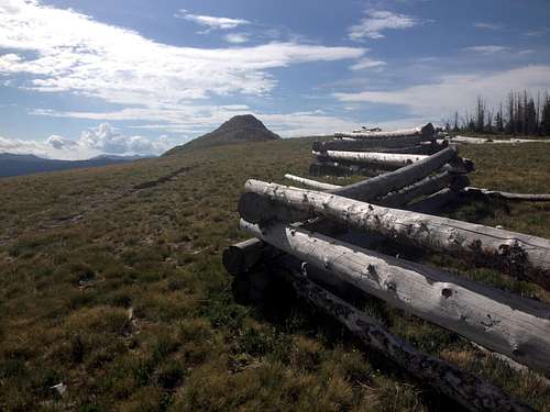
Snow Fence
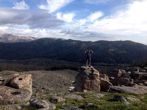
Several hundred feet past this a cliff there is a cairn and a sign marking the ski area boundary. The snow-fence also ends. From here leave the trail and follow the vague paths up the north ridge of Alberta Peak. Watch your footing, some of the blocks are loose. Once at the summit cairn, enjoy the views of Treasure Mountain to the northwest, and the Continental Divide to the southeast!
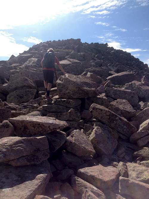
Summit Ridge
Map
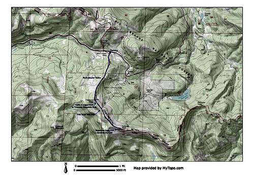
Alberta Peak Topo Map
Getting There
Columbine
There are seemingly two trailheads here; one that starts on the left of the signposts (as you are looking at them), and one on the right. The trailhead to Alberta Peak (and the CDT) is the one on the left