
-
 6456 Hits
-
 75.81% Score
-
 6 Votes
|
|
Mountain/Rock |
|---|---|
|
|
0.00022°N / 78.42887°W |
|
|
San Antonio De Pichincha |
|
|
Hiking |
|
|
Summer, Winter |
|
|
8655 ft / 2638 m |
|
|
Overview
Cerro Catequilla (2,638 m / 8,655 ft) is located 15 minutes north of Ecuador's capital city Quito, and only ten minutes east of the Mitad Del Mundo Monument. Along with Cerro La Marca and Cerro Sincholagua (Pululahua) It is one of the easiest low elevation peaks within the Mitad Del Mundo area due to its easy access to its trailhead. Access to the Class III trails and/or summit can be done by car, bike or foot.
It was used as an astronomical observatory by the Quitu Cara culture centuries ago. The Equatorial line passes right through its summit.
Cerro Catequilla
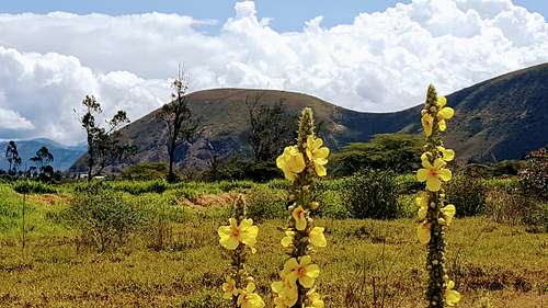
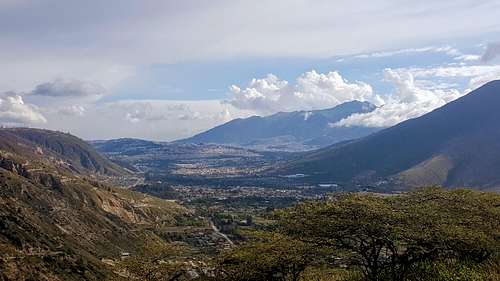
The views from its summit of the nearby elevations of the Eastern Andean Cordillera and the volcanoes of Fuya Fuya and Cotacachi and Cayambe to the east are stunning as well as the surrounding neighborhoods of San Antonio De Pichincha down to the west and the city of Quito to the south.
Getting There
The trailhead is located 10 minutes away from Monumento Mitad del Mundo at the Middle of the World in Quito. To get to Monumento Mitad del Mundo you will need to drive for about 25 minutes north of Quito. About 1 km before getting to the monument take the first exit at the roundabout to the east towards "Puente de Pajaros", then follow the brand new highway "Avenida Simón Bolivar" eastbound till getting to the next roundabout. Once there take the 2nd exit to the north and continue on a dirt road for about 2 minutes. A sign showing the way to Cerro Catequilla will be visible at the right side of the road. This is the town of San Antonio De Pichincha.
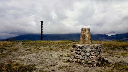
Catequilla's summit
Another way to reach the trailhead is from "Balneario Público" (Public Swimming Pools). The road to the swimming pools is located on the southeastern side of the town of San Antonio de Pichincha, by the creek. Ask to locals about Balneario Público, and they will send you the right way.
Route
Fro the trailhead at the Catequilla sign, follow the road up to the top or to the saddle of Catequilla (2,573 m / 8,442 ft). You can make your way up by foot, car or the best way... by bike. The dirt road is pretty much straight forward and uphill. The summit can be seeing up north during the hike.
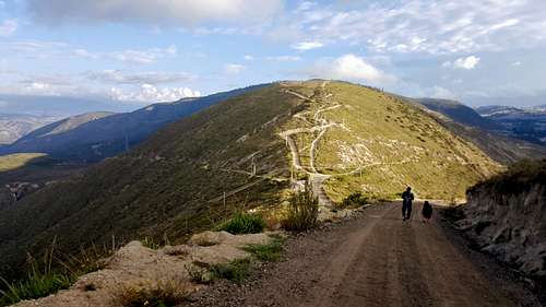
Road to Catequilla
Red Tape
* There are dogs along the way especially in the town of San Antonio.. sometimes ready to chase runners and bikers on the way down.
When to Climb
* All year round, preferably before noon to avoid afternoon clouds and enjoy of the views.
Camping
* Not recommended near populated areas.
External Links