
|
|
Mountain/Rock |
|---|---|
|
|
47.42771°N / 121.6834°W |
|
|
Hiking, Mountaineering |
|
|
Winter |
|
|
4320 ft / 1317 m |
|
|
Overview
 Change Peak
The unofficially named Change Peak, located south of I-90 is peak that slowly but surely getting popular with the peak bagging community. Due to the fact that is quiet close to Seattle and is on the same trailhead as the much more popular nearby Mount Washington, many more disciplined peak baggers are choose the lesser known Change Peak. Many others peak baggers are also linking the two peaks together along with other peaks in the region. This peak will get a visit usually once week to once a month depending on the season but this will probably be growing in the upcoming years as nearby Mount Washington and Mailbox Peak continued to get overcrowded.
 Change Peak from Mount Washington
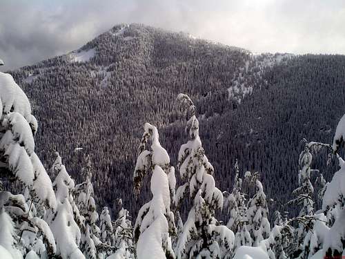
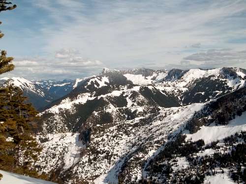
If you are just to do Change Peak by itself it is roughly 3000 feet of elevation over 7 miles of roundtrip. The to get to the true one must go through a heavy bushwhack from one of the logging road provided you come from the north or the south. The east side contains a number of avalanche zone so because of this I not recommend going up this mountain from the east side unless the avalanche danger the moderate range or safer (1 or 2). Personally I was a cautious on cross these avalanche slide zones and can only recommend that others do as well. I’d classify the summit scramble in summer probably a Class 2 but personally from what I saw this mountain is best to be climbed with some caution during winter and early spring. Once you get to the summit you will be rewarded with an excellent view to the west of Rattlesnake Ridge, the northern Seattle metro area and the Olympic Mountains. And to the east there are good views of McCellan Butte, Greenway Mountain and many other peaks in the I-90 region. These look prettiest in winter with snow covering many of the clear cuts.
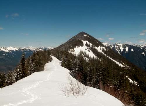
 View from the summit area of Change Peak toward McClellan Butte
 The north ridge of Change Peak
Route Information
 Make a left here. In winter there will not be many track on this trail
 At the edge of the Great Wall
From the Ollalie State Park parking area you want to head up the side path to the John Wayne trail and head west (right on it) in about 300 yards you will find an unmarked trail on your left-hand side. This is the Mount Washington Trail. Take the Mount Washington trail roughly 2 miles as it steadily rise until it reaches the intersection with the Great Wall Trail. Make a left on the Great Wall and take it all the way up until the trail reaches a forest road. Along the way you will pass right underneath the Great Wall which will have a moat during the winter. In terms of what I saw in winter once past the Great Wall the trail becomes overgrown and the snowshoe path was hard to make out. Once on the road make a left.
 Traversing the steep eastern slopes of Change Peak
 Zephyr on one of rare open areas along the ridge
As soon as you around a couple turns you will see Change Peak right in front you. Take the road all the way to the base of Change Peak. From there it is either a thick bushwhack from the north or south sides or a steep climb at east slope that have high avalanche danger in winter.
Here is an excellent map of the route up Change Peak as well as Greenway Peak by fellow SPer Eric Willhite
Getting There
VIA I-90: From I-90 just east of North Bend get off of Exit 38. From the ramp you must make a right. About roughly 100 feet in front of you make another right onto gravel that will lead into a parking area. A Discover Pass is required.Red Tape
Discovery Pass is required at the trailhead. It is $10 for the day and $30 for the year.Camping
Camping here is not recommended due to the fact that there are no good sites and the fact that you are close to the watershed.External Links
There is avalanche terrain on this summit so please check this website outExcellent trip report from fellow SPer Eric Willhite on this mountain
Another page on the summit
WTA Trip Report on Change Peak