Toggle navigation
Mountains
Routes
Images
Trip Reports
Forum
What's New
People
Areas & Ranges
Articles
Trailheads
Canyons
Huts & Campgrounds
Albums
Logistical Centers
Fact Sheets
Lists
Custom Objects
Gear
Plans & Partners
WELCOME TO SUMMITPOST
SIGN IN
REGISTER
Guatemala
Additional Parents
Volcán Chicabal
Topographical Maps for Guatemalan Volcanoes
Guatemala Photos
Getting Around in Guatemala
Photos of Chicabal Lake and Volcano
Image
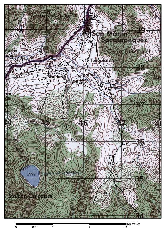
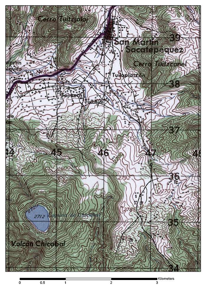
Chicabal Volcano Topographical Map
View High-Resolution Image
Chicabal Volcano Topographical Map
A topographical map I made of the Chicabal Volcano, Lake, and town of San Martin while I was working for the municipaliy. The black lines are roads (created with a GPS).
« PREV
NEXT »
BLong
on
Sep 30, 2008 12:39 am
Comments & voting
Other parents
Lat/Lon:
14.78783°N / 91.65585°W
Image Type(s):
Hiking
Image ID:
447824
4476 Hits
72.08
% Score
2
Votes
Log in to vote
Comments
No comments posted yet.
to post!
Don't have an account?
Guatemala
(Area/Range)
« PREV
Viewing
#23 of 45
GALLERY
NEXT »
BLong's Image Gallery
« PREV
Viewing
#188 of 362
GALLERY
NEXT »
Volcán Chicabal
(Mountain/Rock)
Loading....
Guatemala Photos
(Album)
Loading....
Topographical Maps for Guatemalan Volcanoes
(Album)
Loading....
Photos of Chicabal Lake and Volcano
(Album)
Loading....
Getting Around in Guatemala
(Fact Sheet)
Loading....
×
You need to login in order to vote!
User Name
Password
Remember me
Forgot your password?
Log me out when I close my browser.
Keep me logged in all the time.
sign in as a user
Don't have an account?
Register now for FREE
Rating available
Suggested routes for you
People who climb the same things as you
Comments Available
Create Albums
Register Here


