This trip report should start with a description of our group. 4 adults 3 teenagers. We are all from NE Ohio with limited experience hiking the distances, altitude and terrain we found in this hike. We are all in fairly decent hiking shape and we have spent lots of time hiking in the Appalachian Mountain ranges back East. We always read trip reports before embarking on hikes like this and we have noticed that most reports seem to underestimate things in our opinion. Probably due to our lack of experience. So this is a report from our perspective. Maybe it will be helpful to others with limited experience. Maybe entertaining for those with lots of mountain miles under their boots. After arriving in CO we acclimated for a few days hiking other trails in RMNP including Flattop and Hallett Peaks.
We decided to give ourselves TONS of time to make sure we could summit and descend before any afternoon storms hit and do it at a slow pace. We awoke around 1:30, scarfed oatmeal, got our gear together and hit the trail around 3:00am. We decided to take what seemed like the easiest route from Sandbeach Lake Trailhead to Sandbeach Lake, up Mt Orton and from there up Chief's Head. The hike from the Trailhead to the lake was great. Temps in the high 40's with a clear sky and full moon made it comfortable and interesting even in the dark. Turned off our flashlights a few times just to take in all the stars through breaks in the trees overhead. Most other trip reports gloss over this section because it is rather uneventful with a relatively smooth trail and steady grade that never really gets difficult. This is the only officially "marked" section of trail from the trailhead for 4.5 miles to Sandbeach Lake. Then the real "fun" begins. We arrived at the Lake just before sunrise (5:15) which was the plan. We all took a break, ate second breakfast and watched the sun come up. We knew it would be pointless to try to navigate the faint trails up the slopes of Mt Orton in the dark. It was hard enough in the daylight.
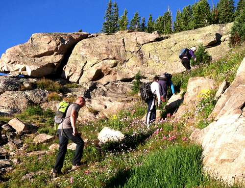
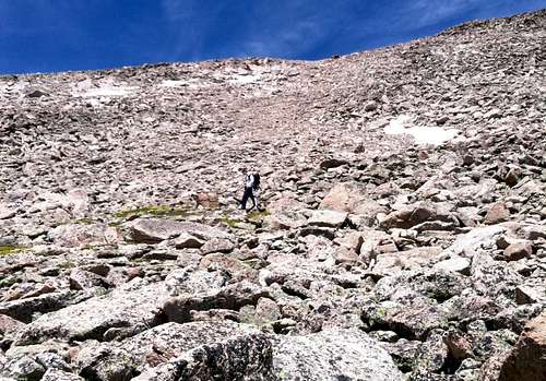
Just before 6:00 am we started up a faint trail headed toward Mt Orton. The easiest description is to walk around the lake counterclockwise to the north side and then look for a trail heading northwest and uphill. We initially got a little off course and hit a dead end boggy area. We quickly realized where we went wrong and got back on course. I would not describe it as bushwhacking but following the faint trail northwest from the Lake is initially a little challenging. Quite a few dead falls to hop over but after about 100-200 yards, the trail to the Northwest becomes more obvious and starts to ascend VERY steeply. A few cairns can be seen here and there. Eventually the trail climbs into more open ground with some boulder hopping and steep grassy slopes. At this point, navigation is not really an issue. Just follow the open grassy slopes up to the big boulder piles that make up the summit of Mount Orton. This part of the hike was very strenuous for us but beautiful. Tons of wildflowers and the sun rising up at our backs.
![Unnamed Image]()
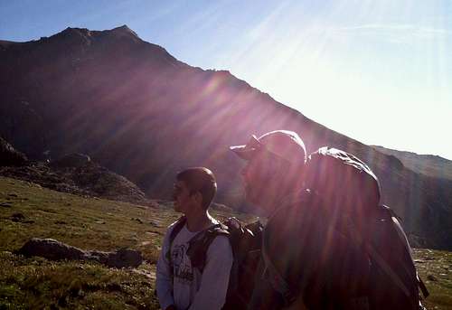
The views of Meeker, Long's and Pagoda to the north and east just keep getting better from this point on. At the top of Mt Orton, its "peak" appears as just a large pile of boulders. Some suggest climbing it to gain good views of surrounding mountains and the rest of the route up Chief's Head. We decided to conserve our energy and just walk around the rock pile. We decided to take a route to the right of the rocks moving counterclockwise around them to the Northeast. This turned into a bit of a boulder-hopping scramble with views down in to Hunter's Creek and Keplinger Lake. This route was more physically challenging but the views were nice and the scrambling easy.
![Unnamed Image]()
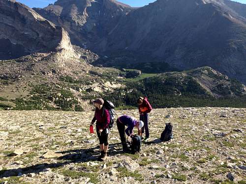
We decided we should take the other route around Orton's peak on the descent. We took a break on the North side of Orton and surveyed the rest of the route ahead of us. Officially called the North Ridge, many refer to it as a "ramp" leading up to the summit of Chief's Head. This description fits well. The views of Long's Peak, Meeker and Pagoda are awesome from this spot.
Hiking is now over wide open ground with a mixture of grass and rocks - very easy and fairly level travel right up to the ramp. Then things get very steep again. The combination of grade and altitude really slowed our group down. The ramp actually has a couple of sections with a section of somewhat level ground between the two steeper sections.
![Unnamed Image]()
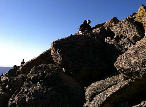
The final ascent is up through boulders and scree. About this time I was thinking about how I didn't have much energy left and we had taken much more time than we had originally planned. We probably would have turned back at this point but the skies were still clear so we figured we had a golden opportunity to take as long as we needed to reach our goal. The final trudge seemed like probably class 2+ in my inexperienced opinion. Hand holds not necessary but I was completely sapped at this point and used as much help as I could get with my hands. There is an obvious gully that runs up to a false summit between Pagoda and Chief's Head. We took this route. Most of us were making very slow progress at this point. The three girls lead the way. All avid runners. The 4 guys brought up the rear even though this hike was all their idea.
![Unnamed Image]()
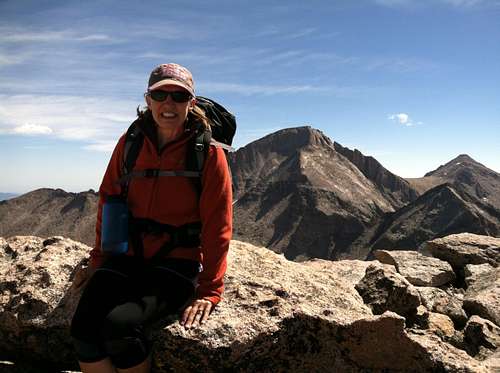
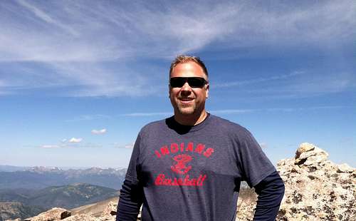
Once up to the false summit, we saw just how steeply the cliffs drop on the other side into Glacier Gorge. Breathtaking and a bit unnerving. At this point we basically turned left, back-tracked a little away from the cliff edge to follow the boulders up several more false summits. Eventually we all reached the peak and signed the register. The girls summited around 10:45, the guys all straggled in one by one until about 11:00. We were feeling whipped.
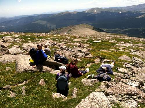
After about 30 minutes and photos on the summit, we carefully descended back down the boulders and scree to the level patch halfway down the ramp. We gathered up gear we had left there to lighten our climb up the summit. We also took a long break.
The breaks on the way back were frequent until we got beneath Orton. The steepness of the descent can be as uncomfortable for me as the climb. My ankles are bad and descent always feels much less stable.
We got back to Orton around 2:00pm and went the other way around this time. Took in views of the route that can be taken to the saddle between Chief's Head and Mt. Alice. Also very scenic.
The descent back to Sandbeach Lake was easier since we had already navigated the faint trails through the woods near the lake. Took one more long break at Sandbeach Lake at 3:00 and hustled back down the last 4.5 miles to the trailhead. Arrived back at the car a little after 5:00. What a day! I know others crank out hikes like this much quicker but we felt just accomplishing our goal of reaching the summit was a big deal for us.


Comments
Post a Comment