
|
|
Route |
|---|---|
|
|
40.77380°N / 110.7521°W |
|
|
Scramble |
|
|
A few days |
|
|
Class 3 |
|
|
Approach
This road to the trailhead leaves from Highway 150. The Christmas Meadows (gravel) Road leaves Highway 150 and heads SE from about .7 miles south of the Bear River Visitor Center and right at milepost 46. Follow the gravel road to the trailhead.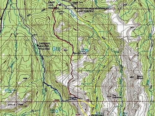 The Blue Line is the route from Christmas Meadows.
Route Description
This is the most difficult of the three routes to Lamotte Peak because of steep and loose rock. It is also the most popular route.From the trailhead at 8800 feet elevation, follow the trail south up Stillwater Fork. The trail is heavily used and is at a gentle grade until reaching a junction after 2.6 miles. Turn left here at the trail posted for Amethyst Lake.
The trail climbs rather steeply past some cataracts before leveling off. Follow the trail for two miles until you reach a meadow due west of the summit of Lamotte Peak.
From the meadow, climb the extremely steep slope east to the summit. There is loose rock and this isn’t a very easy route. The distance from the meadow to the summit is only a mile, but with almost 2700 feet altitude gain. Interestingly, that one-mile takes a longer time than the 4 miles from the Baker Lake Trail. The total distance from the trailhead to the summit is only 5.6 miles, but it seems much longer.
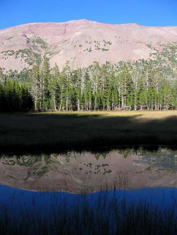 The west face of Lamotte Peak reflected in a pond near Ostler Lake.