
-
 11889 Hits
-
 83.69% Score
-
 17 Votes
|
|
Mountain/Rock |
|---|---|
|
|
46.41751°N / 10.28801°E |
|
|
Alta Valtellina |
|
|
Mountaineering |
|
|
11283 ft / 3439 m |
|
|
Overview
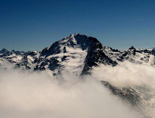
Imposing mountain and highest summit in this part of Rhaetian Alps.
It is placed impressive, between the "Valdidentro", "Valdisotto" e "Val Grosina", but is on the side above Isolaccia where appears more imposing and impressive, with it's vast and icy north flank.
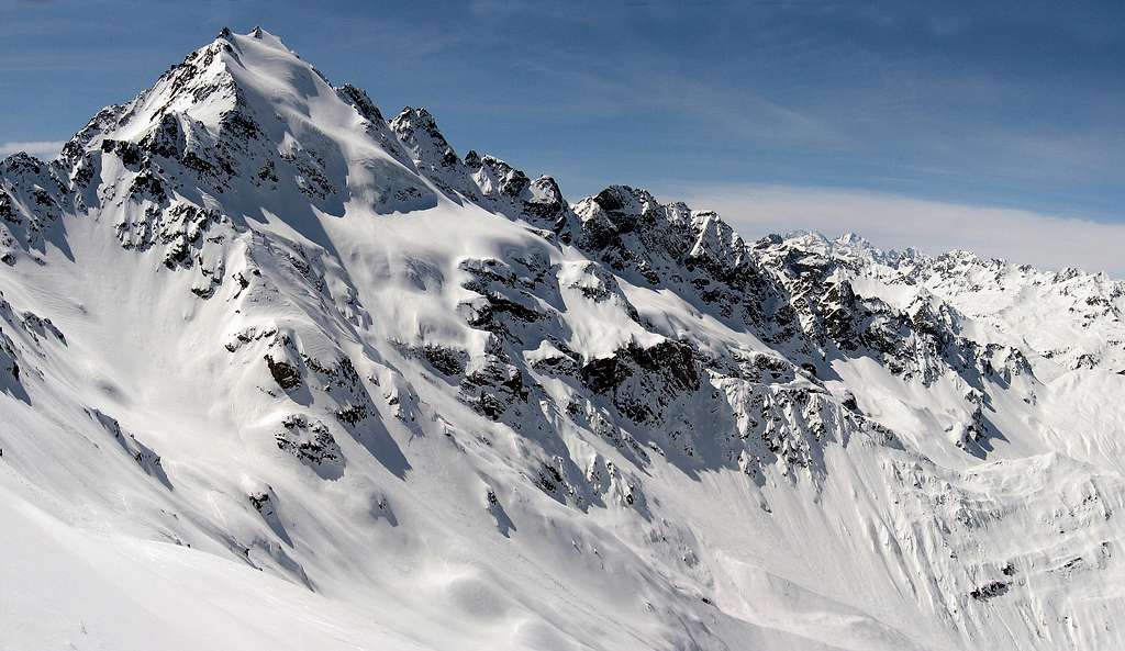
It's composed of three main ridges, and the top is the union between the NW and NE ridges. While the S ridge leads to the rocky "Colle Piazzi".
Impressive is also the west ridge, also called "Cresta Sinigaglia" that extends to the NW with the secondary peaks "Corno Sinigaglia" and "Corni di Verva".
Very Interesting is the north side, completely covered by ice, which is the famous image of the mountain.
It can be divided into 4 glaciers: "Vedretta di Piazzi", "Ghiacciaio Rinalpi", "Ghiacciaio di Cardonè" and "Ghiacciaio di Val Lia".
The aproach to the north side, is along 2 very similar and parallel valleys, shared by a ridge that takes to the glacier: "Val Lia" and "Val Cardonnè".
Above theese valleys 2 bivouacs have been placed to help the climbers in the long aproach. "biv. Ferrario 2400m" and "biv. Cantoni 2625m".
The origin of the name "Piazzi", is not certain, but seems to derive from the name of an ancient family owner of the pastures at the foot of the mountain.
The first ascent can be attributed to J-J-Weilenmann/Franz Poll/Santo Romani in the August 21st 1867.
A curiosity for the Italian people: Cima Piazzi is the mountain printed on the label of the mineral water "Levissima".
 Cima di Piazzi seen from Corno di S.Colombano Cima di Piazzi seen from Corno di S.Colombano |
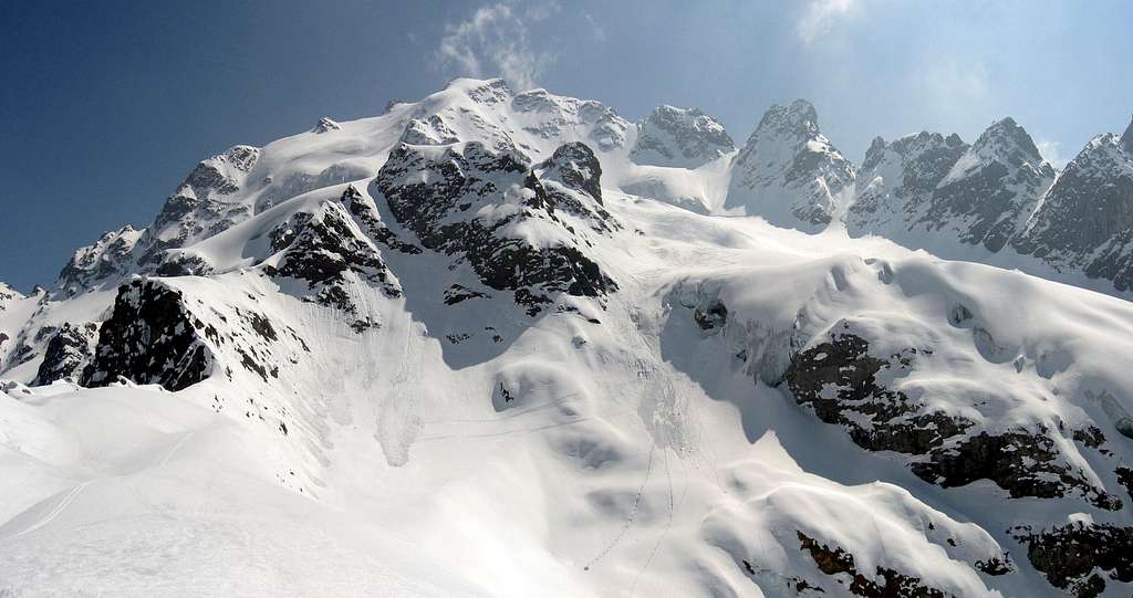 Cima di Piazzi seen from Bivouac Cantoni Cima di Piazzi seen from Bivouac Cantoni |
Getting There
In any case of routes the best starting point is the Valdidentro. Village of "Isolaccia" 1345m in winter and summer or otherwise "Arnoga" 1800m only in summer.FROM MILAN BY CAR: statal route "Vallassina" number 36 to Lecco and then to Colico (north side Como lake) and then Stelvio statal route to Morbegno, Sondrio, Tirano and then to Bormio (three hours). After Bormio take the indication to Valdidentro/Livigno.
FROM MILAN BY TRAIN AND BUS: take a train in the Milan Central station destination Tirano and then a bus to Bormio (4 hours).
FROM SUDTIROL BY CAR THROUGH STELVIO PASS: from Bozen (Alto Adige on the highway between Innsbruck and Verona) to Merano by main route and the by local route through Venosta Valley follow the signals to Stelvio mountain pass (2700 meters, the highest mountain pass reaching by car, open only in the summer period). From here to Bormio (3 hours and half from Bozen, Stelvio pass requires 44 bends to go up and 15 to go down).
FROM SAINT MORITZ (CH) BY CAR: go to Pontresina and then follow the signals to Bernina pass. Turn left when you look the indication to Livigno (I) through Forcola pass (open only in summer period) and then from Livigno through Foscagno pass (2200 meters, open all the year) to Bormio (3 hours).
FROM SANTA MARIA (MUNSTERTAL - CH) BY CAR: follow the signals to Giogo di Santa Maria (Pab Umbrail) on the border between Switzerland and Italy and then to Bormio (1 hour and half, border near Stelvio pass, open only in the summer period).
FROM GERMANY OR AUSTRIA BY CAR: on highways via either Innsbruck or Bregenz to Landeck and then following Staatsstraße S 13 to the italian border at the Reschenpass / Passo di Resia . There the Vinschgau / Val Venosta valley starts that represents the northern border of Ortles-Cevedale group. At Prad the Trafoi valley starts that leads either to Sulden / Solda or via Stilfser Joch / Passo di Stelvio to Bormio.
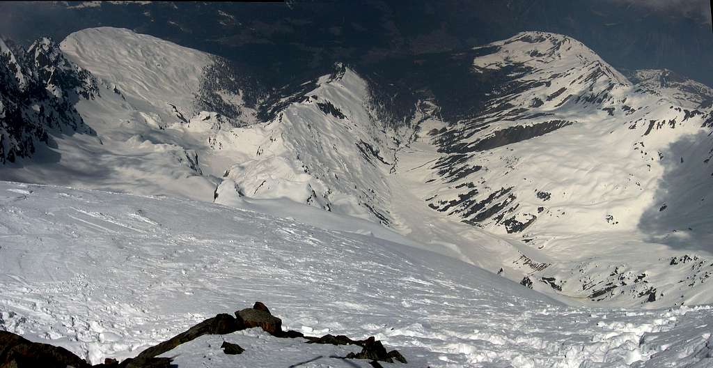 The Valleys Cardonnè and Lia seen from The summit The Valleys Cardonnè and Lia seen from The summit |
Routes Overview
South ridge: Cresta Sinigaglia" Normal route. From Passo di Verva(From Val grosina or Valdidentro) to Colle Piazzi 3022m. Follow the ridge to the summit (F)North east wall: From biv. Ferrario (400m/50°/D-)
West ridge: From "Conca di Verva", rocky climb (many passages of III°)
North ridge: From biv. Cantoni (800m AD)
North wall: From biv. Cantoni (500m AD)
North east ridge: From Colle Rinalpi (450m PD)
East wall: From Campaccio above Cepina (Valdisotto), not recommended (1400m AD)
Ski routes: SEE THE PAGE AT THIS LINK
Huts and Bivouacs
Placed at 2625m on the ridge between Val Lia and Val Cardonnè. Very confortable,with 9 places. From "Madonna di Presedont" 1760m above Isolaccia: along the Val Lia in 4 hours, very easy path.
Bivouac Paolo Ferrario:
Placed more or less at 2400m on the "Dosso delle Pecore", with 6 places. From "Madonna di Presedont" in 2 hours or from Passo delle Pecore in 1,15 hours.
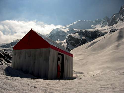
Bivouac "Paolo Ferrario"
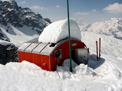
Bivouac "Maurilio Cantoni"