


lcarreau - Jul 31, 2008 7:02 pm - Voted 10/10
Excellent !How do you always hit the clear weather? :)
Nice view, and it beats looking at a map !!!

Rob Ricks - Jul 31, 2008 10:25 pm - Hasn't voted
Re: Excellent !Don't worry. As usual, the weather went downhill from here. Rob
lcarreau - Jul 31, 2008 10:49 pm - Voted 10/10
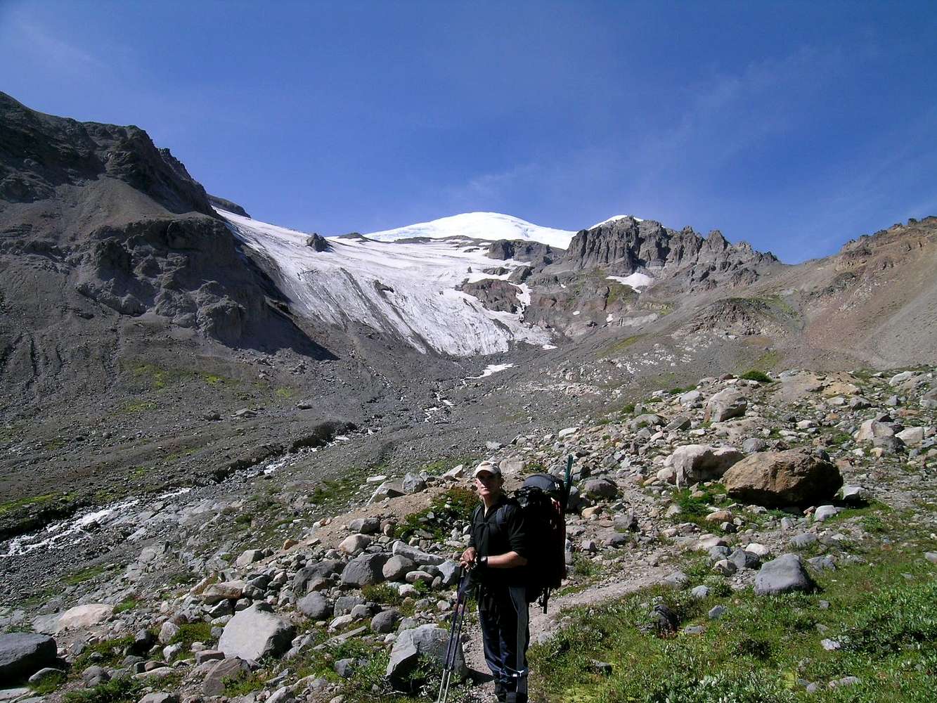
Re: Excellent !Unfortunately, I know what you're talking
about. That's the 'snout' of IG, right??
And the prow is directly above it? It looks
rather steep from this angle, but I'm sure
the going gets easier after you get above the
snout. Long as the weather holds, that is !!!
Rob Ricks - Aug 1, 2008 11:10 am - Hasn't voted
Re: Excellent !You are right. That is the "ablation zone" of the IG in the background. It was mushy rock-strewn slop until we got higher on the glacial ice.
lcarreau - Aug 1, 2008 12:06 pm - Voted 10/10
Re: Excellent !This will be my final comment. I'm suspecting
that the "ablation zone" gets higher or lower, depending on regional variations in climate.
Do some people choose to ascend to St. Elmo's
Pass, then ascend the Winthrop Glacier to
Camp Schurman? Seems like that route would
be a bit smoother. I'd really like to see it!
Were there lots of marmots in this area ??
Rob Ricks - Aug 1, 2008 12:49 pm - Hasn't voted
MarmotsYessiree. I posted a few shots of me with the critters (they were deleted by the link maintainer). The original summit route was from the lower Curtis Ridge and up the Winthrop. I'm sure a drop from St. Elmo's and up the Winthrop has been done. I thought about including it on the page but decided not to since I've not done it or traced it myself. It's probably a jumble compared to just going up the Wedge.


Comments
Post a Comment