Comments
No comments posted yet.

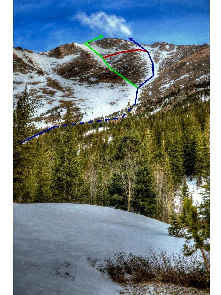
Climbing diagram: The main route in blue follows up from the base at N40.23163 W105.60314 at 10,611' to the bend at N40.23583 W105.60253 at 11,096' and then up to the Dragon's Egg rock. You may detour (green) at Dragon's Egg rock at N40.24141 W105.60242 at 12,087' or stay in the main chute (blue). If the snow is thin or you see no clear path of snow to the summit ridge in the main chute (in blue), the detour (in green) can be used to top out on the Loft near N40.24824 W105.60567. This avoids the more treacherous direct approach of Meeker summit by scrambling to gain the summit on large boulders and snow from the west. If you follow the detour, you may cut right (in red) near N40.24506 W105.60451 at 12,922' to rejoin the main chute (in blue) at N40.24748 W105.60303 at 13,494'. From here multiple paths to the summit ridge are possible, depending on the snow and/or your ability to mixed climb & dry tool. Look for any lines of snow that might exist to help gain the summit ridge. The most direct path is shown in blue, which avoids much of the extraneous steep ridge east of the summit. One strategic possibility is the try to gain a low point on the ridge at the top of Dreamweaver couloir on the north side of Meeker at N40.24876 W105.60383. Mt. Meeker summit is at N40.24851 W105.60478 at 13,952'. From the summit downclimb the couloir. If you find yourself in weather or avoiding the snow later in the day, the rock east and south of the main chute may be used to descend along the couloir to lower elevation.
You are at the First Image | You are at the Last Image |

