
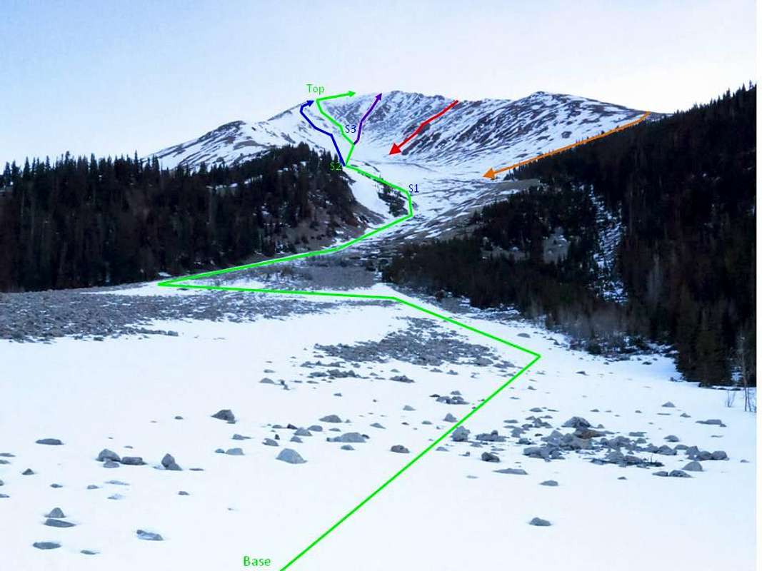
1479_CLIMBERS_DIAGRAM: I have divided the route into sections; in practice sections 2 and 3 seemed to blend into a single middle segment. From the base of the couloir at N38.57047 W106.32587 at 10,798' follow the most continuous line of snow (green route) to the top of section 1 (maximum angle of 27 degrees) at N38.57683 W106.32296 at 11,685’ to the top of section 2 (maximum angle of 35 degrees, 31 typical ) at N38.58005 W106.32250 at 12,338’ to the top of section 3 (maximum angle of 37 degrees, 33 typical ) N38.58408 W106.32172at 13,024’ to the top of the couloirs (maximum angle of 45 degrees, 37 typical) at N38.58657 W106.32156 at 13,702’. If there is plenty of snow it might be possible to ascend a steeper route directly to the summit. The blue route is similar in difficulty to green, but may prove more continuous when lesser snow is present. To descend, one could down-climb the green route to S3 and then glissade the remaining route (something like a 2000 foot glissade). Judging by the tracks, the blue route is a popular ski descent. We saw tracks following the red route down. A very conservative descent (in the event of a late start or active wet slides) might be the orange route.


