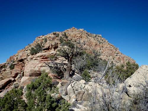
Roughly centered between Grand Canyon Village and Desert View Tower sits Coronado Butte, a striking summit in an area of the south rim that receives surprisingly little traffic. Located just off the unmaintained New Hance Trail, you can expected solitude and expansive views across the Grand Canyon from this impressive butte near the center of the south rim. From the rim, Coronado Butte looks like a technical climb, with sheer sandstone cliffs on its southern and western face. But a series of gullies on the east face offer an elaborate class 3 route to the small summit, with the option for a class 4 variation. For anyone interested in peakbagging in the Grand Canyon, this is one of the best on the south rim.
Enter GCNP via either the major entrance near Tusayan or to the East from Cameron. Giving how central this butte is on the South Rim, it's a fairly equal drive from either entrance. The New Hance Trail is very hidden from the road, and is marked by a couple 'No Parking Anytime Signs' near a shallow pull off. Per the NPS, they would like people to park at some of the other pull offs a bit further down the road in either direction. It seems they really want to discourage traffic on this unmaintained trail....
If coming from the west, the New Hance Trail is 12.5 past the turn off for Yaki Point (South Kaibab Trailhead) and just past the Buggein Picnic Area on a long straight-away. From the east, it is 7.7 miles from the main intersection at Desert View Tower, and shortly past the Moran Point Lookout.
Route
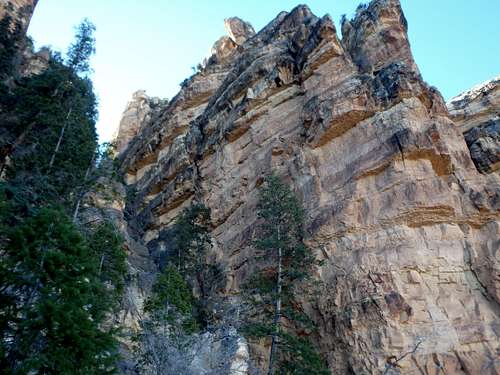
Looking up the class 2 ridge from the approach.
Approach: Once you've find the unmarked trailhead for the New Hance trail, walk 50 yards through forest to the rim with a more official looking sign telling you you've actually found the trail. Coronado Butte is in view almost immediately. Follow the narrow but well graded trail down switchbacks about 1000' to just below a saddle between the rim and Coronado Butte. If you're patient, you can find a use trail that takes you from the New Hance Trail up to the saddle, but there's little brush and cross country up to the saddle direct is pretty straightforward.
The Climb: Once at the saddle, it's a fairly straightforward climb up the rib of rock to reach the flat bench below the summit. This portion is mostly class 2 with a little class 3 in small spots. Any gendarmes and obstacles can typically be bypassed on the right. A small cliff band just before the flat bench requires a short traverse east to reach a short gully containing a single large tree. Trying to climb these bands directly looks possible, but will leave you stranded on a detached pinnacle, so finding the gully is your best bet.
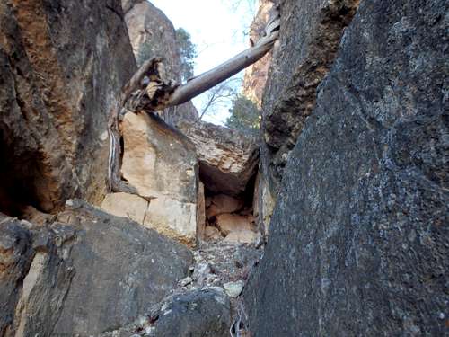
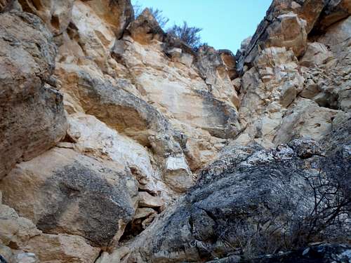
First of three gullies.
Once on the plateau below the main butte, pick up a use trail that traverses around to the northeast side. Don't climb too high too early or you'll just get stuck. The northeast side is characterized by 3 very deep, very obvious gullies. If you're looking up at small cracks wondering if you're there yet, keep going. Once you've reached the gullies, you have two options.
The easiest option technically is to climb about 1/3 of the way up the first gully, mostly class 2 with a bit of class 3 towards the top. You'll reach a chockstone blocking further progress. From the chockstone, follow a narrow catwalk and traverse the corner into the
The catwalk traversing into the second gully.
second gully above some 50' cliffs. Climb up the second gully (similar in difficulty to the first) until you're about 20-30' below a notch separating the lower south summit and higher north summit. Again traverse right, this time on wider slopes to roughly above the third gully to a class 3 rock face. While short, this has the most exposed rock on this variation and is tricky in the winter with ice.
A harder option from a technical standpoint but easier in terms of route finding is to traverse all the way to the base of the third gully from the start and climb that all the way to the summit. The lower third gully is steep class 4, and should be avoided if ice is present.
Red Tape
Chokestone at the top of Gully #1.
Admission to GCNP is $30 for 7 days. I highly recommend the "America the Beautiful" Pass for $80, which covers the entrance fees for all federally managed parks and land for one year.
No additional permits are needed unless you're planning on incorporating this into a backcountry trip, however the nearest water source is the Colorado River.
When to Climb
Last bit of class 3 below the summit.
As with most hiking in Arizona, Fall and Spring are the best. Summer can be brutally hot, although the entire hike is above 6000'. No water sources. Winter can bring serious ice on the New Hance Trail, which is entirely in shade on the north facing wall of the rim. The northeast facing gullies heading up towards the summit also can hold a good deal of snow and ice even when the rest of the route is clear, so be prepared if attempting the summit in the colder months.
Camping
There are two developed campgrounds on the South Rim: Mather (which takes reservations) and Desert View. Desert View is the closest, although it is only operational over the summer.
There is plenty of places for camping at large in the National Forest just outside the park.
Parents refers to a larger category under which an object falls. For example, theAconcagua mountain page has the 'Aconcagua Group' and the 'Seven Summits' asparents and is a parent itself to many routes, photos, and Trip Reports.