
-
 36562 Hits
-
 75.8% Score
-
 6 Votes
|
|
Route |
|---|---|
|
|
44.27060°N / 71.3047°W |
|
|
Hike (Class 1-2) |
|
|
A few days |
|
|
Walk-up |
|
|
Approach
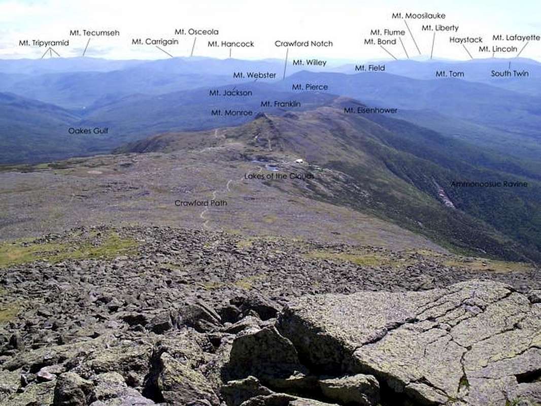
There are many ways of reaching this trail and chances are if you're heading to the summit of Mt. Washington from the Southern Peaks, you'll have to use this trail to get to the summit. The start of this trail is located in Crawford Notch on the Mt. Clinton Road a short distance from where it intersects with Rt. 302. The new lot is on the Mt. Clinton Road. Other accesses are from trails that merge with the path on its way to the summit. Some of these trails are the Mizpah Cutoff, the Webster Cliff Trail, the Mount Eisenhower Trail, the Ammonoosuc Ravine Trail at Lakes of the Clouds Hut, the Westside Trail, and the Gulfside Trail.
Route Description
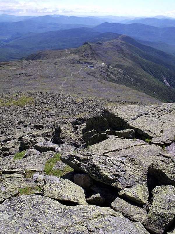
To start off with some history, the Crawford Path is known as the oldest continuously maintained footpath in the United States. The trail presently runs from Crawford Notch all the way to the summit of Mt. Washington, covering a distance of 8.5 miles and 4,750 feet as it crosses the entire line of southern peaks. Work on the path began in 1819 by Abel Crawford and his son Ethan Allan. This first section blazed lead up to Mt. Pierce. Eventually the path was continued all the way to the summit of Mt. Washington. In 1840 a younger son of Ethan named Thomas turned the trail into a bridle path. The path still remains in its original position and only one relocation has occurred. At Mt. Monroe the path was redirected to run by the Lakes of the Clouds Hut understandably.
As you can understand a description of every step of the trail would be relentless, but I will speak of the sections which need attention and below is a list of some of the distances and elevation gain based on the AMC's White Mountains Guide (27th Edition). It is possible to do the entire path in one day as a Presidential Traverse, but you'll need to be in tip-top shape and it is not recommended for inexperienced hiker/climbers. If you do plan on doing the entire traverse you'll definitely need to be spending a night in a hut somewhere unless you have someone pick you up at another trailhead.
The most dangerous part of this path is on the summit cone of Mt. Washington. At any sign of inclement weather, turn back without shame and get below treeline as soon as possible!
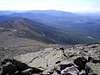
Much of the path is above treeline from the summit of Mt. Pierce on so keep an eye on where you are in relation to the weather. Exposure to the weather is very prevalent along the majority of the path even on Mts. Webster and Pierce due to the stunted vegetational growth.
Distance from Mt. Clinton Rd. parking area:
to Mizpah Cutoff (3,380ft.): 1.9 mi., 1,450ft.
to Webster Cliff Trail (4,250ft.): 3.1mi., 2,350ft.
to Mount Eisenhower Trail (4,475ft.): 5.0mi., 2,750ft.
to Lakes of the Clouds Hut (5,012ft.): 7.0mi., 3,450ft.
to Westside Trail (5,625ft.): 7.9mi., 4,050ft.
to Gulfside Trail (6,150ft.): 8.3mi., 4,600ft.
to Mt. Washington summit (6,288ft.): 8.5mi., 4,750ft.
For a very in-depth coverage on exact distances and descriptions of the uncovered sections on this page, I would recommend the White Mountain Guide as a must read because it has a wonderful step by step description of many other features along the trail.

 |  |  |
Weather on the Crawford Path
The Presidential Range is known for its unpredictable and sometimes severe weather. Always check the forecast before planning a trip into the high peaks! For current weather conditions in Mt. Washington area, click on the link below:
weather.com
Also visit mountwashington.org for up to date, current weather conditions on the summit of New England's highest peak.
Weather Records For Nearby Mt. Washington:
Avg. Summer Temp. = 55F
Avg. Winter Temp. = 15F
Highest Recorded Temp. = 72F
Lowest Recorded Temp. = -46F
Avg. Summer Wind Speed = 26mph
Avg. Winter Wind Speed = 44mph
Highest Recorded Wind Speed = 231mph(world record)
Highest Total Snowfall in 24hr Period = 49.3 inches
Summit Views
 |  |  |
Essential Gear
You'll need very comfortable hiking shoes, food/water depending on how far you plan on travelling along the path, a camera, inclement weather gear, extra clothing, cold weather clothing, and all navigational tools.
 |  |  |  |  |