
-
 8654 Hits
-
 79.04% Score
-
 10 Votes
|
|
Mountain/Rock |
|---|---|
|
|
39.15911°N / 77.81498°W |
|
|
Trad Climbing, Toprope |
|
|
Spring, Summer, Fall, Winter |
|
|
1454 ft / 443 m |
|
|
Overview
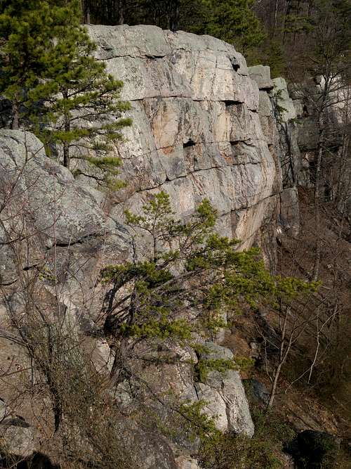
Crescent Rock-- Looking North from the Top
This is not really the place for first-time climbers, as the easiest route is 5.5. There is one 5.6 and one 5.7. Most routes are from 5.9 to 5.12.
Some routes are leadable, including the area must-do Crescent Crack (5.9), but most are better toproped. With 50' of static line, you can set a TR anchor for almost any climb here, but bring a few slings just in case you need some extension. Although I had some stoppers for gear anchors, I never needed to use them. And since the routes are about 50' at most, even a 50m rope is overkill. I was fine with a rope cut to 40m. Consider that before you head out on the 2.5-mile, up-and-down hike to the cliffs, as you will likely be tired before you even start climbing. As hikers with their light packs pass you by, smile in the grim knowledge of all that gear you're hauling.
Because the cliffs face southeast, they can make an excellent winter climbing destination. Summer can get very hot.
Getting There
This is the shortest legal approach. There used to be a shorter one, but landowners closed access to it.
From Route 7 at Snickers Gap (this is about 18 miles west of Leesburg), take the first right (SR 679-- Pine Grove Road) as the road heads down a long downhill stretch (this is if you are going west). Immediately on the right is a parking area for the Appalachian Trail. Hike the trail north for 2.5 miles, twice descending into deep drainages and crossing three "summits." That third summit is the top of the crag. Find a use trail to the base from either the northern or southern end.
Routes
The crag has three sections. From left to right at the base, they are Washington Wall, Main Wall, and Right Sector. In all, there are at least 29 established routes, but there are some obvious unnamed lines as well. One I did as a day-ender because it looked easy is the face just left of The Dish; I'd put it at maybe 5.6 or 5.7.
Here are the routes, organized by section. The ones I climbed are in bold, with comments. Other comments are for location purposes or based on observed conditions.
Washington Wall
- Passage d'Armes (5.11a/b)
- Pyrrhic Victory (5.11c)
- Armed Neutrality (5.10c)
- Crescent Crack (5.9)-- This would be a great lead. As a toprope, which is how I did it, it is not so great. Although the crack has more vertical rise than horizontal length, it is traversing enough that there really isn't a good place for a TR anchor because no matter what, there will be potential for a big swing somewhere. Due to my doing it solo, I could not ask a belayer for slack to minimize the swing, and when I did fall at one point, it was a hassle getting back on in the same place. Hands are great on this climb but the feet can be really slick.
- Boar Hog (5.12b)
- Popeye's Last Crank (5.12a/b)
- Litigiousness Psychosis (5.12d)
- Exploding Lawyers (5.12b/c)
- Legal Crack (5.7)-- Some descriptions I have read mention this route can be brushy. When I was there, it was, to the point of not being worth doing, and that was on a winter day.
Main Wall
- The Dish (5.8)-- This was fun and pretty easy, a good start to the day. Although my picture shows my rope over a big overhang, the route is actually the blocky face to the left of the overhang. The start is the crux, as there is a small overhang to pull right off the ground.
- Coordination Street (5.10a)
- Green Duchess (5.11b/c)
- Crescent Rail (5.11d/5.12a)
- Muddy Desperation (5.9)
- 3D (5.11c)
- Notch Johnson (5.10b/c)
- Brick in the Wall (5.12a/b)
- Merde (5.5)
Right Sector
- Embarrass (5.8)
- Unknown (5.10a)-- This is the crack system just left of the climb listed next; both are pictured on this page. I don't think this one is really 5.10, but it is harder than the 5.8 to its right. I did both off the same anchor.
- Three Mantles and an Overhang (5.8)-- The name says it all. When you reach a ledge with thorn bushes, you probably will want to go a little off-route to the left before getting back on for the finish.
- Unknown (5.8)
- Unknown (5.9)
- Psoriasis (5.9)-- My favorite climb of those I did here. Start up a smooth face to a right-facing flake system and work the flake and slippery feet to a ledge. Then finish up a steep crack with great holds.
- Unknown (5.9)
- Bird Merde (5.6)
- Rockalicious (5/10c/d)
- Ganja Piranha (5.10d)
- The Bitter End (5.11c/d)
 Crescent Crack (5.9) | 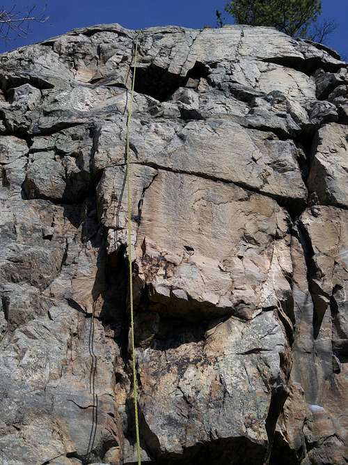 The Dish (5.8) | 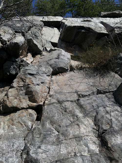 Three Mantles and an Overhang (5.8) | 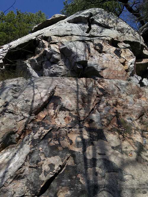 Psoriasis (5.9) |
More details:
hightinerary - May 13, 2016 6:58 pm - Voted 10/10
Some Additional DetailsThat right turn off Route 7 (heading west) is onto 679, also known as Pine Grove Road. Also, the high point above Raven Rocks is 1,454 feet, so the top of the climbing area must be somewhat lower than that.
Bob Sihler - May 13, 2016 10:07 pm - Hasn't voted
Re: Some Additional DetailsThanks. I wasn't sure from the map where the exact spot or elevation was, so the coords and elevation were a guess.
hightinerary - May 14, 2016 9:25 am - Voted 10/10
Re: Some Additional DetailsWhile I'm at it - I'd say the coordinates are more like 39.139281, -77.837869. It's West Virginia.
Bob Sihler - May 17, 2016 9:20 pm - Hasn't voted
Re: Some Additional DetailsThat's actually what I thought might be the case, especially since the trail crosses the state line at one point. It seems the AT is in WV at that point but that the cliffs themselves might be in VA. It's confusing. The author of a popular guidebook lists the site as a VA one, but he makes a few mistakes in his book.