Making Two Point - August 24th, 2014
NFL players played on sprained MCL’s on a regular basis so I figure there’s nothing too exciting about
getting a bunch of easy walk ups on the first leg of my crippled peakbagging tour. After staying in town for a few weeks doing laundry, relaxing and getting started on a freelance project I planned to ramp up the intensity a bit on leg 2, feeling ambitious enough to tackle longer outings with more gain and figured my limitations were at the level of greater mileage/gain totals or anything between moderate to serious scrambling.
I began to eye the Grangeville area which, like leg one, was unexplored territory for me. Saturday night I had to make a decision: drink (in SLC) or drive. I decided to drive, crashing in Twin Falls and then, indeed, having a few drinks at a local brewery.
I would start the second leg of my crippled peakbagging tour on Two Point Mountain which, despite not being a P2K, was an Idaho Range Highpoint over 10,000 feet and as a result, on my list. The vague mental map I had drawn for this second leg was to get the highest peak of the Boise Mountains, check out and drink in Boise, make my way north towards McCall and Grangeville to get Buffalo Hump and Grave Peak, two longer but still basic ascents and then, if my knee held up, swing down and grab Homers Young Peak in Montana, a high priority peak for me at the moment, before returning to Salt Lake as the Labor Day rush hit.
I was in no hurry Sunday morning, knowing that clouds and morning showers would give way to more favorable weather in the afternoon. But i also wanted to (binge) drink for the first time in Boise, and aimed to give myself ample time to do so.
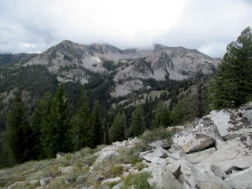
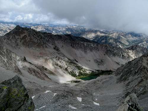
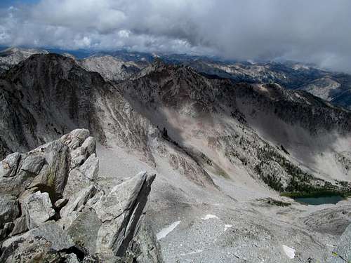
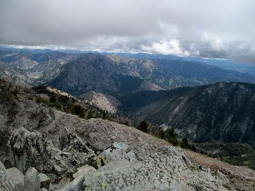
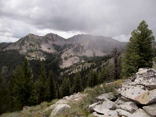
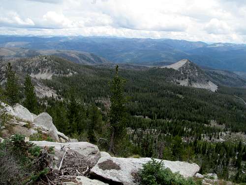
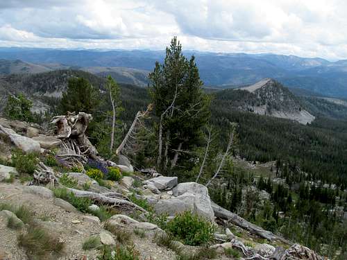
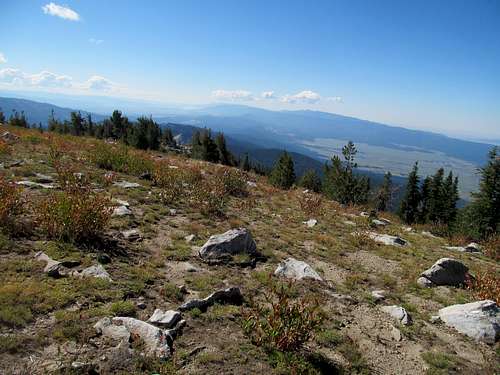
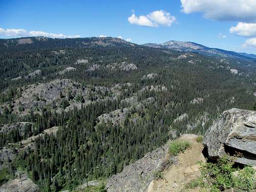
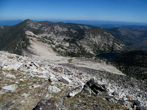
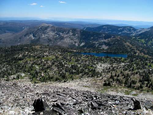
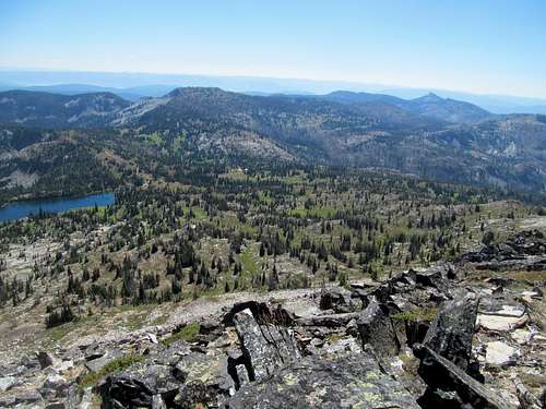
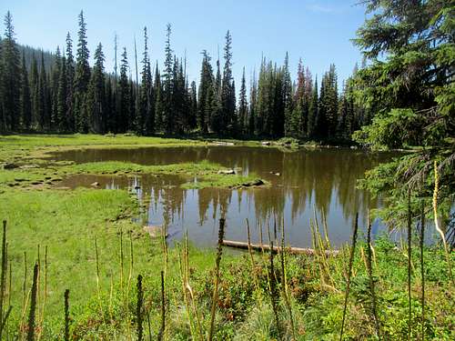
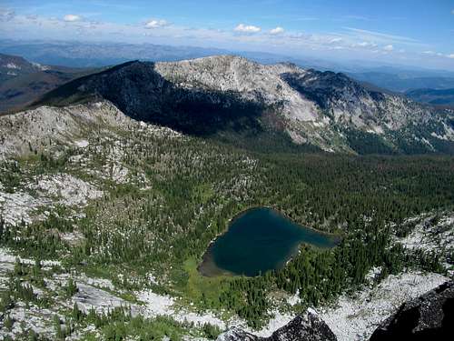
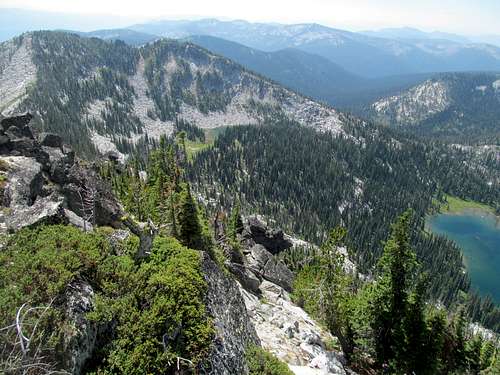
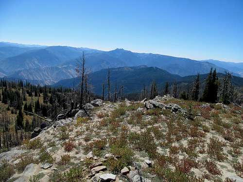
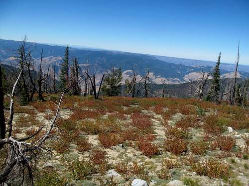
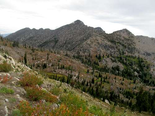
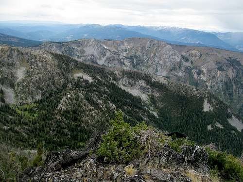
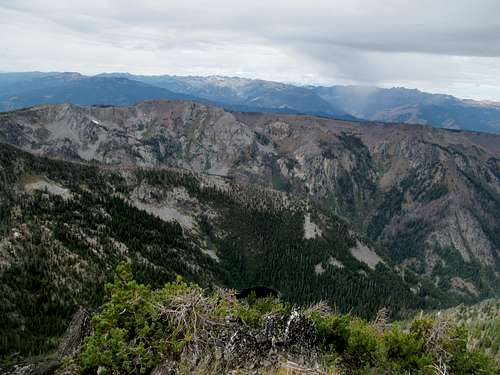
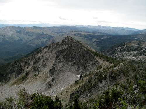
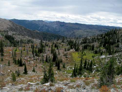
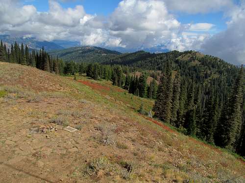
For a mountain range named after a minor major city, reaching the highpoint of the Boise Mountains takes you pretty deep beyond the pale of civilization. Smoky Dome hid in the clouds as I bid goodbye to cell reception past the Soldier Mountain Ski Area, but despite the out-of-sight high peaks, the scenery of the lush forests and pastoral creeks were nice and calming. As a 10,000 foot range highpoint I placed a high priority on 2Point, and hoped to get views form the top by the time the clouds cleared as forecasted, but the low clouds I saw driving over each subsequent pass were not encouraging. Two mountain passes later I turned onto the Bear Creek Road, which was rocky and bumpy but considering roads I’ve driven before and after in this state, nothing too out of the ordinary.
I had misgivings about the peak itself as well. Fully healthy it’d be a good and brief workout, no more and no less. But the peak was trailless and very steep, and I could only wonder how my knee, mostly functional if not fully healed from getting my MCL blasted by a sedan in Savannah Georgia, would fare on such a strenuous test.
My knee felt well enough to not carry two crutches. I worried that two metal hunks would be too much for lightning bait with the iffy weather and decided to carry one crutch and one paint chipped hiking (ski) pole. Notwithstanding the fact that the ski pole was probably gonna have the same chance of attracting lightning, I would go with this tried and true method for most of the rest of the peaks of the year.
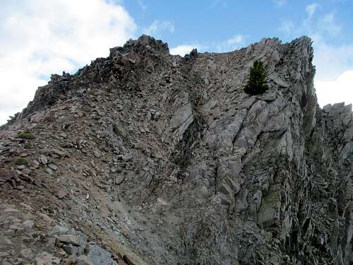
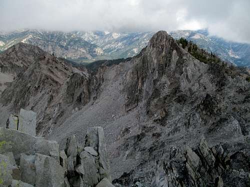
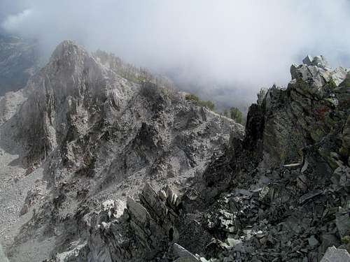
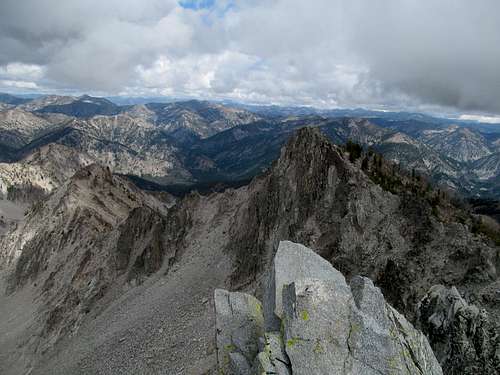
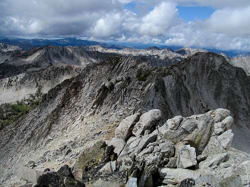
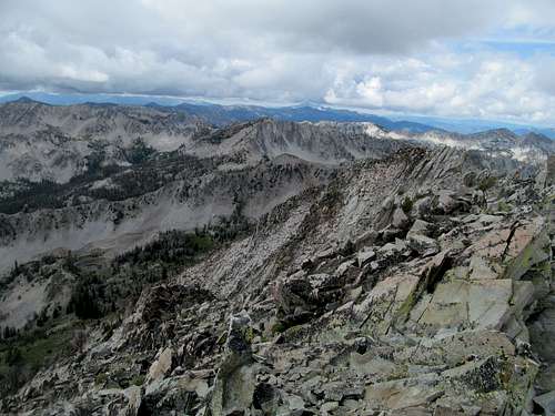
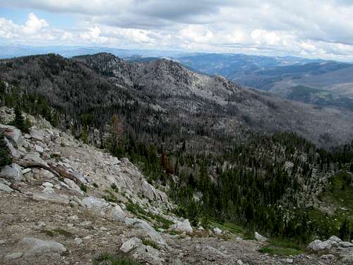
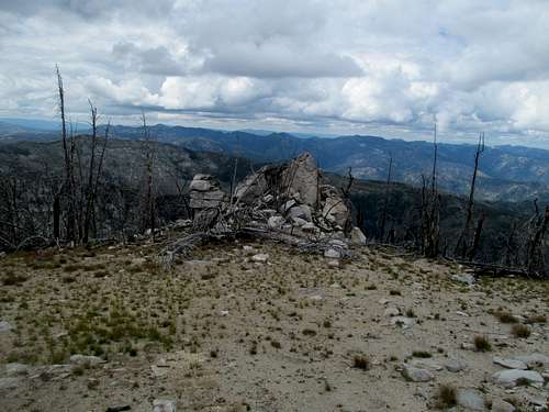
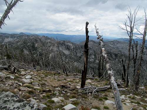
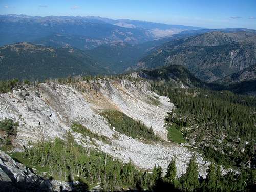
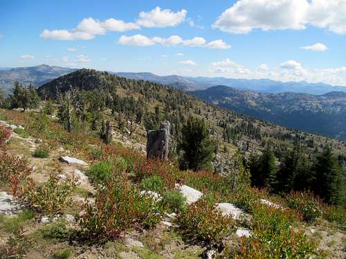
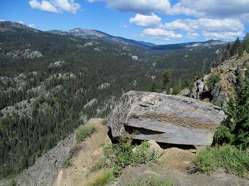
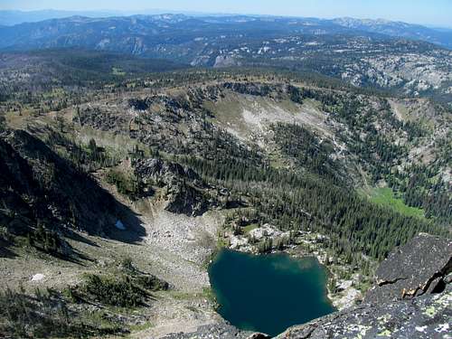
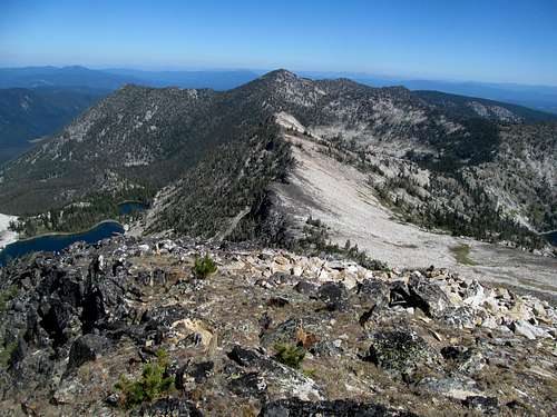
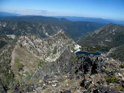
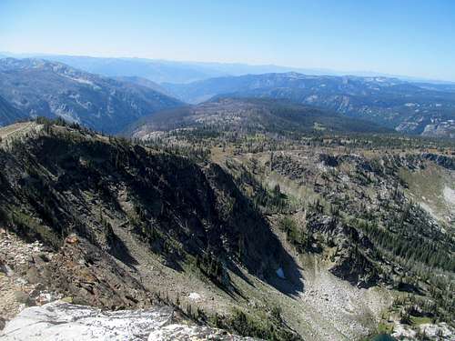
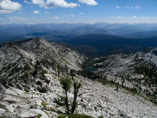
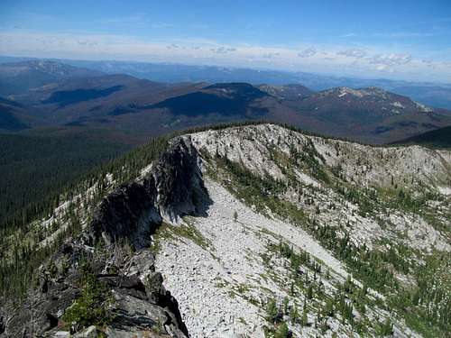
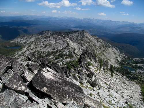
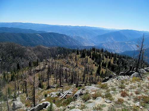
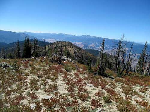
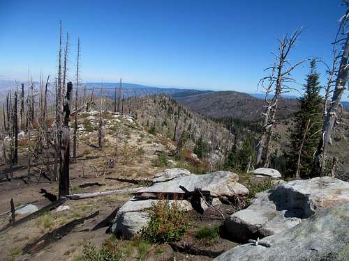
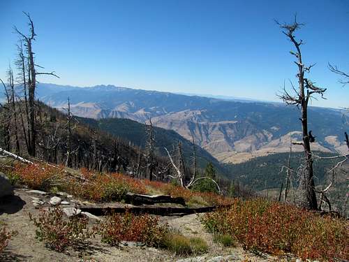
The route was steeper than I even anticipated, but as long as the mixed grass and dirt footing was good I managed to manage, and really the ascent became more of a test on my lungs than my knee. The end seemed tangible enough but I’ve been in this game wayyy too long (or at the very least reasonably long enough) to be suckered in by false summits. It ain’t over till it’s over, and the rockier nature of the ridge the higher made me somewhat apprehensive.
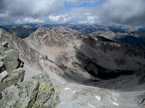
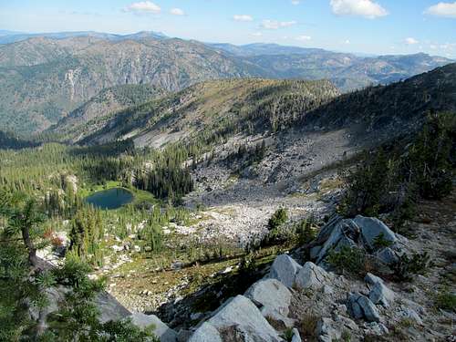
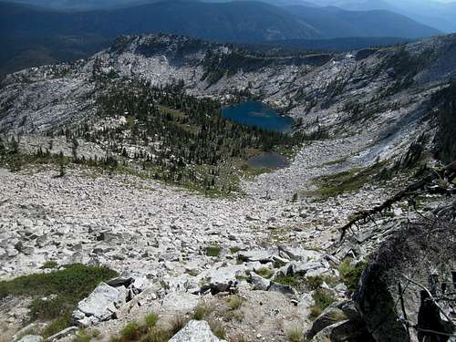
The summit rocks were precarious for my knee, but doable. With careful steps maintaining light pressure on the leg, I had no issues reaching the very top, but wandering around talus that was larger, blockier, and slightly wobblier than anything I’d yet encountered on the cripple peakbagging tour required extra caution.
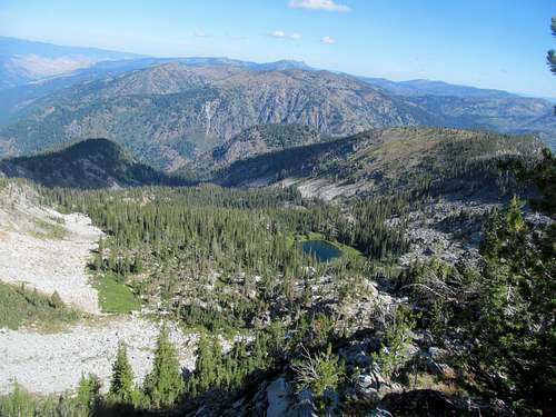
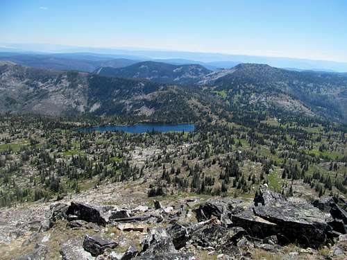
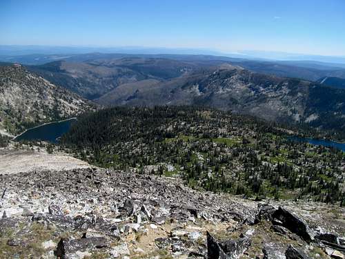
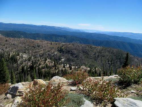
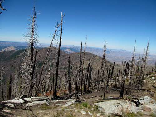
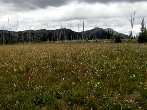
While views of nearby Ross Peak was pretty good along the ascent, the real meat of the panorama was still hidden under low cloud cover when I arrived at the top.
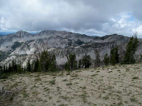
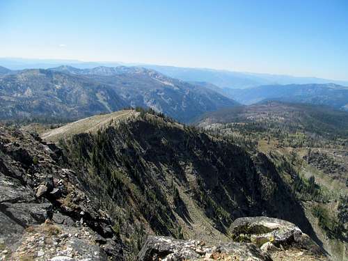
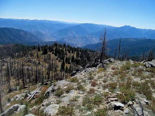
I waited, knowing/hoping for improving weather, and eventually my patience was rewarded when rising clouds greeted me with views into the Sawtooths and the apparent topographic fact that, at this stage of the Boise Mountains game, there wasn’t much really separating that range from its most rugged and famous neighbor.
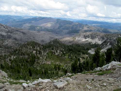
My need for views satiated, I descended with the clear and tangible goal to not slip on the wet grass coming down, again taking extra caution on ground that I would have joyfully skipped carelessly past fully healthy.
Views emerged and disappeared behind the edifice of Newman Peak, and I enjoyed the serene drive through a different landscape on the way out.
I arrived in Boise midafternoon, found a great value motel just outside of downtown…cheap and not much to look at from the outside, but a pleasant surprise inside spacious, clean with a huge and seemingly clean king bed as its centerpiece. After showering and resting up a bit I hit the town in Boise, drinking there for the first and only time (thus far) and staying up way too late.
Log Mountain Smackdown - August 25th, 2014
That meant a late start Monday morning. I was heading north towards McCall and hoped to get Log Mountain in between. With no sports games going on I still was limited timewise by a reasonable chance of thunderstorms after noon and the first of what would be four fantasy football drafts that I’d have on this leg of my trip.
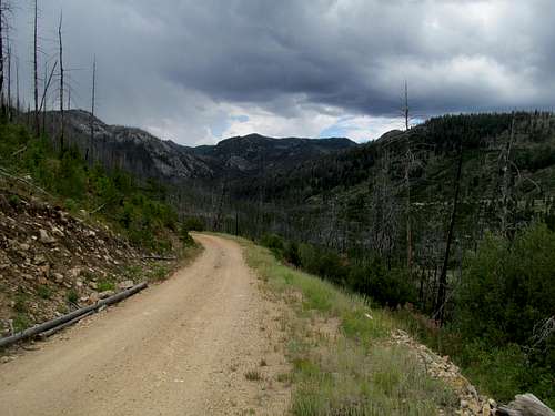
In my hurry I made a major mistake. After cruising down the great roads approaching Warm Lake, I decided to hop on the Cabin/Trout Creek (FR 467), which cut northeast directly onto FR413 north to Yellow Pine, rather than continuing east past Warm Lake then north on 413 along a more perpendicular vector. In my defense, the Benchmark Idaho Atlas had 467 as a pretty major dirt/gravel road, but it soon deteriorated into one of the rockiest, slowest, steepest, excrutiating bumpy, narrow and wet roads I’ve ever driven. And after costing me probably an extra hour en route to 413, as well as years off my life and that of my truck, I breathed easy when the road descended and seemed to improve closer and closer towards 413 when, maybe a mile or so from the promised land, a pretty big ass fallen tree blocked my progress towards gravel.
Oh the irony, stopped by a log en route to Log. I considered my options. Running late already, I did NOT want to drive nearly the entire length of 467 back to Warm Lake. The tree was way too large and heavy for me to move even half an inch, and I did not have a chainsaw or anything like that. The way it hung just above the road though...just high enough to tempt me...especially on the right side where the roadbed declined slightly...that I felt I had a chance to squeeze my 4Runner through.
So after several moments of pause I breathed deeply and wedged my 4Runner clean through. And go it went, but not before taking off pieces of the bike racky thing on my roof and unhinging completely on one side the deflector shield above the rear windshield. The roof was barely a flesh wound and I’ve still done nothing to fix it, but the deflector was more serious. I could latch it back on, but it would bobble loose and off whenever the road got too bumpy or curvy.
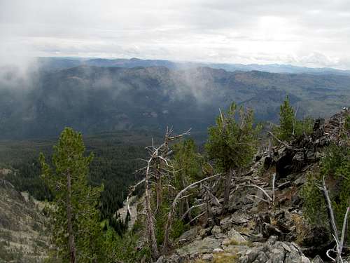
Despite stopping every so often to rehang my deflector, I reached the very sedan accessible trailhead for Log many hours past my intended start time. The clouds didn’t look promising, but the mostly treed-in approach and summit dared me to continue with my plans.
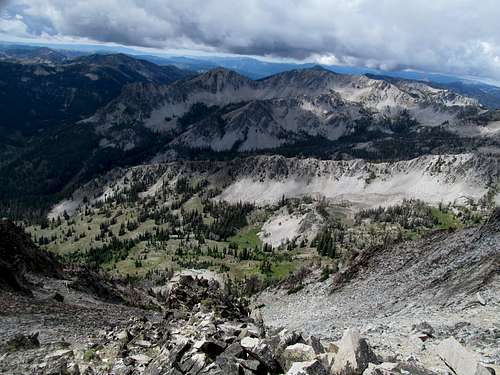
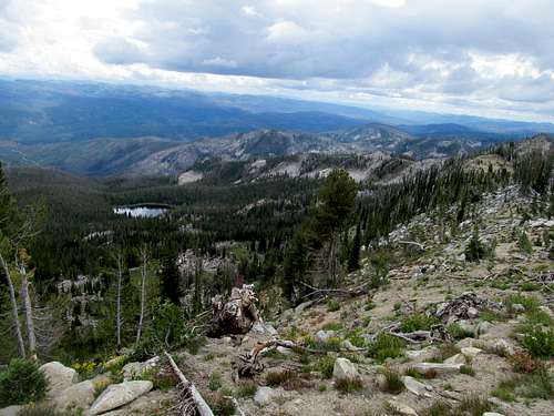
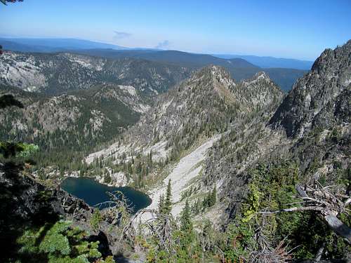
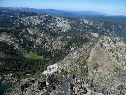
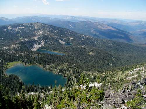
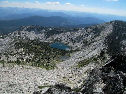
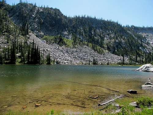
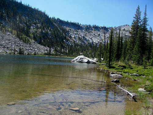
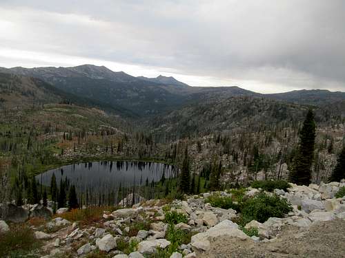
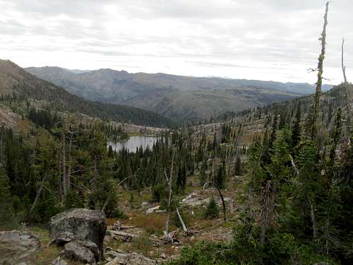
I followed the trail towards Rainbow Lake, finding a spot to venture into the backcountry near the middle of the drainage between Log’s NE ridge extension (Pt. 8688) and Shell Rock Peak, ascending crisp slabby terrain into the lusher meadows within the small bowl below Log.
Staying on the northern aspect of the bowl, I got through with minimal bushwhacking where, opting out of what seemed to be a steeper ascent up Log’s east face, I chose instead the saddle NE of Log sitting adjacent between it and 8793. The saddle seemed to be guarded by some steep slabs, but a cripple friendly alternative was found to the left of these, and once more I was reminded of the sorry state of my heart and lungs ascending carefully the steep and grassy ridge to the summit.
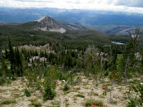
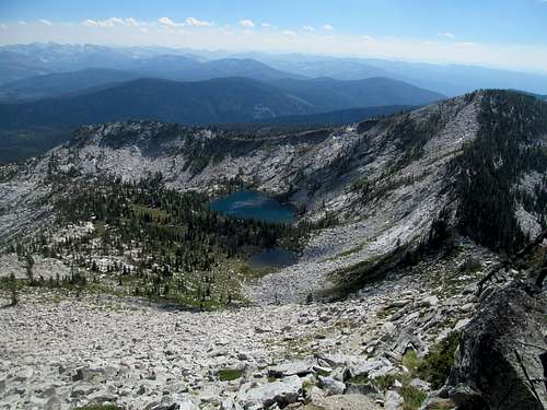
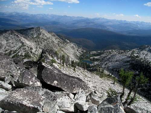
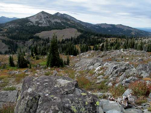
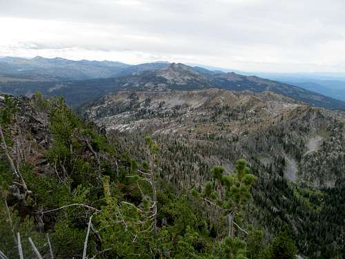
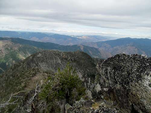
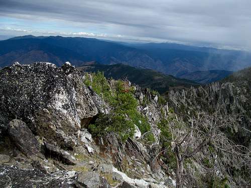
The large summit boulder presented some challenges that I was able to carefully surmount, and I took in the cloudy but clear views as much as I could, especially northwest to my first views of the impressive Lick Creek Range.
East, the bevy of Salmon River summits seemed indistinguishable from each other, and I tried my best to discern which bump in the distance was Big Baldy; there were several candidates.
I descended the summit block most carefully and made my way south, hoping for clear views around the trees south and southwest. Finding some at a few clear areas, I decided that with the help of my now very trusty crutches I could manage my way down the steeper sandy east face of the peak, descending without incident.
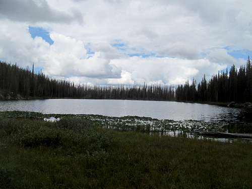
I used my GPS to find my way back to the trail and, after gauging my time and my fantasy draft, decided to venture just a bit further to get a glance of serene Rainbow Lake.
My 4Runner thanked me for taking the paved road back through Warm Lake. I had initially decided to “camp” and sleep in the truck somewhere near McCall, but my hangover, my exhaustion, and the sheer appeal of such a cool little town, of which I was once more forewarned by Greg, wore down my defenses and I got a cheap motel south of downtown. My rear deflector came loose a couple times on the curvy roads past Warm Lake, but thankfully gave me no problems on the short stretch of highway into town. After stopping by an autozone and verifying the fact that there was no body shop in town and that I needed to reach Grangeville to get it fixed, I bought some duct tape to hold it together in the meantime, checked in and, seeing as wifi was nonexistent in my room, did my draft in the motel lobby.
One more errand before checking out the town. I had received a voicemail from my good friend Phil asking what I knew about Vegas. Well, he asked the right person, obviously. Apparently he needed to plan his older brother’s bachelor party so I typed together a quick (detailed) summary of options and attractions (ie bars, clubs and dayclubs), not entirely knowing how this postscript to this Idaho trip would affect events down the road.
First, dinner and I got an excellent burger at “My Father’s Place”, a retro-type joint that advertised the requisite “best burgers in town.” Then I parked by the impressive Payette Lake downtown, enjoying the vista only long enough to walk to the Salmon River Brewery, where I sampled a flight and caught a glimpse of an NFL preseason game. Still sporting something of a raw hangover from Boise, I decided to call it an early night.
Drafting Granite - August 26th, 2014
Next up on the agenda was Granite Mountain, a P1K in the Grassy Mountains north of town that I had never the less marked onto my list due to its status as an area/sectional highpoint in Tom Lopez’s Climbing Idaho book.
I had promised to help my former coworker Justina with her fantasy football team at her new company...but was fuzzy on what meant in terms of me doing stuff...until I got a text from her nearing the Granite trailhead. Apparently the draft was today, as in now, and she needed me to tell her who/what to draft.
Fortunately Granite’s proximity to McCall, highlighted by its easy access via roads leading towards Brundage Mountain then Goose Lake, allowed me to google draft guides, player statuses, injuries, and projections, then relay them to Justina via text or call every time she was due up for a pick.
Thank God for the easy and pleasant access trail too, which enabled me to do all this without having to pay much attention to said trail, even while still using a crutches. I suppose it was a sign that my recovery was going well seeing how much leeway I currently had to be careless and sloppy without consequence.
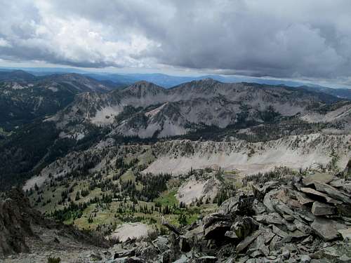
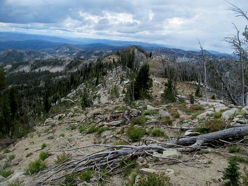
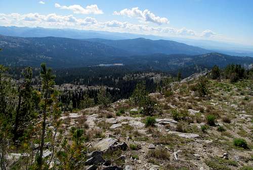
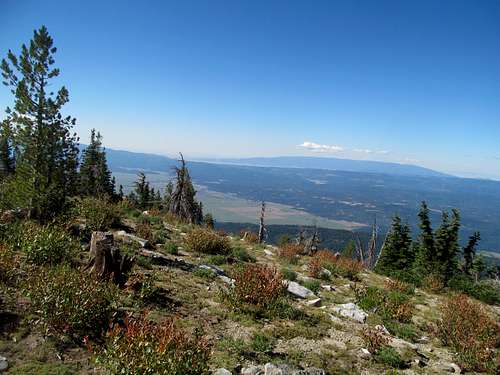
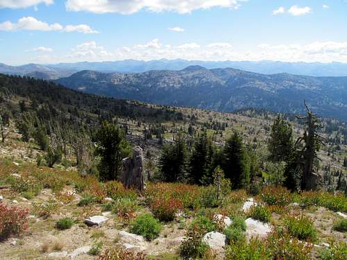
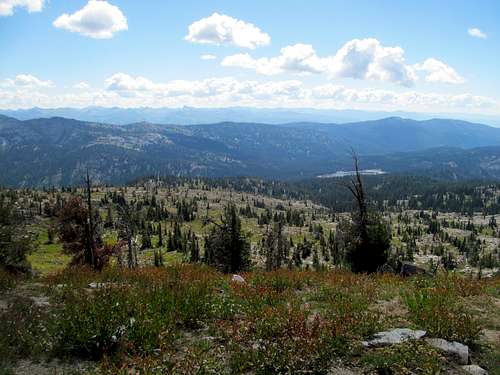
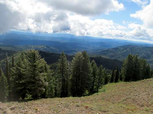
As for the hike itself, the trail gained elevation modestly after crossing a stream and traversed a few flat areas alternated but short headwalls before reaching the long summit ridge. Here, the trail turned left and seemed to wander forever south through denser vegetation until it finally reached the summit lookout.
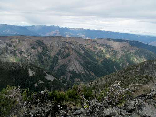
The lookout was cool, as were my first ever views of the Seven Devils Mountains across the Snake River. Behind them the Wallowas, yet another new and novel concept.
Patrick Butte, a peak I knew but had not thought much about, loomed like the true devils horns to the north, and like the day before, the Lick Creek Range served as the highlight within sight, this time looming to the east.
After doing more researching and offering more advice on draft picks, I started down, but not before stopping by the open north summit to get some views. It was only in writing this more than a year later and reviewing the maps that I realized that the north summit is apparently the true summit, a foot higher than the lookout area.
I crossed paths with several groups of hikers from McCall on the way down, and normally I’m more than eager to chat, answer questions about the summit, etc, but this day I felt like an ass offering merely a cursory greeting while urgently doling out more draft instructions on the phone.
The draft wound down and I still had a chance to enjoy the amazingly scenic views back to the trailhead. My cell reception finally gave way along the narrow canyon surrounding US-95 between New Meadows and Riggins, but fortunately the only pick I missed was the last one.
Riggins seemed like a tiny little drive by hamlet and a cell reception anomaly between vast dead zones, and past it reception vanished once more. I checked out the White Bird Battlefield historic site en route to Grangeville, then finally relapsed back into civilization. The low plains of the Palouse were hot and humid on this late August day, and I sweated it out literally and figuratively as a local body shop cobbled my 4Runner back together.
Buffalo Hump Day - August 27th, 2014
The next two days saw a rampup in the quality of my peak agenda: first Buffalo Hump then Grave Peak, two major prominent and isolated high summits in the Clearwater Mountains, the like-kind northern counterpart to the Salmon River Mountains. Too sweaty and not mentally prepared to spend two consecutive nights sleeping in the car, as Grave’s remoteness almost required, I shelled out bucks for a motel in town despite how absurdly overpriced they were.
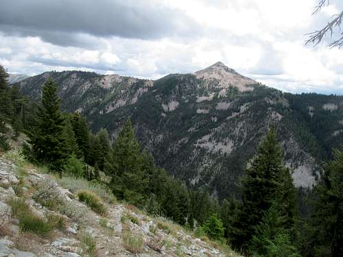
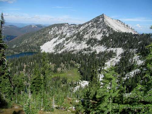
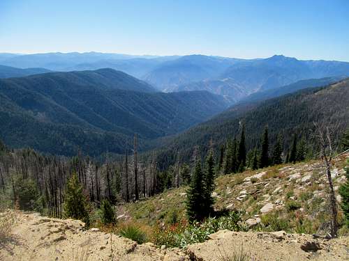
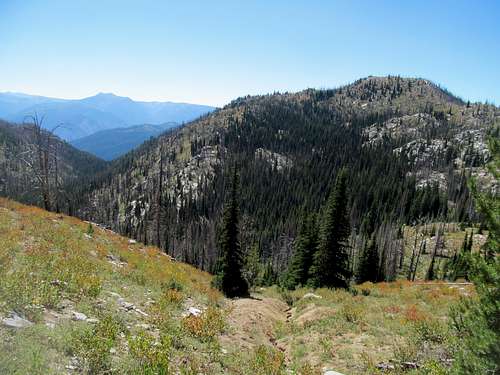
Laying low for the night, I woke early and drove up and down the scenic Mt. Idaho Grade road down into the fresh air surrounding the South Fork of the Clearwater River. The road, ID-14, leads to Elk City, where pavement ends and a brutally rough Magruber Corridor road takes you past the edge of the wilderness, emptying eventually in the Bitterroot Valley in Montana. I would not be venturing into Big Sky Country though, as Buffalo Hump’s turnoff was a few miles short of Elk City, reached after many miles of curves and braking. After driving through an endless sea of green, the distant views of the sparkling granite of Buffalo Hump and its surrounding peaks from Orogrande Summit lit a spark of excitement, seeing as I had not seen anything too alpine since Two Point to start the trip.
I had read accounts of how bad the road was up to Hump Lake , but Greg had additionally warned me about how quickly and badly the road deteriorated after descending past Orogrande Summit. He was not wrong. It started as smooth sailing and I passed by a small parking spot on the side; common sense would have told me to stop, but the road was good so in the name of preserving my knee I decided to press my luck.
The next few miles were hell on my tires and knuckles as the 4Runner bumped down endless rocky and steep crux sections and I, h8er of all bad roads, felt the need to put the car in 4Low. There were no turnaround spots, no stopping forward progress or gravity, and I had no choice but to follow the road all the way down to Lake Creek not knowing 100% that I could make it back up.
I didn’t push my luck further after arriving at the creek, choosing to park at the obvious turnout, and started down the road/creekbed, alternately smooth then rocky. The road up the headwall below Hump Lake was probably bad for jeeps, but walking it made it seem like any other dirt road; several large rocky levels would’ve caused trouble even for the most intrepid of drivers.
I made it to Hump Lake to the expected yet still very surprising sight of cabins, hell, modern mc-logmansions, and continued down the road to try and not wander onto private property. The church camp, based on google results, showed no signs of current inhabitants, and I wondered how often peeps here would amble up to Buffalo Hump as a backyard stroll. And from these cabins really, that’s all it was, crutches or no crutches.
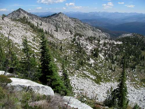
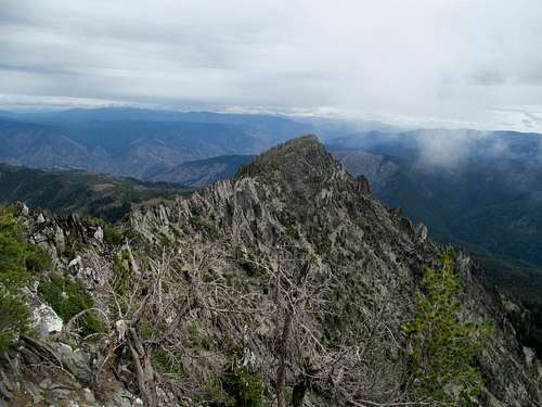
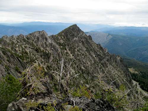
I continued down the road as it disappeared towards the southern terminus of the Hump’s south ridge, crossed one thin line of brush and trees, passed through a meadow and ambled up some gently rocky ledges to make my way up to the ridge proper. It wasn’t smooth sailing as I traversed with still the ghost of a hobble up typical narrow ridge conditions with a level of brush and rocks just enough to pose an annoyance.
The dropoff on the left just below the summit was surprisingly precipitous, as was the view of the sheer south face of the peak down into remarkable Mirror Lake.
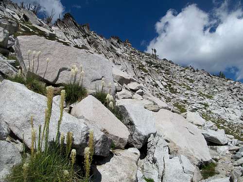
The summit block itself made me nervous as it seemed rocky and loose, but a nice little climbers trail took me and my crutches up to the top with ease.
Buffalo Hump had to be one of the more satisfying summits I ever had the chance to eat a crumbly granola bar on as it presided over a vast and green swathe of rumbling green hillocks surrounded on nearly every side by the prettiest of just-so-slightly-sub-alpine lakes and on its west side between and besides Hump Lake, grassy terraces graced by the most sparkling and sublime shades of emerald.
It was one of those summits where you linger far longer than planned, get up to start your descent, then stop and realize you need just a few more minutes to take it all in and savor the sights and feel of a very special place.
I followed small cairns and a vague trail partway down the ridge and noted how it cut left back towards Hump Lake not too far from the summit, tracing the trail and small, two or three rocked cairns all the way back, one pastoral tableau at a time, to the dirt road. The trail and cairns were likely imperceptible until you see it, then afterwards just so manifest once you know what to look for.
Summit nirvana now history, I worried once more about my ability to drive the 4Runner back up to Orogrande summit. I did it, or rather the 4Runner did all the work while I carefully and nervously put the car in 4Lo once more and hoped for upward progress through each of the cruxes, more than I had remembered coming down. I breathed easy when the road finally improved for the last time, and cruised back to Grangeville to the melodic ramblings of Bill Burr.
A Grave Day - August 28th, 2014
For once I had nothing to do (ie no drafts and no sports) after a mountain, so I killed time by visiting a small café in town and stocking up on fast food that I hoped would tide me over for when I really deep six'd civilization for the next day.
US-12 leads up the Lochsa and the Middle Fork of the Clearwater to access Grave Peak, and Greg had informed me that I would have zip to a nil of a chance at cell reception along the highway between Kooksia and Lolo. The thought was dreadful…once I embarked upon this historic passageway my connection to the real world was history for 24 hours, and I drove with trepidation. Upon reaching Kooksia I realized that I was running low on water for both the Grave hike as well as casual drinking/tooth-brushing water, so I bought some flavor ices at a convenience store.
Grave would also be a decision point as well…my original plan had been to swing up US-12 to Montana, get Grave along the way, and then turn south through the Bitterroots to eventually end up at Homers Young Peak, my number 1 mental priority at this point in time. However, Greg was now finalizing his plans for Labor Day, which involved following my 4Runner’s tracks up to McCall, hitting up a few peaks in the Boises and Lick Creeks and following up with Patrick Butte before swinging over to Oregon for the Wallowas. Logistics and the knee prevented me from putting the Wallowas into consideration for this trip, but Patrick Butte was enticing. It was a difficult and remote peak that I would be remiss to experience #FOMO on knowing that I could have opted in, but it was also a difficult and long peak that would stretch the limits of my rehab, as well as change the course of my trip to effectively forego Homers Young for this leg. The weather made its decision for me in the intervening days, deteriorating in Montana while staying mellow in Idaho, so by the time I drove east up US-12 backtracking Lewis and Clark’s trek to the Pacific 200 years ago my mind was already made to return to Idaho after Grave.
The small hamlet of Lowell featured an RV park and campground, a bar, a junction with the Selway Road (leading to Fenn Mountain, which I hope to one day get after) and for me, one last respite of civilization before Grave. I parked here next to the Selway River and enjoyed a sunset slept within sight of humanity.
Morning brought yet another round of driving through a tree tunnel beside a sparkling river. Signs of life at the Lochsa Lodge and a few other hikers at the Grave trailhead served to remind me that the sky was not falling, and I wasn’t that deep into the wild. A well groomed dirt road led to the Kooskooskia Meadows TH, but not before ascending steeply and early from the highway and offering some great views of Rhodes Peak across US-12 to the north; I forget how bad the turnoff road to Kooskooskia was now…after the rough and tumbles of the previous week it didn’t trigger much of a reaction from me, but Greg recalls it as possibly too rough for a sedan.
The other hikers were only dropping off their car off in preparation for some kind of shuttle hike, so I would likely have the mountain to myself. I had high expectations; Greg had done this peak a few weeks before on his Stripe trip before he had met up with me on Baldy in Montana in the middle of my first CripPeak leg, and had gushed about how impressive and special the summit was.
The first leg of the hike coming in from the southeast followed the wide dirt road downhill maybe a couple hundred feet…never a good way to start things. A cairn marked a turnoff right where, after skirting around some more meadows with distant ridges in sight, it ascended steeper terrain through thick tree cover for an indeterminate amount of time.
And through that entire period of time I was wondering what the hell Greg was thinking. I mean, I trusted that the scenery was gonna improve the higher I got, but he made this damn peak sound like it was sparkling in pixie dust, unicorns, show ponies and sprinkles from beginning to end, yet all I noticed was a long and fairly dull hike down and up through trees, pleasant be sure, but not all that special especially considering yesterday’s near transcendent moments at the top of Buffalo Hump.
Eventually the trail began to level out before descending another hundred or so feet down to Swamp Lake, which was pretty but once again, seemed understated after Greg’s talking up of the route. From Swamp Lake the trail cut through denser, wet brush, which added to the annoyance level until it rounded the alternately grassy and craggy high reaches along the Friday Ridge crest.
Swinging south and then west around the borderline ranked Friday Ridge 8118 summit, I finally got a good look at the backside of Grave, still far away. The view of the Wind Lakes here on the western slopes of Friday Ridge was nice, but the day was veering strongly into fields of pure suckage as I traversed a narrow and unwieldly trail chocked with brush, low branches, and mediocre footing.
The traverse was annoying, but Grave did get closer and closer.
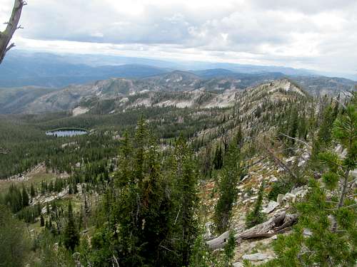
It was only after the trail hit the saddle between Friday Ridge and Grave, crossing back over onto the eastern side of the divide, when the secret revealed itself: a shimmering, sparkling blue and emerald lake, unnamed 7,367 feet below the NE bowl of Friday Ridge and sitting pretty as one of the most spectacular lakes that I had yet seen. After that I enjoyed an extended period of wonderment within the constant presence of that sublime lake, managing to manage the slightly steeper trail to the wonderful rocky summit and lookout.
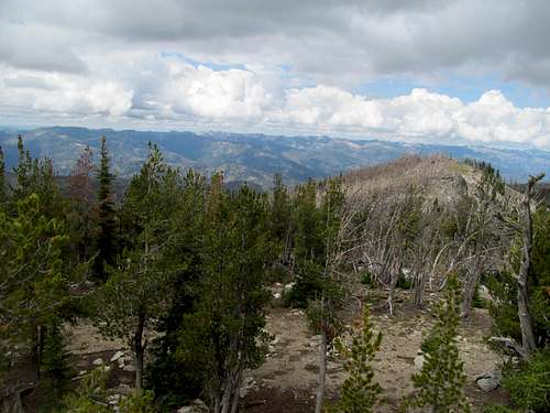
Surrounded in every direction by sparkling lakes, pristine forests, and the clear and awe-inspiring sight of the Bitterroots rising across the wilderness corridor, I took in the views while still carefully treading along the large, precarious summit boulders. Grave’s summit is pretty damn small, the abandoned and boarded up lookout pretty damn large, which made for not a lot of room for a cripple to sit, eat a granola bar, and enjoy the views.
I made several circuits around the lookout, trying to spot something new in each angle and perspective at the magical spot. Like Buffalo Hump the day before I procrastinated my descent but unlike yesterday, I had a deadline in the form of yet another fantasy draft I needed to get to by the evening.
So I descended, taking picture after picture of that little lake below Friday Ridge before reluctantly saying goodbye to it, crossing over to the other side of the ridge.
The descent was a return to mediocrity, wading through brush back to Swamp Lake, though the latter provided a serene afternoon backdrop before the return trip start the first of several uphills and monotonous miles through the tree tunnel.
With all the little odd junctions on this route I found myself a little confused and uncertain of whether or not I was on the right route, especially when my GPS reset after I changed its batteries and refused to connect with the satellite for whatever shitty tech reason. The junction with the original trail and road brought me back to reality and, as much I would have loved to enjoy and savor the historic passageway back down US-12, I was playing it real close with my draft.
Having not had cell reception since the previous night, even from atop Grave, my phone came to with a barrage of draft related texts as I neared the canyon exit…including several frantic texts from the league’s commissioner wondering whether I had gone haywire. I responded back to assure them I was on my way, and hurried up the scenic riverside highway through the waning hours of twilight. I checked in to a raggedy motel in Kamiah and logged in with minutes to go. Tired in a sleepy town with not much for bars or anything open after 9, I took another opportunity to rest up on a quiet night after reloading on groceries.
South by Southwest Butte - August 29th, 2014
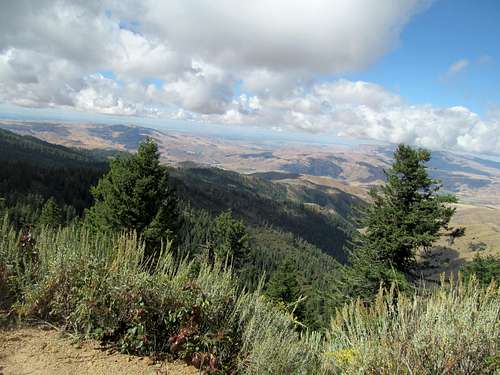
Kamiah and the Grave trip would be my apex point on my journey north, and Labor Day Friday found me heading back south towards McCall. First, I stopped by a historic Nez Perce roadside park/historic site in the early morning, then retraced my steps past Grangeville back up into the mountains past Riggins, where the Big Salmon Road took me down the western mouth of its namesake river.
I had always imagined the entire stretch of the Salmon as entirely remote and inaccessible as it lived up to its No-Return moniker running through the heart of Idaho. While that is still true, I never realized such a good dirt road couldlead any casual tourist down one of the wildest canyons in the country. Knowing of the Corn Creek road coming in from the east as well certainly doesn’t detract in my mind much less reality the scope of the Salmon’s wildness, but the great gravel road and bridge crossings en route to Southwest Butte certainly narrowed it a bit.
While I was in no hurry, the fact that I was not in a hurry meant I was running late. I still needed to figure out the rendezvous with Greg at some point and, while I was tired and didn’t care all that much about getting a peak today, I still needed to get myself a peak.
Patrick Butte with Greg on Saturday was the plan. The peak, a 17 mile or so round trip affair, was not on my original agenda and pushed the boundaries of what I felt comfortable testing my knee on, but FOMO meant I couldn’t say no if Greg was doing it. Fortunately, after five somewhat challenging days my knee felt strong and battle-test, but nevertheless I would comfort myself with a rest day up Southwest Butte before Patrick.
Thus, a day already starting to bristle with heat and humidity by the time I pulled up to the informal trailhead at the Nut Basin divide after many miles of steep guardrail-less switchbacks circling around the Allison Creek drainage. I don’t remember that much detail about this ascent, other than expecting it to be a walk in the park. And while it was, it was a hot and muggy walk, with the ups and downs not contributing to the ease of the climb.
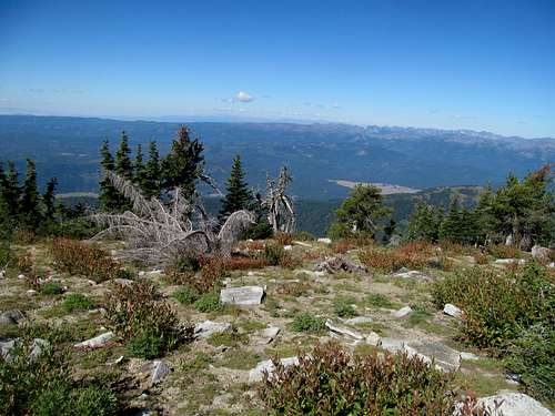
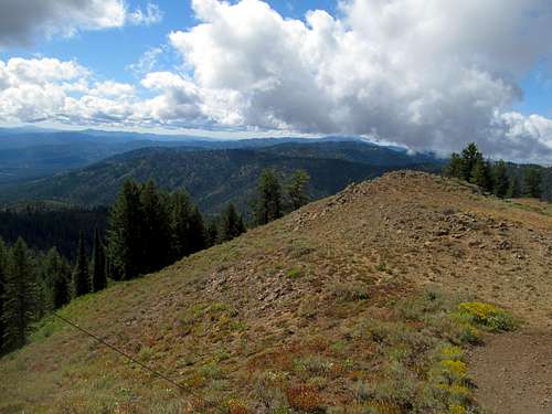
While Southwest Butte looks somewhat impressive from certain angles, up close it looked like a moderately rocky nub that nevertheless seemed excrutiatingly high as the dirt road/trail dropped one last time onto a marshy flat just below the summit. I followed the road back up until it cut just below the summit, and make quick work of a few layers of light ledgy scrambling to make the summit.
While the hike was mostly uninteresting, the summit views were spectacular here, up above the precipice of the Salmon River Canyon at its deepest.
Above it, the devil-horned summit of Patrick Butte viewed at the angle of its greatest vertical relief was juxtaposed against gentler views of the Clearwater range to the north.
And while these angles were visible at the trailhead too, the summit offered additional glimpses of the Seven Devils and Wallowas as well.
The uphills on the way back kinda sucked, and all but guaranteed that I’d roll into a non-motel night in the back of my truck sweaty and dirty.
I pulled into a gas station in McCall and spotted a familiar looking 4Runner with Utah plates. Greg had arrived, and we chatted and plotted course before he made an early start for the PattyButte trailhead. I meanwhile stopped by the other brewery in McCall, the one named for the town, and enjoyed a few beers and a late lunch while catching glimpses of a torrid UConn BYU football game.
Patty Cakes - August 30th, 2014
A night out in McCall would have to wait another night, backtracking back towards Brundage Mountain and past Goose Lake, down the end of the smooth newly graded road down to a wide yet empty trailhead.
Where was Greg? Perhaps he was checking out campspots? Knowing him, he was more likely to seek out a dirt track off the main road for some more privacy. I backtracked, then spotted his jeep down a very shallow side road right off the main one. We chilled, had a few drinks, then turned in for what would be the last peak we’d team up for during my three year duration in Utah.
Greg was in a hurry as he would be driving hundreds of miles of dirt roads through Hells Canyon into the Wallowas right after Patrick Butte. In order to expedite things, I got a head start on the sandy and overall level trail while he got up and packed up his camp, treading the first few miles to Warm Springs Saddle.
Having not done much research on the route, I was a little unsure of the way from here but Greg arrived not shortly afterwards. We continued took the right turn and passed the Twin Lakes (not really visible from the trail), cresting over a saddle through some light woods onto the western flanks of the Grassy’s, only to do some more disheartening descending.
Having packed a shit ton on the toughest test of my knee to date, I ditched some water by a fence here, my second cache past Warm Springs Saddle.
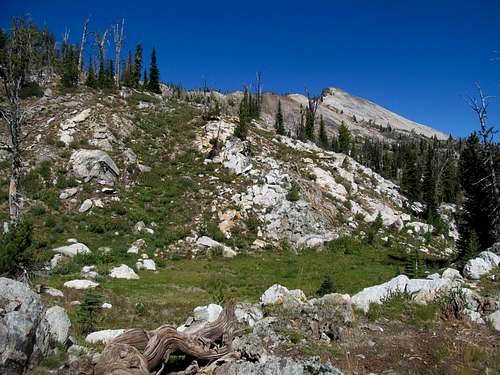
Views started opening up on the left as the trail headed traversed open terrain and headed up through a bare ridge occasionally decorated by charred tree stumps. We found ourselves at a good elevation, sitting only 600 or so feet below the summit, before having to drop 400 or feet or so down to the southwest saddle of PattyButte in the basin above Paradise Lake. The trail itself aimed towards the lake, so here we left it aiming for the saddle to minimize the elevation loss, a goal accomplished but not without resorting to some moderate bushwhacking lower along the descent.
A thousand feet left to gain on a long day made longer due to a knee still at maybe 70-80%...the gain was initially just your basic, backcountry steep shit up relatively open terrain. We approached low clouds swirling up from the Salmon on a chilly day and threatening to overwhelm the already intimidating summit, and I hoped that we would make it before it was socked in.
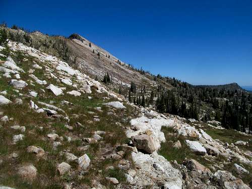
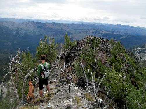
The last three hundred feet were hell. I had expected easy scrambling, and yet found steep, loose talus and climb-scrambling moves much more difficult than what I was comfortable with at this stage of the rehab. Dark clouds made every leg of the climb seem like a blind corner, and I picked and scabbed at what would hopefully be the path of least resistance.
I topped out after one steep but thankfully solid move, only to see the summit still lying maybe half a football field away, with a steep and rocky ridge between us. I cursed at having fallen for a false summit and at how much more I’d have to put my knee and fatiguing legs through.
Greg waited for me at the summit and pointed at where to go. I downclimbed from the false summit and alternated scrambling and a loose traverse left of the ridge crest to reach the top.
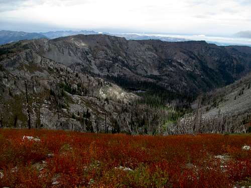
And after all this shittiness, I was rewarded with socked in views from the low clouds and fog. Granted, the Lick Creeks, Seven Devils, Wallowas…ie most of the surrounding ranges were all clearly visible. But dammit, I wanted all the views, I wanted to see north, I wanted to gaze deep down the same Salmon River gorge that I had peered at from the other side the day before, I wanted to see the depths of the Clearwater Mountains wilderness that I had immersed myself on Buffalo Hump and Grave.
I swore and screamed in rage (a preview of the next August a year removed), and Greg, anxious to descend, lingered around just long enough for the clouds to start burning off and for me to get my goddamn views.
Satisfied, I followed Greg down, sidehilling it around the immediate summit ridge before having to reclimb the false summit, then trying my best not to injure myself by descending carefully ass in face out the loose stuff. Back on safe ground, yet slowing down, I tried my best to keep up as we recrossed the saddle and started back uphill. Muscles and lungs burning, I found myself trailing Greg significantly as we waded through brush once again to find the trail, only to huff air as I slowly made my way up the last grueling few hundred feet back up to the ridge crest.
We descended the ridge, and before the last climb back up towards the Twin Lakes saddle Greg ascertained that I was good to finish the hike alone on a good trail, afterwards jogging off into the sunset/Oregon towards the concluding leg of his Labor Day trip.
I retrieved a few bottles of water at the fence and quickly drank them as my leg muscles, fading slowly but surely, forced myself over the hump and began the downclimb back to Warm Springs Saddle. The worst of it was over, that last climb of several hundred feet during what would be the hottest ten or so minutes of my hiking day.
More waters retrieved, and a long and mostly dull trek out consisting of literally dragging my legs through the sandy first/last three miles of the trail. I could still walk at a decent pace and was far from being anything near debilatated, but my muscles and joints were clearly creaky and very sore from compensating for the knee on the long, 17 mile day; this was slow for me, at the end of a day that should have been a moderate day, not a marathon. But such is life when you take rehab on the road and, as for the knee, it felt dully sore and was probably a little swollen but once again, and thankfully, felt still structurally sound by the end of the hike.
A nice triumphant drive out and return to McCall, where I showered, changed and on Labor Day Sunday, finally got to have my first real night on the town since Boise. Bars in small towns are always hit or miss, and from the moment I walked into the Forrester Club, a cozy saloon style bar smack in the middle of downtown, I could tell it would be (maybe too much of) a hit. The locals recommended the locally brewed Hells Canyon Jalapeno beer, which was fucking amazing, and I probably downed three or four of them within my first half hour there.
The rest of the night blurred by as I seemed to chat with everyone at the bar about all manner of topics, ending the night at the surprisingly nightclubby Yacht Club…who would’ve expected a DJ pool party in the middle of the Idaho backcountry, the requisite Miami beach mattresses or Las Vegas pool cabanas replaced by wooden benches and a dock, set beside the slowly pulsating waters of one of the prettiest lakes in the country still glimmering under the clear night sky.
Lazy Hawley Finale - August 31st, 2014
I was hurting the next morning. I hurt everywhere, literally, from head to toe. I had harbored vague thoughts of Steamboat Benchmark, an easy hike outside of town, but with a looming 3 PM fantasy draft, decided to head back south to Boise.
Along the way, I left the highway for a sidetrip up to Hawley Mountain, a drive up P2K that had eluded me in 2012 after a tree blocked the access road on a late afternoon while going after a 3rd peak after Shafer Butte and Mt. Harrison. The road was no problem this time, though I had to drive around some slower trucks that didn’t have a pressing fantasy draft coming due.
I forced the 4Runner up the rugged rocks just below the lookout, and climbed up to the lookout to survey distant ridges hidden by low clouds. Unlike other trips, I had not the time to wait for the clouds to burn off, and sacrificed views from a pretty average summit to finish the drive back to Boise.
With some time to kill, I got food and bought some loafers for an upcoming wedding before plugging in at a Barnes and Noble for the fourth and final fantasy draft of my trip.
Something about Boise felt awfully right to me; I really liked the vibe and feel of this town and was found myself hard pressed to leave it. Had I known that this would be my last foray through Idaho in my three year stint west, I would have been more hesitant to leave the state. But for now, with my knee healing and matching the challenges my peak OCD was offering it, the future was still wide open, but my travelling window was closing, and I still had many a mountain to check off the list, many a tedious mile to drive, many a motel bed to collapse on and many a small town and brewery to check out before the final drive back east.
A Bitter Postscript - November 24th, 2015
Writing now more than a year after the fact, this leg of the Crippled Peakbagging tour has stirred up many a strong emotion in me. I didn’t realize it until recently, but while other singular peaks may have been more rewarding in 2014, this was my favorite extended journey from my last summer out west, with each summit occupying a special spot within the Idaho wilderness and in my heart. And yet each picture I review deep in the heart of Idaho’s wildest reaches continues to bring out the rage and sleepless nights, triggering moments hitting too close to home to my misses in summer of 2015, my haze socked non-views on McGuire and Taylor in the Frank as well as atop Piquett and Leidy. Seeing the pictures from Buffalo Hump and Grave reminded me of the views north I didn’t have from McGuire, seeing the pictures of the Salmon River gorge from Southwest Butte reminded me of the views hidden from me of that very same river from the top of the Bighorn Crags, and the clear vistas of the Bitterroots from Grave rising north from nothing into granite perfection reminded me of the counterpart views from the southeastern end of the range denied to me by the same godforsaken smog on top of Piquett. So all I can say for this TR is that I’m glad it’s filed, done and over with, and maybe I can try and not think about this part of the world for a day or two so that I can sleep again. With so much anguish, anger and unfinished business lingering from this past summer’s trip left hanging, I don’t know what the future brings and if there’s anything I can do to make it right in whatever not-so-right-mind that drives me to do this shit, so all I can do now is to quote the greatest sage of our generation and utter those famous words, “we’re on to Cincinnati”.


Comments
Post a Comment