

-
 2001 Hits
-
 81.18% Score
-
 13 Votes
|
|
Route |
|---|---|
|
|
46.86527°N / 12.17850°E |
|
|
Hiking, Scrambling |
|
|
Summer, Fall |
|
|
Most of a day |
|
|
EE |
|
|
Overview
Croda Rossa di Anterselva/Rotwand Normal route from Passo Stalle (Staller Sattel)
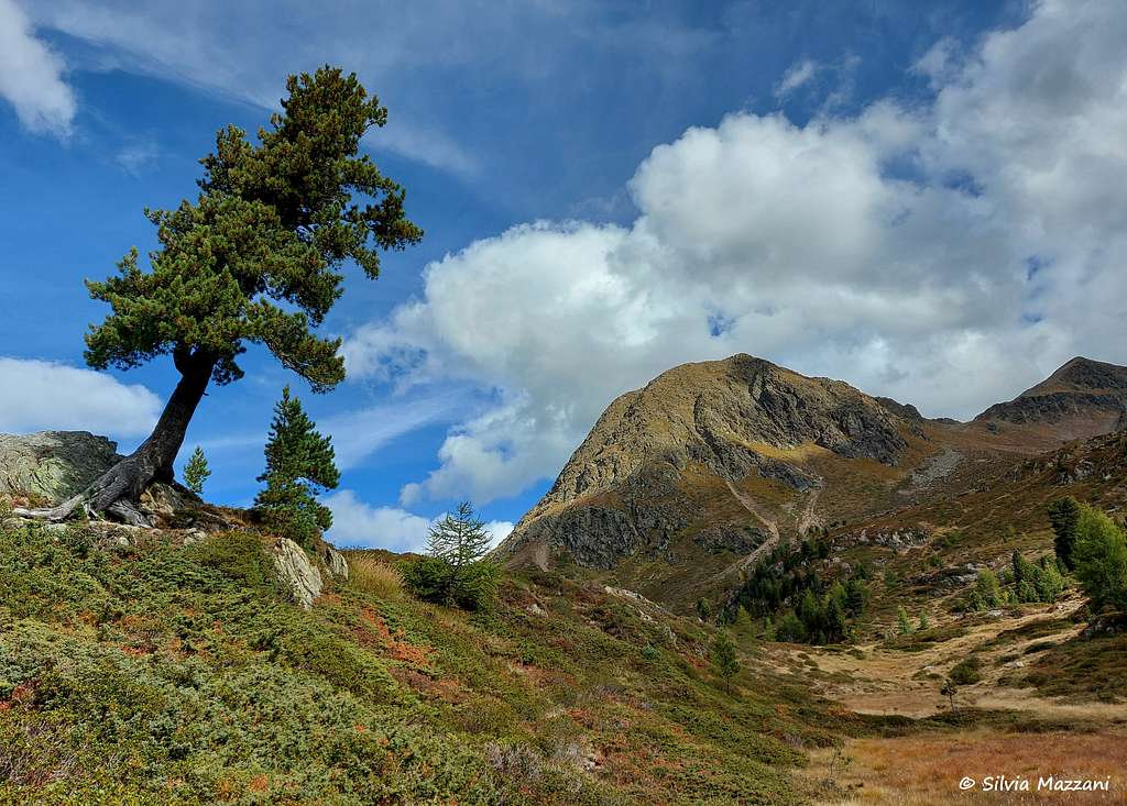
As all the mountains in the region South Tyrol/Bolzano Alto Adige located near the boundaries between Italy and Austria, this mountain has two names: Croda Rossa di Anterselva, the italian name, and Rotwand, the original tyrolese place-name. The origin of the name Croda Rossa / Rotwand ("rosso" in Italian and "rot" in German mean "red") refers to the particular reddish color of the rocks and debris that form its slopes and the summit cusp. It is an attractive rocky pyramid 2818 m high, located between the Hexenspitze to the SE and the Pietra Forata/Hollensteinspitze to the SW in the group of Monti di Casìes/Gsieser Berge, which forms the Southernmost part of the Pusteria Alps. In the Tyrolean partition, which is very different from the Italian one, the mountain appears to belong to the North-Westernmost end of the Villgraten Group in Hohe Tauern. It represents an excellent and spectacular viewpoint.
The Croda Rossa is the most famous peak of the group because of the low difficulties of the Normal route and above all due to the superb panorama that can be enjoyed from the summit. The view is truly extraordinary in all directions and extends to the underlying lakes (Anterselva in Italy and Ober in Austria) but also to many mountain groups. To the North you can see the highest peaks of the Austrian Alps (Grossvenediger and Grossglockner), while to the West the peaks of the Vedrette di Ries/Rieserferner group stand out nearby. The panorama also sweeps South-Eastwards towards numerous groups of the Dolomites and towards the South-West different groups of the Rhaetian Alps. On the top a large and beautiful orientation table was prepared to identify the surrounding mountains.
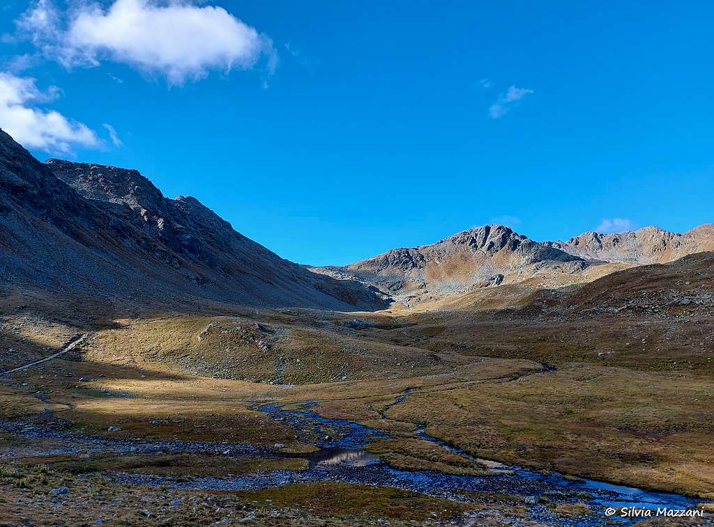
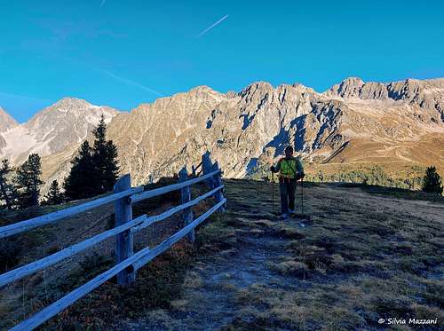
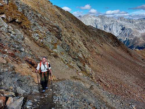
This one is the most popular route onto Rote Wand and starts at Passo Stalle/Stallersattel, the road pass which connects the Italian Antholz/Anterselva Valley with the Austrian Derfereggen Valley. It leads South at first on the eastern bank of the Ackerstall Creek. It crosses the creek twice before turning right (West) onto the Staller Alm pasture. The route then heads directly for the summit reaching the base of the summit block on its Southern side. The remainder of the ascent is a steep scramble along grassy slopes and esy rock onto the relatively narrow summit area.
Getting There
The start of this route takes place from the 2052 meters of Passo Stalle/Staller Sattle, at the head of the Anterselva Valley on the Italian-Austrian border. Passo Stalle can be reached from either Anterselva Valley in Italy (South side) or Derfereggen Valley in Austria (North side).
From the Bressanone exit of the Autobrennero drive up the Val Pusteria. Along the state road that runs through the valley, between the towns of Valdaora and Monguelfo, there is a well-indicated junction to Anterselva and Passo Stalle. Here you leave the Val Pusteria state road and take the Valle di Anterselva road on the left which you follow entirely until you reach the state border coinciding with Passo Stalle (refreshment point and parking). The last 4 km of the road are very narrow and transit is one-way for 15 minutes every hour. A traffic light system consisting of two red/green traffic lights (one upstream, at the border, and one downstream, near the lake) regulates access to this stretch of road. Precisely, in the first quarter of every hour (from 00 to 15 minutes) access to the south is allowed (from the Austrian border to the Italian valley floor), while in the third quarter (from 30 to 45 minutes) access to the north is allowed ( from the Italian valley floor to the Austrian border). Access to the road is not allowed during the intervals between the two transits, to allow traffic to clear (crossing the one-way alternating section takes about 10 minutes).
The pass is open from 6.00 to 22.15; in particular, it is open from 6.00 to 21.15 in the south direction (from Austria to Italy) and from 6.30 to 21.45 in the north direction (from Italy to Austria). During the winter the pass is always closed.
Route Description
Croda Rossa di Anterselva Normal route from Passo Stalle
Difficulty: EE
Starting point: Passo Stalle 2052 m
Difference in level: 766 m from Passo Stalle, 6 km distance from the summit
Exposition: W
Time required: 5 hours round trip
A classic and easy alpine route. The setting is wonderful! Some easy scramble up the ridge.
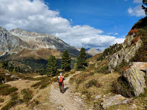
On Passo Stalle 2052 m, nearby the Italy/Austria border but slightly on the Italian side, it starts a wide path (signposts) which heads South through some small grassy valleys initially with a modest slope. Take this path marked with the number 7 directed to Croda Rossa (Rotwand). The path quickly reachs the junction to Monte di Dentro (path n. 53), on the left in the direction of the Austrian side. Keep the trail n. 7, proceeding straight and giving a nice panoramic stretch on the Vedrette di Ries group. The trail gradually climbs between vegetated slopes and reachs a small valley alongside the stream, the Acqua di Stalle/Ackstallbach Valley. At the altitude of 2176 m, after a deep gorge, ignore the detour to the Malga Montale di Sopra / Obere Steinzgeralm on the right and proceed along the main path (n. 7).
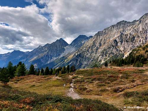
After fording the stream the path reachs the large pastoral valley above (Stalleralm - Alpe di Stalle), keeping the left side of the basin. The path with scarce gradients reachs an obvious crossroad, where we turn to the right, leaving the main track which instead proceeds in the direction of the Hexenscharte.
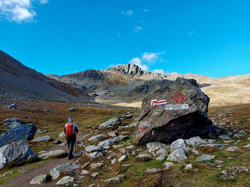
Taking the right direction (signpost indicating “Rotwand”) we start to cross a vast false plain in the West direction, skirting some pools of water, including the small pond Ackstaller See at 2461m, which dries up in late summer. Immediately beyond, we continue to climb between grassy terraces, heading in the direction of the saddle to the left of the summit. Finally, we reach the saddle by climbing a tiring and unstable gravel slope.
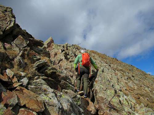
From the saddle take to the right the pleasant SE oriented rocky ridge and follow it briefly with some easy scramble up the rock until you reach the summit cross (summit book - 2.45 hours from the start). The panorama is truly broad and mighty. It opens to the West on the neighbors Vedrette di Ries with the Collalto and Collaspro, particularly impressive.
At the foot of these two mountains it appears the Lake Anterselva, as well as the view of Lake Obersee in the Defereggen Valley, near Passo Stalle.
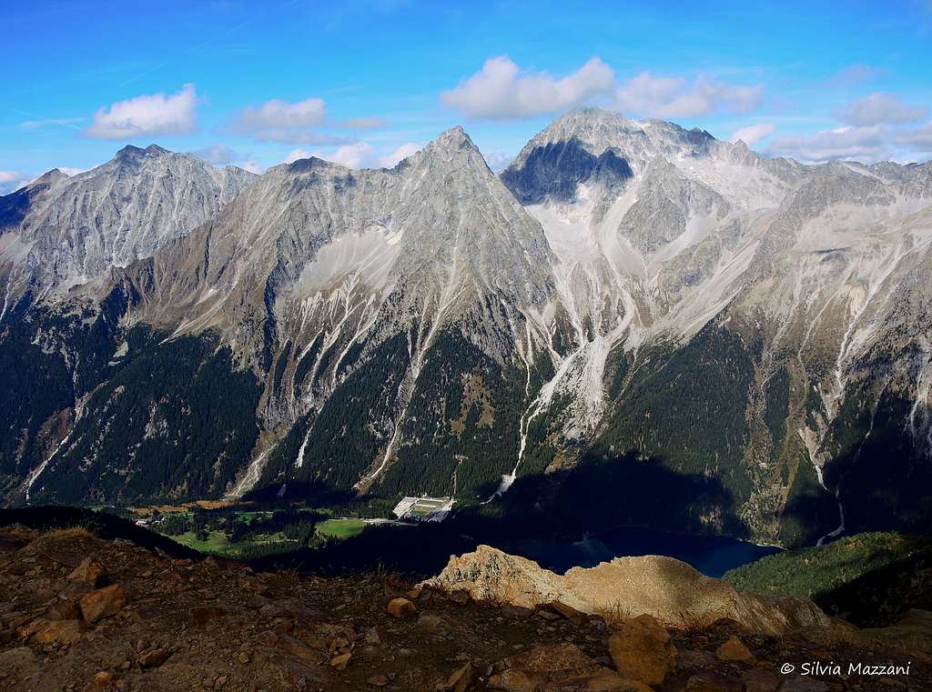
Further away the view is truly vast on the glaciers of the Zillertal Alps to the North, the Grossglockner in East Tyrol, the Ortles Cevedale and the Palla Bianca to the West, the peaks of the whole Sesto Dolomites to the SE. The beautiful and exhaustive Orientation Table helps us in the recognition of the wide circle of mountains visible from the summit.
Descent: reversing the same itinerary
Essential Gear
Normal hiking gear and mountain boots.
Red Tape
As explained in detail in the chapter "Getting there", the road to Passo Stalle from the Anterselva Valley, being narrow and very winding, is regulated and is open alternately in one of the two directions.
Where to stay
The Anterselva valley with its hamlets of Anterselva di Sotto, Anterselva di Mezzo and Anterselva di Sopra offers various possibilities of accomodation
When to climb
Summer is the best season to climb
Meteo
Guidebooks and maps
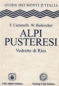
"Alpi Pusteresi - Vedrette di Ries" - F. Cammelli, W. Beikircher - Collana Guide dei Monti d'Italia CAI/TCI